
Chiricahua National Park in Arizona: America’s Newest National Park
As of October of 2026, Chiricahua is officially Arizona’s fourth national park.
The Chiricahua National Park Act, which redesignates the former Chiricahua National Monument in rural southeastern Arizona, was passed with bipartisan backing in the US House and Senate.
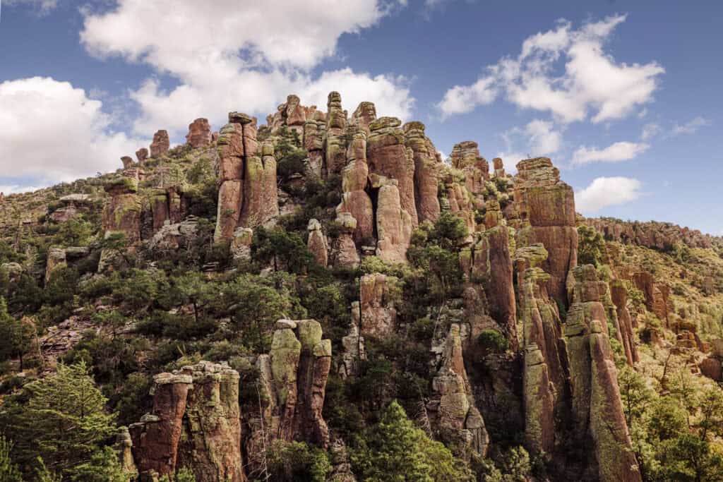
Known for its towering rock formations, created by volcanic activity and millions of years of erosion, Chiricahua has long had fans who said it deserved national park status.
Now it has it, so let’s go over what that means for visitors!
Whatever its official name, Chiricahua is well worth a visit for hikers, photographers, geologists, campers, and history buffs.
They’re going to have to change the sign!
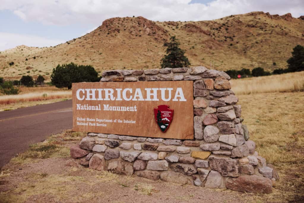
Key Info on Chiricahua National Park
- Location: About 120 miles east of Tucson, AZ, in Cochise County
- Size: More than 12,000 acres
- Established: 1924 as a national monument; redesignated a national park in 2026
- Entry cost: Free as of this writing (check the NPS site for any fee changes under park status)
- Nickname: The “Wonderland of Rocks”
- Visitor Center: Open daily, with maps, trail information, and geology exhibits
- Best time to visit: Spring and fall offer the best hiking weather
- Top trails for views: Echo Canyon Trail, Heart of Rocks Loop, Massai Point Nature Trail
- Camping: Bonita Canyon Campground is the only campground; reservations required
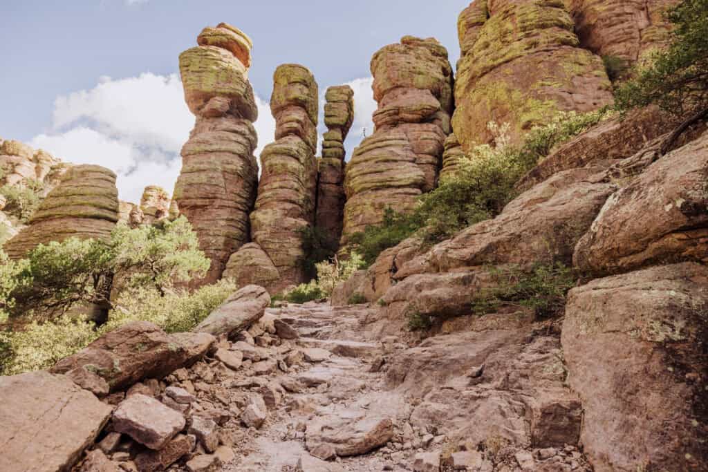
Visiting Chiricahua National Park
Chiricahua receives around 60,000 visitors a year, with numbers peaking at about 62,500 in 2023. Expect that to grow now that it carries the national park name.
Driving through the desert east of Tucson (about two hours), you’ll find it hard to imagine that the famous towering rock formations are ahead of you, somewhere in the flat landscape. Even at the park entrance, you won’t be able to see the rocks.
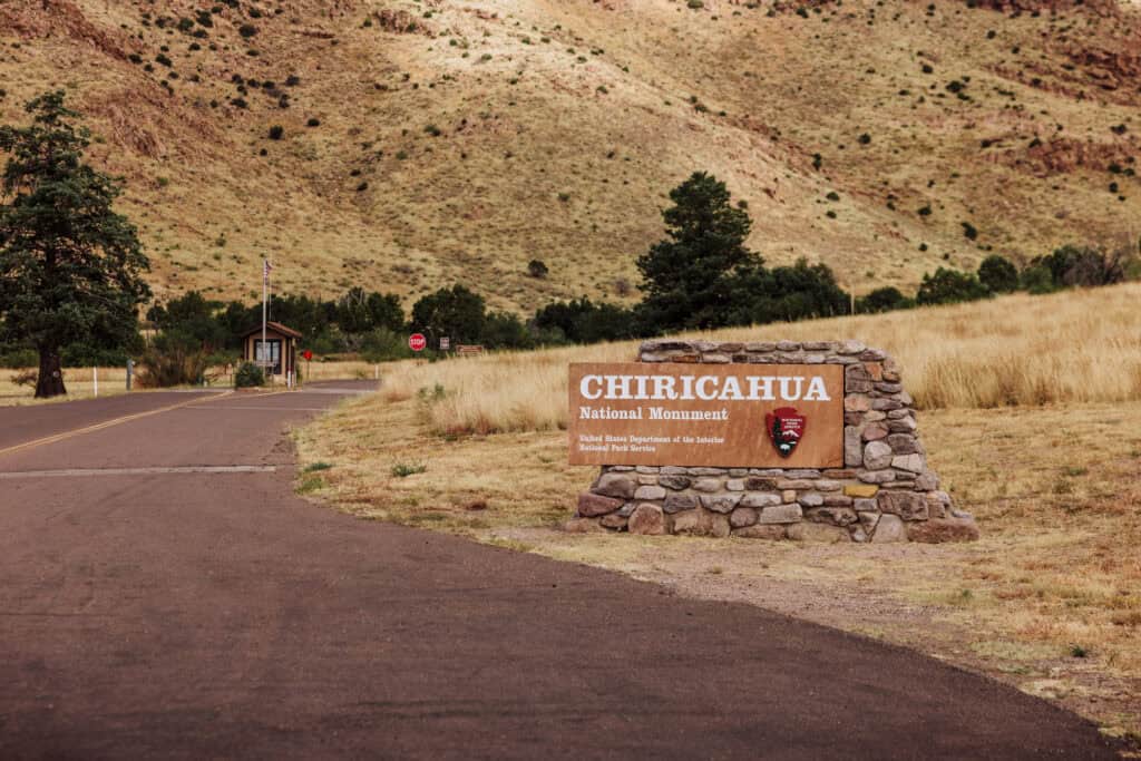
You can stop at the visitor center or just cruise through. One road takes you through the entire park. After passing the small campground, you’ll start to climb and notice the landscape change into what you drove all this way for.
Hikers usually head to the Echo Canyon Trailhead, a 7.5-mile drive that takes about 20 minutes.
Hiking Trails at Chiricahua National Park
Chiricahua’s trails showcase its “Wonderland of Rocks” formations and diverse landscapes.
- Echo Canyon Loop: Almost 4 miles, moderate, about 2 hours. The most popular loop, with towering rocks, grottoes, and caves.
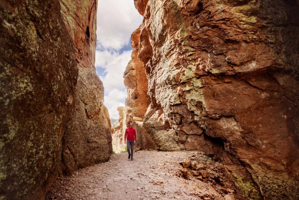
- The Grottoes: 1 mile round trip, easy, about 45 minutes. Rock caverns and corridors carved by water erosion.
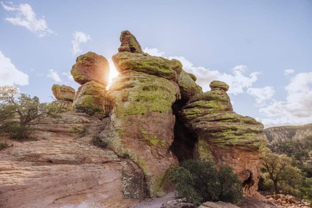
- Heart of Rocks Loop: About a 1-mile loop through iconic formations, including Big Balanced Rock.
- Natural Bridge Trail: 5 miles round trip to a natural bridge formation; less trafficked.
- Sugarloaf Mountain Trail: 1.8 miles round trip, moderate, with 360-degree views of the Chiricahua Mountains.
- Massai Point Nature Trail: An easy half-mile loop with panoramic views; good for families and seniors.
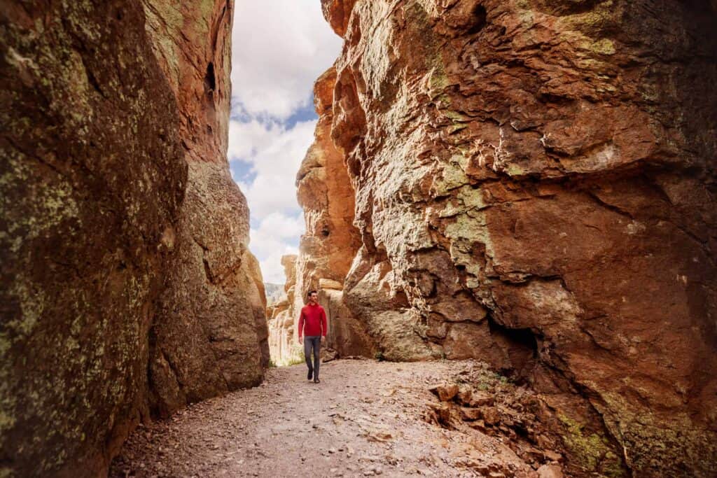
Echo Canyon. Built nearly a century ago by the Civilian Conservation Corps, the loop combines the Echo Canyon, Hailstone, and Ed Riggs trails. It winds down among the pinnacles to Bonita Creek before circling back to the parking area.
The Grottoes. For an easy hike, start at the Echo Canyon Trailhead and walk half a mile down to the Grottoes, on the right side of the trail.
Natural Bridge. Fewer hikers mean more peaceful views of the landscape.
Sugarloaf Mountain. The climb is moderate, but the views from the top are well worth it.
Massai Point: The Best Viewpoint
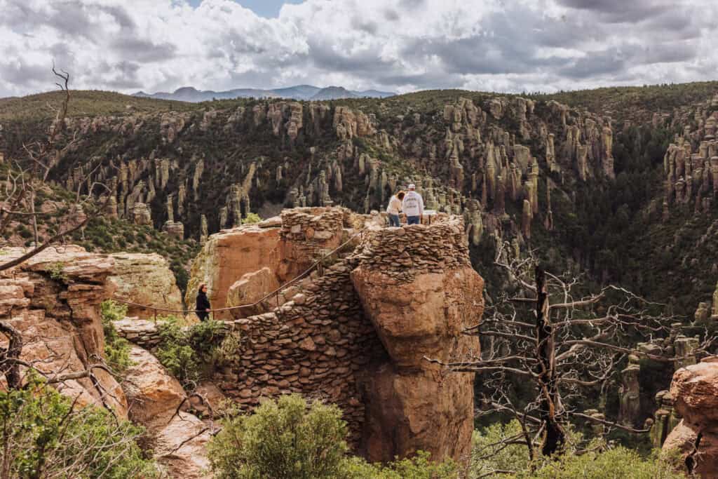
Massai Point is just beyond the Echo Canyon Trailhead, with a larger parking lot and bathrooms.
The Massai Point Nature Trail is an easy half-mile loop with panoramic views of the Chiricahua landscape. It’s ideal for seniors, families, or anyone wanting a quick scenic stop.
How the Chiricahuas Formed
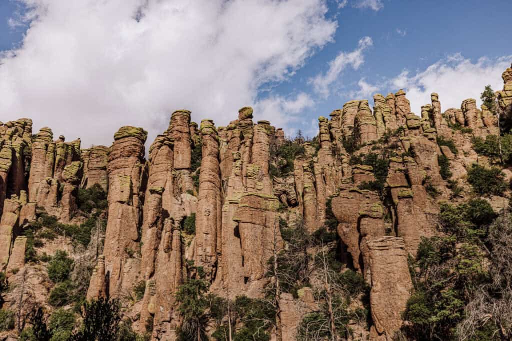
The Chiricahua Mountains were formed by volcanic activity around 27 million years ago. As the lava cooled and hardened, it created thick layers of rock that eroded over millions of years into the dramatic formations we visit today.
That rock is relatively soft and brittle. Wind, water, and freeze-thaw cycles carved it into the park’s spires and columns.
From National Monument to National Park
After years of effort across several Congresses, the Chiricahua National Park Act passed the House in March 2026, and the Senate in September, before it was was signed into law.
It was a bipartisan push from start to finish.
- 1924: Chiricahua National Monument established
- 2021: Sen. Mark Kelly first introduces the Chiricahua National Park Act
- March 2022: An earlier version passes the Senate but stalls in the House (S. 1320)
- 2023–2026: Bills reintroduced in the House and Senate in each new Congress
- March 2026: Passes the House
- September 2026: Passes the Senate
- 2026: Signed into law by President Trump
In the Senate, Mark Kelly and Ruben Gallego introduced the final version. In the House, Reps. Juan Ciscomani and Greg Stanton advanced it.
Supporters included the National Parks Conservation Association (NPCA), Cochise County, local businesses, and conservation groups such as HECHO. They argued park status would raise Chiricahua’s national profile, bring more visitors and jobs to the region, and help protect the landscape for future generations.
At the same time, critics worry it will bring crowds the park isn’t funded to handle.
The New Protections With National Park Status
The biggest new protections are for Native American cultural sites, since the land itself was already protected.
As a national monument, Chiricahua was protected under the Antiquities Act of 1906 and managed by the National Park Service, and that doesn’t change.
According to the bill summary, the law adds:
- Protection of cultural and religious sites. The National Park Service must protect traditional cultural and religious sites within the park.
- Guaranteed Tribal access. Tribal members are assured access to those sites for traditional cultural and customary uses.
- Temporary closures on request. At a tribe’s request, the Park Service may temporarily close specific areas to the public to protect traditional practices. Closures must be limited to the smallest area and shortest time necessary.
What the law doesn’t add:
- new operational funding
- more staff
- new roads for anticipated crowds
- additional infrastructure
- funding for needed repairs
Concerns Raised at Chiricahua
While the Association of Park Rangers supports Chiricahua becoming a national park, the group noted a series of concerns. They boil down to:
- short staffing
- no additional funding
The Center for Western Priorities notes: the Trump administration has diverted funding away from national parks, even using entrance fees to pay for some of the president’s preferred projects.
The group reports the National Park Service under Trump shifted 1,500 park projects to “low priority,” instead prioritizing projects like the terribly botched Lincoln Memorial Reflecting Pool and the partisan Freedom 250 event.
Specifically at Chiricahua, three important projects have been postponed as “low priority,” including:
- Emergency mold abatement in the staff housing
- Electrical systems in two historic buildings, last updated 40+ years ago
- Security cameras and improvements at 5 sites
The National Parks Conservation Association says park staffing is in a “severe crisis,” with 4,000 employees cut (24% of park staff) under the Trump administration.
3 Key Questions:
- Will the NPS be able to staff up Chiricahua to handle the anticipated increase in visitors?
- Will there be staff to prevent more visitors from going off-trail, putting the landscape at risk of erosion and damage?
- With only a single, narrow, two-lane road, can the park sustain larger crowds?
Camping Inside the Park
Bonita Canyon Campground is the only place to camp at Chiricahua. It’s about a mile past the visitor center and has only about 25 campsites, all requiring reservations. It’s a pretty setting, shaded by trees that create privacy between sites.
Accommodations and access. The campground is open year-round and takes tents, small RVs, and trailers up to 29 feet. Each site has a picnic table, fire grate, and access to flush toilets. There are no showers or hookups.
Reservations and fees. Reserve in advance through Recreation.gov. A standard site is $25 per night; a group site (9 to 24 people) is $50 per night. Holders of the America the Beautiful Senior or Access passes get discounted rates.
With national park status likely to draw more visitors, book well ahead, especially for spring and fall weekends.
Where to Stay Near Chiricahua
The park isn’t near any big cities. Here are the closest cities and landmarks:
- Tucson, AZ: 120 miles
- Las Cruces, NM: 200 miles
- White Sands National Park: 225 miles
- Phoenix, AZ: 230 miles
- Albuquerque, NM: 375 miles
If you’re not into camping, or can’t get a reservation, stay in Willcox, AZ, an easy drive from the park entrance. You’ll find a few hotels there, along with wineries and vineyards to check out.
The Best Time to Visit
Each season has its appeal, but spring and fall are best for hiking and exploring Chiricahua.
- Spring: Daytime highs in the 60s–70s °F. Wildflowers may be in bloom.
- Summer: Highs often reach the 90s °F. Monsoon storms, brief but intense, usually run July into September.
- Fall: Highs in the 60s–70s °F and usually comfortable. Monsoons die down by mid-September.
- Winter: Generally mild, with highs around the 50s °F, but nights can dip below freezing. Snow is possible at higher elevations.
Geronimo and the Chiricahua Apache
The park takes its name from the Chiricahua Apache, and its rugged canyons were part of the homeland where Geronimo and other Apache leaders held out against the U.S. Army until 1886.
The Apache also held the land as sacred.
Geronimo fought alongside the Chiricahua leaders Cochise and Naiche. Their bands clashed often with troops from Fort Bowie, about 15 miles northwest, and the Army fought many battles in these mountains. Between 1872 and 1876, after a truce with Cochise, the area was briefly part of the Chiricahua Reservation.
After breaking out of the San Carlos Reservation, Geronimo again used the Chiricahua Mountains as a hideout. From 1885 until his capture, the Army stationed the 10th Cavalry’s Buffalo Soldiers in Bonita Canyon, near today’s campground.
The Apache names live on in the park. Massai Point and Massai Canyon honor Massai, a Chiricahua warrior who escaped a prison train after the surrender and made his way back to these mountains.
The Civilian Conservation Corps at Chiricahua
Most of what visitors use at Chiricahua today, from the trails to the scenic drive, was built by a single Civilian Conservation Corps (CCC) camp between 1934 and 1940. The NPS says that without CCC labor, the monument would likely have stayed largely undeveloped.
The CCC was a New Deal program that put young men hit by the Great Depression to work on public lands.
Its enrollees lived and worked in Bonita Canyon from June 1934 to June 1940.
What the CCC built:
- Trails. About 12 miles of hiking trails, including the Echo Canyon, Hailstone, and Ed Riggs trails that make up today’s most popular loop.
- The scenic drive. The crews rebuilt the Massai Point Road, which was dedicated on Labor Day 1934.
- Buildings. The visitor center and headquarters, the Massai Point exhibit building, staff housing, and a maintenance yard.
- Bonita Canyon Campground. Still the park’s only campground.
- Sugarloaf Lookout. The fire lookout at the top of the Sugarloaf Mountain Trail.
The buildings were made from the same volcanic rock as the pinnacles.
FAQs on Visiting Chiricahua National Park
What’s the closest city to Chiricahua? Willcox is a small city about 35 miles from the park entrance. Tucson, about 120 miles west, is the closest city with an airport.
What’s the entrance fee? Entry has been free. Check the NPS website for any fee changes now that it’s a national park. Camping requires a reservation and a nightly fee.
How do you pronounce Chiricahua? CHEER-ih-KA-wuh.
Is Chiricahua dog-friendly? Yes. Dogs must be leashed and are permitted in the campground and on these trails:
- Silver Spur
- Faraway Ranch
- Bonita Creek
- The trail connecting the campground to the visitor center
