Hikes Near Great Falls, MT: 20 Scenic Trails

THE BEST TRAILS & HIKES NEAR GREAT FALLS, MT
Montana is a paradise for outdoor enthusiasts, and there are many great trails and hikes near Great Falls, MT.
Within an hour’s drive of Great Falls, which is in North Central Montana, you’ll find a wide variety of hiking opportunities through its stunning landscapes.
While serious adventure hikers will go deep into the Montana wilderness, I want to focus on the trails near Great Falls which are great for day hikes, families, and hikers of all ability levels.
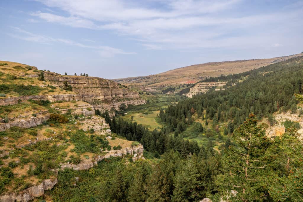
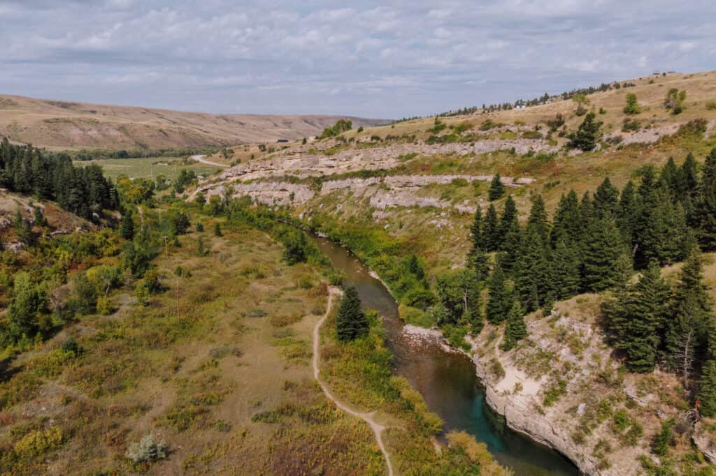
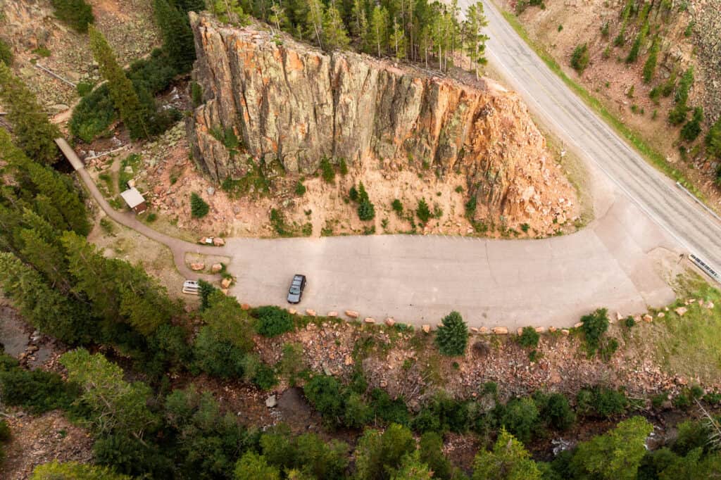
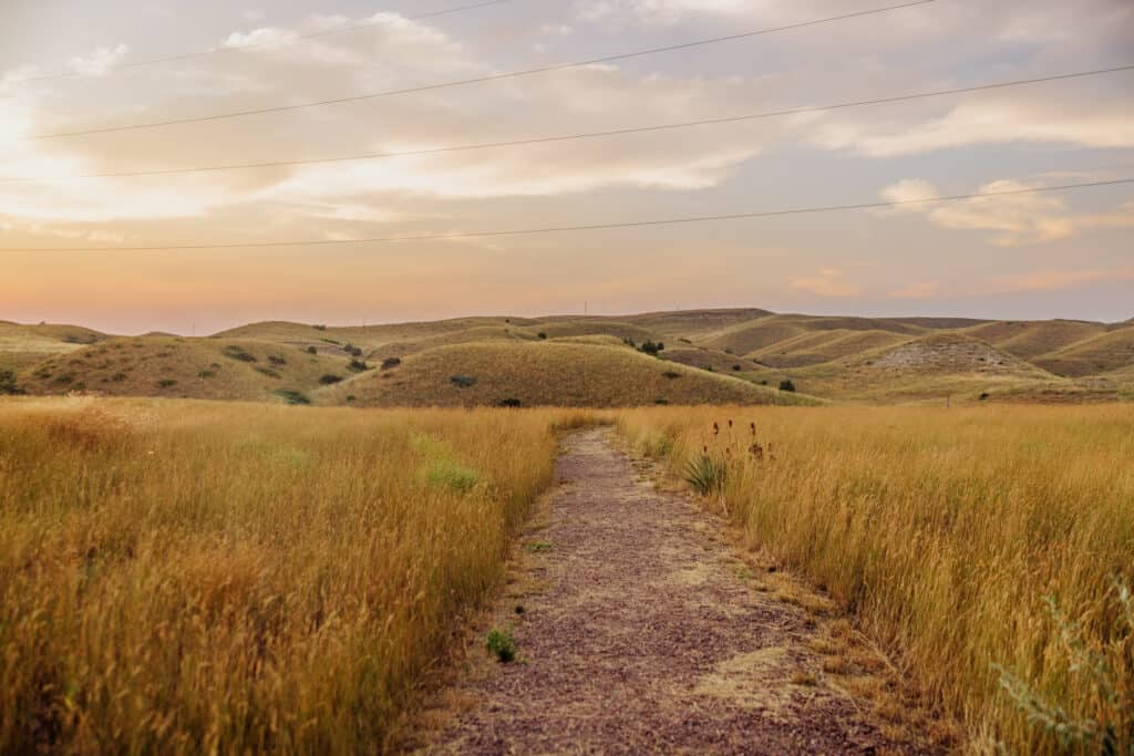
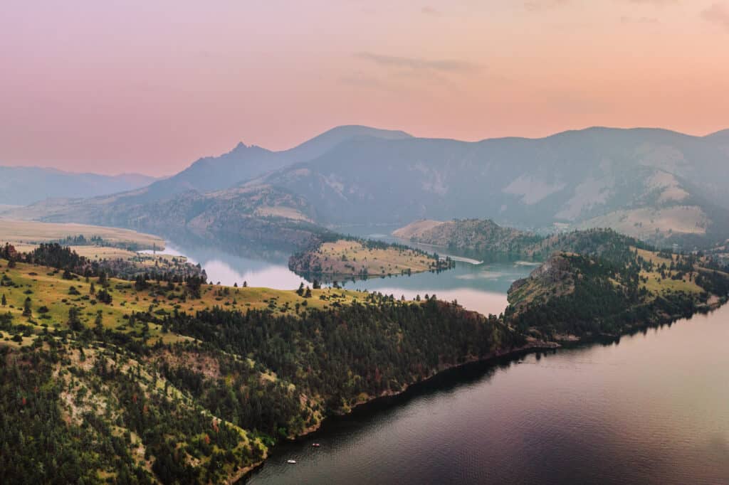
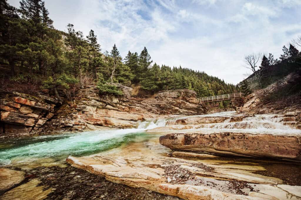
Sluice Boxes State Park Hikes
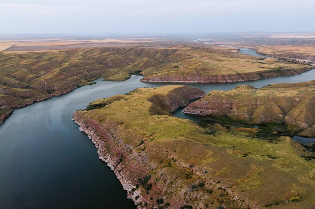
The hikes and trails through Sluice Boxes State Park are some of the best and most well-known near Great Falls, MT. The drive is only about 30-miles southeast of the city.
Belt Creek carved a canyon through the limestone, creating a rugged area full of hiking, swimming, and fishing opportunities.
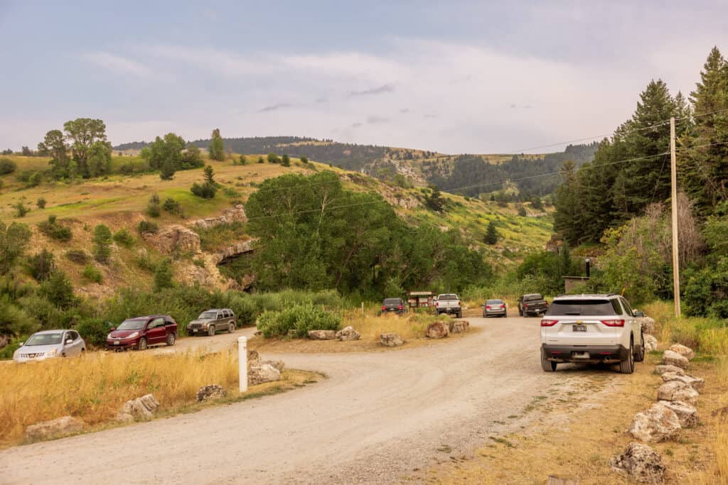
There are two parking areas, and each delivers a different kind of hiking experience.
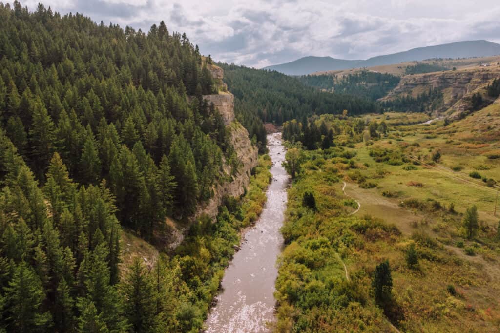
Sluice Boxes: Lower Trail
The lower trail is busier, but you should still find ample parking in the lot, which is right off the highway.
The trail will take you right alongside Belt Creek, as it runs through the area.
During the summer months, it’s a popular swimming hole. People love jumping off the cliffs here into the water.
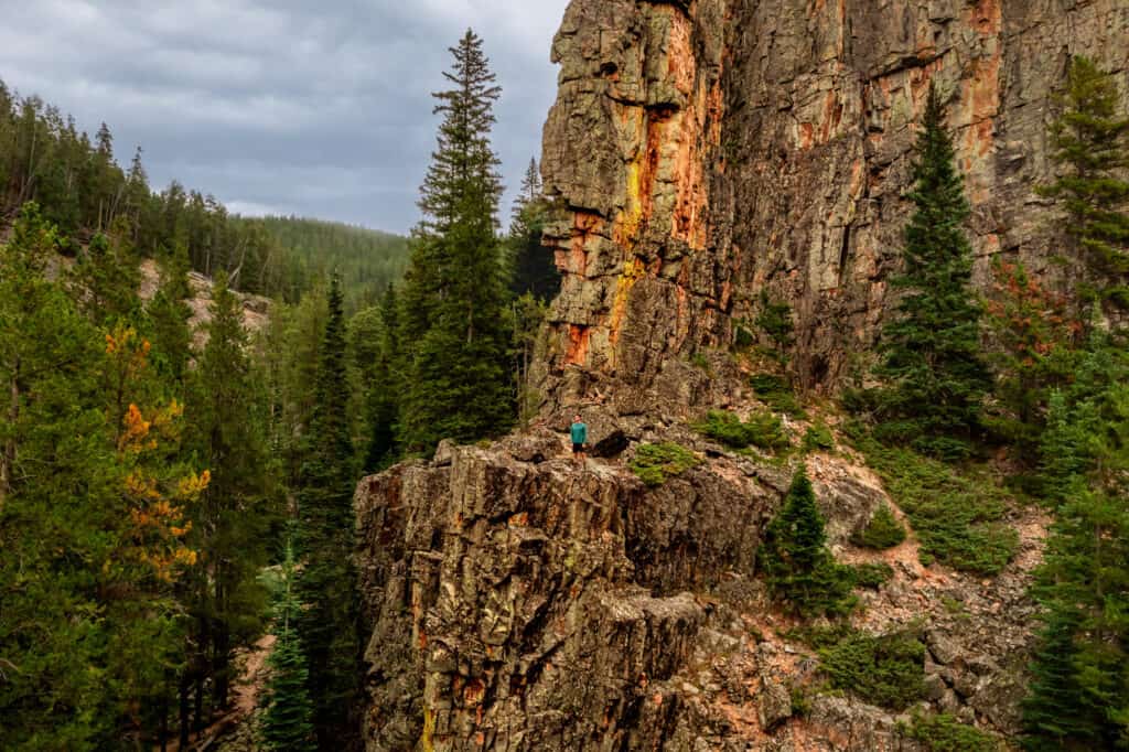
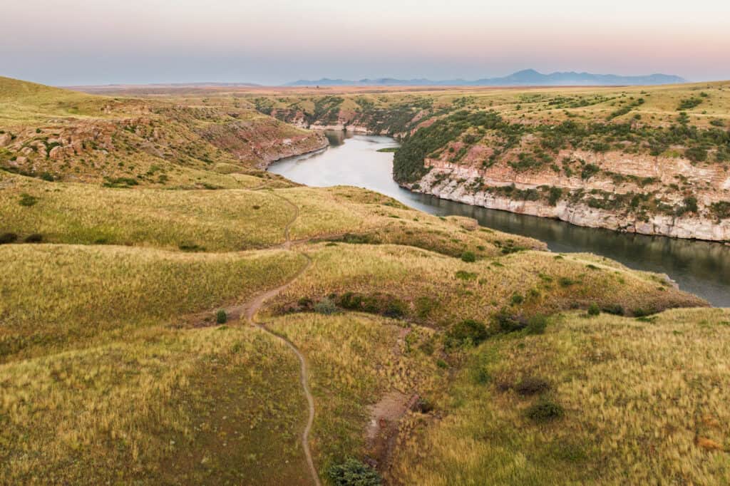
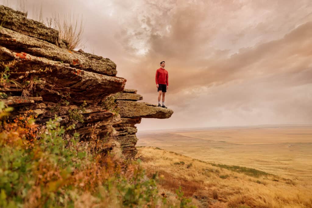
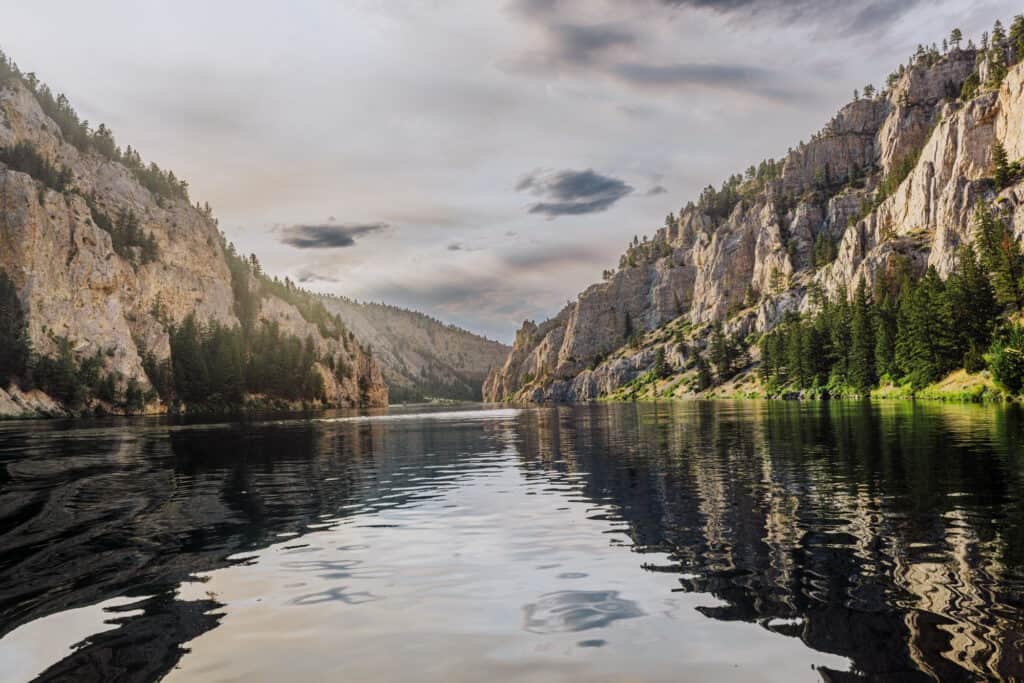
Sluice Boxes: Overlook Trailhead
The Overlook Trailhead lot is the *second parking area you’ll come to at Sluice Boxes State Park. It’s usually uncrowded, with plenty of spots to choose from.
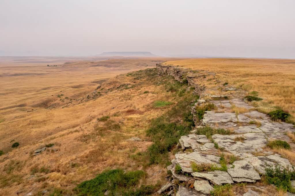
The trails here, known as Cliff Face and Ridge Top, will deliver stunning views. For part of the hike, you’ll be walking along the stone cliffs below:
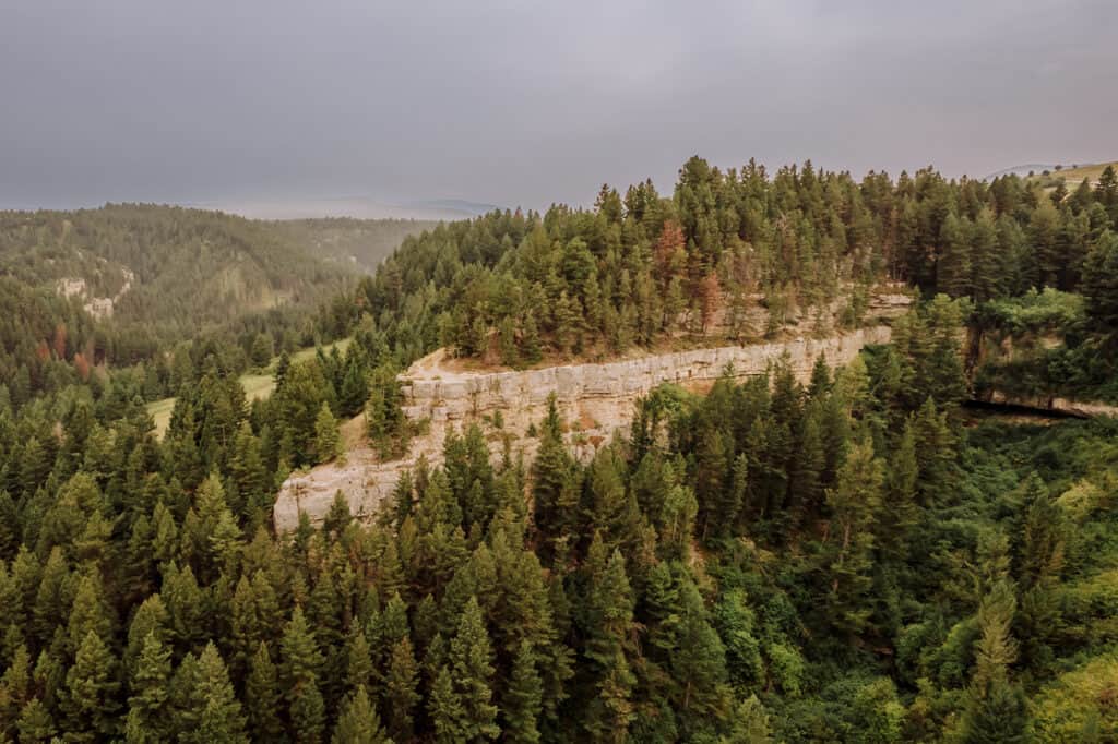
Here’s a look at the trail, as you’ll see it along the cliffs:
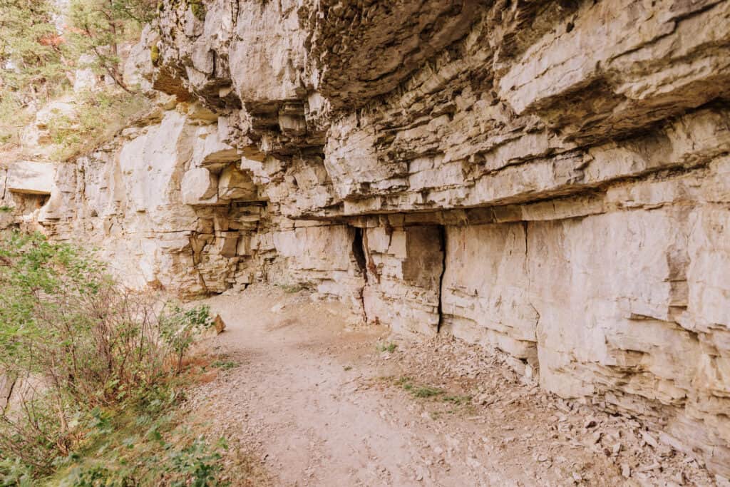
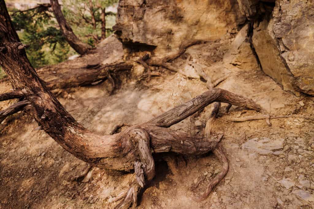
The Sluice Boxes State Park trails are well-marked and traveled, but still pretty rugged.
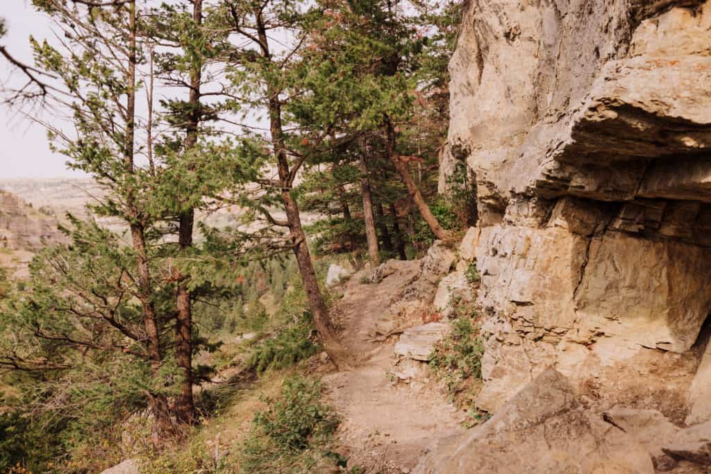
You’ll be hiking along cliffs, climbing over roots and rocks along the way.
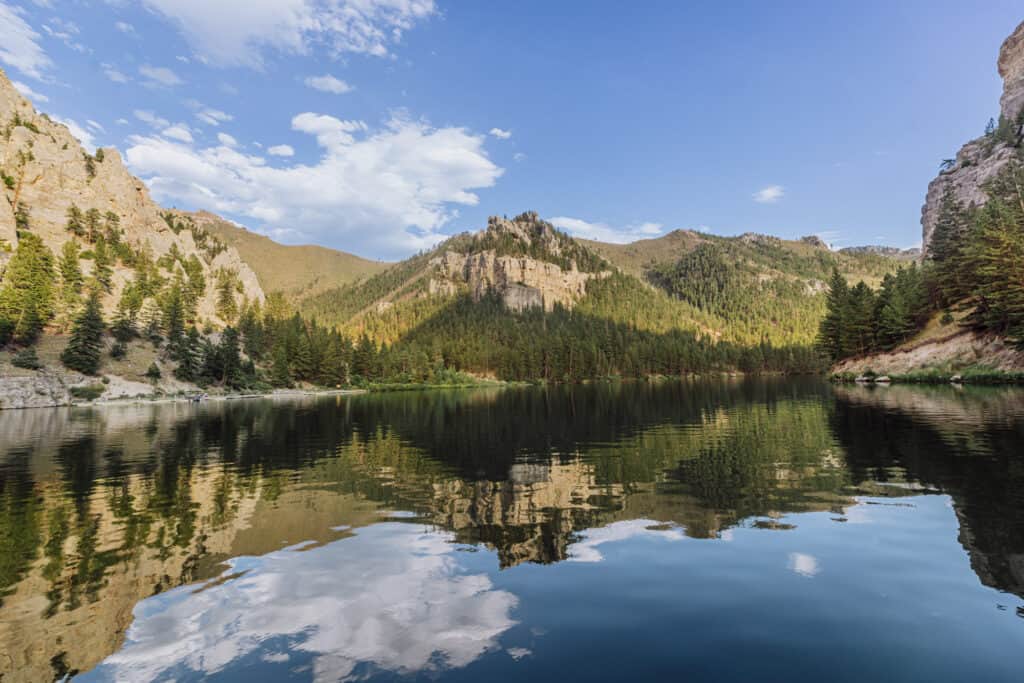
A word of caution about hiking at this Montana State Park during the winter:
People have died, as have their pets, from accidentally going over the cliffs at Sluice Boxes. It’s especially dangerous during the winter. Snow and ice can make it difficult to tell when the narrow trail ends, and where the drop-off begins.
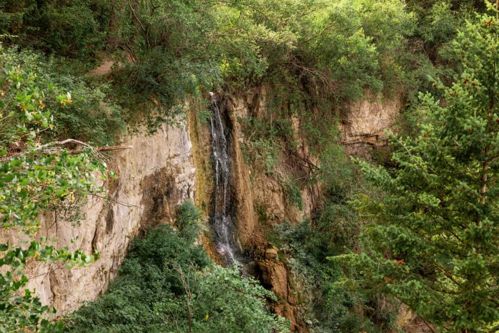
During the rest of the year, the trails are fun to hike, and deliver amazing views of the valley, and even a waterfall along the way.
Sluice Boxes Hiking Info
🔘 Drive from Great Falls: 35 miles
🔘 Trail Parking: Two large lots
🔘 Elevation: 4,125′
🔘 Seasons & Hours: Year-round
🔘 Permits & Fees: $8 (out-of-state parking)
🔘 Amenities: Vaulted toilets
🔘 Camping: Back Country Permit needed from FWP
🔘 Kid-Friendly: Yes, especially the lower trail
🔘 Dog-Friendly: Yes
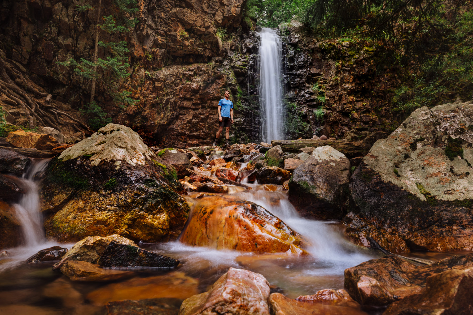
Hike the Memorial Falls Trail
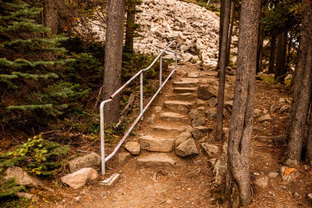
The hike to Memorial Falls is another great family option, in the Lewis & Clark National Forest south of Great Falls, MT. The trail leads to a pretty waterfall, with a cascade that runs down a rocky creek through the forest.

It’s a beautiful drive to this well-marked and highly-traveled trail. There are 20 parking spots at the trailhead parking lot, along with a vaulted bathroom.
The trail to the falls is rugged at times, but also includes hand railings to help hikers climb up the steeper spots. It’s not exactly the “Montana wilderness” some hikers might be looking for, but this makes Memorial Falls a great option for families!
Pro Tip: Stop by Bob’s Bar in Neihart on your way back to Great Falls for some of the best burgers around!
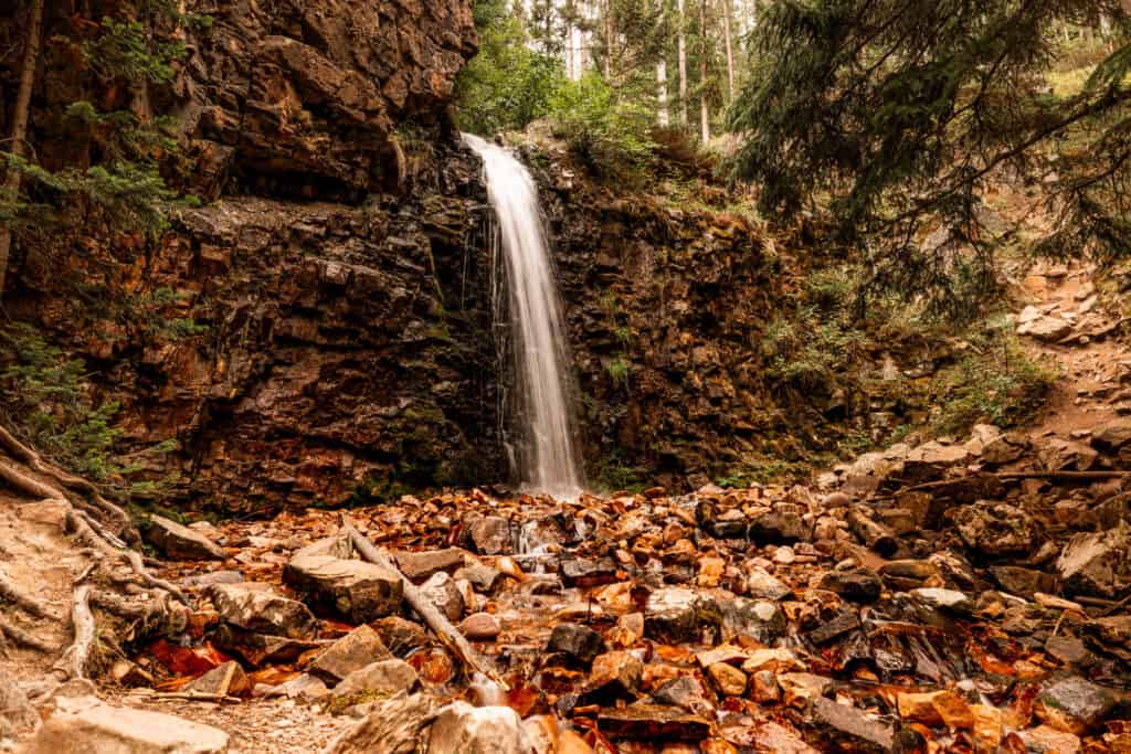
After checking out the waterfall and creek, you can also hike around and up to the top of Memorial Falls for an even better view of the Lewis and Clark National Forest.
As with many of the hikes, you’re advised to be “bear aware.” I’ve seen black bears around here, but they’re most likely not interested in the hikers.
Memorial Falls Hike Info
🔘 Trail Parking: Large lot off Hwy 89
🔘 From Great Falls: 60 miles
🔘 Trail Length: 3 miles (round trip)
🔘 Trail Condition: Rocky & well-marked
🔘 Elevation: 5,620′
🔘 Seasons & Hours: Year-round
🔘 Permits & Fees: None
🔘 Amenities: Vaulted toilets
🔘 Kid-Friendly: Yes
🔘 Pet-Friendly: Yes
Hikes Along The River’s Edge Trail
The River’s Edge Trail is a system of 60-miles of hiking trails, which begin right in the city of Great Falls, MT.
The trails run along a stretch of the Missouri River, known for its significance during the Lewis & Clark Expedition in the 1800s.
In 1805, the group was traveling down the river, when a series of rapids and waterfalls ground their trip to a halt. They ended up carrying everything 18-miles around the falls (which were referred to as the “Great Falls” of the Missouri).
These days, some of the “Great Falls” are covered by water due to the dams which were built along the river in the 1920s.
The hikes and trails along the Missouri River come complete with mini history lessons at the trailheads.
Giant Springs State Park
Giant Springs is one of the most well-known sites in Great Falls, MT. You won’t find challenging hikes here, but rather walking trails which are very family-friendly. These trails link up with the rest of the River’s Edge Trail system.
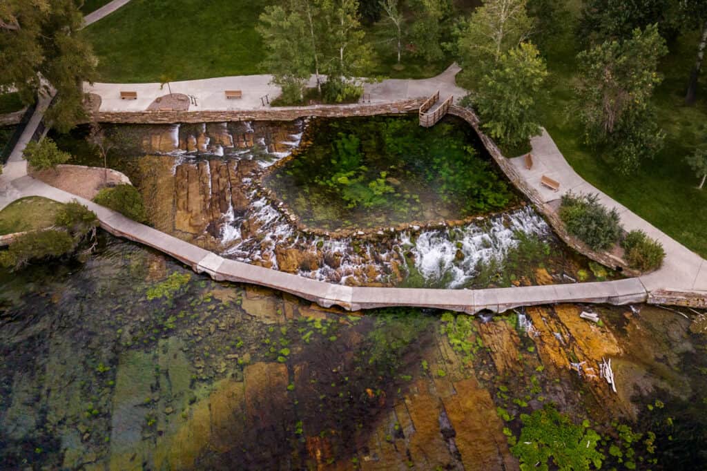
It’s worth a stop to check out one of the biggest freshwater springs in the country, which is also considered to be the “shortest river in the world!”
You’ll find people walking the 2.1-mile Giant Springs Loop Trail. It’ll provide nice views of Black Eagle Falls.
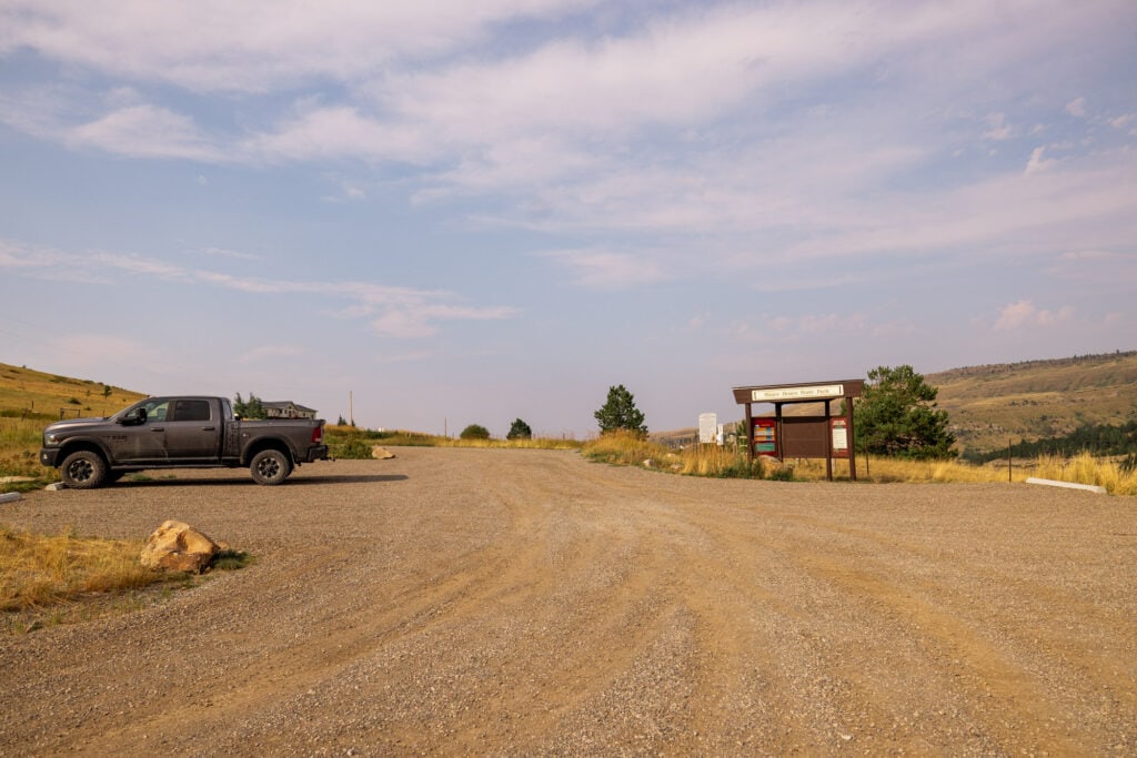
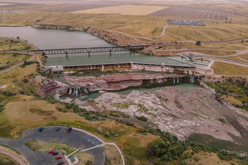
Morony Dam: The Sulphur Springs Trail
It’s a 15-mile drive northeast of the city to this hike near Great Falls. You’ll take a paved, but bumpy road, to the trailhead at Morony Dam.
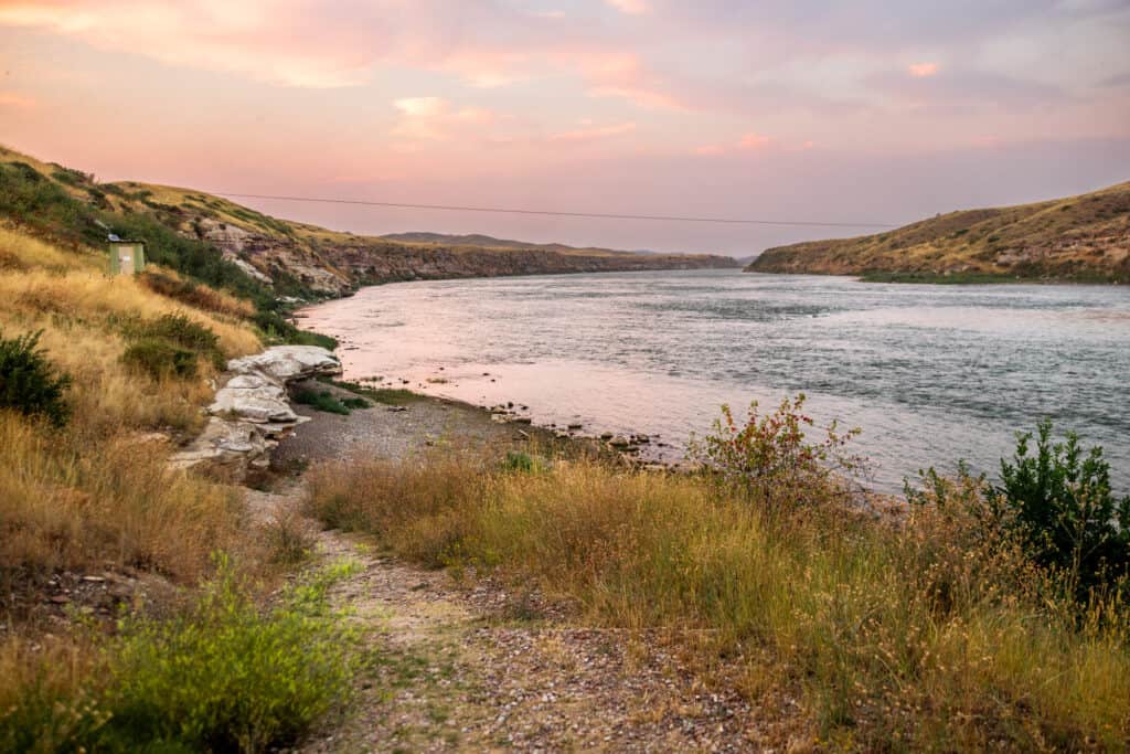
There are two trails here: Sulphur Springs and North Shore.
Sulphur Springs is a 1.8-mile walking trail, through the rolling hills and fields, which leads you to a famous mineral spring.
HISTORIC SPOT: Sacagawea, the only woman on the Lewis & Clark Expedition, was deathly ill at this point on their journey. It’s said that the mineral waters from Sulphur Spring helped to rehydrate and heal her.
From the same Morony Dam parking area, you can also access the North Shore Trail. Both dirt trail options are also very popular with mountain bikers.
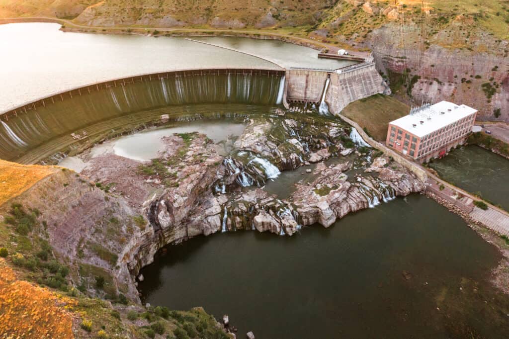
Ryan Dam Trailhead
Ryan Dam is on the same road you’ll take to Morony Dam, northeast of Great Falls, MT.
You can take a suspension bridge across to Ryan Island, which has picnic areas and viewpoints of the waterfalls and dam.
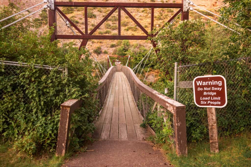
Ryan Island is typically only open during the summer months, between Memorial Day and Labor Day. It’s a great picnic spot in the summer.
The Missouri River drops around 100-150 feet through Ryan Dam, spinning the turbines that produce power for 50,000+ homes.
The River’s Edge Trail, which is dirt in this area, runs on the north shore of the Missouri River from the Ryan Dam area.
Black Eagle Falls
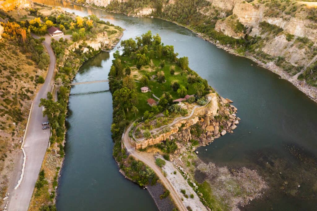
On the south end of the River’s Edge Trail, you’ll be closest to the city of Great Falls.
If you’re hiking in the area, it’s worth a stop at the Black Eagle Falls, which are accessible from the north side of the Missouri River. After parking, you’ll follow a bridge across part of the river to Black Eagle Memorial Island.
Half of the original falls are covered by the water pooling behind the Black Eagle Dam. Originally built in 1891, the hydroelectric plant here gave Great Falls its nickname: “The Electric City.”
Depending on the water levels, you might be able to hike along the shoreline to the base of Black Eagle Falls.
It’s also a popular spot to fish for trout, walleye, perch, and more.
Rainbow Dam: Lewis & Clark Overlook Trailhead
Just beyond the Lewis & Clark Interpretive Center, you’ll find trails overlooking Rainbow Dam. There’s parking at the Lewis & Clark Overlook Trailhead.
In this area, some of the trails are paved and smooth, while others are dirt and run along the steep cliffs above the Missouri River.
River’s Edge Trail Info:
🔘 Trail Length: 60 miles of options
🔘 Trail Condition: Paved
🔘 Elevation: 3,300′
🔘 Seasons & Hours: Year round
🔘 Permits & Fees: Free
🔘 Amenities: Vaulted toilets
🔘 Kid-Friendly: Yes
🔘 Pet-Friendly: Yes
🔘 Trail Map: Click Here
First People’s Buffalo Jump
This is a unique and historic hike near Great Falls, MT, which is also a National Historic Landmark.
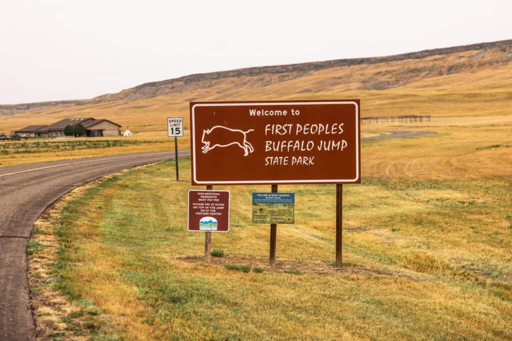
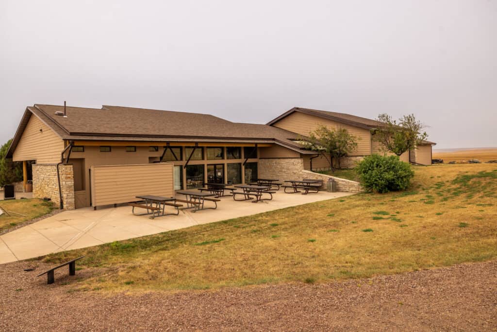
It’s about a 15-mile drive southeast along Interstate 15 to First People’s Buffalo Jump State Park. You’ll find a visitor center in this rural spot, several miles off the highway.
First People’s Buffalo Jump is one of the largest “bison jumps” in the country. You’ll learn about the Northern Plains Indians‘ hunting tactics, and how they used the natural rocky cliffs to hunt bison.
The trail itself is initially unremarkable, leading you through grassland and up a few switchbacks. It’s a 3-mile loop trail, and the first mile or so is a gradual incline which continues to get steeper. Bring water with you, especially if it’s warm out.
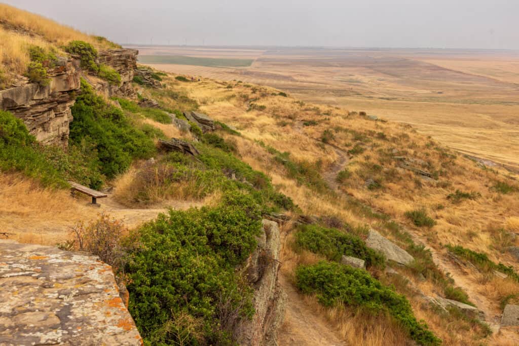
At the top of the switchbacks, you’ll arrive at the top of a mile-long butte or bluff. It’s a beautiful site, and fascinating to think about the ancient hunting practices.
You’ll learn from signs along the trail that the “buffalo runners” would jump over the cliff themselves, as they were being followed by a stampede. They’d jump onto a ledge and hide as the animals fell to their deaths all around them.
HIKING TIP: Watch for Prairie Rattlesnakes in the rocks. Stay out of their way, and they’ll do their best to avoid you, too!
First People’s Hike Info
🔘 Trail Parking: Large lot
🔘 From Great Falls: 15 miles
🔘 Trail Length: 3 miles
🔘 Trail Condition: Groomed dirt & rocks
🔘 Elevation: 3,400′
🔘 Seasons & Hours:
Summer: Daily
Winter: Wed – Sun
🔘 Permits & Fees: $8 (out-of-state car)
🔘 Amenities: Visitor Center
🔘 Camping: No
🔘 Kid-Friendly: Yes
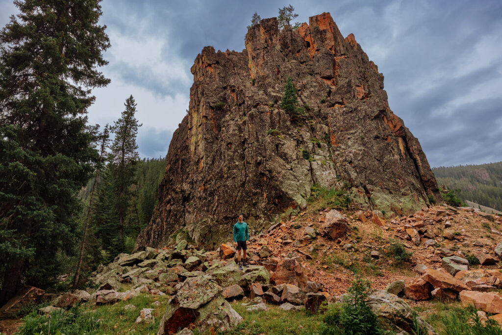
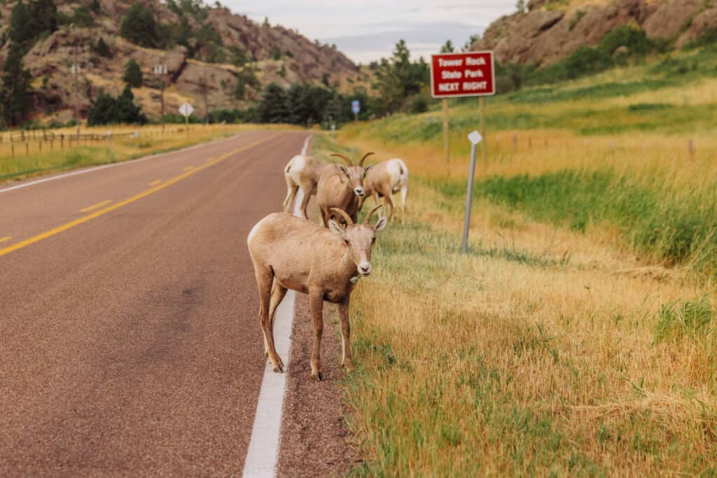
Tower Rock State Park
Tower Rock is a prominent milestone near Cascade, MT, south of Great Falls. It’s an easy 33-mile drive south of the city, and the trailhead parking lot is right off the highway (Interstate 15).
The Lewis and Clark Expedition encountered Tower Rock during their journey up the Missouri River in 1805. It became a marker of progress for the expedition as they left the plains and crossed into the Rocky Mountains.
The prairies meet the mountains at Tower Rock. The area was created by volcanic activity 70 million years ago.
Tower Rock Trail
Signs at the trailhead say the Tower Rock Trail is only a quarter of a mile. In reality, it’s quite a bit longer.
The downside of this spot is: you’ll be hiking along the mountainside which is adjacent to the interstate. While the noise of freeway traffic is pretty constant, the views are still beautiful.
Just south of Tower Rock, along I-15, you’ll find a scenic viewpoint with a parking lot. There’s a small paved walkway that will lead you up some stairs through the rocks to a stunning vista overlooking the mountains and creek. It’s definitely worth a stop if you’re in the area.
Chances are: you’ll have a friendly wildlife encounter!
Hardy Creek
For a quieter experience near Tower Rock, drive behind the state park along the Recreation Road, to Hardy Creek. The views here are even better! The creek winds its way through the rocky terrain.
While there really aren’t marked trails here, it’s definitely worth parking and climbing around on the rocky shoreline.
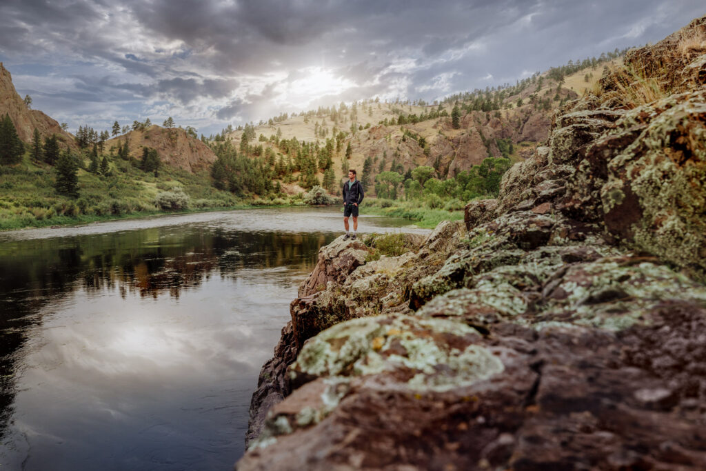
This is a popular spot for fly-fishing, kayaking, and floating. Anglers from all over the world come to fly fish this stretch of the Missouri River.
If the water’s deep enough, you can dive in off the rocks during the summer!
Tower Rock Hike Info
🔘 Trail Parking: Large lot off I-15
🔘 From Great Falls: 35 miles
🔘 Elevation: 3,400′
🔘 Seasons & Hours: Year round
🔘 Permits & Fees: $8 (out-of-state car)
🔘 Amenities: Vault toilet
🔘 Kid-Friendly: Yes
🔘 Pet-Friendly: Yes
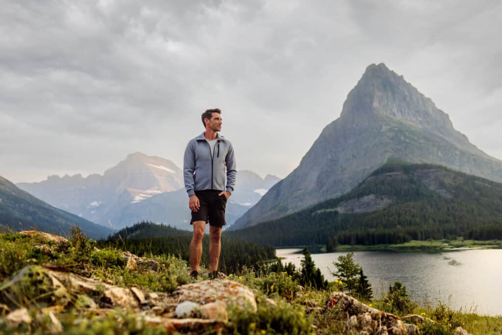
Glacier National Park
Great Falls, MT, can be used as a base for an amazing trip to one of the most beautiful places on Earth: Glacier National Park!
It’s a gateway to the eastern entrance to the park, near St. Mary, or to Many Glacier:
Virginia Falls
I’m only going to mention the hike that’s closest to Great Falls, but there are countless others. The hike to Virginia Falls is “a must” on a visit to Montana! Parking is about 150 miles from Great Falls, so this can still easily be done in a day trip (speaking from experience).
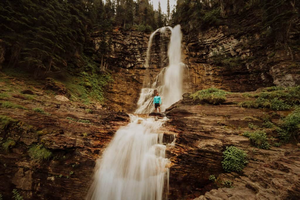
You’ll have to remember the permitting system and reserve a pass for Going to the Sun Road. You can also get to the park entrance before they start checking passes early in the morning (since the gates to Glacier never close). From the park entrance, it’s just a few miles to the Virginia Falls parking area.
The hike is just a bit less than 4-miles long.
The trail to Virginia Falls will take you through forests and meadows, along the St. Mary River. You’ll pass through an area burned in a wildfire several years ago. It’s interesting to see the regrowth happening in this part of the park.
Along the way, you’ll pass St. Mary Falls, another beautiful site along the trail, which is about 1.5 miles in.
Virginia Falls Hike Info
🔘 Trail Parking: Side of Going-to-the-Sun Rd.
🔘 From Great Falls: 165 miles
🔘 Trail Length: 3 miles
🔘 Elevation: 4,500′
🔘 Seasons & Hours: Closed Seasonally
🔘 Permits & Fees: Going-to-the Sun Permit
🔘 Pet-Friendly: No
As a side-note, Glacier National Park is also one of the prettiest, most scenic places in the USA to get married or elope!
Holter Lake Hikes
Holter Lake is known for its boating opportunities more than its trails, but it’s close enough (and pretty enough) to include on this list of hikes near Great Falls, MT.
It’s about a 60-mile drive south from the city to Holter Lake (which is also really just part of the Missouri River between Great Falls and Helena).
Juniper Bay to Log Gulch
This is about a 4-mile trail from tiny Juniper Bay, along the eastern side of Holter Lake:
It’ll take you on a loop over to the Log Gulch Campground.
Holter Lake Hike Info
🔘 Trail Parking: GPS: 46.968567, -111.957994
🔘 From Great Falls: 60 miles
🔘 Trail Length: 4 mile
🔘 Elevation: 3,600′
🔘 Kid-Friendly: Yes
🔘 Pet-Friendly: Yes
Gates of the Mountains Trails
The Gates of the Mountains Wilderness is a scenic area located along the Missouri River in the Helena National Forest. It’s about 80 miles south of the city, so I’m including the trails here as some of the hikes near Great Falls, MT.
I’ll list a few of the hiking options in this area, most of which offer great views and solitude:
Refrigerator Canyon Trail
The Refrigerator Canyon Trail is 9-miles long, and begins here:
- GPS: 46.85002771768229, -111.730544275751
Mann Gulch
This one’s for the experts and serious adventure hikers!
You’ll have to boat to the trailhead on the Missouri River, before setting off on your hike through the Gates of the Mountains Wilderness.
You can boat to the Merriwether Trailhead:
- GPS: 46.765971, -111.886337
Alternatively, you can go farther up the river to Mann Gulch:
- GPS: 46.765971, -111.886337
The views are stunning along this 10-mile trek!
I’d suggest checking the latest hiker reports on AllTrails.
Beaver Creek / Hauser Dam Trail
The Missouri River Beaver Creek Trail isn’t really part of the “Gates of the Mountains” area, but it’s another trail option along the stretch of the river toward Helena. There’s a trailhead parking lot near the dam, and the trail itself is about 4-miles long, with plenty of access to the river for fishing and swimming.
- GPS: 46.765971, -111.886337
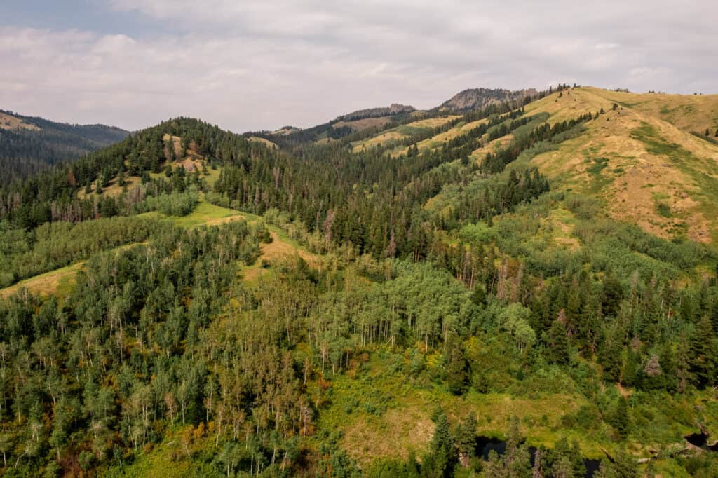
Hiking in The Highwood Mountains
The Highwoods provide great camping and hiking trails near Great Falls, MT. There are several trails that cater to different skill levels, providing opportunities for both casual hikers and more experienced adventurers.
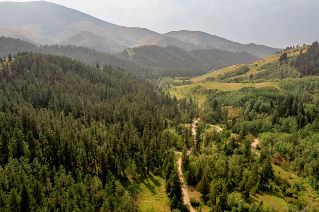
The highest point in the Highwood Mountains is Mount Baldy, which reaches an elevation of around 8,914 feet
The Windy Mountain Loop
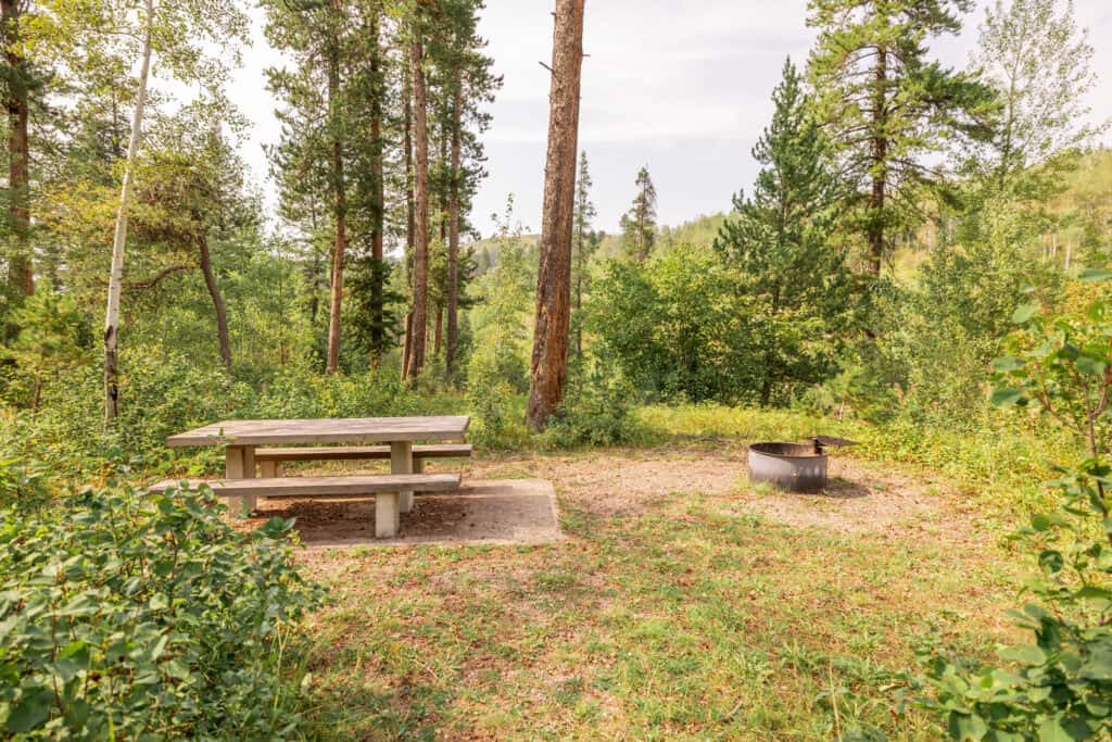
Many of the hikes in the Highwoods start at the Thain Creek Campground, which is an easy 40-mile drive from Great Falls. Cars might be able to make the trip, but it’s easier in a truck or SUV.
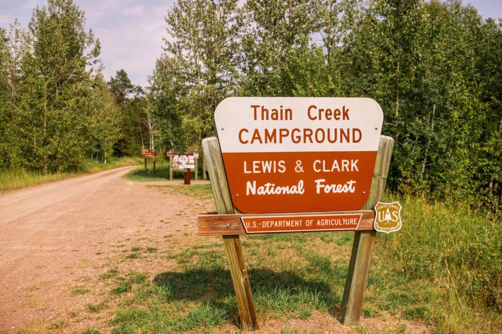
You’ll find plenty of parking at the campground. If you’d like to stay overnight, it’s $10, which can be paid on-site.
The Windy Mountain Loop starts in the campground, labeled as Trail 413.
- GPS: 47.476018, -110.585159
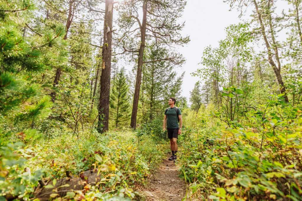
It’s about a 7-or-8-mile loop.
You’ll find wildflowers blooming into August, and beautiful foliage come fall.
Highwoods Hike Info
🔘 Trail Parking: Thain Creek Campground
🔘 From Great Falls: 40 miles
🔘 Trail Length: 7 miles
🔘 Amenities: Vaulted toilets
🔘 Camping: Yes
🔘 Kid-Friendly: Yes
🔘 Pet-Friendly: Yes
Hikes in The Bob Marshall Wilderness
The Bob Marshall Wilderness Complex is a rugged wilderness area, near Great Falls, MT. I was introduced to it as a young reporter, when a helicopter dropped me off on a peak to cover a wildfire in the summer of 2003.
The Bob Marshall Wilderness Complex encompasses more than 1 million acres of diverse landscapes, including mountains, forests, rivers, and alpine meadows.
Devils Glen
Devil’s Glen is known for its striking rock formations, towering cliffs, and scenic beauty, near Augusta, MT.
You’ll start at the Dearborn Trailhead:
- GPS: 47.2698948590196, -112.51541634623453
The trail itself is about 6-miles, out-and-back.
Chinese Wall Trail
This one’s for the true wilderness adventure-seekers! I haven’t done it, but it requires a few days to conquer the 27-miles (or so) in each direction.
The Chinese Wall Trail is a popular hiking route in the Bob Marshall. The Wall itself is a towering limestone cliff, which stretches for about 12 miles along the Continental Divide. It reaches heights of up to 1,000 feet in some places.
The trailhead for the Chinese Wall Trail is typically accessed from the Benchmark Trailhead, located off Benchmark Road in the heart of the Bob Marshall Wilderness Complex.
- GPS: 47.48940845979424, -112.8830706209031
The trail’s length can vary depending on where you start and how far you hike.
A permit is required to enter the Bob Marshall Wilderness Complex, including the Chinese Wall Trail. These permits help manage the number of visitors to ensure the preservation of the wilderness environment.
Bear safety is crucial, as the Bob Marshall Wilderness Complex is home to grizzly bears.
Swift Dam & Reservoir
Swift Dam creates Swift Reservoir near Dupuyer, MT, which is 100 miles from Great Falls.
There are a few easy trails around the reservoir, a campground, and far more challenging trails into the wilderness.
Heart Lake
The hike to Heart Lake begins at the Indian Meadows Trailhead, which is a 90-mile drive from Great Falls, closer to the town of Lincoln.
The trail itself is about 10-miles (out-and-back). It’ll lead you to gorgeous Heart Lake, which is known for its clear, turquoise water!
Hikes Near Havre
Havre is a two-hour drive from Great Falls, and it’s home to the biggest county park in the USA. Beaver Creek Park encompasses part of the Bears Paw Mountains.
The mountains and trails are about 20-minutes south of Havre. The highest peak is Baldy Mountain, at about 7,000 feet.
The trails in the Havre area will feature a variety of landscapes, from grasslands to pine and aspen groves, and volcanic rock formations.
Options include:
- Mount Otis Trail
- Rotary Canyon Loop
- Bullhook Butte Loop
- Bearpaw Nature Trail
FAQs on Hikes Near Great Falls, MT
Let’s quickly tackle a few other questions related to the trails and hiking near Great Falls, MT.
What’s the elevation of Great Falls, Montana?
The city of Great Falls, MT, sits at about 3,300 feet in elevation.
What national parks are near Great Falls?
Glacier National Park is the closest to Great Falls. It’s about 150 miles from the city to the eastern entrance of the park at St. Mary.
Yellowstone National Park is father along the southern edge of Montana.
In addition to the national parks, the Great Falls area is close to both the Helena and the Lewis and Clark National Forests.
How do you prepare for bears on hikes in Montana?
Even if there’s a remote chance you’ll see a bear, each of the trailheads is marked with a “Be Bear Aware” sign. Grizzlies are very common in and around Glacier National Park. They’re also known to roam the Missouri River between Helena and Great Falls.
Most hikers will carry bear spray, and many will carry bells to warn the bears that you’re coming. As always, the best advice is to never come between a mother and her cubs. Plus, if you’re camping, store your food properly.

How far is it from Great Falls to Glacier National Park?
It’s about 150-miles from Great Falls to Glacier’s eastern entrance.
How far is it from Great Falls to Yellowstone National Park?
It’s about 225 miles from Great Falls to the entrance of Yellowstone in the town of Gardiner, MT.
What are a few other things to do in Great Falls?
Glad you asked 😀➡️ Click here for a full post of things to do!
What are some good restaurants in Great Falls?
Another great question 😀➡️ Click here for restaurant options in the city.