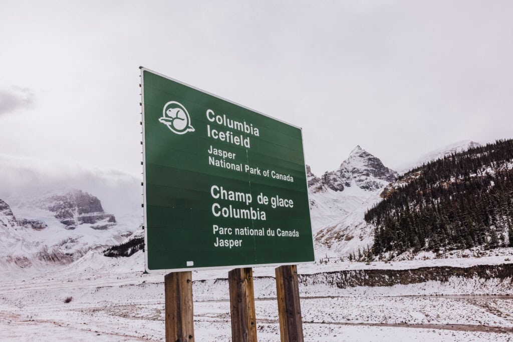
Hike to the Athabasca Glacier: Easy Access to the Ice Age in Jasper

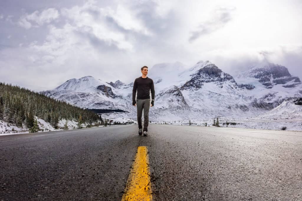
The Athabasca Glacier is one of the most popular stops on the Icefields Parkway. You’ll have easy access, dramatic views, and the chance to stand at the edge of a true Ice Age remnant.
This rapidly receding glacier is part of the massive Columbia Icefield, and it’s one of the few places in the Canadian Rockies where you can walk right up to the ice. You don’t need technical skills or equipment for this climb!
Whether you’re here for photos, the guided glacier tour, or the nearby Skywalk, this guide breaks down what to expect in every season, how the glacier has changed over time, and the essential advice for your visit.
Tours to the Athabasca Glacier
It’s easy to rent a car and drive the Icefields Parkway to the glacier, but if you’d rather have someone else handle the logistics, these two options have excellent reviews:
➡️ Click to Book: Banff to Glacier & Other Sites
➡️ Click to Book: Full Day Tour from Banff
How to Get to the Athabasca Glacier
The glacier is located along the Icefields Parkway (Highway 93 North) in Alberta, Canada.
- From Jasper: 60 miles (97 km)
- From Banff: 115 miles (185 km)
- From Lake Louise: 105 miles (169 km)
There’s a small lot, with room for around 20 vehicles, right at the trailhead.
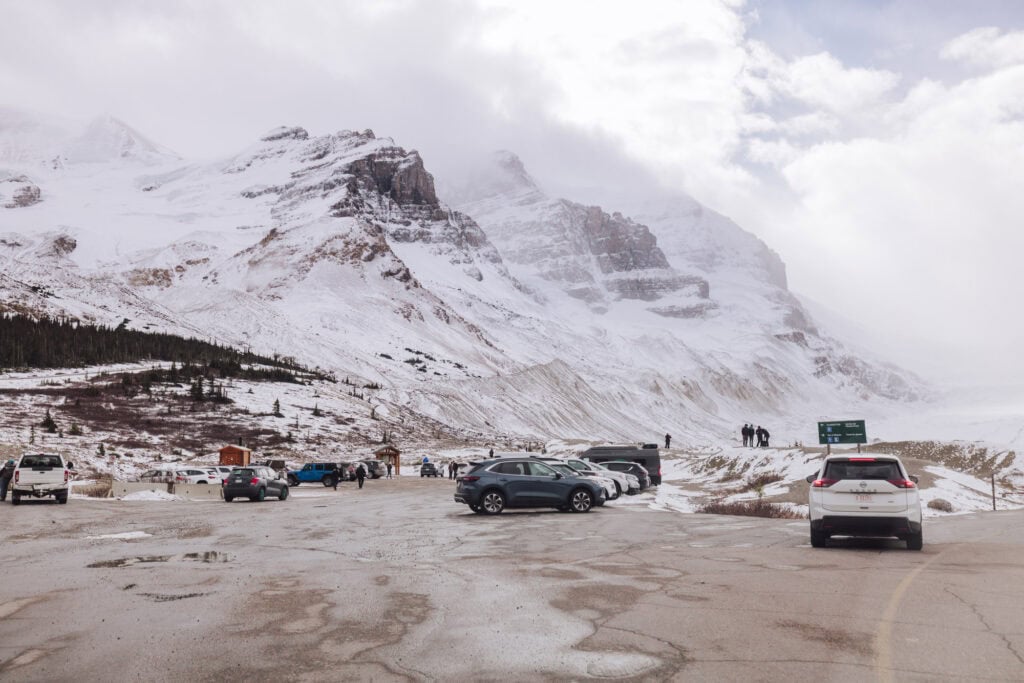
You’ll find additional parking across the street at the Columbia Icefield Center.
Hiking to the Glacier
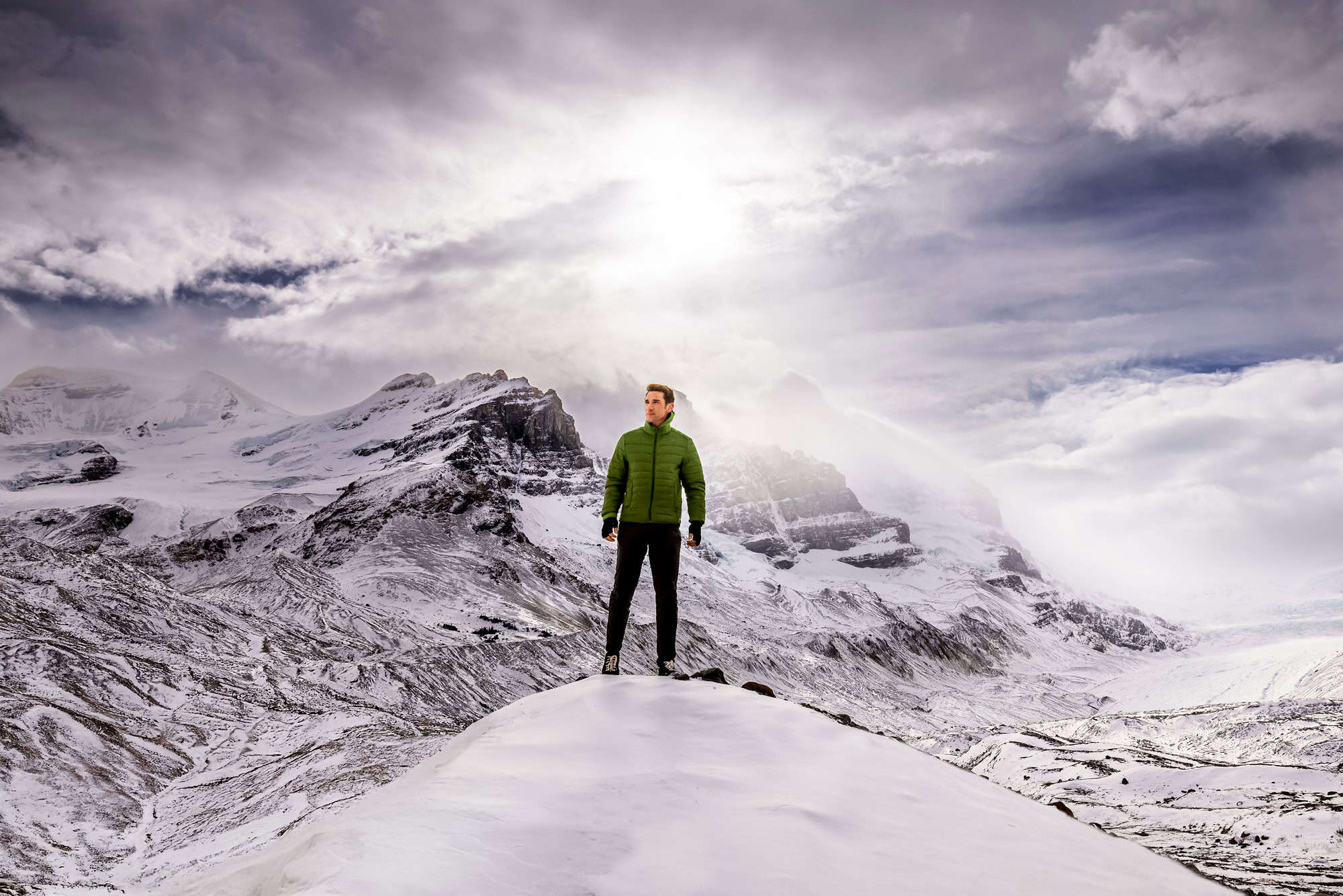
Most months of the year, you’ll be freezing here! I say that not to discourage you from visiting, but rather to remind you to bundle up. That means: glove, scarf, layers, etc.
For me, it’s fascinating (though troubling) to see the glacier’s retreat over the last century. They do a great job staking out markers through the decades, which you’ll hike by on your way up. It’s a visual representation of climate change.

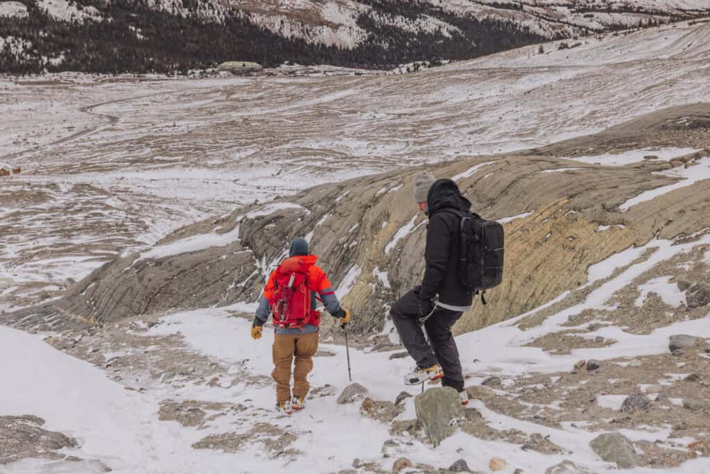
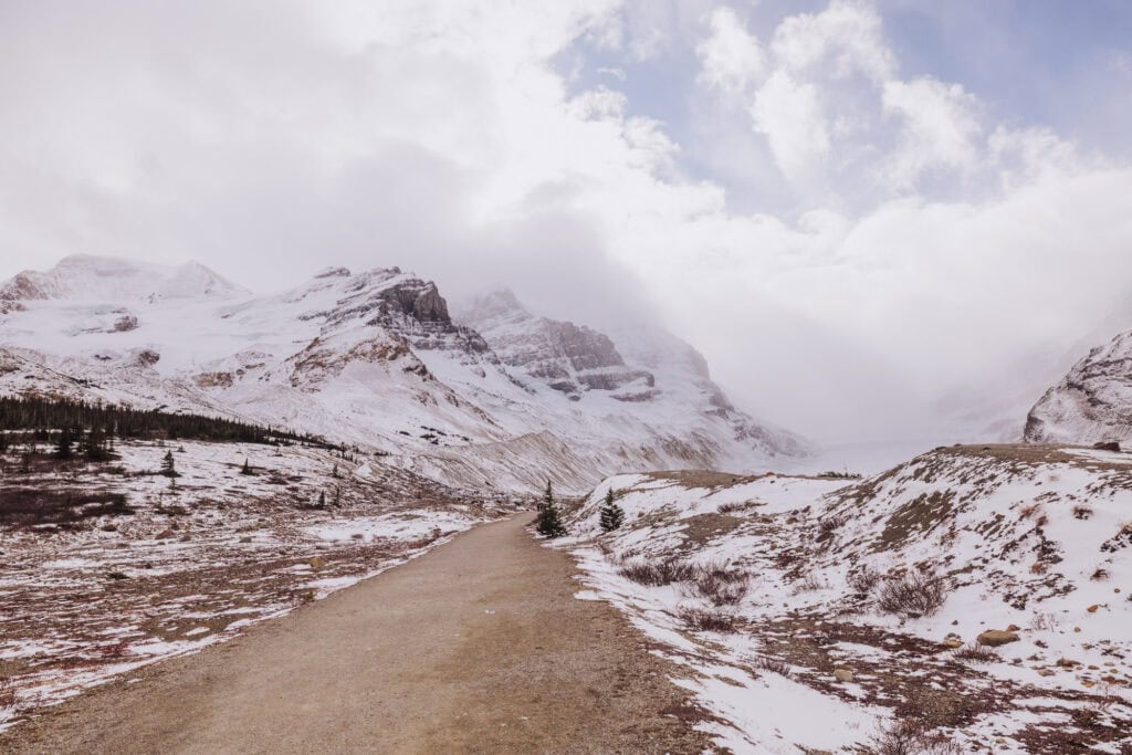
There are a couple of trails to the Athabasca Glacier from the parking lot, which generally lead to the same spot.
Toe of the Athabasca Glacier Trail
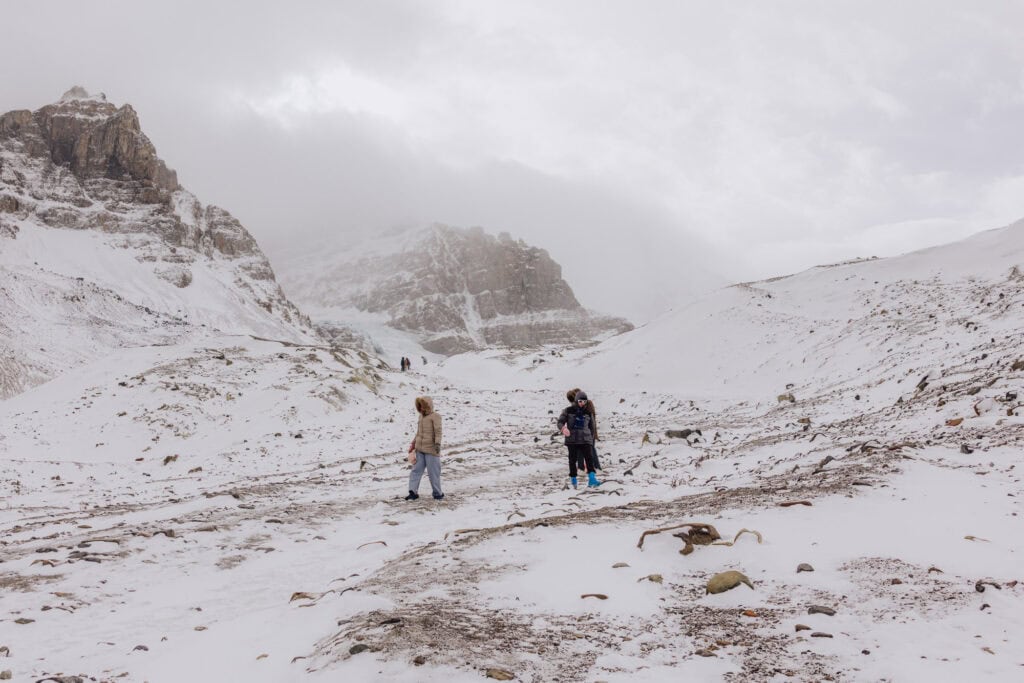
This is a moderately challenging hike, especially in the wind and snow.
- Trailhead: Across from Columbia Icefield Center
- Length: 1 mile round trip (though it seemed longer!)
- Time: About an hour
- Terrain: Uphill in parts and rocky/icy
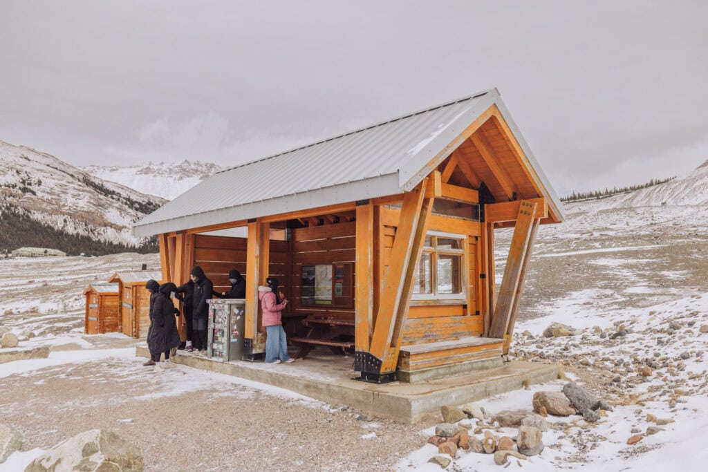
The parking lot has a couple of nicely-maintained vaulted toilets.
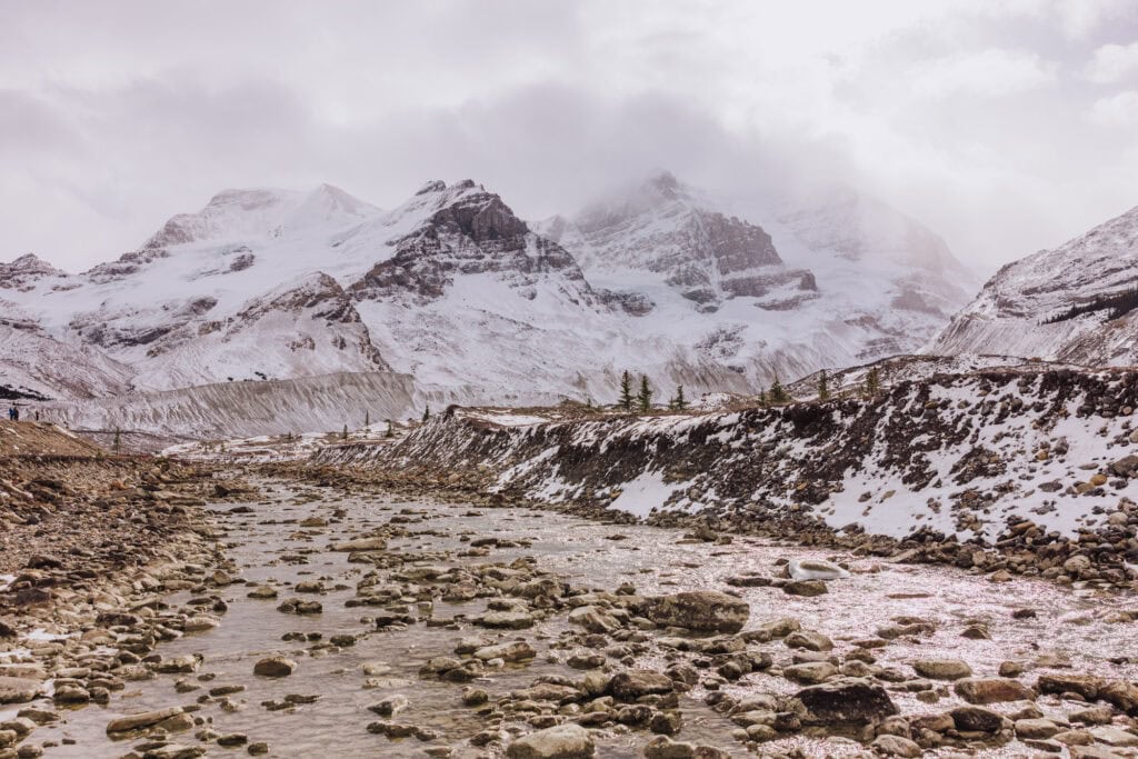
Along your hike, you’ll pass over a stream of pristine water coming off the glacier.
The trail leads uphill, and the wind begins whipping.
There’s a small wooden hut about halfway up to take shelter in if you need a break.
It gets icy and slippery in spots (unless you’re there on a warm summer day), but the view is breathtaking. And again, this is one of the few glaciers that’s accessible without a technical hike.
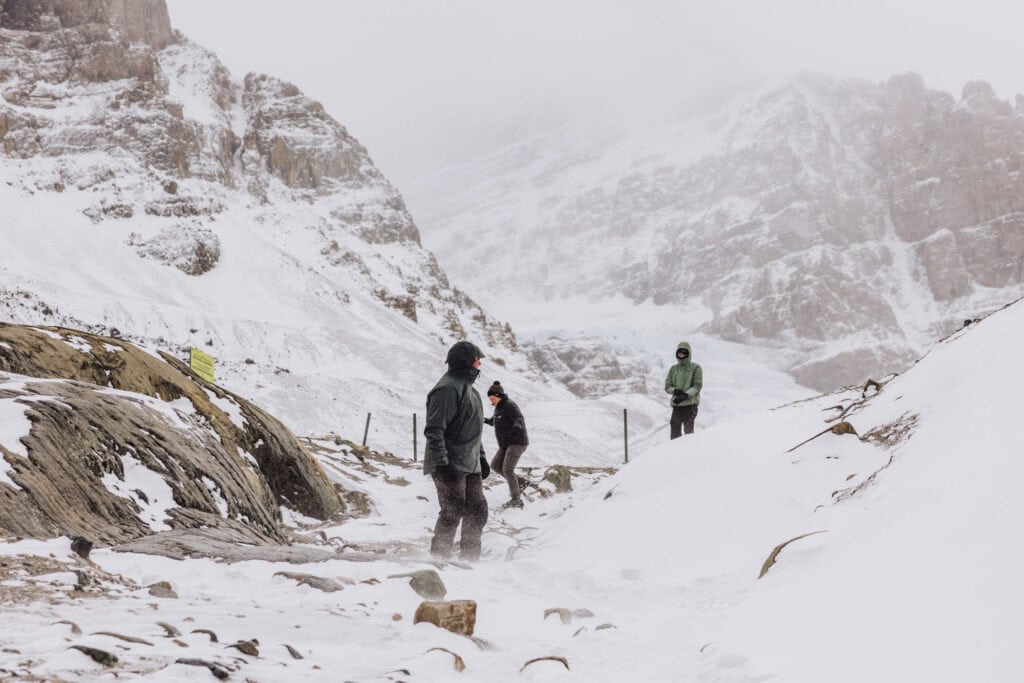
People with trekking poles and metal crampons for their shoes (spikes) had the easiest time getting up and down.
Safety Advice for Visiting the Glacier
The trail is free and open to the public at all times, but visitors are advised to:
- Stay off the glacier unless on a guided tour. The surface hides deep crevasses.
- Dress for winter even in summer. Winds funnel through the valley and drop the temperature quickly.
- Fuel up before the drive. There are no gas stations between Lake Louise and Jasper except at Saskatchewan River Crossing (seasonal).
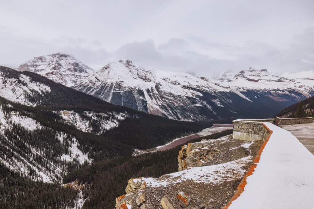
History of the Athabasca Glacier and Its Rapid Recession
The Athabasca Glacier is the most accessible toe of the Columbia Icefield. While still massive, it stretched much farther down the valley than it does today.
The Athabasca Glacier’s retreat began in the late 1800s, and has sped up significantly over the last century. The glacier has lost more than half its volume and continues to shrink by roughly 10 to 16 feet per year.
Visitors can still walk right up to the glacier’s edge, and Parks Canada places dated markers along the access road showing where the glacier reached in previous decades.
It’s an easy way to visualize how quickly the ice has pulled back.
While guided glacier tours allow you to step onto the ice with a certified guide, independent visitors are not allowed to walk on the glacier due to hidden crevasses and unstable ice.

Weather at Athabasca Glacier: What to Expect Each Season
The Icefields Parkway sits at high elevation, and the weather at Athabasca Glacier is colder and windier than in nearby Jasper or Banff.
In fact, glaciers make their own wind. It’s one of the things I learned on my visit. You’ll notice a cool breeze coming off the ice, no matter what time of year you visit.
Air passing over the ice is cooled. Since cold air is denser and heavier than warm air, it slides downhill, creating something called a “katabatic wind.”
Spring (April into June)
Temperatures range from the mid-20s to the high 40s °F. Expect winter conditions into May, including snow on the ground and icy winds.
Summer (July through September)
This is the warmest window for visiting the glacier, with highs in the 50s and low 60s °F. Still, bring a warm layer or shell.
Fall (October and November)
Temperatures drop back into the 20s to 40s °F, and early snow returns. Services begin to close for the season, and daylight hours shrink.
Jasper in October is beautiful with fall foliage. By mid-month, you should prepare for the potential for snowfall. By November, Jasper’s crowds are smallest before ski season begins.
Winter (December through March)
The area freezes over, with temperatures in the single digits and below 0°F. The road to the glacier is open year-round, but blowing snow, poor visibility, and avalanche risk are common. The Icefield Centre and glacier tours close for winter.
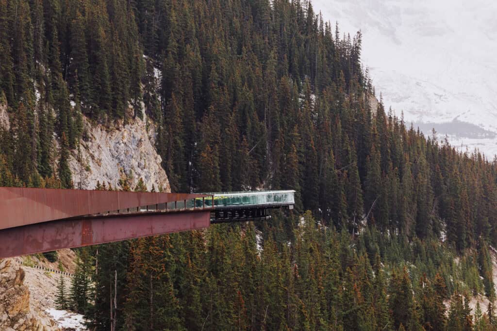
The Columbia Icefield Skywalk
About five minutes south of the glacier, the Columbia Icefield Skywalk is a glass-floored viewing platform that extends 918 feet above the Sunwapta Valley.
It offers one of the best elevated viewpoints on the Icefields Parkway.
Entry is ticketed, and most visitors pair it with a glacier tour since they typically share the same starting point at the Icefield Center.
The Columbia Icefields Discovery Center
The Columbia Icefields Center is the main visitor hub for the Athabasca Glacier and the Columbia Icefield area. It’s essentially your base for information, parking, food, and tours, but it’s only open from late spring to early October.
Tours From Here
The Center is the departure point for two paid experiences:
- Columbia Icefield Skywalk Shuttle: A bus takes you to the Skywalk, a few miles north.
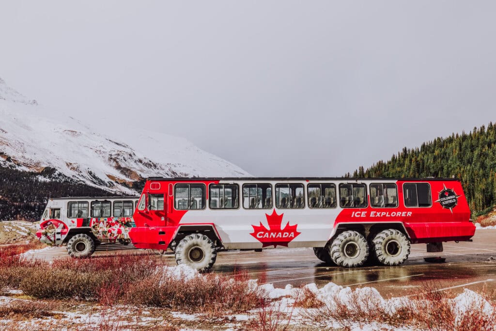
- Ice Explorer Glacier Tour: A guided trip onto the Athabasca Glacier in large, specialized vehicles. This is the only safe way to stand on the ice without mountaineering guides.
More on the Icefields Parkway
The Icefields Parkway is one of the most scenic drives in the world, connecting Banff and Jasper. It stretches between both national parks in Alberta.
Basic Info:
- Distance: 144 miles (232 km) one way
- Driving Time: Between 3 and 4 hours nonstop
- Endpoints: Lake Louise (Banff National Park) and Jasper (Jasper National Park)
- Opened: 1940
- Services: Limited! There’s one gas station at Saskatchewan River Crossing.
- Road Conditions: Check 511 Alberta before you depart.
Other Favorite Stops
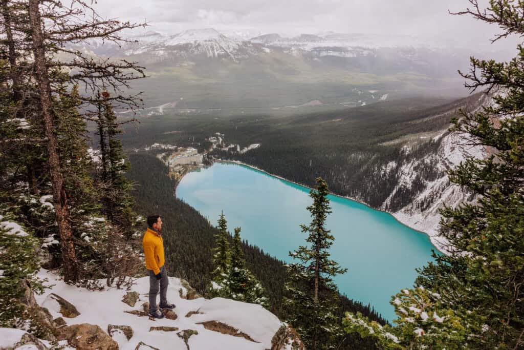
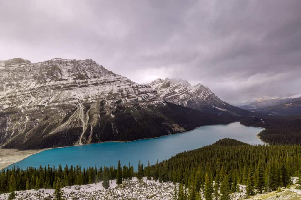
Aside from Athabasca Glacier, I’d recommend Peyto Lake and the hike to Bow Summit. It’s 27 miles north of Lake Louise. Peyto is also famous for its turquoise water, and for having the shape of a wolf’s head.
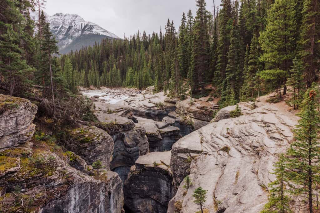
A sometimes overlooked stop on the highway is Mistaya Canyon. It’s a pretty hike to a stunning viewpoint.
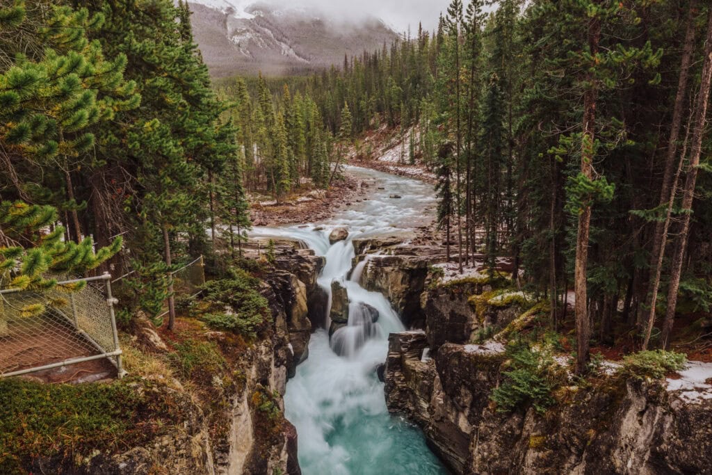
North of Athabasca Glacier, you’ll find Sunwapta Falls (photo below) and Athabasca Falls. The hikes are easy, and the viewpoints are beautiful.
Farthest south, at Lake Louise, the Big Beehive Trail delivers iconic views (after a tiring hike!).