The Best Stops on the Icefields Parkway: 10 Tips Before Your Drive

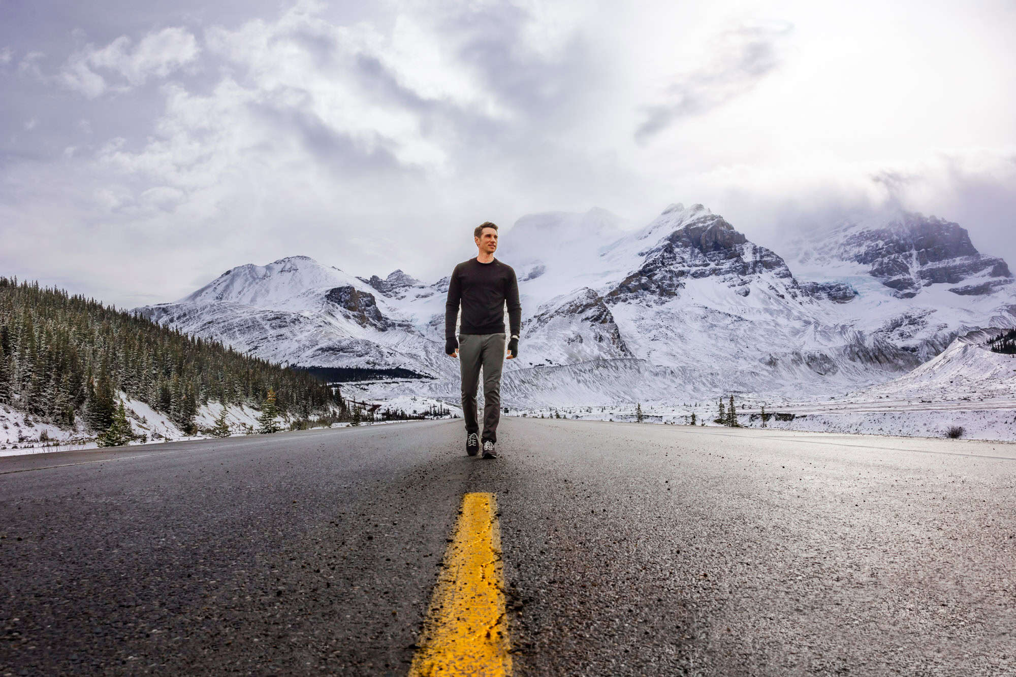
The Icefields Parkway is one of the most scenic drives in the world. It’s a 144-mile (232 km) stretch in Alberta, linking Lake Louise in Banff National Park to the town of Jasper in Jasper National Park.
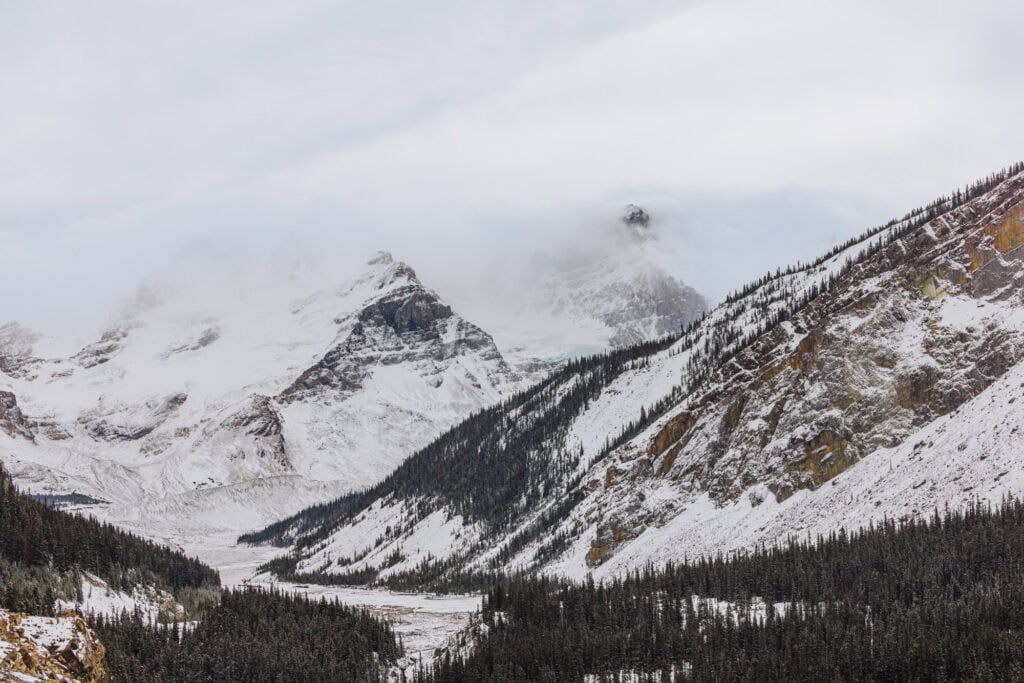
The Parkway winds through the heart of the Canadian Rockies, with its famous glaciers, turquoise lakes, waterfalls, and sweeping mountain valleys visible along the way.
When it comes to renting cars, I usually use Discover Cars. Their search tool is easy to use, and includes local brands in addition to international rental companies.
➡️ Click to Search Rental Cars
Key Info on the Icefields Parkway
- Distance: 144 miles (232 km) one way
- Driving Time: Between 3 and 4 hours (if driving nonstop)
- Endpoints: Lake Louise (Banff National Park) and Jasper (Jasper National Park)
- Opened: 1940
- Elevation: Peaks at about 6,800 ft (2,070 m) at Bow Summit.
- Services: Limited! There’s one gas station at Saskatchewan River Crossing.
- Cell Signal: Large stretches are dead zones.
- Best Time to Visit: June to early October for clear roads and full access.
- Road Conditions: Check 511 Alberta before you depart.
Tours of the Icefields Parkway
While I prefer to rent a car and drive myself, it’s understandable to want someone else to handle the logistics and navigation! Here are two top tour options, with excellent reviews, for the Icefields Parkway:
10 Things to Know Before Your Drive
Here’s the advice I wish I’d known before my first drive along the Icefields Parkway, between Banff and Jasper.
1. Minimal Cell Service
There are a few spots where you’ll find a signal, like the stretch between the Columbia Glacier Icefield and the Saskatchewan River Crossing. Otherwise, be prepared to not have service.
2. Only One Gas Station
We ran into people at a trailhead whose gas gauge said they only had 55km left. There’s only one gas station along the highway, at Saskatchewan River Crossing.
3. Temperatures Fluctuate
Wear layers, no matter the time of year. Temperatures fluctuate with the elevation. Plus, glaciers “make their own wind,” so even in the summer, you’ll feel the chill!
4. Rules on Dogs
The stops along the Icefields Parkway are mostly dog-friendly. They just have to be leashed.
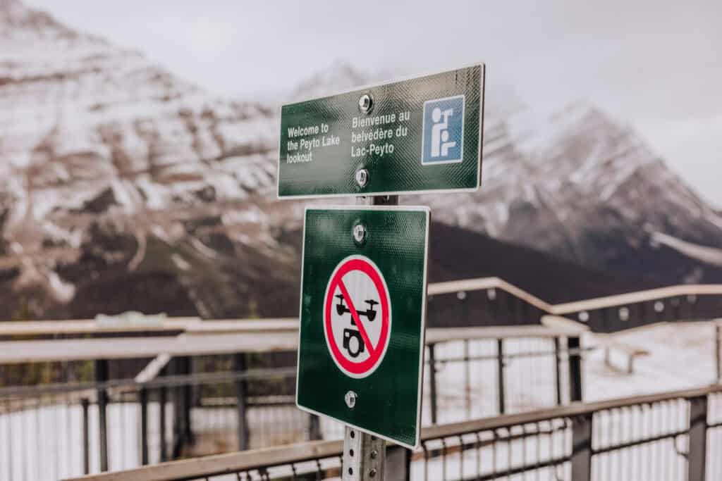
5. No Drones Allowed
There are no drones allowed in Banff or Jasper National Parks, without a special permit.
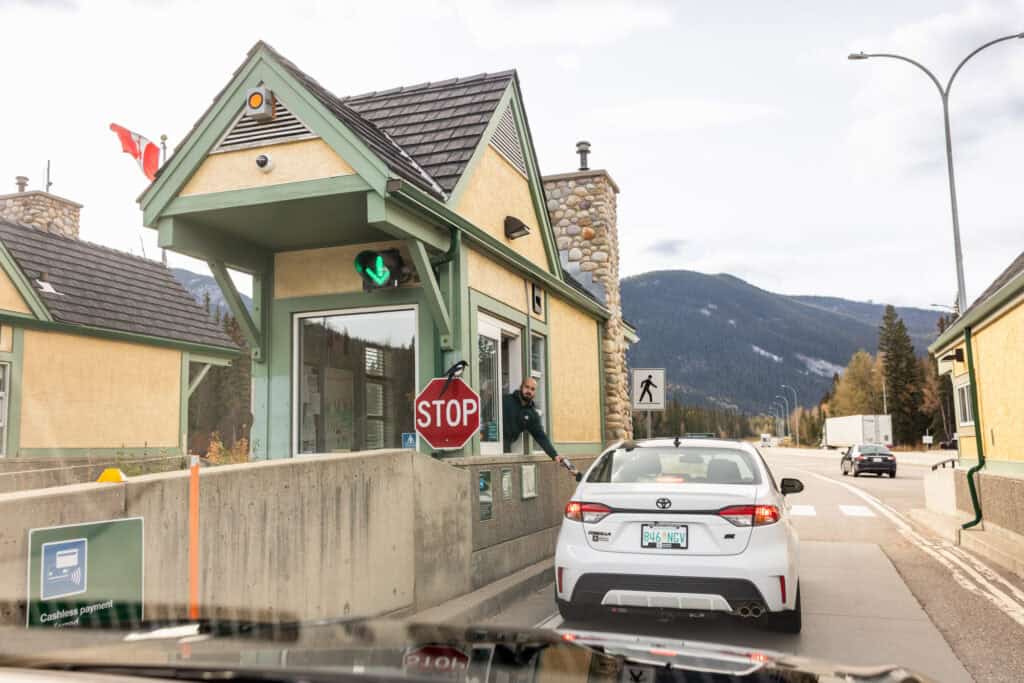
6. Cost to Enter
You’ll pay $11 per vehicle, per day. They’ll give you a permit/receipt, which you’ll tape inside your window.
7. Bring Bear Spray
Banff and Jasper are home to a lot of grizzly and black bears. If you’re hiking, make sure to bring bear spray.
8. Spikes for Winter
By mid-October, make sure you have metal spikes or crampons for your shoes. Even the easy trails will be slick! I tumbled down a few, wearing my normal hiking shoes.
9. Restrooms
I was pleasantly surprised by how nicely-kept the vaulted toilets are in the parking lots and trailheads along the way! There are very few *real restrooms.
10. Winter Warning
The rules say: your vehicle *has* to have winter tires or chains, between November and March. It’s the law, according to Parks Canada. The Icefields Parkway isn’t salted, so even with the plows, you’ll be driving on compacted snow and ice.
Iconic Stops on the Icefields Parkway
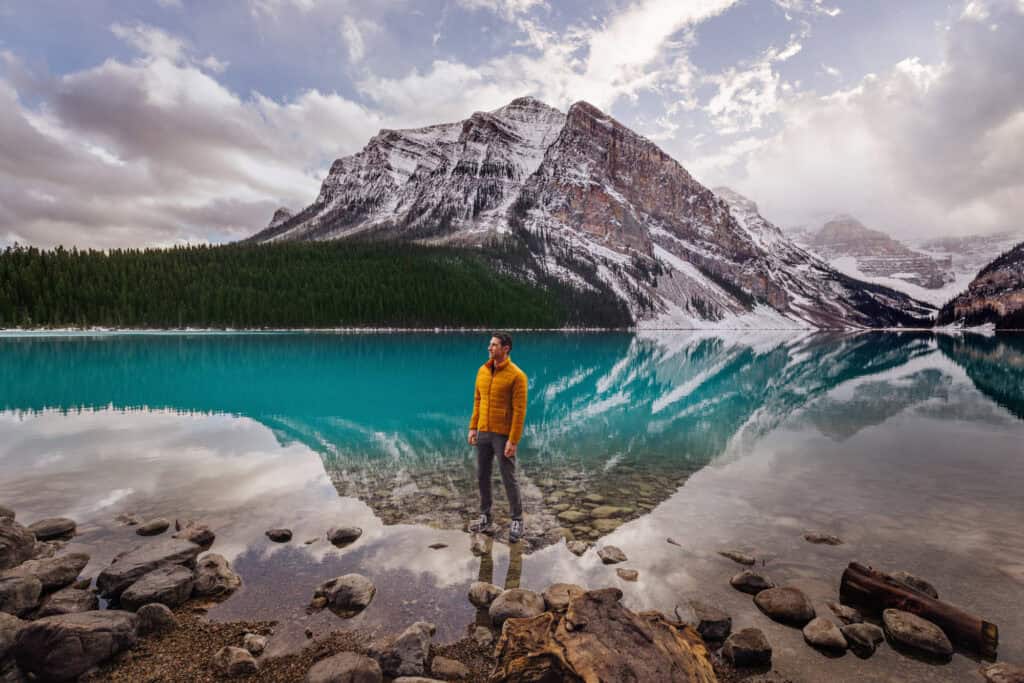
The list is endless, but if it’s your first trip, here are a few spots I suggest checking out, starting with the most famous: Lake Louise.
There are a couple of hiking options here, including the challenging Big Beehive Trail.
Herbert Lake: 3 miles north of Lake Louise
In calm winds, this lake mirrors the surrounding peaks. There’s a small parking area right off the highway and a short path around the shore.
Bow Lake: 25 miles north of Lake Louise
One of the larger lakes along the route, Bow Lake, sits beneath the Wapta Icefield and Bow Glacier.
It’s a stunning place to stretch your legs, with a short shoreline walk and the Bow Glacier Falls Trail (about 5.5 miles round-trip).
Crowfoot Glacier Viewpoint: 21 miles north of Lake Louise
This quick roadside stop offers a clear view of Crowfoot Glacier, which once resembled a three-toed crow’s foot clinging to the mountain. Two of the glacier’s “toes” have melted away.
Peyto Lake Viewpoint — 27 miles north of Lake Louise
Peyto Lake is one of the Icefield Parkway’s most famous stops. From the lower parking lot, it’s a 0.6-mile (1 km) uphill walk to a wooden platform overlooking the wolf-head-shaped lake.
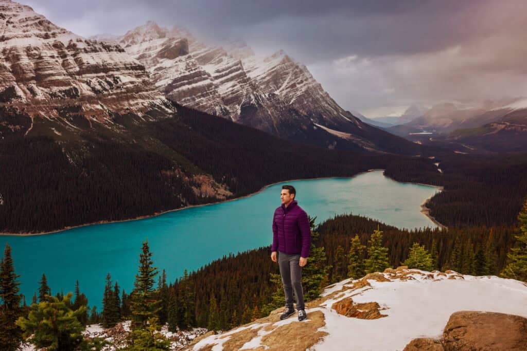
Continue up the Bow Summit Trail (about 2 miles) for a more peaceful view with smaller crowds. This is the highest point on the Icefields Parkway, and you’re likely to have the trail and the peak to yourself.
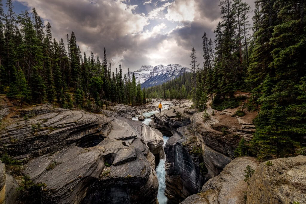
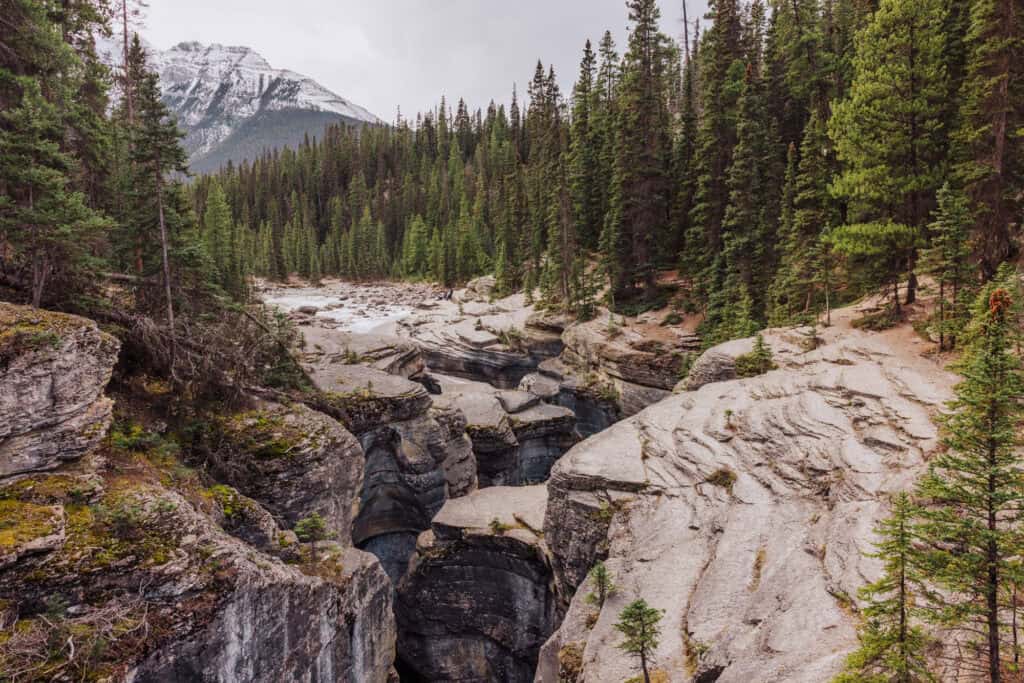
Mistaya Canyon: 45 miles north of Lake Louise
A short 0.3-mile (0.5 km) downhill walk leads to a powerful canyon carved by the Mistaya River. The swirling, sculpted rock formations show the force of glacial meltwater over millennia.
I consider this an underrated stop, which delivers some of the most stunning views along the Icefields Parkway.
Saskatchewan River Crossing: 50 miles north of Lake Louise
This is the only real service stop on the Parkway, and your last chance for gas until you reach Jasper! There’s also a small lodge, restrooms, and a cafe.
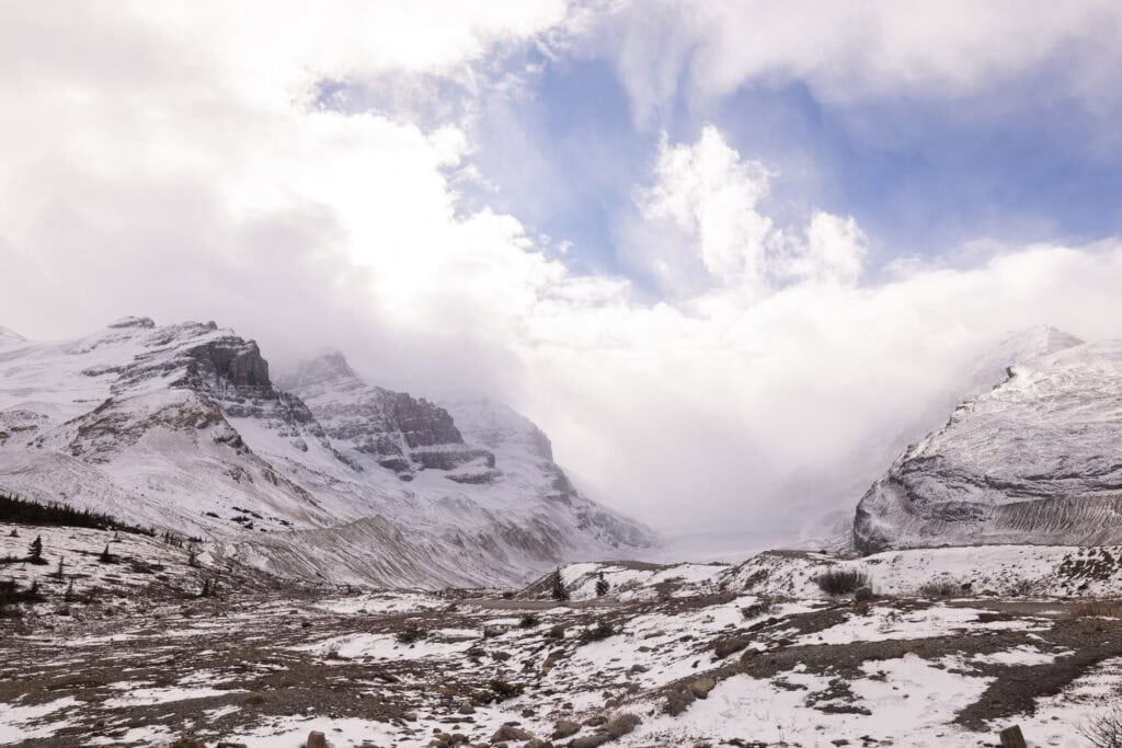
Columbia Icefield & Athabasca Glacier: 80 miles north of Lake Louise
The centerpiece of the drive, the Columbia Icefield, is a massive sheet of ice feeding six major glaciers, including the Athabasca Glacier. You can walk up to the glacier on your own, but bring layers!
The glacier “creates its own wind” and it gets cold!
Across the street, the Columbia Icefield Discovery Centre offers exhibits, food, and restrooms. It’s only open during the summer and early fall.
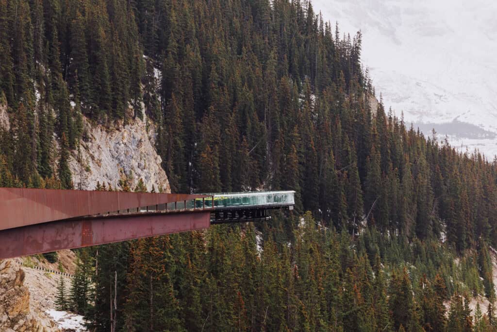
Columbia Icefield Skywalk: 85 Miles North of Lake Louise
The Skywalk isn’t a necessary stop, but it’s an option during the summer and fall months.
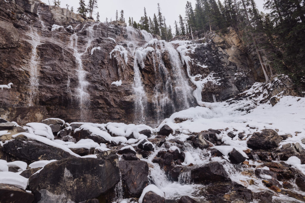
Tangle Creek Falls: 84 Miles North of Lake Louise
Right alongside the highway, the multi-tiered falls are a stunning sight. You can admire them from the lot or scale them. They’re equally stunning after freezing over during the winter.
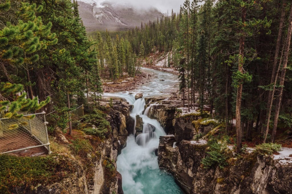
Sunwapta Falls: 112 miles north of Lake Louise
The Icefields Parkway crosses from Banff into Jasper National Park around this point.
Sunwapta Falls is an easy 0.3-mile (0.5 km) walk from the parking area. The upper falls crash through a narrow gorge, while the lower falls are reached by a slightly longer trail through pine forest.
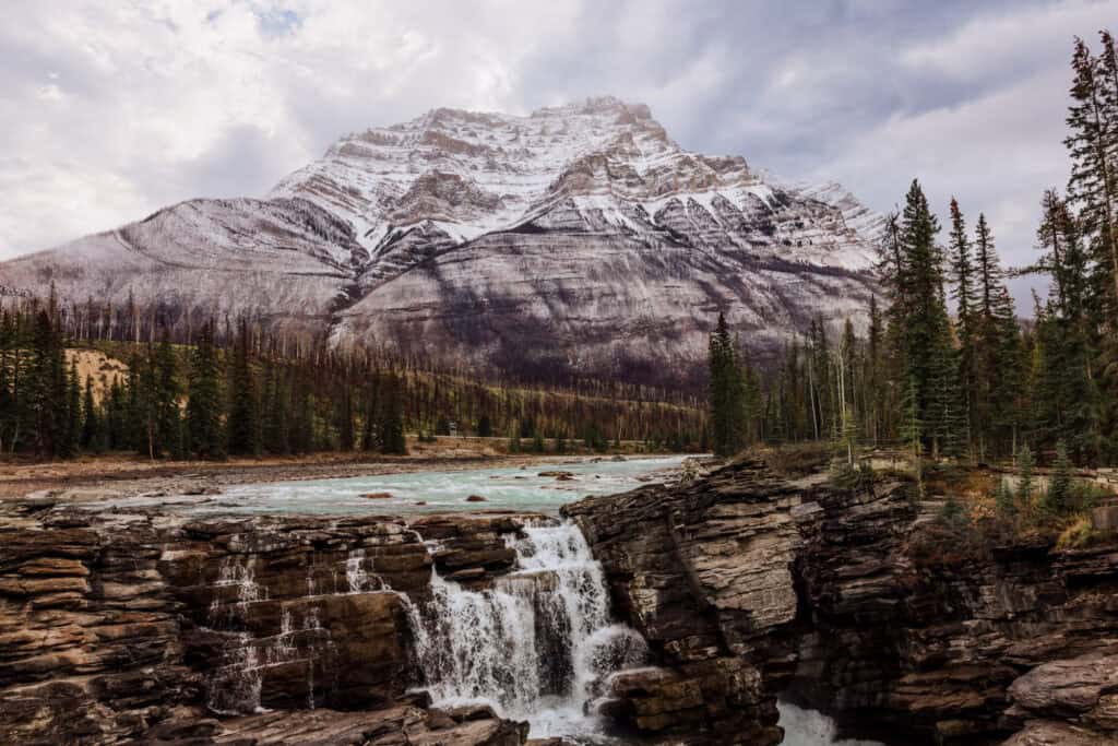
Athabasca Falls: 20 miles south of Jasper
A must-stop destination near the end of your journey, Athabasca Falls is known for its raw power, carving through the rock canyon. The easy paved paths and bridges lead to several viewpoints over the gorge.
Driving Conditions & Seasons on the Icefields Parkway
The weather impacts conditions along the Icefields Parkway. Nice weather brings crowds, while snow creates dangerous driving conditions.
Summer on the Parkway: May into October
- The highway is fully open and extremely popular.
- Expect crowds at major stops like Peyto Lake, Columbia Icefield, and Sunwapta Falls, especially between 10 a.m. and 4 p.m.
- Days are long in June, July, and August, and that extra daylight provides more opportunities to explore the area.
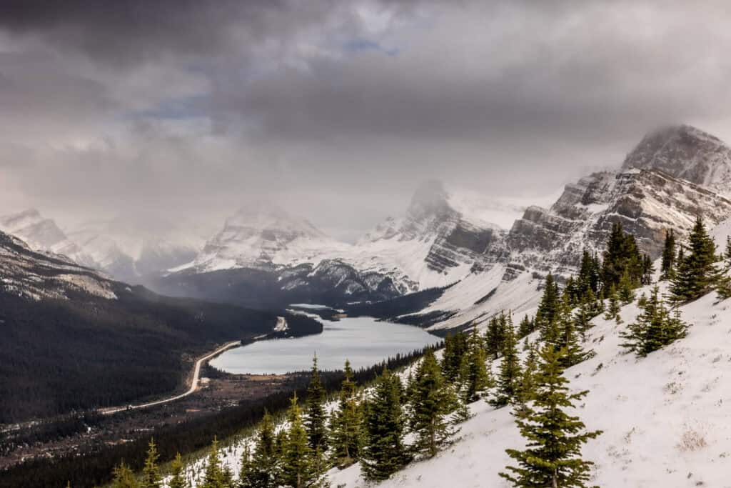
Winter on the Parkway: November through April
- Conditions can turn treacherous, with sections occasionally closed during storms.
- I’ve seen plows working hard by mid-October, especially near the pass.
- Drivers are required to have winter tires or chains from November 1 to April 1.
- Use 511 Alberta to monitor conditions.
With those warnings in mind, a winter drive along the Icefields Parkway can be a stunning (albeit cold) experience, with frozen waterfalls and snowy peaks.
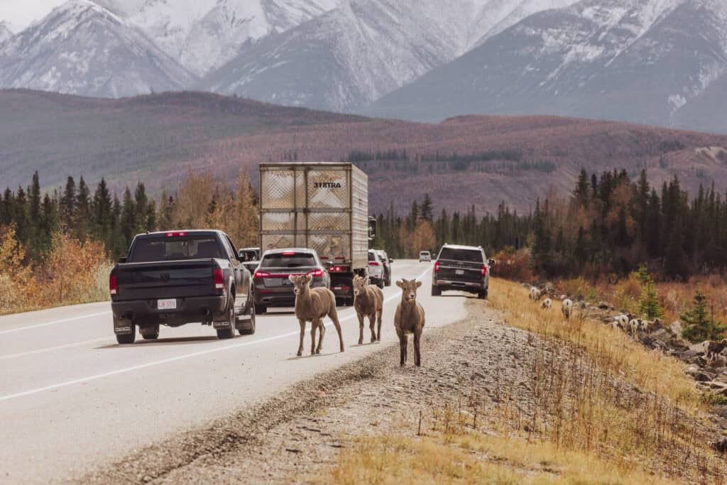
Wildlife on the Parkway
I’ve seen bears, elk, and bighorn sheep along the Icefields Parkway. I haven’t seen a moose (yet) but they’re around, too!
A Brief History of the Icefields Parkway
Construction of the Icefields Parkway began in the 1930s, as a Depression-era public works project.
The original gravel route opened in 1940, offering access to some of the most remote mountain scenery in Canada at the time.
It was later widened and paved in the 1960s, making it more accessible to travelers while still maintaining its wild, undeveloped feel.