Point Reyes Hiking: The Best Trails on the Coast

THE BEST POINT REYES HIKING TRAILS
You’ll find many different Point Reyes hiking options at the National Seashore, which is a convenient escape from city life in San Francisco.
While you can do backcountry hikes here, I’m focusing on the more popular day trip options along the beautiful coast of Northern California.
Key Advice for Point Reyes Hiking Trails
Let’s start with the basics, no matter which Point Reyes trail you choose.
Point Reyes National Seashore
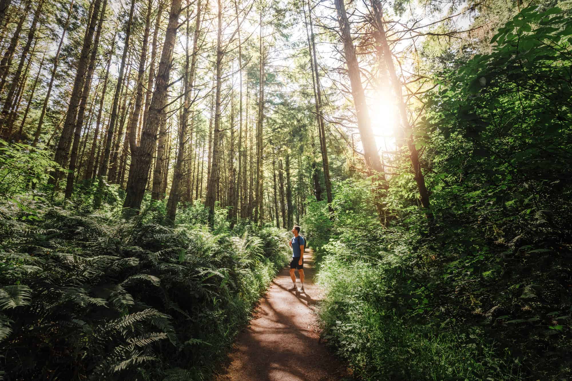
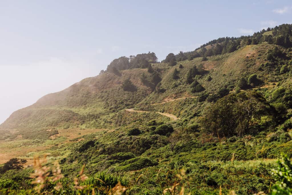
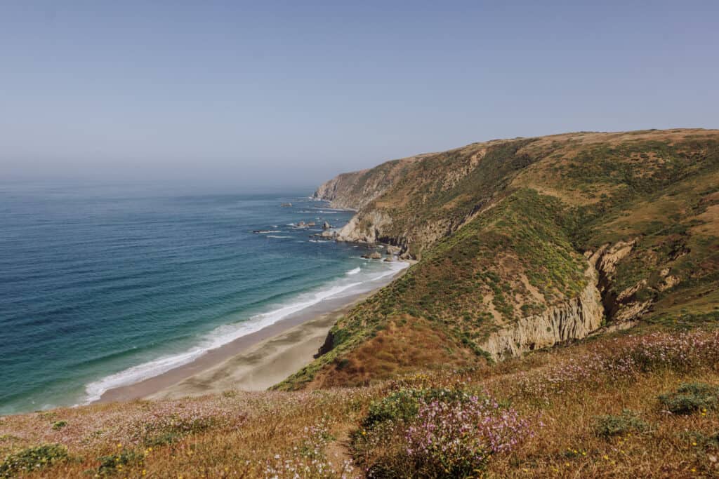
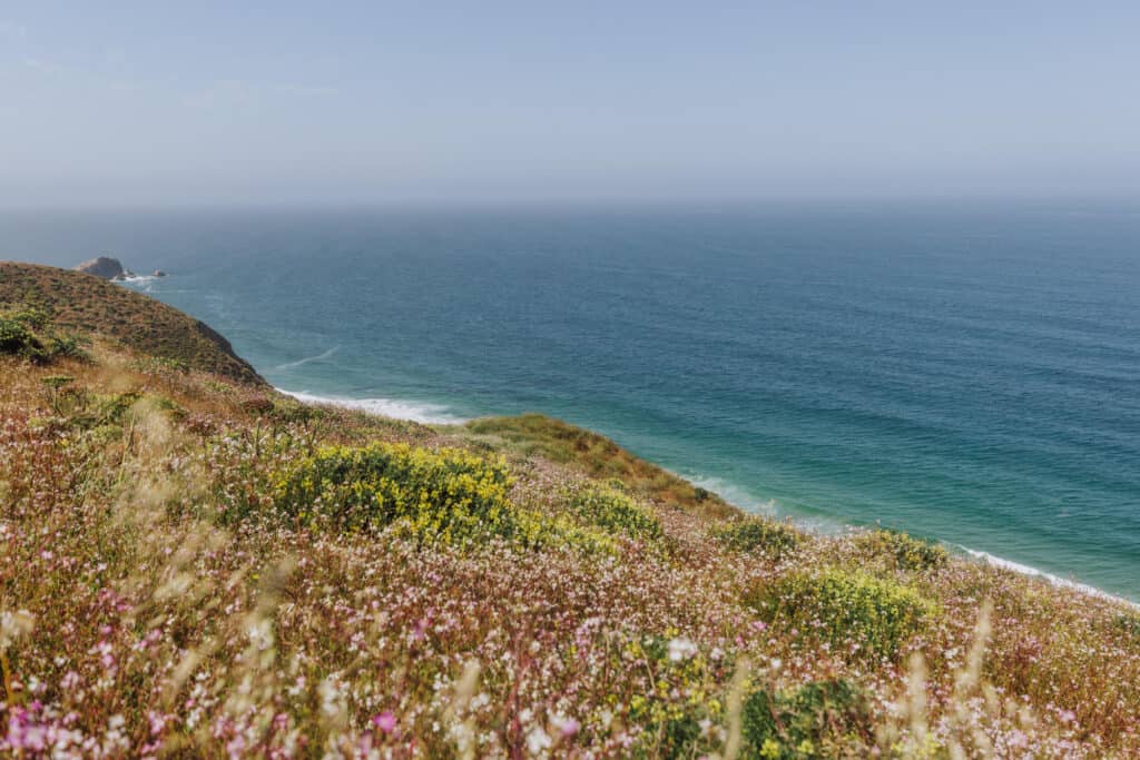
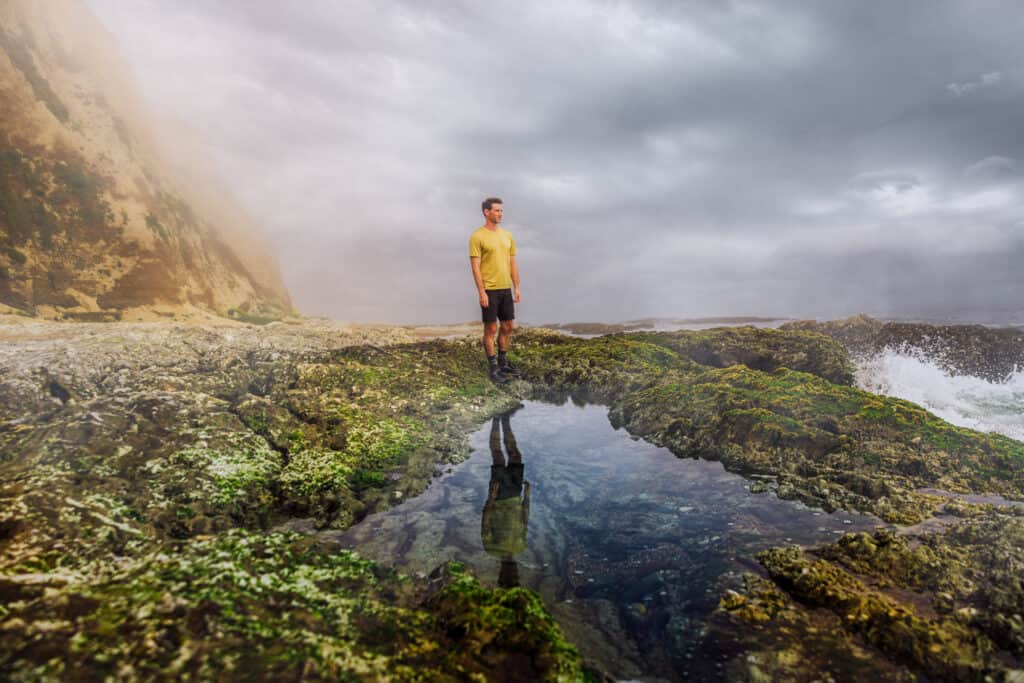
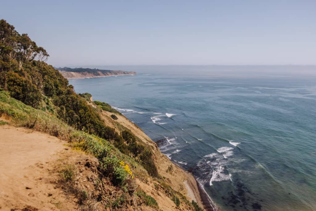
Point Reyes National Seashore is a stunning coastal preserve, which spans more than 71,000 acres. It encompasses a diverse range of ecosystems, including rugged cliffs, pristine beaches, rolling grasslands, and dense forests.
The park is about 40 miles northwest of the Golden Gate Bridge in San Francisco. It’ll take between one and two hours to get there, depending on the route you choose and traffic conditions that day.
Park Entry
There are no fees for Point Reyes hiking! The entire National Seashore is free to enter and explore, and no permits or reservations are needed. You won’t even have to go through a gate to enter the park. Only campers will need a permit.
There’s No Cell Service
You’ll find spots at Point Reyes National Seashore where you might get a bar or two of cell service. For the most part, be prepared to go without a signal for your entire Point Reyes hiking experience.
Download 2 Apps for Point Reyes Hiking
Due to the lack of cell service, these two apps will help you find and track your progress along any Point Reyes trail:
- National Park Service App: It’s free, and you can download the entire Point Reyes section to use offline while you’re hiking.
- AllTrails Pro: The “Pro” version also allows you to download different Point Reyes hiking trail maps to use offline.
Bring Your Own Food & Water
Food and water options inside the park are very limited. Anyone going on a Point Reyes trail should be entirely self-sufficient, with plenty of snacks and more water than you think you need.
Prepare for Weather Changes
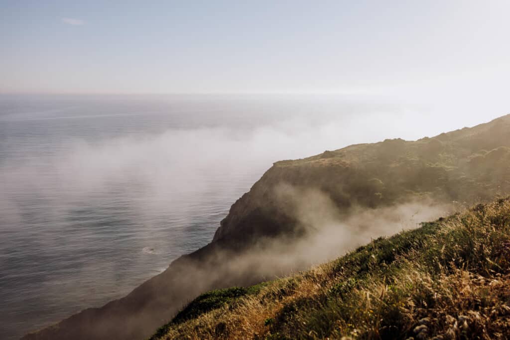
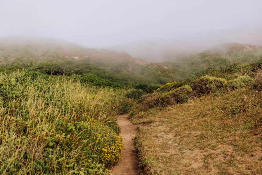
Especially during the summer, your Point Reyes hiking experience is likely to include an array of weather conditions. It could be foggy and 50 in the morning when you start, before warming up to the 80s midday. Layers are always helpful in this part of coastal California, which is considered to be one of the foggiest places in the country.
Check for Point Reyes Closures
You’re unlikely to encounter any closures on a Point Reyes hiking trip. Just in case there’s trail maintenance, roadwork, or storm damage, check the National Seashore’s website before you make the drive.
Wildlife on Point Reyes Trails
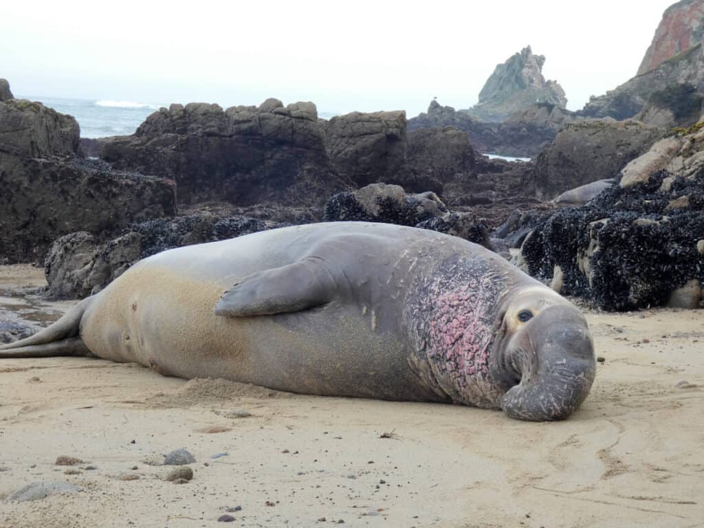
A bear has been spotted here and there over the years. The mountain lions will keep to themselves. You’re likely to see elk, seals, and sea lions.
The law prohibits humans from coming within 100 feet for the marine life. A National Park Service ranger took this photo of an elephant seal near Chimney Rock:
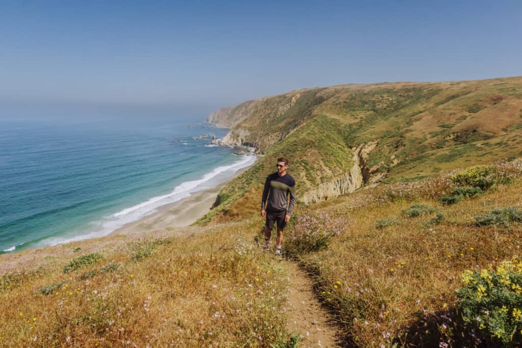
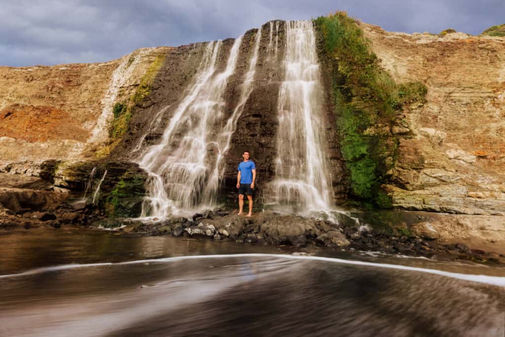
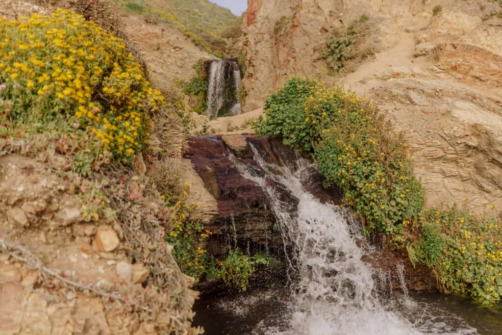
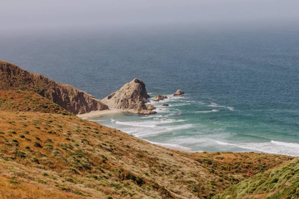
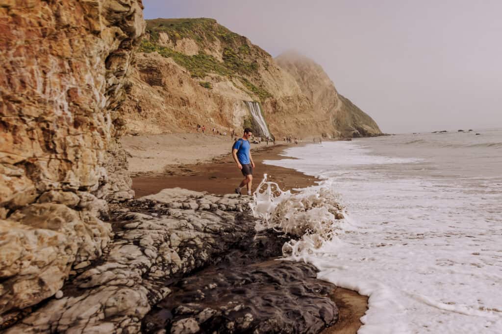
The Best Point Reyes Trail: Alamere Falls
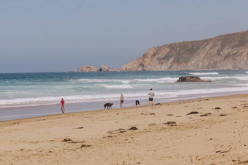
For the average visitor, the best Point Reyes hiking trail is the beautiful trek to Alamere Falls. The 7-mile trail leads you to a unique coastal waterfall. It flows right off a cliff onto the beach, and into the Pacific Ocean.
I have a much more detailed post about Alamere Falls and why I think it’s the best Point Reyes trail, but here are the basics:
Alamere Falls Distance & Difficulty:
It’s 7-miles from the trailhead to the waterfall. The hike itself is considered moderate-level, with mild elevation changes and some uneven terrain.
You’ll see seniors and kids on the trail, so it’s a good choice for anyone in decent shape who’s used to exercise.
The trail is well-worn and marked, so you won’t get lost.
Alamere Falls Trailheads
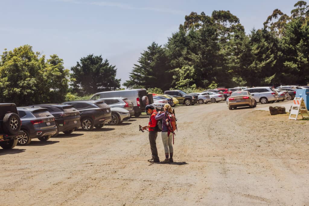
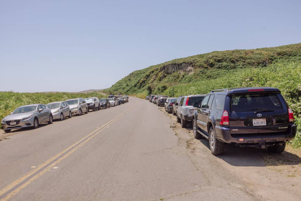
You can start this Point Reyes hike from one of three trailheads. Most hikers use the Palomarin Trailhead, but each is roughly 7-miles long.
- Palomarin Trailhead: The Palomarin Trailhead is the most popular and commonly used trailhead to reach Alamere Falls. It is located on Mesa Road, about 3 miles (4.8 kilometers) west of the town of Bolinas. From the Palomarin Trailhead, hikers can follow the Coast Trail to reach the falls.
- Bear Valley Trailhead: The Bear Valley Trailhead is another starting point for the hike to Alamere Falls. It is situated in the Bear Valley Visitor Center area, which is accessible from Bear Valley Road. Hikers can follow the Bear Valley Trail, connecting to the Coast Trail, to reach Alamere Falls.
- Five Brooks Trailhead: The Five Brooks Trailhead provides an alternative route to Alamere Falls. It is located on Highway 1, approximately 8 miles (12.9 kilometers) south of the town of Olema. From the Five Brooks Trailhead, you can hike or bike to the Coast Trail, to reach the falls.
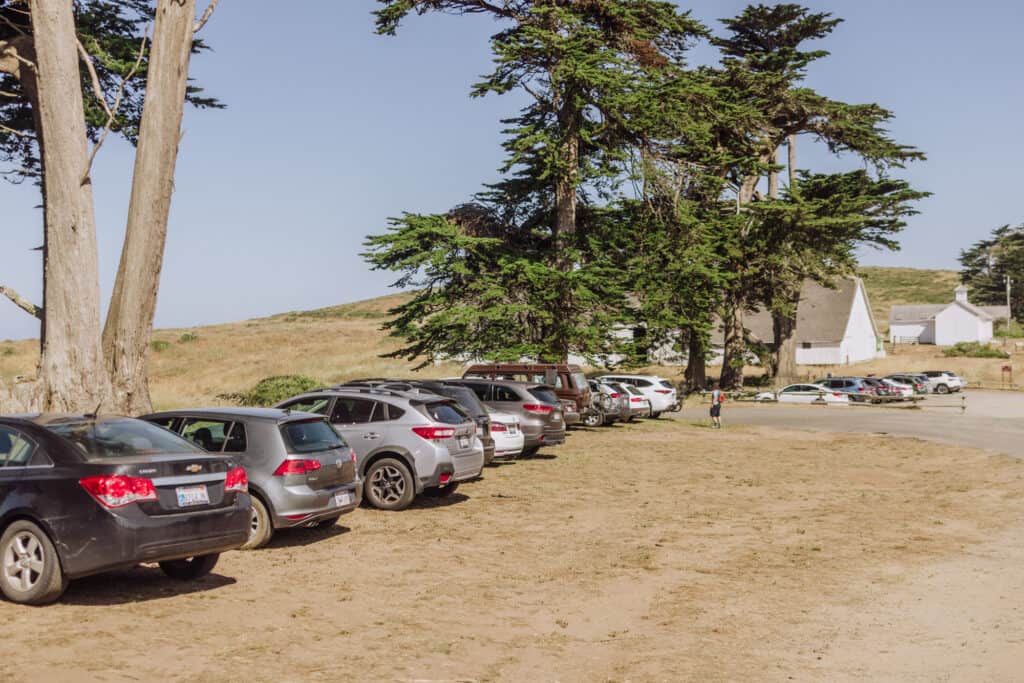
The Palomarin Trailhead has a large parking lot, with bathroom facilities:
Why I Think Alamere Falls is the Best Point Reyes Trail
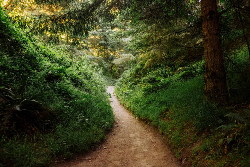
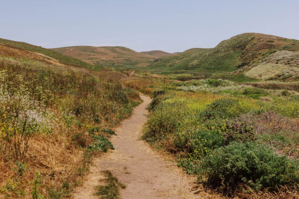
The trail to Alamere Falls offers stunning coastal scenery along the way, but you’ll pass through other environments, too. You’ll hike through beautiful forests, open grasslands, and meadows, before emerging along the rugged coastline again.
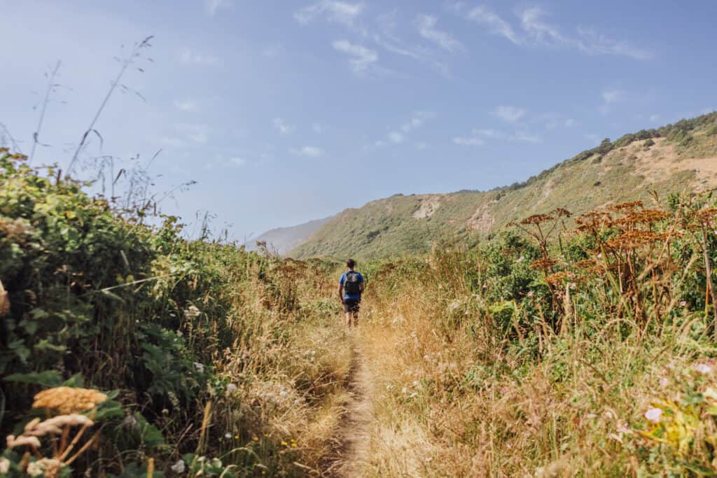
The final mile is a very pretty walk down the beach to the waterfall. Climbing up above the waterfall will give another beautiful perspective of this unique spot, which I think is “tops” when it comes to Point Reyes hiking.
Alamere Falls Trail Details:
🔘 Distance: 14 miles round-trip (without shortcut)
🔘 Difficulty: Moderate, due to length
🔘 Payoff: Coastal waterfall!
🔘 Dog-Friendly: No
🔘 Bikes: Only from Five Brooks Trailhead
🔘 Camping: At Wildcat Beach
Tomales Point Hiking Trail
The trail to Tomales Point is one of the most popular Point Reyes Hikes, and for good reason! It takes you on a journey along a narrow strip of land that extends into the Pacific Ocean. The hike offers stunning views of the coastline, and opportunities for wildlife viewing.
You’ll follow a long, two-lane, bumpy (but paved) road, and go through ranch land inside the park’s boundaries. Eventually you’ll arrive at the trailhead for Tomales Point.
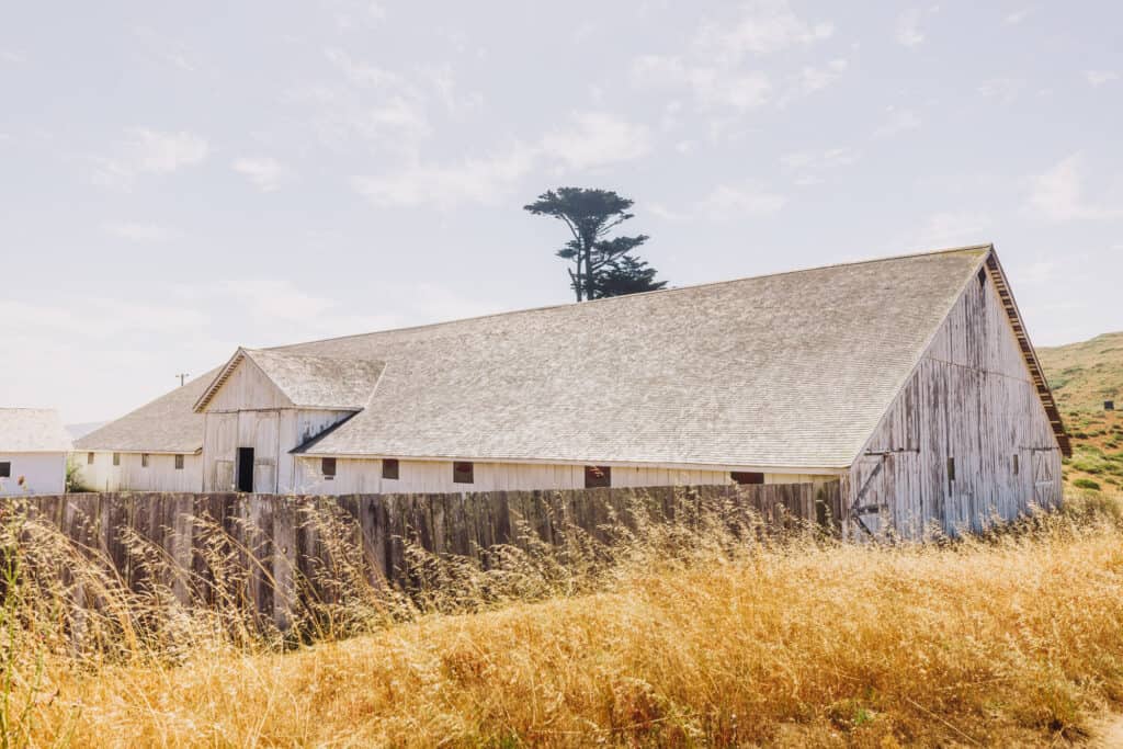
There’s a large parking lot, just before the historic Pierce Point Ranch, established in the 1820s. It’s one of several working ranches managed by the National Park Service.
The National Park Service maintains the first three miles of this Point Reyes trail. The remaining 1.7 miles to Tomales Point will be slightly more rugged.
Tomales Point Trailhead and Location
The trailhead for Tomales Point is located at the northern end of Pierce Point Road, which is accessed via Sir Francis Drake Boulevard in Point Reyes National Seashore. The drive from the Bear Valley Visitor Center takes approximately 30-40 minutes. There is a parking area available near the trailhead.
Distance and Difficulty
The round-trip distance of the Tomales Point Hiking Trail is approximately 9.4 miles (15.1 kilometers), making it a moderately long hike.
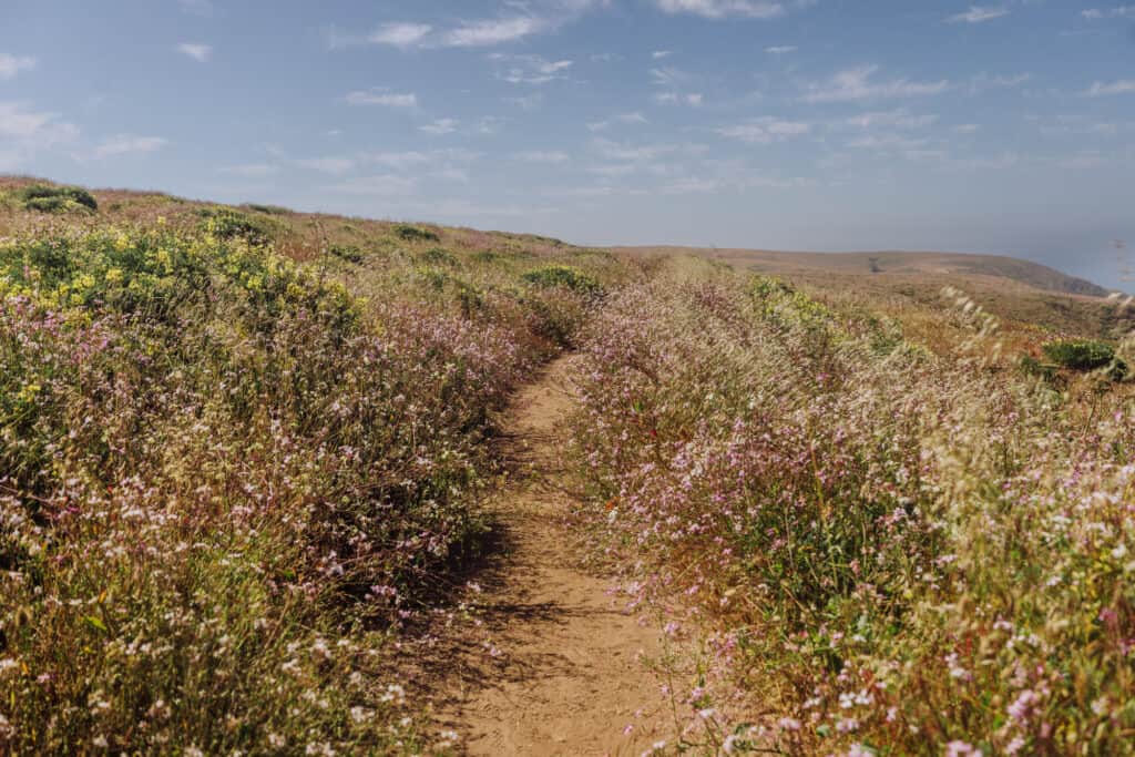
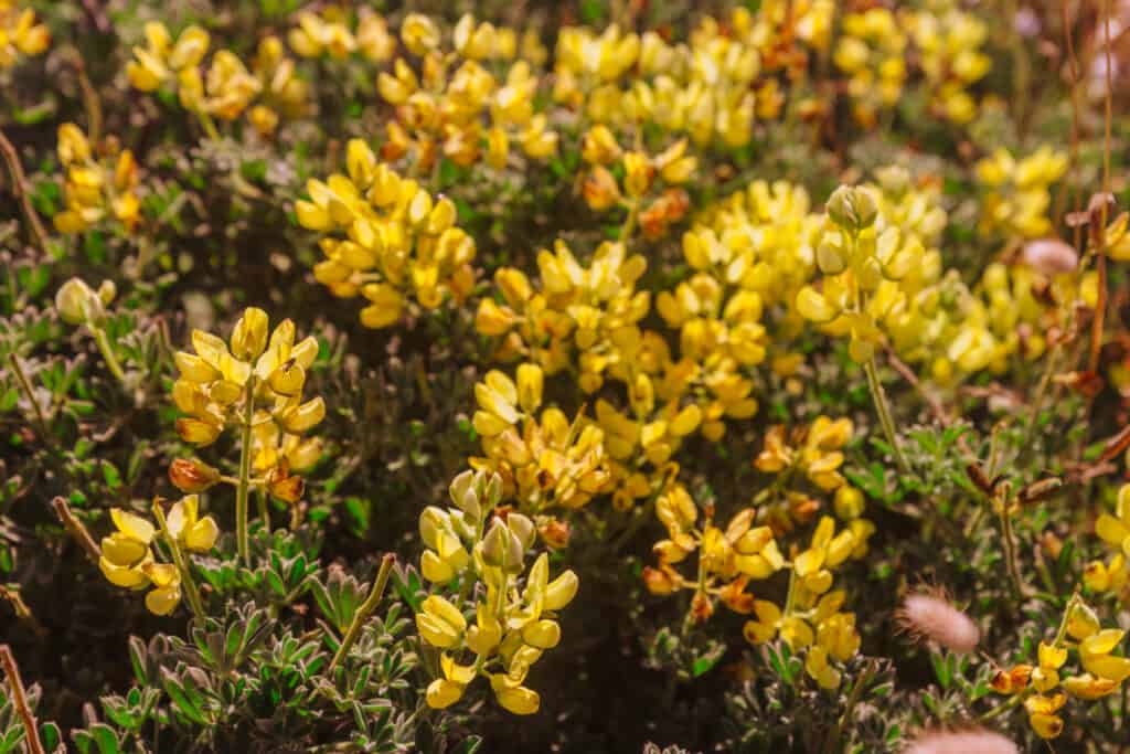
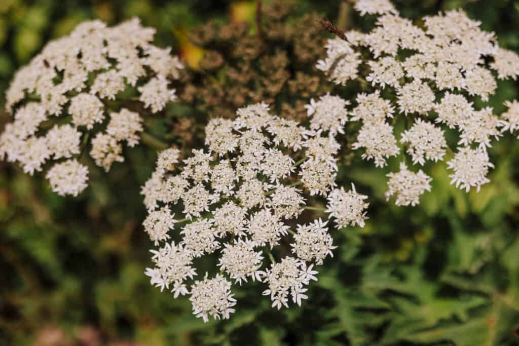
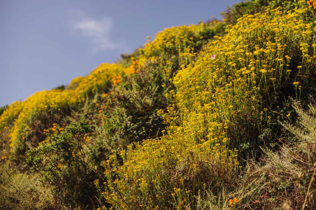
The terrain is mostly flat, packed sand. During the spring and early summer, the shrubs will bloom with wildflowers.

There are few trees along the way, so there won’t be shade in the summer. It also means: it gets really windy along the trail with nothing to break the coastal breezes.
Wildlife Viewing
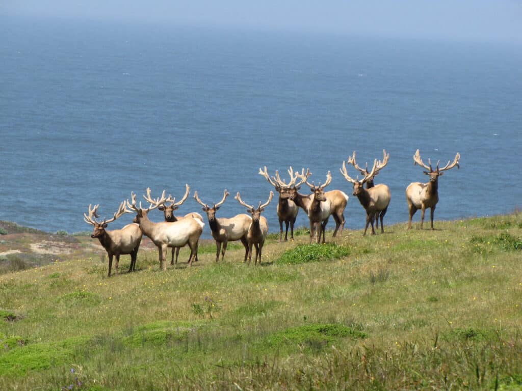
One of the highlights of the Tomales Point Hiking Trail is the opportunity to spot tule elk, a subspecies of elk native to California. The Tomales Point area is home to a significant population of these majestic creatures. They can often be seen grazing or resting along the trail.
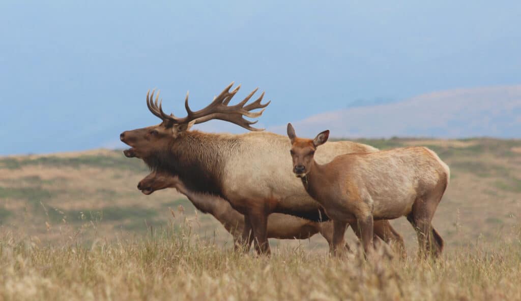
The tule elk were hunted to extinction on the peninsula in the 1850s, but reintroduced in 1978.
Birdwatchers will also enjoy the chance to observe various species, including raptors and shorebirds.
Tomales Point Trail Details:
🔘 Distance: 9+ miles round-trip
🔘 Difficulty: Easy-to-moderate
🔘 Payoff: Elk encounters and stunning coastal views
🔘 Dog-Friendly: No
🔘 Bikes: No
🔘 Camping: No
🔘 Wildlife: Elk!
Chimney Rock Hiking Trail
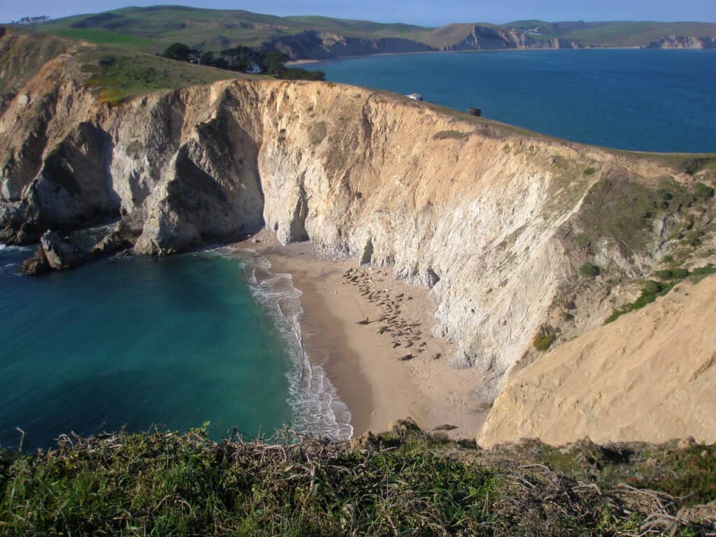
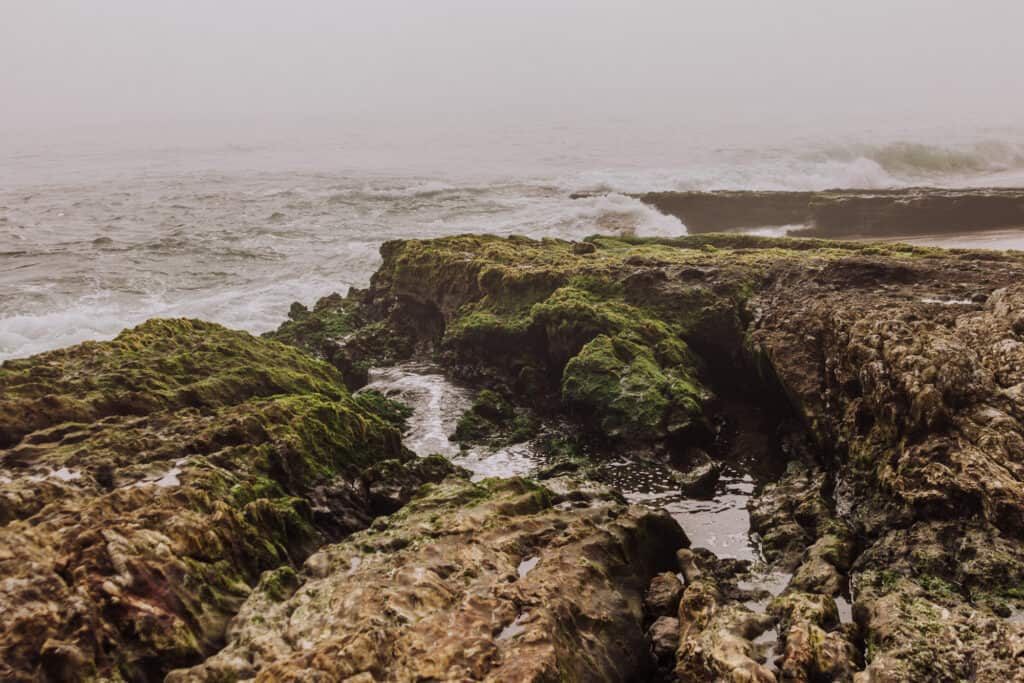
The Chimney Rock Trail is a popular Point Reyes hiking option because it’s relatively short, but still offers amazing coastal views, plus the chance to see marine life along the rocks.
The highlight of the trail is Chimney Rock itself, a distinctive rock formation jutting out into the ocean. It serves as a prominent landmark and a nesting site for seabirds.
Below the trail, along the coast, you’re likely to see colonies of elephant seals.
Chimney Rock Trailhead and Location
The Chimney Rock Trailhead is located at the Chimney Rock parking area, which is accessed via the Drakes Beach Road in Point Reyes National Seashore. The trailhead is approximately a 1.5-hour drive from San Francisco. There is a parking lot available near the trailhead, but it can get busy during peak times.
Distance and Difficulty
The round-trip distance of the Chimney Rock Trail is about 1.75 miles (2.8 kilometers), making it a relatively short hike. The trail is mostly flat and well-maintained, suitable for hikers of all skill levels and ages.
Wildlife Viewing
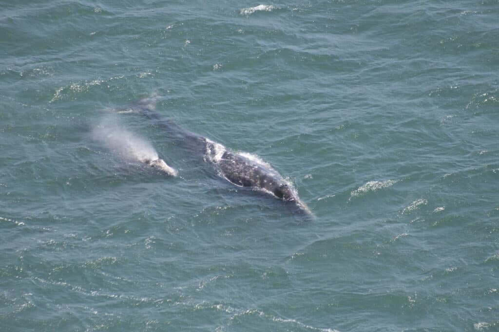
The Chimney Rock area is known for its abundant wildlife, making it a popular spot for nature enthusiasts. During the hike, keep an eye out for seals and sea lions lounging on nearby beaches.

Depending on the season, you might be lucky enough to see migrating gray whales!
Chimney Rock Trail Details:
🔘 Distance: Under 2 miles (round-trip)
🔘 Difficulty: Easy
🔘 Payoff: Coastal views and marine life
🔘 Dog-Friendly: No
🔘 Bikes: No
🔘 Camping: No
🔘 Wildlife: Seals, sea lions, and whales
McClure’s Beach Trail
The hike down to McClure’s Beach is a great Point Reyes trail, which is close to Tomales Point and the Pierce Point Ranch. It’s a relatively short hike (half a mile) from the lot to the beach, which is surrounded by coastal cliffs.
The trail to McClure’s Beach winds through coastal scrub, grasslands, and wildflowers. As you approach the beach, you’ll be greeted by breathtaking vistas of rugged cliffs, crashing waves, and the Pacific Ocean. The beach itself is known for its interesting rock formations and tidal pools.
Trailhead and Location
The trailhead for McClure’s Beach is located off Sir Francis Drake Boulevard. From the trailhead for Tomales Point (at the ranch) take a left and keep going down the road to the lot for McClure’s Beach.
The trailhead parking lot is large, with both garbage and restroom facilities (vaulted toilets).
Distance and Difficulty
The round-trip distance of the trail to McClure’s Beach is about one mile. This Point Reyes trail is considered moderate, since it’s a lengthy incline. It’s a packed-sand trail, which is clearly marked.
It’s all downhill on the way to the beach, but all uphill on the way back to the trailhead!
Beach Access and Safety
After descending the trail, visitors can explore McClure’s Beach.
Keep in mind: swimming at McClure’s Beach is not recommended due to strong currents, undertows, shark sightings, and jellyfish.
McClure’s Beach Trail Details:
🔘 Distance: 1 mile (round-trip)
🔘 Difficulty: Moderate, since it’s all uphill on the way back
🔘 Payoff: The beach
🔘 Dog-Friendly: No
🔘 Bikes: No
🔘 Camping: No
🔘 Wildlife: Jellyfish
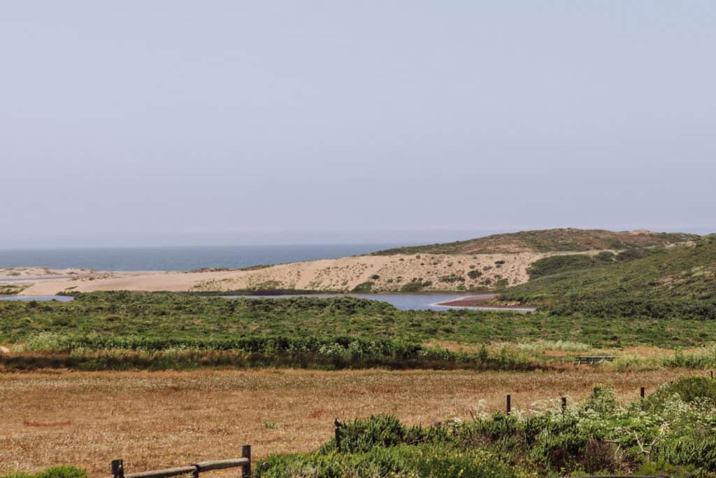
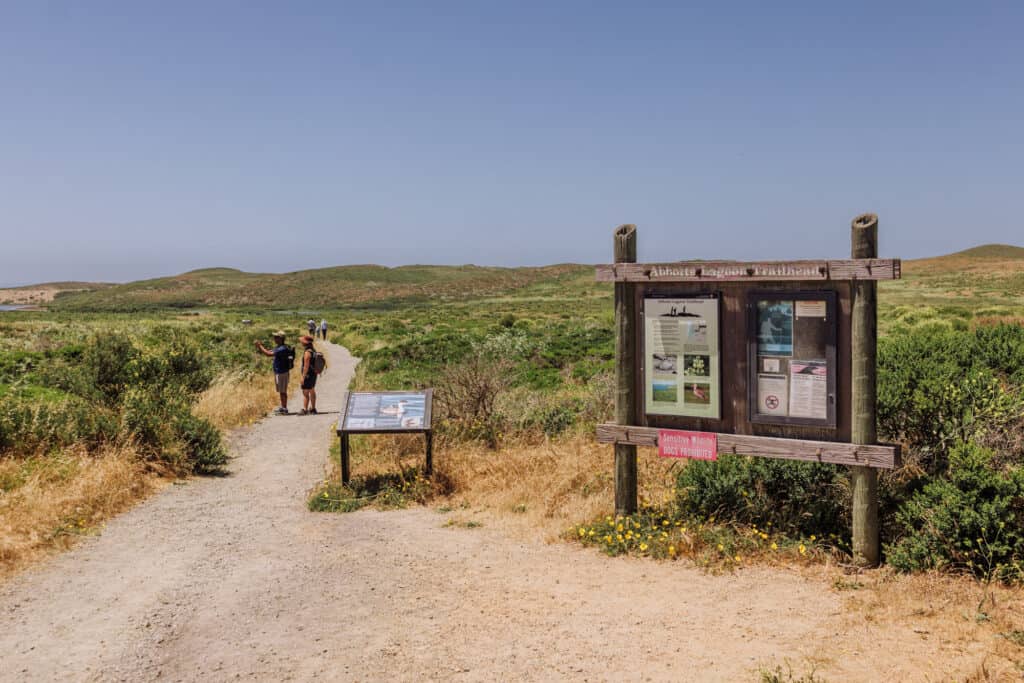
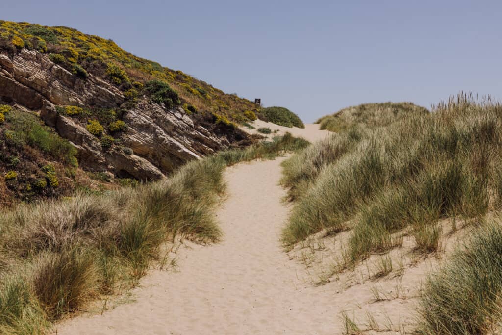
Abbotts Lagoon Trail
The hike to Abbotts Lagoon is a scenic Point Reyes trail, which takes you through marshes, grasslands, and sand dunes. Abbotts Lagoon is a shallow brackish water lagoon, which is an important habitat for migratory birds. It’s a great spot for birdwatching, especially during the spring and fall migrations.
Trailhead and Location
The trailhead for Abbotts Lagoon is a 30-minute drive from the Bear Valley Visitor Center. There is a large parking lot right at the trailhead, with garbage bins and restrooms (vaulted toilets).
Distance and Difficulty
The loop trail to Abbotts Lagoon is approximately 2.5 miles, and considered relatively easy. The well-maintained trail is flat and suitable for hikers of different abilities. You’ll see a lot of children and seniors enjoying this Point Reyes trail.
Wildlife Viewing
Abbotts Lagoon is known for its diverse wildlife. Bird enthusiasts can observe a variety of shorebirds, waterfowl, and raptors. Common species include herons, egrets, ducks, and falcons. Keep an eye out for other wildlife as well, such as deer, foxes, and reptiles.
Abbotts Lagoon Trail Details:
🔘 Distance: 2.5 miles (round-trip)
🔘 Difficulty: Easy
🔘 Payoff: Dunes & lagoon ecosystem
🔘 Dog-Friendly: No
🔘 Bikes: No
🔘 Camping: No
🔘 Wildlife: Birds and deer
Kehoe Beach Trail
The Kehoe Beach Trail stands out from many of the other Point Reyes hiking options, because dogs are allowed! If you’re a dog owner or lover, this is a fun hike, with an entertaining dog-friendly beach at the end.


People and pets will enjoy the mile-long trail to the beach, and the expansive stretch of sandy coastline.
Trailhead and Location
The trailhead for Kehoe Beach is located off Pierce Point Road in the northern part of Point Reyes National Seashore. The drive from the Bear Valley Visitor Center takes approximately 30 minutes.
There’s no parking lot at the Kehoe Beach Trailhead. You’ll have to park alongside the road. There is a bathroom (vaulted toilet) at the start of the trail.
The road will be busy by midday on the weekends in the summer.
Distance and Difficulty
The round-trip distance of the Kehoe Beach Trail is just over two miles. The hike is considered easy-to-moderate in difficulty, with relatively flat terrain and well-defined trails. It’s suitable for hikers of various skill levels, and is family-friendly.
You’ll see a lot of people carrying ice chests, umbrellas, and chairs to setup on the beach.
Beach Access and Safety
Kehoe Beach is a great place for beachcombing, walking along the coast, or simply relaxing and letting the dogs entertain you. It’ll seem crowded, and you’ll pass quite a few people on the trail on a sunny day, but the beach is large, so there’s plenty of room to spread out.
Just note: swimming at Kehoe Beach is not recommended due to strong currents and hazardous surf conditions.
There are restrictions on part of Kehoe Beach between March and September, so people and dogs don’t disturb endangered birds nesting in the area.
Campfires are allowed here, if you get a permit first at the visitor center.
Kehoe Beach Trail Details:
🔘 Distance: About 2 miles (round-trip)
🔘 Difficulty: Easy/moderate
🔘 Payoff: Fun dog beach
🔘 Dog-Friendly: Yes!
🔘 Bikes: No
🔘 Camping: Not really
🔘 Wildlife: Dogs!
Coastal Hike to Sculptured Beach
Sculptured Beach isn’t technically a Point Reyes trail, but I’d definitely consider it a hike!
From the very popular Limantour Beach, it’s a full two-mile walk directly down the coastline to Sculptured Beach.
You’ll find interesting rock formations, tidal pools, seals, and more.
Trailhead and Location
The parking lot at Limantour Beach is a 20-minute drive down a windy, paved road from Point Reyes Station. The large lot gets crowded on weekends during the summer. There are bathroom facilities and garbage bins in the lot.
Distance and Difficulty
It’s two miles from Limantour Beach to Sculptured Beach, all along the sandy coastline. The difficulty level is low, as long as you’re easily able to walk on the sand for a round trip total of four miles.
After the two miles from Limantour, the sand will turn to a series of rock formations on the beach.
You’ll pass Santa Maria Beach 1.5 miles into your walk.
Sculptured Beach Trail Details:
🔘 Distance: 4 miles (round-trip) from Limantour
🔘 Difficulty: Easy (all beach)
🔘 Payoff: Rock formations & peaceful spot
🔘 Dog-Friendly: No
🔘 Bikes: No
🔘 Camping: No
🔘 Wildlife: Possibly seals or sea lions
The Best Time of Year for Point Reyes Hiking
The easy answer is: summer.
With that said, you can really enjoy a Point Reyes trail any time of year. I’m not into rainy hikes, so for me summer is my best bet!
You’re most likely to see the beautiful wildflowers along the trail in late spring and early summer.
Here’s a breakdown of how each season impacts hiking at Point Reyes:
- Winter (December to February): Winter brings cooler temperatures and the highest amount of rainfall to the area. Hiking Point Reyes trails during this season can be challenging due to the muddy and slippery trails caused by rain. Fog is also common (and not a deal-breaker for me).
- Spring (March to May): Spring at Point Reyes National Seashore brings milder temperatures and rainfall. The landscape becomes lush and green, and wildflowers start to bloom. The Point Reyes Trails can remain muddy and slippery, so proper footwear is essential.
- Summer (June to August): Summer brings cooler temperatures compared to other parts of California. The highs are often in the 60s, but that’s perfect hiking weather for me! It’s relatively dry, and the trails aren’t as muddy. Fog can still roll in and out anytime.
- Fall (September to November): Fall is another great time of year for Point Reyes hiking. The weather is warm and dry, and the trails are generally in good condition.
Aside From Point Reyes Hiking …
There’s a lot to see at Point Reyes National Seashore! It’s a great weekend escape.
Here a few of the other sites to see, when you’re done with the trails:
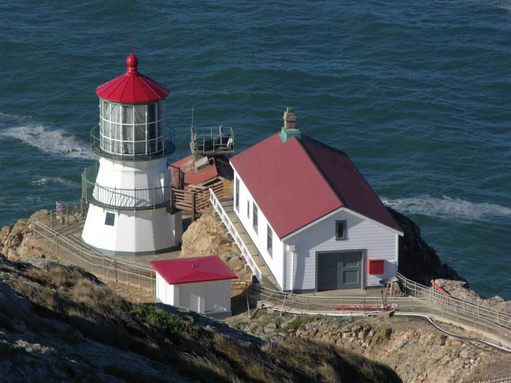
- Point Reyes Lighthouse: Visit the historic Point Reyes Lighthouse perched on a dramatic cliff, and enjoy panoramic views of the rugged coastline. Take a tour and learn about the lighthouse’s role in guiding ships along the treacherous Point Reyes Headlands.
- Drakes Beach: Relax on the sandy shores of Drakes Beach, known for its expansive shoreline and scenic beauty. Explore the nearby visitor center and enjoy views of the iconic Drakes Estero.
- Cypress Tree Tunnel: Stroll through the picturesque tunnel of near-century-old cypress trees, which leads to the old Morse Code radio station in the park.
- The S.S. Point Reyes Shipwreck: Make a quick stop behind the market in Inverness to check out the decaying remains of the S.S. Point Reyes. The WWII-era ship, which became a fishing vessel, beached here years ago. Let’s just say… it’s not long for this world… so stop by and check it out.
- Seals & Sea Lions: There are a few overlooks near the Point Reyes Lighthouse where you can observe the marine life without interfering.
- Bear Valley Visitor Center: Start your visit at the Bear Valley Visitor Center, where you can gather information, learn about the park’s natural and cultural history through exhibits, and obtain trail maps and permits.
FAQs About the Point Reyes Hiking Trails
Let’s tackle some of the frequently-asked-questions about Point Reyes hiking. Some of these are answered above.
What’s the most scenic hike in Point Reyes, California?
The hike to Alamere Falls offers the most diverse scenery, with both coastal cliffs and lush forests.
If you’re looking for only a coastal California hike, consider the Tomales Point hiking trail since you’ll have ocean views most of the way.
Are there bears at Point Reyes National Seashore?
You likely won’t come across any bears at Point Reyes, but black bears do live in Marin County, California.
Point Reyes National Seashore rangers say a hiker spotted a black bear on the Laguna Trail in 2023. Bears were spotted in Inverness and at Kehoe Beach in 2022.
There are rare mountain lion sightings. You’re most likely to see elk and marine life, like elephant seals and sea lions.
Where can you see the elk at Point Reyes?
The Tomales Point hike is your best bet for spotting the tule elk that roam the grasslands and cliffs above the coast. They were hunted to extinction in the area, but brought back quite successfully through a breeding and management program beginning in the 1970s.
What are the best campsites near Point Reyes?
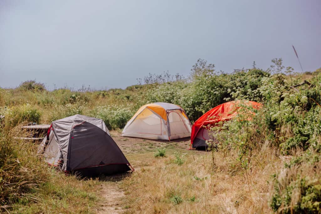
If you’re down for a hike into a campsite, I’d recommend Wildcat Campground. It’s about six miles from the Palomarin Trailhead. You’ll need a permit. It’s on a hill above Wildcat Beach. It’s a nice spot that’s not crowded due to the distance and effort it takes to get there.
CLICK HERE for the Recreation.gov website to check out camping opportunities at Point Reyes.
Wrap on Point Reyes Hiking
A Point Reyes hiking trip is a great weekend idea, whether you’re from San Francisco or visiting from out-of-town. It’s also a great weekend trip from anywhere on the West Coast, from Phoenix to LA to Seattle, or for inland hikers from Salt Lake or Denver looking for a more coastal experience.
The park is never overly-crowded, and provides an opportunity to escape city life for a day or two. It’s refreshing to be in the coastal environment, surrounded by cliffs, beaches, dense forests, and expansive meadows full of wildflowers.
We’re looking forward to our next visit!
Check out our other posts about the California Coast: