20 Hidden waterfalls in Arizona

Arizona is full of beautiful hidden gems, beyond the Grand Canyon, Antelope Canyon, and Sedona, which are on bucket lists for people from around the world.
In a state known for its desert landscapes, people are surprised to find stunning waterfalls … some of which are much easier to find then others.
Social media is full of inaccurate information about many of these famous spots. Some require permits, others are only seasonal, and a few are off limits altogether!
Water Wheel Falls
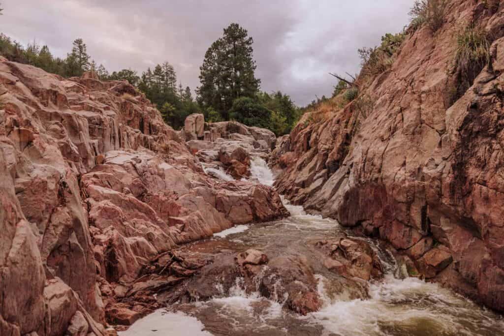
Water Wheel Falls is in the Tonto National Forest, near Payson, Arizona.
It’s a family-friendly hike, which leads to a series of cascades and swimming holes.
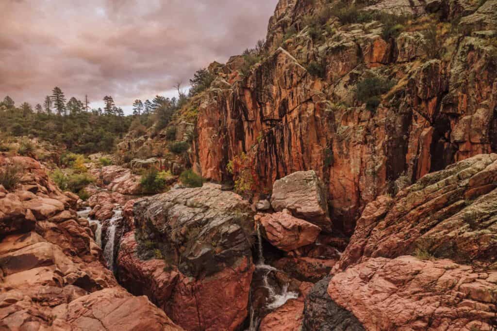
The parking lot only holds 40 vehicles, and it can fill up on busy summer days.
The trail begins on the north end of the parking lot. It follows Ellison Creek upstream.
Rescue crews are called here often, for hikers who slip and injure their ankles.
- Location: 10 miles north of Payson
- Cost: You’ll need an $8 day pass, which you can buy along the road.
- Trailhead Parking: A lot of Houston Mesa Rd., which fills on busy summer days
- Hiking Distance: About 1.5 miles
- Warnings: Parking is limited, and there’s no cell service.
Fossil Springs
I think Fossil Springs has to be one of my favorite Arizona destinations (waterfall or not).
Hiking from the Bob Bear Trailhead, near Payson, you’ll come to a beautiful waterfall and creek, with a hidden cave to swim into.
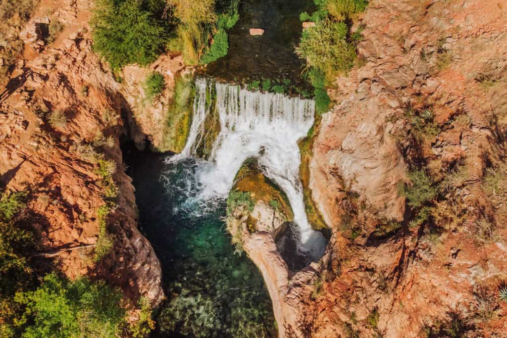
The Bob Bear Trail hike is around 10 miles, roundtrip. The way in is all downhill, and the way out is all uphill, so it’s rated as a “difficult” hike.
There’s minimal shade along the hiking route, so keep that in mind during the summer.
Still, it’s worth it for this beautiful waterfall and swimming hole.
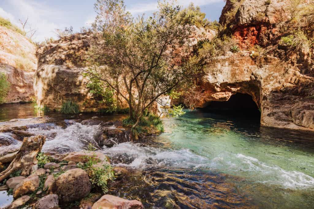
Down below the main waterfall, you can swim into a cave, where the light reflects off the travertine rock to create an iridescent glow.
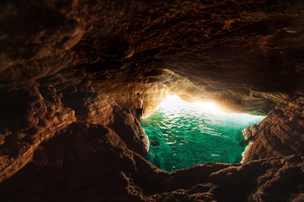
You’ll need a permit to visit from April through September.
Remember: Save more than half of your water to drink on the hike back out!
- Location: Near Strawberry, AZ, which is a 2-hour drive from Phoenix
- Cost: Nominal fee …*if* you can secure a permit on recreation.gov
- Trailhead Parking: Bob Bear Trailhead is a 30-minute drive northwest of Payson
- Hiking Distance: Roundtrip, it’s 10 miles.
- Warning: Cell coverage is spotty or non-existent, depending on where you are on the trail.
Fossil Creek
People confuse Fossil Creek and Springs. It’s part of the same waterway, but two very different experiences.
Fossil Creek’s trail will still bring you along a crystal-clear creek to a pretty waterfall.
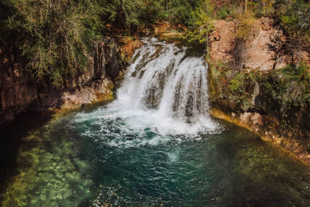
Fossil Creek is pretty, but not as dramatic as Fossil Springs.
The hike to Fossil Creek is much easier than the hike to Fossil Springs.
Plus, the trailhead parking lots are accessible through Campe Verde, not Strawberry.
From April through September, you’ll need a permit (reservation) to park in one of the lots, which fill during the summer.
- Location: Camp Verde, AZ
- Cost: $6 per car, and you’ll need to reserve a parking permit on recreation.gov
- Trailhead Parking: There are 8 designated parking lots.
- Hiking Distance: It depends on your assigned lot. The Dixon Lewis Lot is closest to the waterfall, just over a mile away.
- Warning: It’s a 15-mile drive down a rough, dirt road.
Sycamore Falls
Syacmore Falls is a stunning waterfall in Northern Arizona.
The hike itself is less than a mile, and it’s relatively easy.
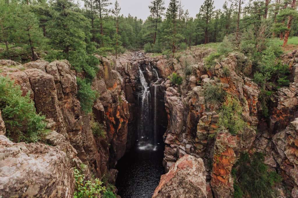
Sycamore Falls can be seasonal, so if it’s been dry for a month, the waterfall could be a trickle. On the other hand, after a big storm or snowmelt, it could be raging.
- Location: near Williams, AZ
- Cost: Free, and no permits or reservations are needed
- Trailhead Parking: It’s a small lot, 50 minutes from Flagstaff
- Hiking Distance: Roundtrip, it’s about 2 miles
Tonto Natural Bridge (2 Waterfalls)
Tonto Natural Bridge is a state park near Payson, which is home to what’s thought to be the world’s largest natural travertine arch or bridge.
There are two waterfalls here: the main one, directly under the natural bridge, and a second one, which is down a side trail slightly upstream.
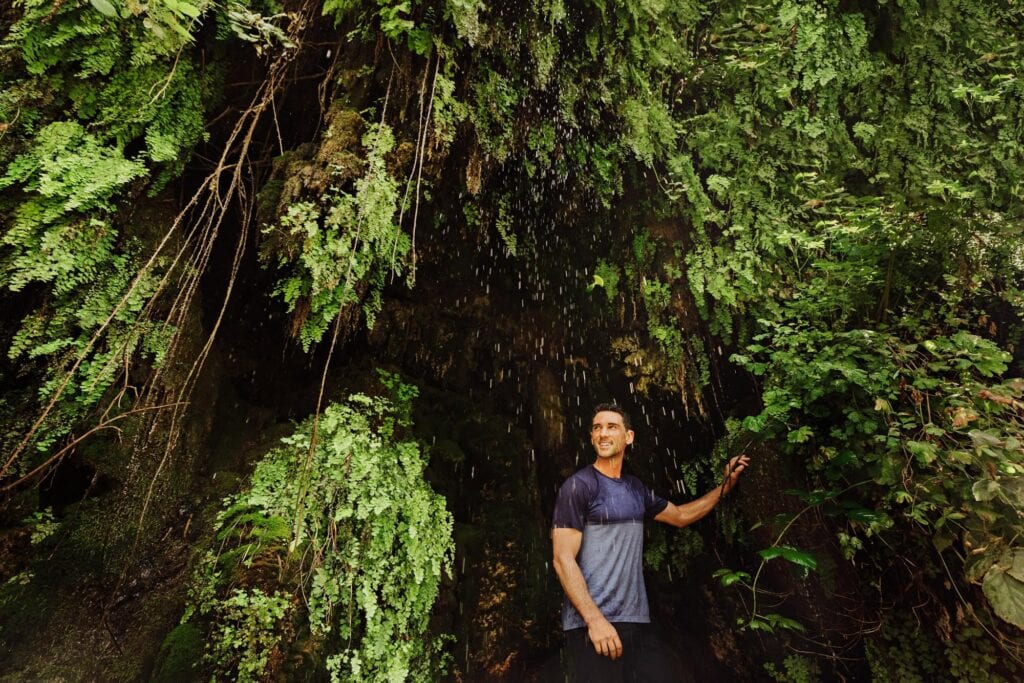
The Gowan Trail will lead you on a steep and slippery (in parts) trek down into Pine Creek. You’ll end up under a misty waterfall, created by springs above. In this photo, you can see the cascade in the background:
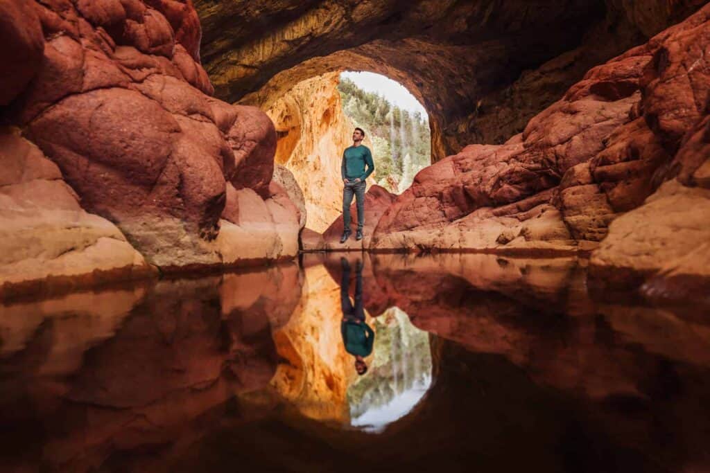
The bridge is 183 feet high, and the tunnel is 150 feet wide.
The second waterfall is down the aptly-named Waterfall Trail. It’s 300 feet down a set of steps to a mossy, green waterfall cave area.
- Location: Tonto Natural Bridge State Park in Payson, AZ
- Cost: $10 for adults, $5 for kids
- Trail Parking: Large lots at the park
- Warnings: Rescues are frequent here because of the slippery rocks under the bridge.
Havasu Falls
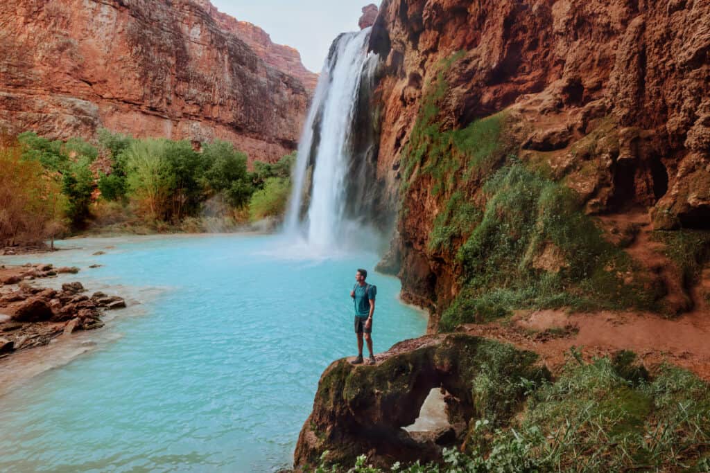
Havasu is perhaps the most famous of the stunning waterfalls along Havasu Creek.
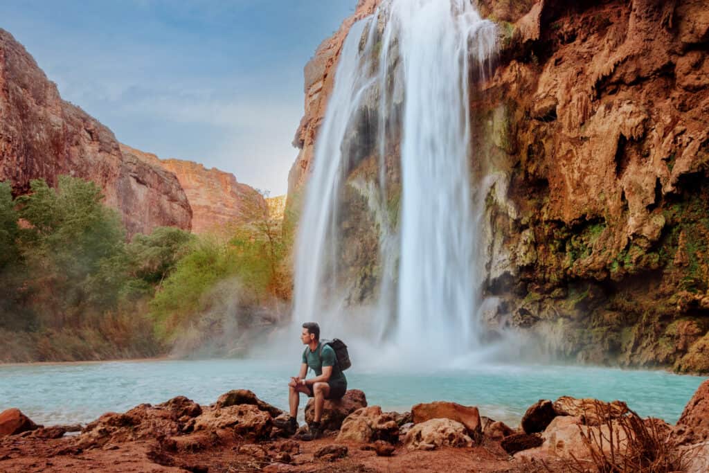
A visit requires a permit, overnight camping, and a lengthy hike through a desert canyon.
This is not a day trip, even if you use the helicopter to bypass the hike.
I have a series of detailed posts about Havasu Falls and the other waterfalls along Havasu Creek on the Havasupai Reservation.
- Location: Havasupai Reservation in the Grand Canyon
- Cost: $450 (for a 4-day/3-night camping pass)
- Trailhead Parking: North of Peach Springs
- Hiking Distance: 10 miles from the trailhead
- Warnings: This requires a commitment and advanced planning.
Mooney Falls
Mooney is the tallest waterfall along Havasu Creek, and perhaps the most infamous (thanks to the vertical climb down to the base).
Mooney falls is about 3 miles beyond the village of Supai, at the end of the Havasupai Campground.
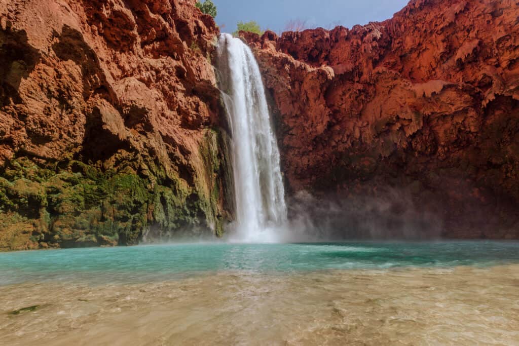
There are campsites right on the top of the falls. For many visitors, the view from above is enough!
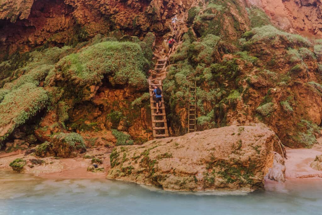
For many more, it’s worth the climb down through a rock tunnel, and down a series of wooden ladders and rock steps to get to the bottom.
I have a few blog posts about the descent down Mooney Falls, and everything else you need to know about this majestic Havasupai waterfall.
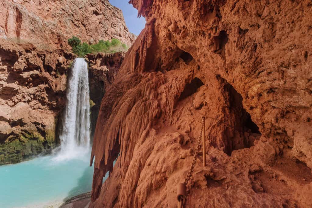
The ladders and chains are intimidating, especially if you’re not into heights.
Putting mind over matter is worth it, to enjoy everything at the base of Mooney Falls and beyond.
- Location: Havasupai Reservation in the Grand Canyon
- Cost: $450 (for a 4-day/3-night camping pass)
- Trailhead Parking: North of Peach Springs
- Hiking Distance: 12 miles from the trailhead
- Warnings: This requires a commitment and advanced planning.
Little Navajo Falls
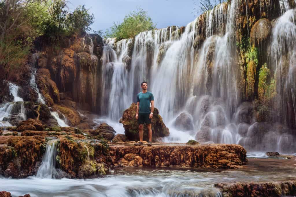
Little Navajo is a “newer” waterfall along Havasu Creek.
In my complete post on the spot, I call Little Navajo Falls “Havasupai’s Overlooked Gem.”
It’s the first set of falls hikers will come across after leaving the village of Supai, bound for the campground.
During a flood in 2008, Havasu Creek carved a new path, sending the water plunging over the rocks in what is now a beautiful waterfall and swimming hole.
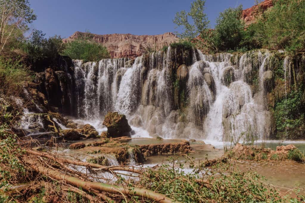
It’s not as dramatic or famously blue as Havasu or Mooney Falls, but far fewer people visit Little Navajo, making it a much quieter way to spend the afternoon.
- Location: Havasupai Reservation in the Grand Canyon
- Cost: $450 (for a 4-day/3-night camping pass)
- Hiking Distance: 1.5 miles from Supai (or about 8 miles from the trailhead)
- Warnings: This requires a commitment and advanced planning.
50 Foot Falls
This was one of my favorite waterfalls at Havasupai.
I say *was* because a flood changed the course of Havasu Creek in 2024, and it doesn’t flow over the site anymore.
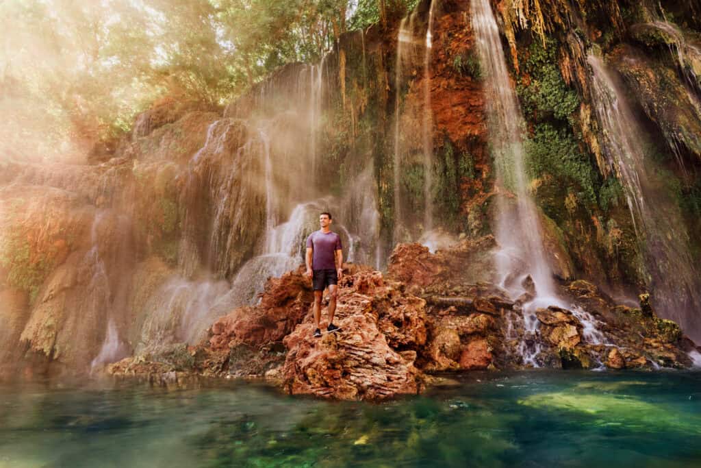
It required a hike down an unmarked path and through a marsh, but it was worth it!
Maybe the creek will one day curve back over these cliffs.
- Location: Havasupai Reservation in the Grand Canyon
Beaver Falls
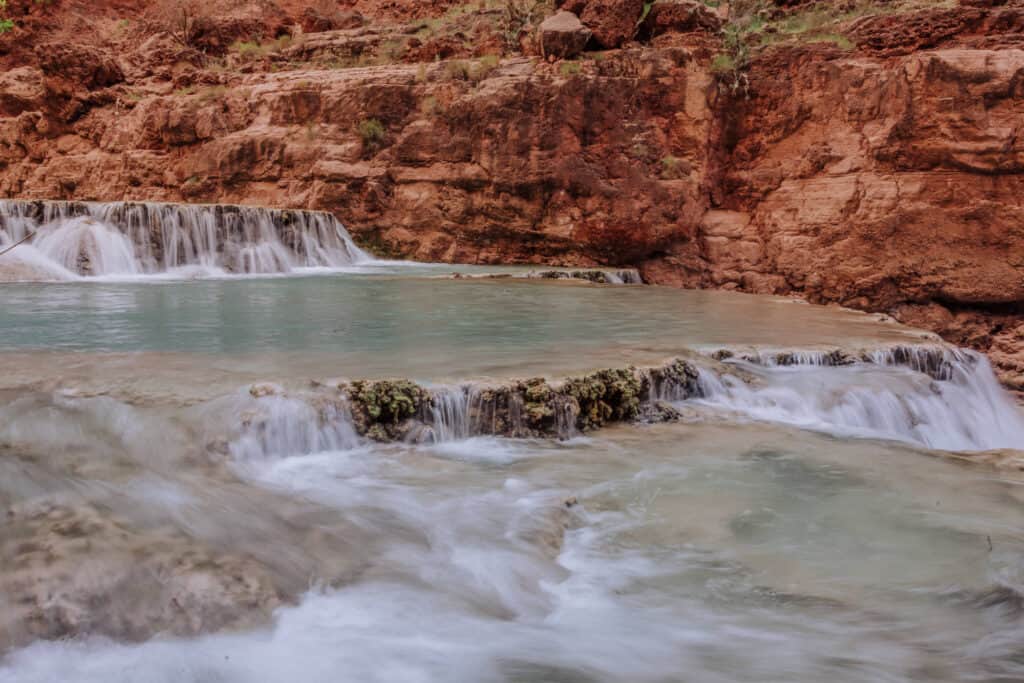
Beaver Falls in Arizona is an oasis on the Havasupai Reservation near the Grand Canyon.
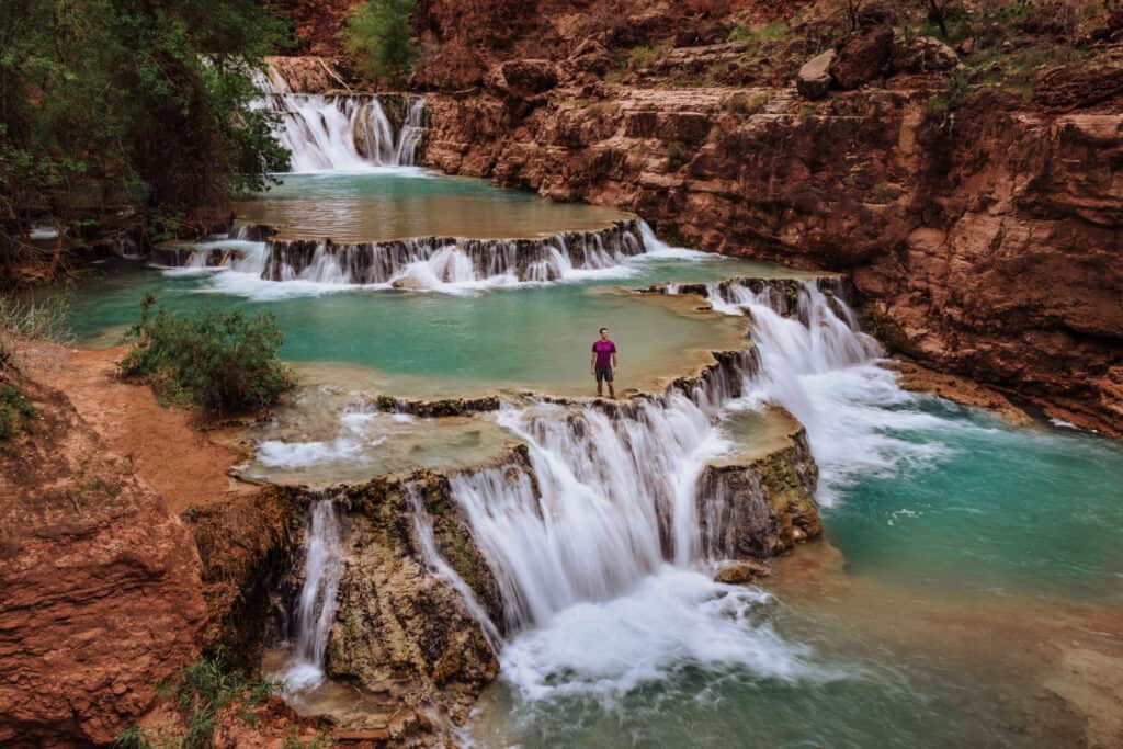
It gets overshadowed by the more Insta-famous Havasu Falls, but that’s what makes Beaver more of a hidden gem.
It’s worth the extra hike to get to what might be the most unique swimming hole in Arizona.
This is *not* a day trip from anywhere… aside from the Havasupai Campground.
- Location: Havasupai Reservation in the Grand Canyon
- Cost: $450 (for a 4-day/3-night camping pass)
- Trailhead Parking: North of Peach Springs
- Hiking Distance: From the campground: 3 miles downstream (Havasu Creek)
- Warnings: This requires scaling the ladders and chains down Mooney Falls.
Grand Falls (Chocolate Falls)
Grand Falls, also called Chocolate Falls, is closed to visitors.
It flows on the Navajo Nation northeast of Flagstaff, turning dry cliffs into a raging waterfall that rivals Niagara. They really roar during spring snowmelt or right after a big monsoon storm.
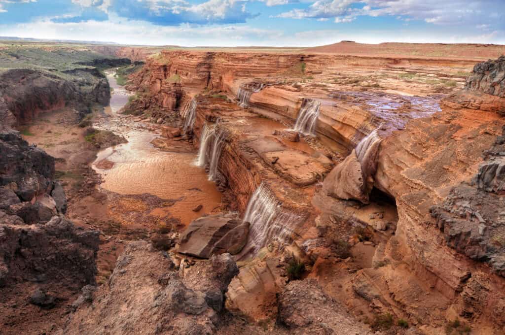
Sadly, it became so popular several years ago … and people made such a mess… that the tribe closed access to the public.
- Location: About 30 miles northeast of Flagstaff, on Navajo Nation land near Leupp
- Visiting: You’ll only legally have access if you know know someone with rights to the land who can escort you.
Cibecue Falls
Cibecue Falls is a 50-foot waterfall tucked into a red-walled canyon on the Fort Apache Indian Reservation.
To get there, you’ll spend most of the hike wading up Cibecue Creek itself, crossing it again and again on the way to the falls. It’s remote, it’s beautiful, and it’s one of those hikes where the drive is half the adventure.
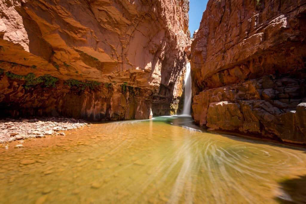
The hike itself is only about 3 miles roundtrip, and you’ll be hopping boulders and wading through the creek the entire way.
The one has one of the oddest permit requirements. You have to buy a permit at a Sinclair gas station (Carrizo C-Store). It’s at the junction of Highways 60 and 73.
Check the rules and regulations for Cibecue Falls on the tribe’s website.
- Location: Near Cibecue, AZ, roughly 2.5–3 hours northeast of Phoenix
- Cost: A $45-per-person tribal access permit
- Trailhead Parking: Cibecue Creek Trailhead (small dirt lot) one hour north of Globe
- Hiking Distance: It’s about 3 miles roundtrip, and rated moderate.
- Warnings: Swimming is technically prohibited in reservation waters, the last stretch of road includes a creek crossing best suited to high-clearance vehicles. Plus, if there’s rain or inclimate weather, they’ll close the hike for flash flooding fears.
Ribbon Falls (Grand Canyon)
Ribbon Falls is the gem of the North Kaibab Trail in the Grand Canyon.
Water pours about 100 feet onto a moss-covered travertine dome, and there’s a path up the side that lets you walk behind the falls for a different view.
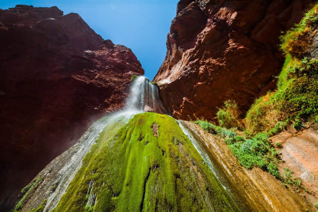
From the North Rim, it’s roughly 17 miles roundtrip with about 4,500 feet of elevation change. Most people hike in one day, camp, and then hike out the following day.
For parking, the North Kaibab Trailhead Lot is a free parking area located 1.5 miles north of Grand Canyon Lodge on Highway 67. It’s often full. If that’s the case, you can park roadside.
Additional parking is available at the Backcountry Information Center or the North Rim Campground kiosk.
Always check the Grand Canyon’s conditions. The North Rim closes for several months each winter.
- Location: Grand Canyon National Park, off the North Kaibab Trail below the North Rim
- Cost: Grand Canyon entrance fee. Plus, a backcountry permit is required if you’re camping.
- Parking: Grand Canyon’s North Rim
- Hiking Distance: Roundtrip, it’s around 17 miles from the North Rim
- Warnings: This is a serious, remote hike with thousands of feet of elevation change, minimal shade, and creek crossings where the footbridge is frequently washed out.
Arizona Falls
Not every Arizona waterfall requires a hike.
Arizona Falls is a 20-foot, man-made cascade tucked into the Arcadia neighborhood of Phoenix, right along the Arizona Canal.
It doubles as a working hydroelectric plant and a public art installation, complete with poetry etched into the concrete. It’s not a wilderness experience, but it’s a genuinely cool, free stop if you’re in the city and want to hear rushing water in the middle of the desert.
- Location: 5802 E. Indian School Rd., Phoenix (Arcadia neighborhood)
- Trailhead Parking: G.R. Herberger Park
- Cost: Free
- Hike: None
- Warnings: This isn’t a natural waterfall, so don’t expect a wilderness setting. Swimming isn’t allowed.
Horseshoe Dam
Horseshoe Dam has a waterfall you can actually walk behind … BUT… *only* when SRP (Salt River Project) is releasing water from Horseshoe Reservoir into the Verde River.
When it’s flowing, usually briefly in the spring, it’s a dramatic, multi-tiered cascade pouring over a concrete spillway.
The flow depends entirely on water management decisions rather than rain or snowmelt, so this is one of the more unpredictable waterfalls on this list.
Always check SRP’s release schedule before making the drive, since releases can start or stop with little notice.
- Location: Tonto National Forest, about 58 miles northeast of Phoenix near Rio Verde
- Cost: A Tonto Discovery Pass is required ($8 daily or $80 annually)
- Hiking Distance: None really
- Warnings: The last 9 miles of road are rough, so a truck or SUV is recommended.
Seven Falls
Seven Falls lives up to its name: a series of seven cascades and pools, inside Tucson’s Sabino Canyon Recreation Area.
The canyon stream runs most of the year, which is rare for the desert, and the granite pools at the base are deep enough for swimming.
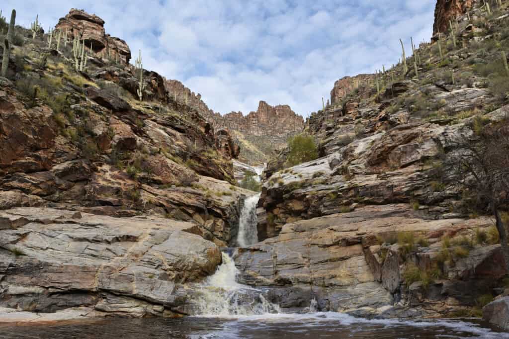
This is one of Tucson’s most popular hikes, with a near-constant water flow, and a swimmable payoff at the end.
The best conditions are typically October through May, when the creek is running higher.
- Location: Sabino Canyon Recreation Area, Tucson
- Cost: A day-use fee is charged at Sabino Canyon. A shuttle to the trailhead is available for an additional fee.
- Trailhead Parking: Sabino Canyon
- Hiking Distance: From the visitor center, it’s almost 9 miles roundtrip. Taking the shuttle cuts it in half.
- Warnings: Little shade and extreme heat in summer, multiple creek crossings, and a parking lot that fills up fast on weekends.
Tanque Verde Falls
Tanque Verde Falls is a series of seasonal waterfalls east of Tucson.
The main waterfall is an 80-food drip into a swimming hole.
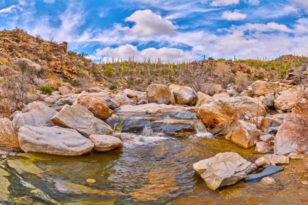
A warning about Tanque Verde: it’s beautiful, but it’s proven dangerous over the years with a number of cliff jumping accidents and injuries on the slippery rocks.
- Location: Redington Road, east of Tucson (Coronado National Forest)
- Cost: Free
- Trailhead Parking: Upper or Lower Tanque Verde Falls Trailhead
- Hiking Distance: It’s about 2 miles roundtrip, and the hike involves some scrambling.
- Warnings: Slippery rocks, a history of serious injuries and drownings, and real flash-flood danger during monsoon season. Skip this one if rain is in the forecast anywhere upstream.
Chiva Falls
Chiva Falls is a roughly 75-foot seasonal waterfall in a canyon east of Tucson.
A lot of people ride ATVs out to it, in addition to hiking.
The trail crosses rocky washes and hillsides dotted with saguaro cacti and ocotillo before dropping into the canyon where the falls hide.
Like most desert waterfalls, it only really runs after decent rain, so January through April tends to be the best window.
- Location: Coronado National Forest, east of Tucson
- Trailhead Parking: Chiva Falls Trailhead
- Cost: Free
- Hiking Distance: Almost 9 miles, roundtrip, and rated difficult.
- Warnings: The creek crossings and exposed, rocky terrain make this a genuinely tough hike in the heat — start early and bring more water than you think you’ll need.
Massacre Falls
Massacre Falls is another seasonal cascade in the Superstition Wilderness.
It’s named for a 19th-century legend about Apache warriors and Mexican gold miners.
The hike passes an old mine shaft and a sweeping viewpoint before reaching the falls themselves. Like most Superstition waterfalls, it’s entirely dependent on recent rain or snowmelt, so timing your visit matters more than anything else.
Post-monsoon storm or right after snowmelt in the higher elevations are your best bets for actually seeing water flowing down Massacre Falls
- Location: Superstition Wilderness, near Apache Junction
- Cost: Free
- Trailhead Parking: Crosscut Trailhead, Massacre Grounds Trailhead, or Canyon of the Waterfalls Trailhead
- Hiking Distance: Roundtrip, the hike is 6 miles, and rated moderate.
- Warnings: Almost no shade along the route except right at the falls, so this is not a good midday summer hike.
Canyon of the Waterfalls
On the rare days when it’s flowing well, Canyon of the Waterfalls might be the most dramatic seasonal hike in the Superstition Wilderness.
Cascades rundown the cliffs, creating a stunning sight in the desert.
On dry days, it’s just a nice desert hike … which requires some scrambling up rocks.
November through April, right after a solid rain, is the time to witness the waterfall.
- Location: Superstition Wilderness, near Apache Junction
- Cost: $10 per vehicle at the state park, and free at Canyon of the Waterfalls Trailhead
- Trailhead Parking: Lost Dutchman State Park or Canyon of the Waterfalls Trailhead
- Hiking Distance: The roundtrip is roughly 5-miles, and rated difficult.
- Warnings: The trail is largely unsigned past a certain point, rocks get slippery when wet, and the payoff is entirely weather-dependent.
Carney Springs Waterfall
Carney Springs is seasonal, flowing only after heavy rainfall in the Supserstitions, an hour east of Phoenix.
It’s 200+ feet tall, so quite a site to see (when it’s running).
The Shaka Cave and Wave Cave are both nearby.
- Location: Superstition Wilderness, an hour east of Phoenix
- Trailhead Parking: Peralta Trailhead or Lost Goldmine East Trailhead
- Cost: Free
- Hiking Distance: From the Lost Goldmine East Trailhead, it’s about 4 miles roundtrip.
- Warnings: Peralta Road can flood and wash out after storms, and the rocks at the base of the falls are sharp rather than slippery, so watch your footing.
