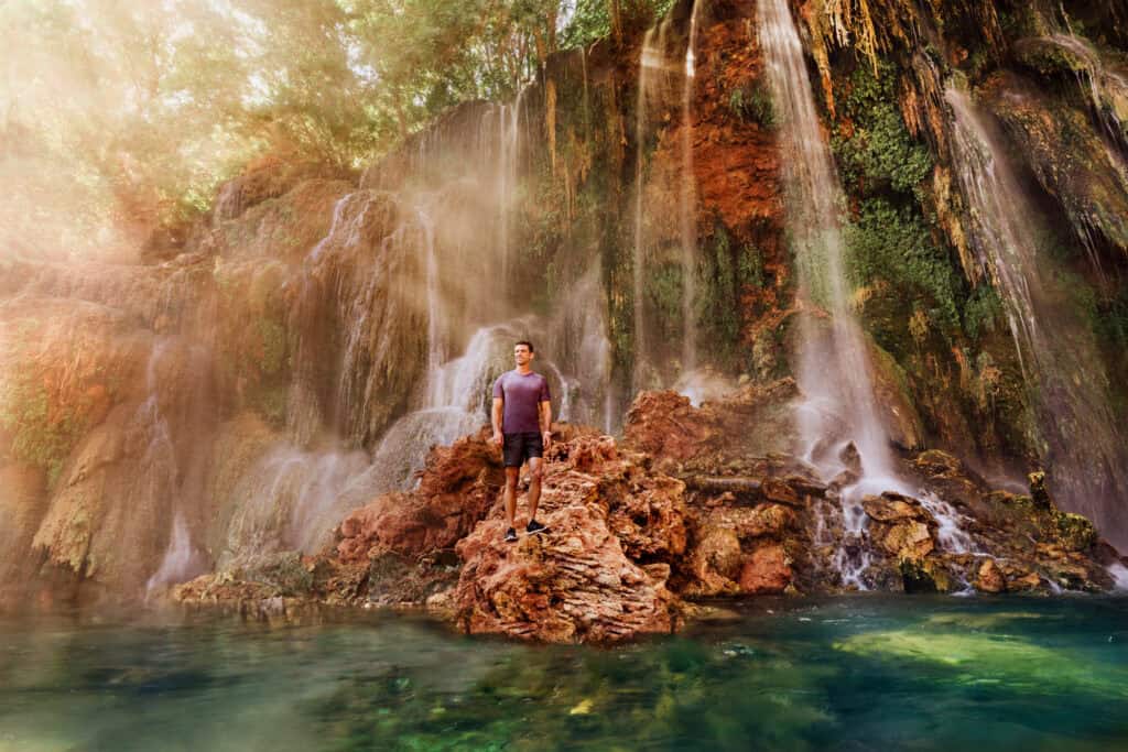
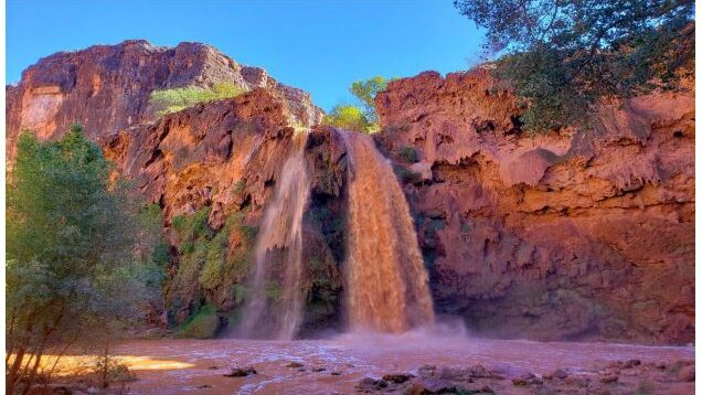
Little Navajo Falls: Havasupai’s Overlooked Gem

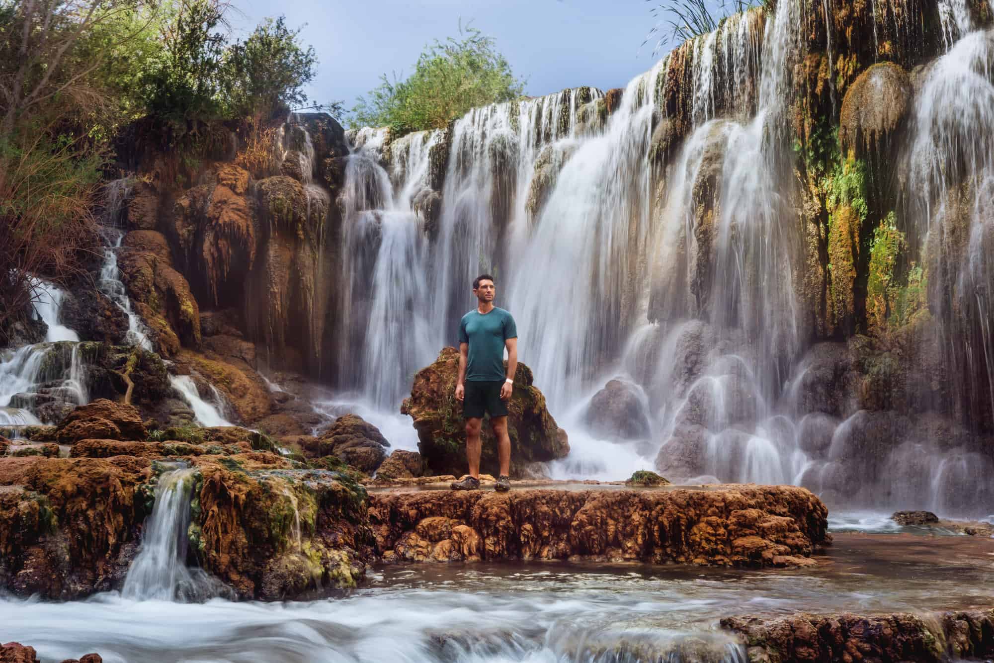
Little Navajo Falls, sometimes called New Navajo Falls is the first in a series of waterfalls hikers will see at Havasupai
Little Navajo Falls can be described as the “newest” waterfall along Havasu Creek on the Havasupai Reservation. During a massive flood in 2008, Havasu Creek carved a new path, sending the water plunging over the rocks in what is now a beautiful serene spot along the trail.
How to Find Navajo Falls on Havasu Creek
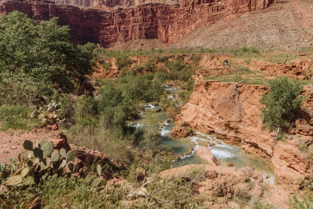
Beautiful, spring-fed Havasu Creek runs through the Havasupai Reservation west of the Grand Canyon in Arizona. It’s one of the biggest tributaries to the Colorado River. Snowmelt and runoff from the Kaibab Plateau filter down through the rocks and into the creek.
Havasu Creek runs about 20 miles through the reservation, cascading several times over the rocky terrain, creating stunning waterfalls which have become world-famous.
Little Navajo Falls is the first set of waterfalls hikers will be able to see from the trail, as they hike the 11-miles into the Havasupai Falls campground.
From the dirt trail above, you can see a series of terraces in the creek, and Little Navajo Falls is nearby.
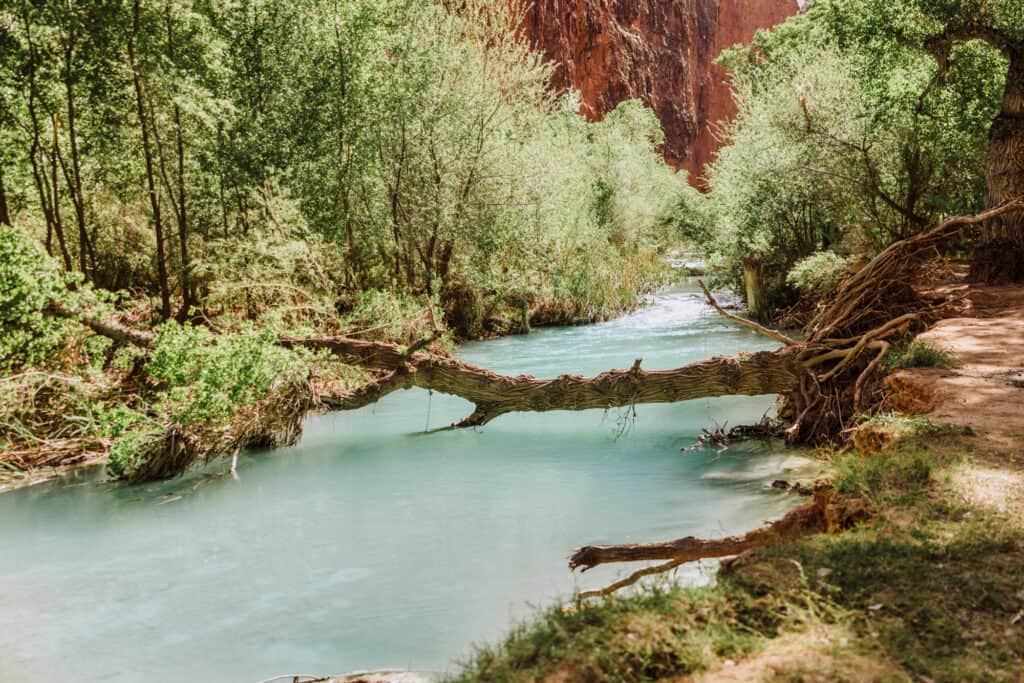
The Havasupai Tribe has lived along the creek in the canyon for 700 years. “Havasupai” actually translates to “people of the blue-green water.”
The Tribe says a heavy concentration of lime in the water creates the bright blue color in the creek. Geologists say other minerals like magnesium and calcium carbonate add to it when the sun reflects.
the Water Temperature in Havasu Creek
Don’t believe all of the blogs that say the water temperature at Havasupai is an even 70 degrees year-round! It’s not true.
While in the summer, the temperature of Havasu Creek rises nicely into the 70s, it’s in the 60s during the spring and fall and the 50s during the winter.
The US Geological Survey has a gauge in the stream near Supai, measuring daily temperatures, which you can check out here. It’s pretty cool!

Where is Little Navajo Falls?
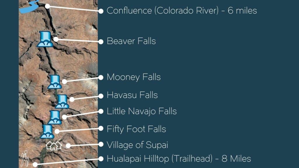
A satellite view shows Little Navajo and the other waterfalls along Havasu Creek are part of the canyon system which includes the Grand Canyon National Park.
The waterfalls go in this order down Havasu Creek:
- Fifty Foot Falls
- Little Navajo Falls
- Havasu Falls
- Mooney Falls
- Beaver Falls
- The Confluence (with the Colorado River in the Grand Canyon)
Map of Little Navajo Falls
This map shows the series of waterfalls along Havasu Creek. You’ll see Fifty Foot Falls is actually the first one hikers pass after leaving the village of Supai, but it’s hidden from the trail.
Little Navajo Falls has Changed
Little Navajo Falls is an example of the constant evolution of Havasu Creek over time. The area was dry and rocky until a massive flood moved through the Havasupai Reservation in 2008.
People living in the village of Supai recall floodwaters rushing through town in mid-August of 2008. The USGS says it carved away the land and ended up creating what is now known as Little Navajo Falls.
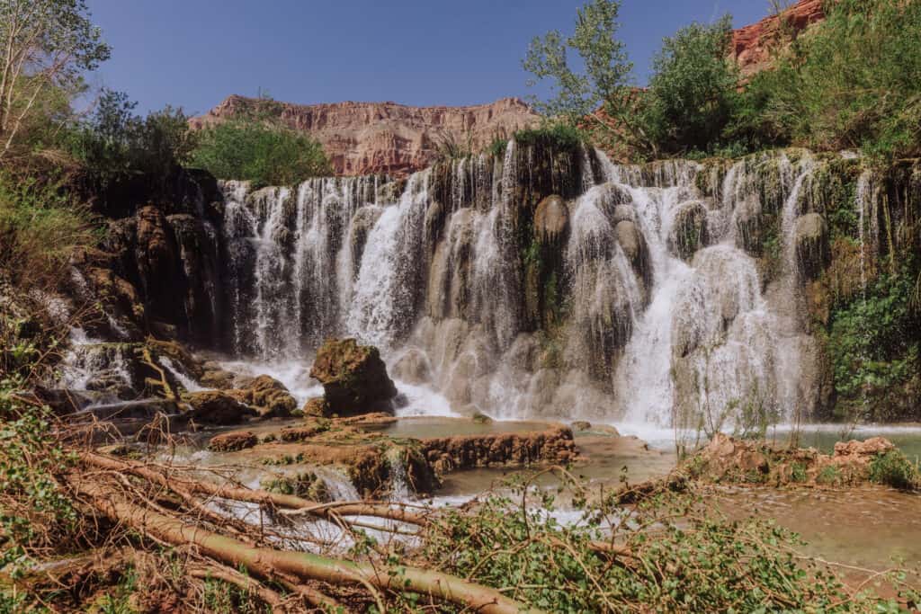
These days, it really looks like Little Navajo Falls has always been there. The lush greenery surrounds the area, which sits below the hiking trail between Supai and the campground.
It’s one of the wider waterfalls at Havasupai, and includes pools of water to swim and lounge in.
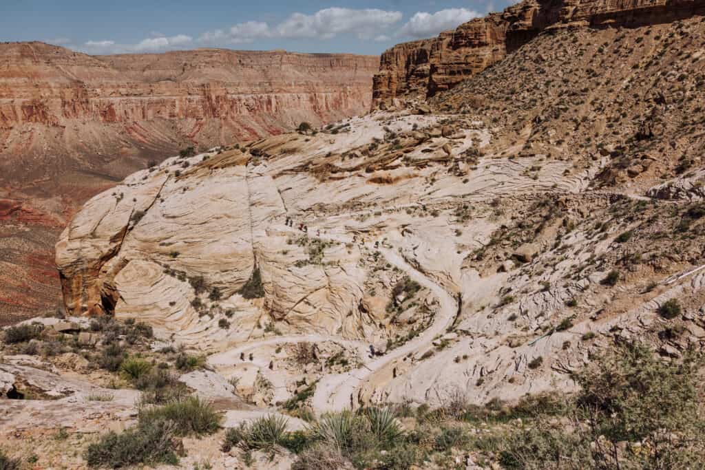
The Trail to Little Navajo Falls
Little Navajo Falls is right off the trail, between the village of Supai and the Havasupai Campground. It’s about a mile walk up from the campground to Navajo Falls.
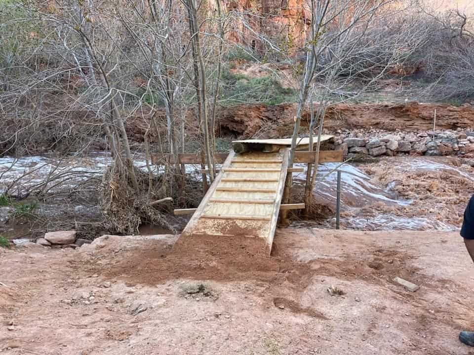
While you can see the waterfall easily from the trail, it might take some effort to get down to the creek.
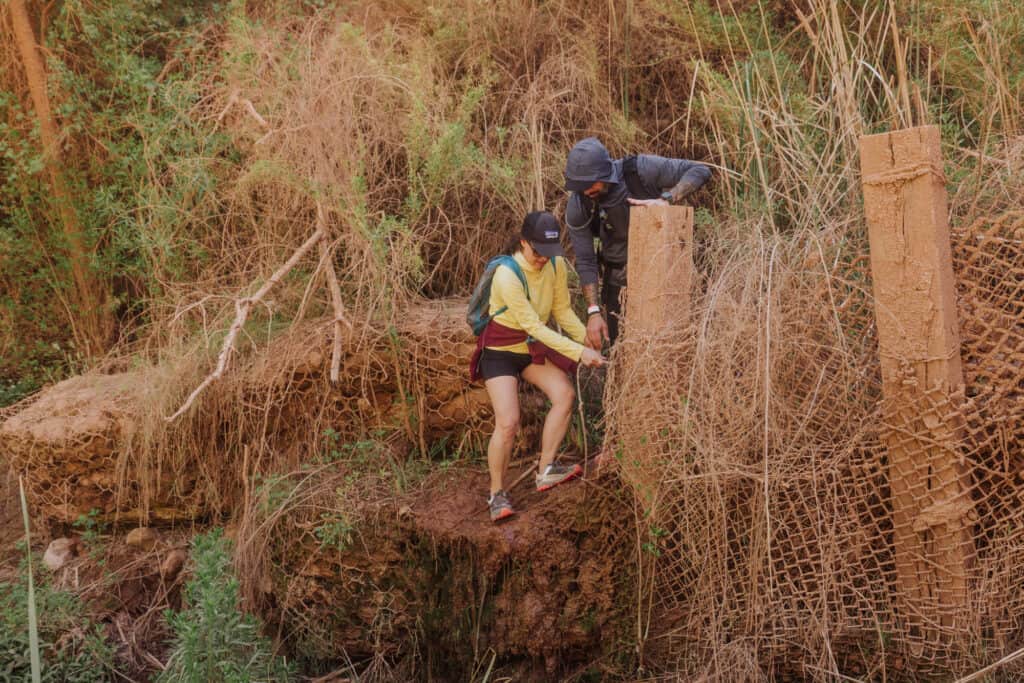
Another flood in 2023 washed over part of the trails used to get down to the creek, making them impassable. The descent to Little Navajo Falls’ pools requires a little more effort and a few leaps over big rocks. It’s still manageable and worthwhile.
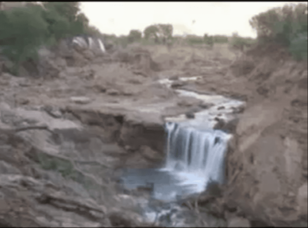
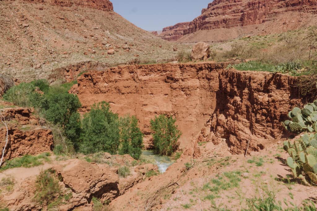
This photo of an area near Little Navajo Falls shows the mess left behind after a flood moves through:
It’s a reminder that as floods move through Havasupai every year or so, the trails to each of the waterfalls will continue to evolve.
Go Upstream to Fifty Foot Falls
Fifty Foot Falls is often overlooked by visitors to Havasupai, simply because it’s more hidden.
It’s actually the first cascade after the village of Supai, but it can’t be seen from the hiking trail to the campground.
From Little Navajo Falls, you can walk upstream along the left side of the creek and you’ll come up to Fifty Foot Falls.
This area isn’t surrounded by the towering cavern walls, like Beaver and Mooney Falls farther downstream. It means: it’ll be sunnier for more hours of the day, making it a great spot to swim and lounge around during your visit to Havasupai.
Side-Note: Cell Signal
A lot of people love going to Havasupai to unplug and disconnect, but in case you want to send an “I’m alive” text back home, Little Navajo Falls is the place to give it a try.
From the trail above the falls, you’re likely to get at least a weak signal for texting.

How Navajo Falls Formed
We have Mother Nature to thank for creating the beautiful Little Navajo Falls relatively recently.
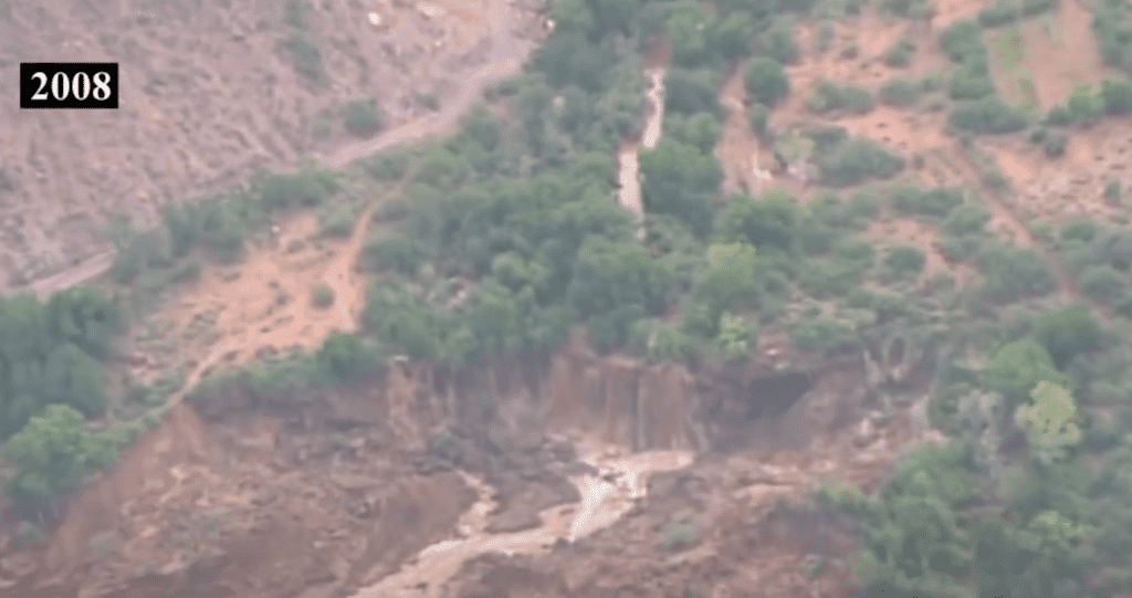
The Havasupai flood of 2008 was a natural disaster that occurred on August 17-18, 2008. Staff with the USGS say 6-inches of rain fell in a short period of time, triggering a flash flood along Havasu Creek.
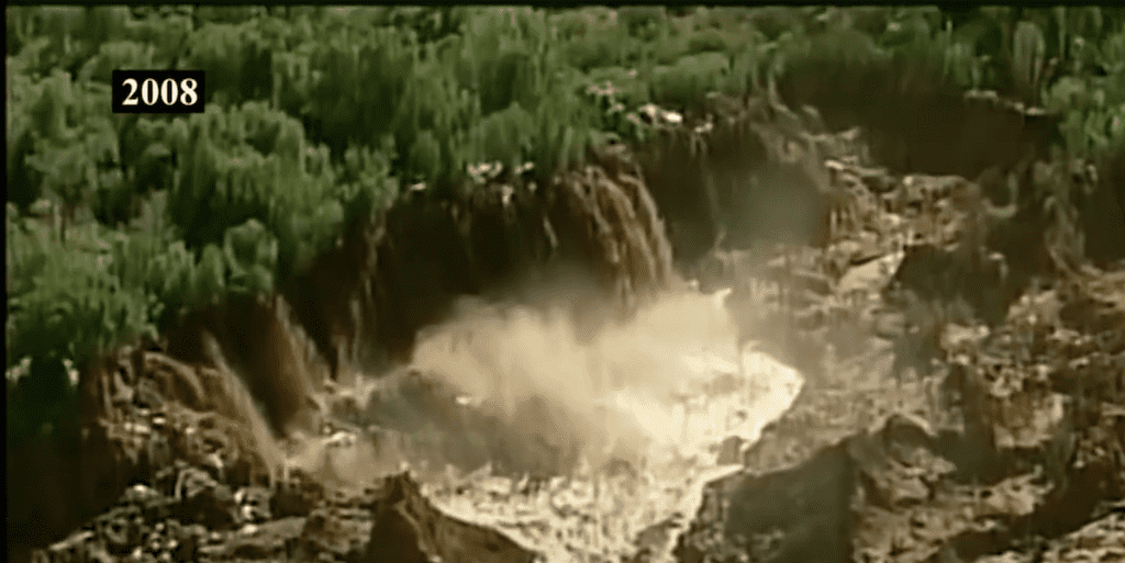
Their gauges near the village of Supai say the creek, which normally flows at 65 cubic-feet per second, surged to 6,000 cubic feet per second!
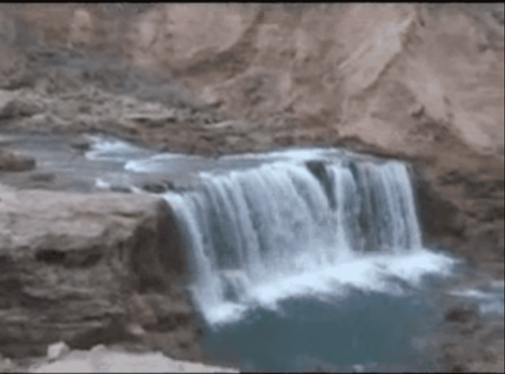
The USGS crew on scene 10 days after the flood took these photos of a “new” waterfall, which was left after the flood scoured a thick layer of sediment out of the area.
The Havasupai Reservation, including the village of Supai, was inundated with water, causing significant damage to homes, buildings, and infrastructure. The flood also caused significant erosion to the landscape, altering the course of waterfalls and streams in the area.
Rescue efforts were launched immediately following the flood, with helicopters and other emergency personnel deployed to evacuate people from the affected area. Many tourists and hikers who were visiting the area were stranded and had to be rescued, while several members of the Havasupai tribe were also displaced by the flood.
Damage estimates were well into the millions.
It took nearly a year to clean and restore the area, before it was reopened to visitors in the summer of 2009. The Havasupai people and the National Park Service also implemented measures to improve emergency preparedness and response to future floods and other natural disasters in the area.
The USGS says the flood waters wiped out the original Navajo Falls, but created a new series of cascades, now known as Little Navajo Falls.
Other Historic Floods at Havasupai
Havasupai Falls have been impacted by major flooding events over the years.
Here are a few examples of some of the major floods over the last century or so:
- 1910: The largest flood on record destroyed the entire Supai village
- 1935: Houses in Supai flooded again
- 1970: In one summer, a series of 10 flash floods swept through Havasupai
- 1990: A wall of water wiped out the village of Supai
- 1997: Flood damaged the campground and village
- 2002: Havasu Creek flooded, forcing a campground evacuation
- 2005: Another wall of water hit the village and campground
- 2008: Historic flood caused extensive damage to waterfalls, trails, and campground
- 2012: Flooding again damaged trails and campground
- 2018: Flash floods trapped 172 campers, who had to be evacuated by helicopter
- 2022: Flash flood hit, and the early warning system failed because gauges were damaged
- 2023: Snowmelt from heavy winter snowfall caused flooding and campground evacuation
- 2024: Deadly flash flooding hit the trail, village, and campground
Getting to Havasupai Falls
You still need a permit to visit, and a trip to Little Navajo Falls requires an 11-mile hike in a remote part of Arizona.
There are two ways to get a permit:
- Reservations open each year on February 1st (but sell out immediately)
- Check the cancellation list every morning for upcoming dates this year
Surrendered permits can be transferred to anyone who wants to buy them. They’re only available on the official Havasupai Tribe Reservation website.
The cost to buy a transferred Havasupai Falls permit is now $455 (per person). If the reservation you happen to find for the dates you want is for two people, you’ll pay $910, even if you’re going solo on the hike.
You cannot buy partial reservation transfers.
The cost of permits has risen sharply. The tribe cites the escalating cost of removing garbage (which has to be flown out since there are no roads), plus ongoing repairs from past floods and mitigation efforts to prevent catastrophic damage from future floods.
Hike to Little Navajo Falls
It’s 11 miles from a remote hilltop, an hour north of Peach Springs, Arizona, down through a canyon to the Havasupai Falls Campground.
It’s a strenuous but beautiful hike, beginning with a series of switchbacks that take you down into the canyon. You’ll follow a dry wash for several miles until it runs into Havasu Creek. Following the blue waters downstream, you’ll come to the village of Supai.
The land near Little Navajo Falls is a packed sediment, and hikers are warned to stay away from the crumbly ledges.
Visitors in the summer usually leave on the hike before dawn, to avoid the intense daytime heat.
There’s no water along the way, until you reach the creek, so bring plenty with you *before you leave Peach Springs.
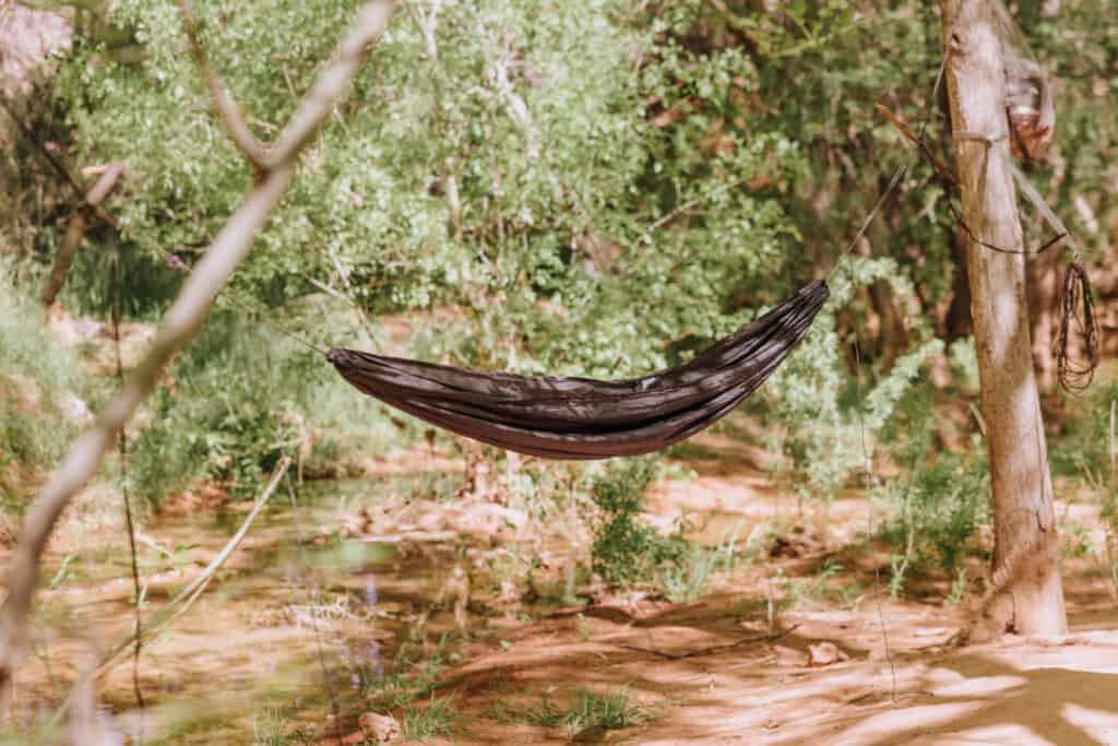
Camp Near Little Navajo Falls
The Havasupai Falls Campground runs along Havasu Creek, for more than a half-mile stretch between Havasu Falls and Mooney Falls.
Here’s the abbreviated advice to keep in mind as you arrive at the campground after an 11-mile trek:
- Pick a site with a picnic table
- Don’t setup the tent near the bathrooms
- The outhouses run out of toilet paper by midday
- Bring a water filtration bladder to fill up from Fern Spring or the creek itself
- Drones, campfires, and alcohol are prohibited
Best Time to Visit Little Navajo Falls
I’ll just speak for myself here. For me, it’s too cold from mid-October through mid-April in this area. Overnight lows dip well below freezing, and the creek water (while still in the 50s) is too cold to enjoy.
I’d aim for April 15 through June. Yes, it gets really hot in June, but you’ll still find shade along the hike AND be able to cool off in the creek at the campsite.
Keep in mind: the Havasupai area is impacted by summer monsoon storms. By July, you run the risk of monsoon rainfall affecting your visit. The monsoon season runs through September, so it’s something to keep in mind when planning your trip.

Wrap: What We Love about Little Navajo Falls
All of the Havasupai Falls waterfalls are unique and interesting!
Little Navajo Falls is a great place to relax for a while, and you might only see a couple of other people here. It’s definitely a quieter scene than you’ll find at the busier (and more majestic) Havasu Falls and Mooney Falls.
It’s also one of the most accessible waterfalls at Havasupai. You won’t have to scale a rock wall, which is the case at Mooney and Beaver Falls.
Photography here is also a fun challenge. Clouds help even out the lighting, because the sun can create harsh shadows. Also, setting a longer exposure will help capture those picturesque “smooth” lines in the cascading water. Even with an iPhone, you can set it on “live” photo, then choose “long exposure” when your photo comes up in the gallery.
Little Navajo is definitely a spot to check out on a visit to Havasupai … if… you can snag a permit!