Hike to the Confluence: Havasu Creek Meets the Colorado River

HIKING AT HAVASUPAI: THE CONFLUENCE IN THE GRAND CANYON
Havasu Creek, famous for its blue water, is the second largest tributary to the Colorado River. It flows through a canyon into the Colorado at a spot known as “the confluence.”
It’s a popular discussion topic among groups visiting Havasupai Falls, as they sort out whether it’s worth spending a full day making the trek or if they should stick closer to the campground.
This post should contain everything you need to know about the hike to the confluence in order to make the right decision for your visit to Havasupai!
The Confluence Hike at Havasupai Falls
Hiking from the Havasupai Campground to the confluence is a full-day, 18-mile adventure. The advice from the Havasupai Tribe is to leave the Beaver Falls area no later than 10:30am.
We meant to leave much earlier, but got a late start, because breakfast and everything takes longer when you’re camping! Our trip to the confluence from Beaver Falls began right at 10:30am, and we were back right around 5:30pm.
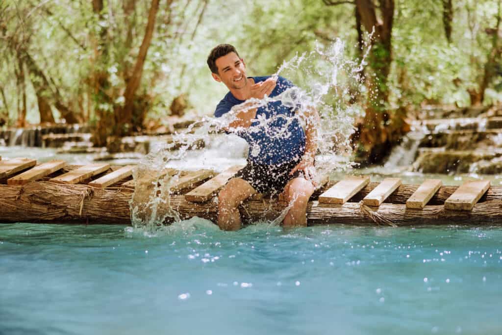
You’ll cross Havasu Creek at least seven times on your way from the Havasupai Campground to the confluence with the Colorado River.
The trail itself is worth the journey, in my opinion.
The only negative for me was drying my feet off and changing from water shoes to hiking boots at each creek crossing.
The Confluence Hike Distance
The hike to the confluence is roughtly a 17-18-mile round trip from the Havasupai Falls Campground.
From the end of the campground at Mooney Falls, it’s a three mile hike to Beaver Falls, and then another five-plus miles to the confluence with the Colorado.
Each mileage estimate I’ve seen is a bit different because the trail meanders and isn’t clearly defined in spots. Plus you’re likely to get off-track at least once, which will add to your overall distance.
If you’re into counting steps, the hike to the confluence was just over 31,000 for me!
Where is the Confluence?
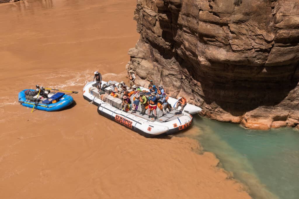
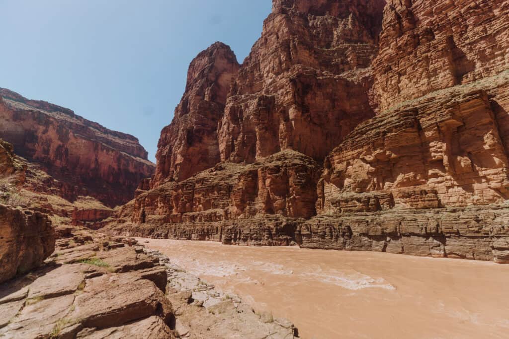
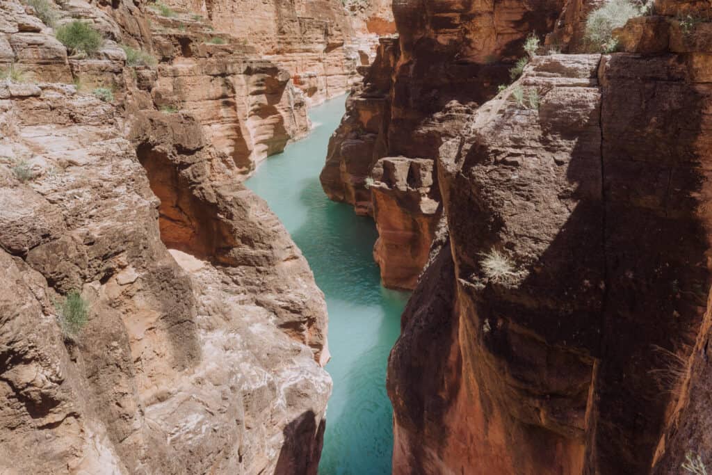
Havasu Creek flows into the Colorado River at “river mile 157.” It’s a well-known spot for river rafters and guides, who let their guests off at the rocks to hike around and check out the blue water in Havasu Creek.
The confluence is in a remote spot, which is within the boundaries of the Grand Canyon National Park. It’s inaccessible by car. You have to hike or raft in.
For Colorado River rafters, it was day seven or eight on their float down the Colorado River, after putting in at Lee’s Ferry (south of Page, Arizona).
Map of the Confluence
The satellite view gives you a sense of how rural this area is. The Grand Canyon is to the east of the red marker at the confluence. The hike to the village of Supai (on the map) from the Colorado River is about 11 miles.
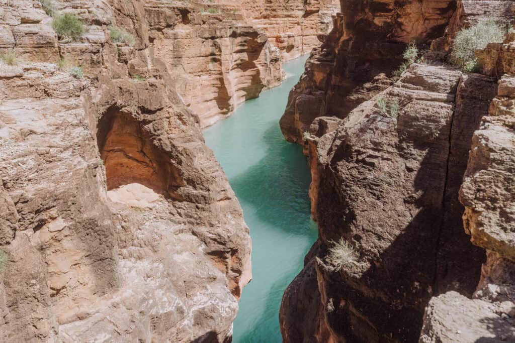
Havasu Creek
“Havasupai” means “people of the green-blue water.” For centuries the Havasupai Tribe has used the water from Havasu Creek on their crops.
The creek is fed by snow melt from the Kaibab Plateau, which seeps into the ground and emerges from the porous limestone, rich in mineral content.
While signs at the Havasupai Falls Campground say Havasu Creek gets its blue coloring from a heavy concentration of lime, geologists say it’s actually the sunlight reflecting the dissolved calcium, magnesium, and calcium carbonate in the water.
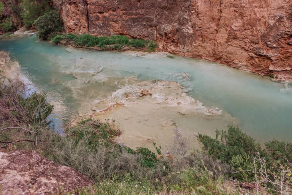
A few times a year, the clear blue water will turn muddy brown. It can happen after a storm any time of year, since Mother Nature is impossible to predict. There’s usually a brown spell in the spring, due to snow melt up in the mountains. Plus monsoon storms are usually strong enough at some point in the late summer to turn the clear, blue water cloudy and brown.
It can take a day or 10 days to clear back up.
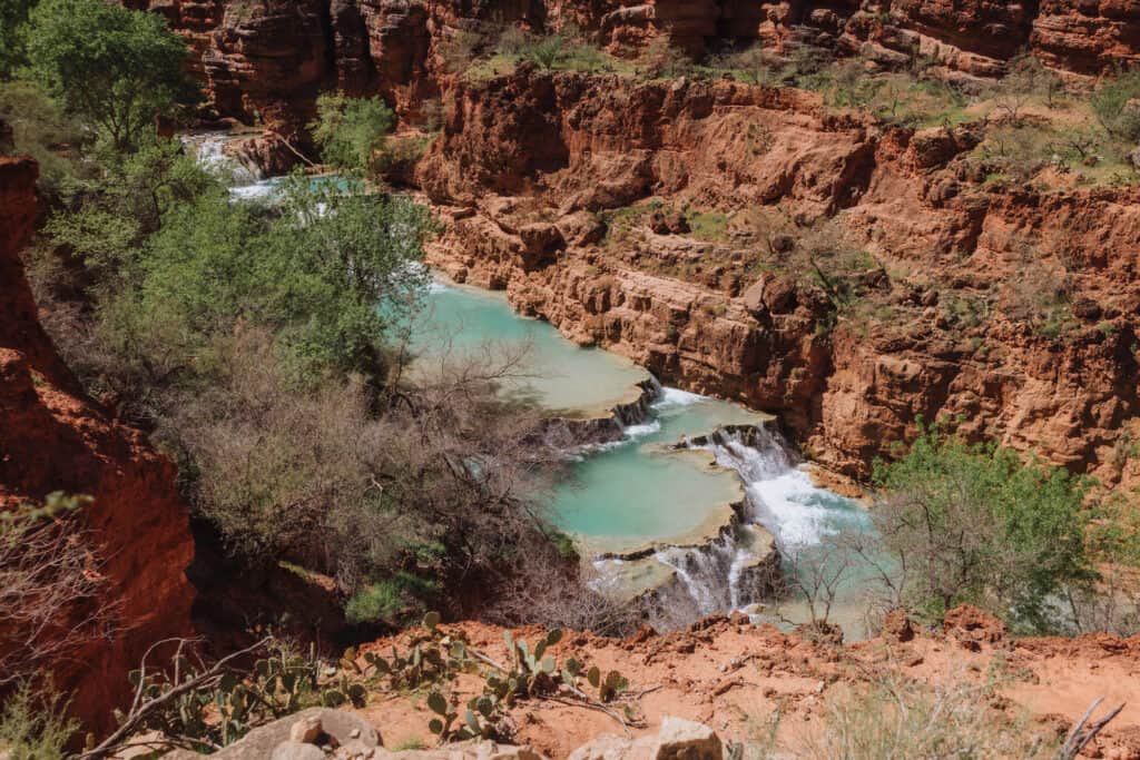
The path of the creek, the waterfalls, and the travertine terraces are constantly changing, as floods hit the canyon.
Water Temperature of Havasu Creek
The US Geological Survey measures the water temperature of Havasu Creek at the confluence, just before it flows into the Colorado River.
The data shows water temperature fluctuating through the year, from as low as 50 degrees Fahrenheit in January to 75 degrees in July.
Water temperature of Havasu Creek also fluctuates by about five degrees through the day near the confluence. It’s coldest around 8:00am, and warmest around 1:00pm, according to the USGS monitors.
Generally, Havasu Creek’s water temperature is in this range:
- January & February: mid-50’s
- March: upper-50’s
- April & May: low-to-mid-60’s
- June: upper-60’s
- July & August: mid-70’s
- September: around 70
- October: mid-60’s
- November: upper-50’s
- December: mid-50’s
Air temperatures dip below freezing around Havasupai Falls, so it’s not uncommon in the winter for steam to rise from Havasu Creek.
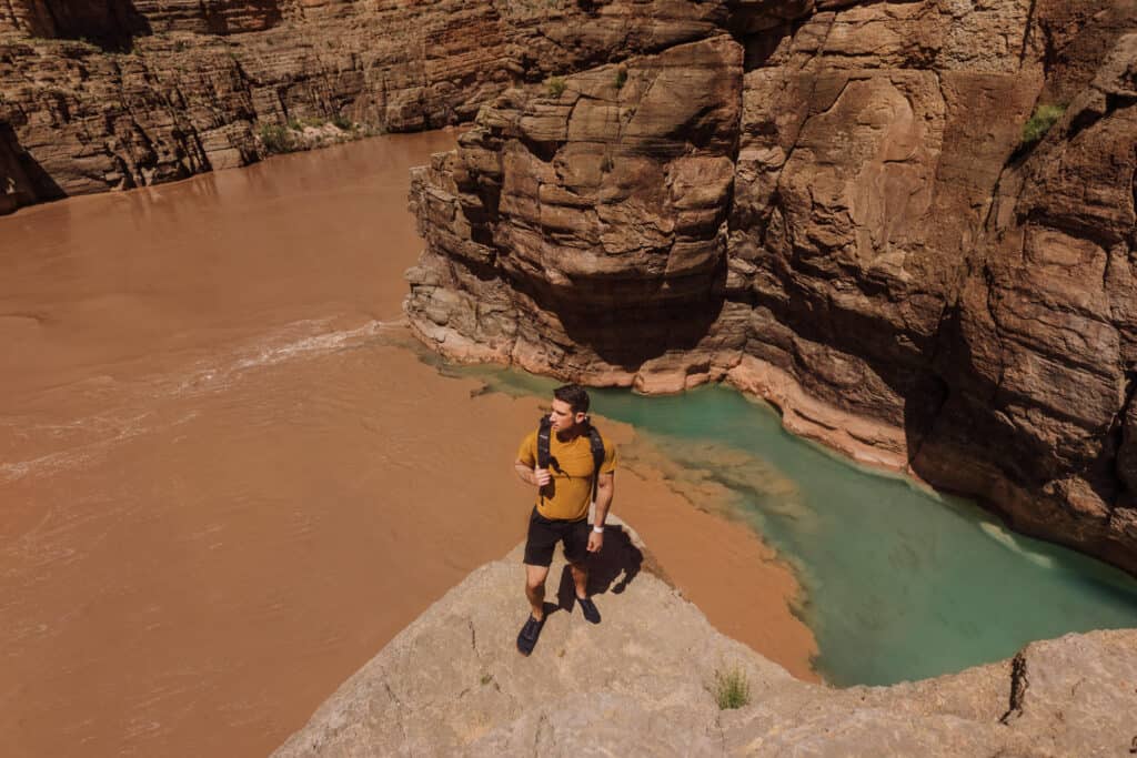
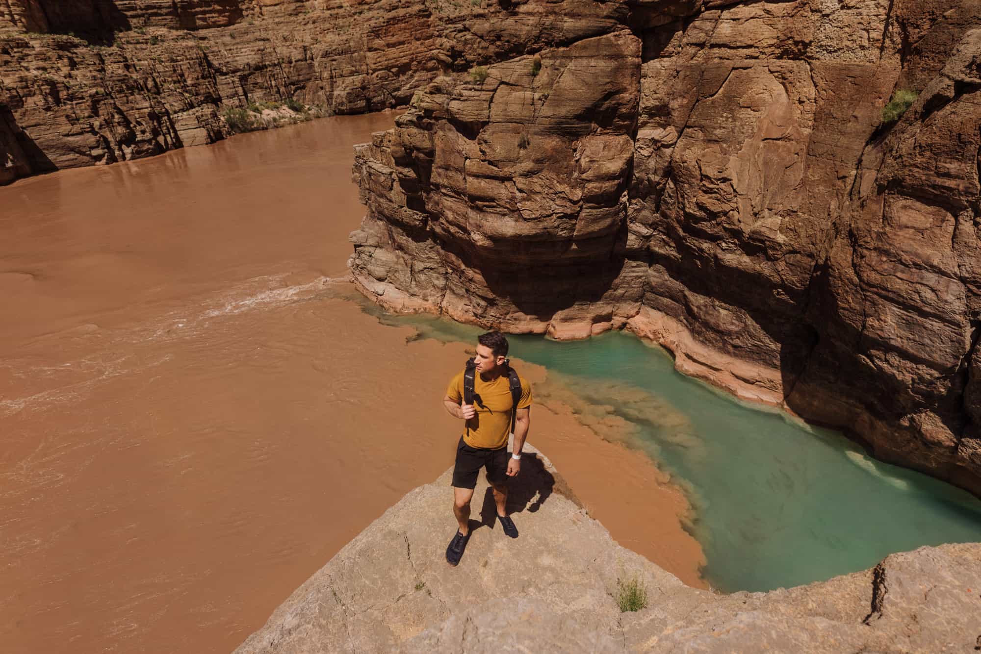
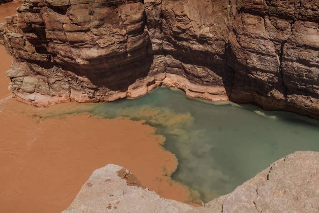
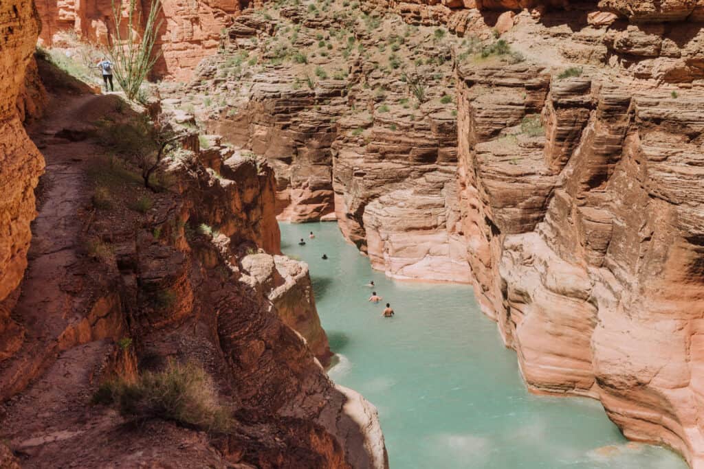
What You’ll Find at the Confluence
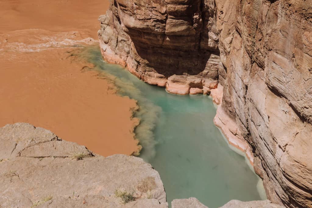
The view at the confluence is truly unique.
You’ll cross Havasu Creek one final time (to the left / west) and climb up the rocky cliff to take it all in.
The brown water from the Colorado River swirls through the turquoise water in Havasu Creek, as it flows in.
You’ll often see big river rafts tied up at the rocks, some of them carrying more than 20 people on Colorado River adventures lasting 10 days.
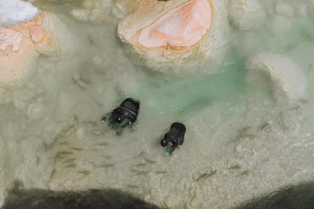
The Fish at the Confluence
You’ll also be able to spot big fish in the clear water. When we were there, researchers with the National Parks Service were studying the springtime spawning of the flannel-mouthed suckers.
They swim in from the Colorado River, and actually swim against the current and jump up the smaller falls in Havasu Creek to spawn. They’re not endangered, but are labeled a “species of concern.”
The NPS researchers were in wetsuits, documenting the fish with underwater camera gear.
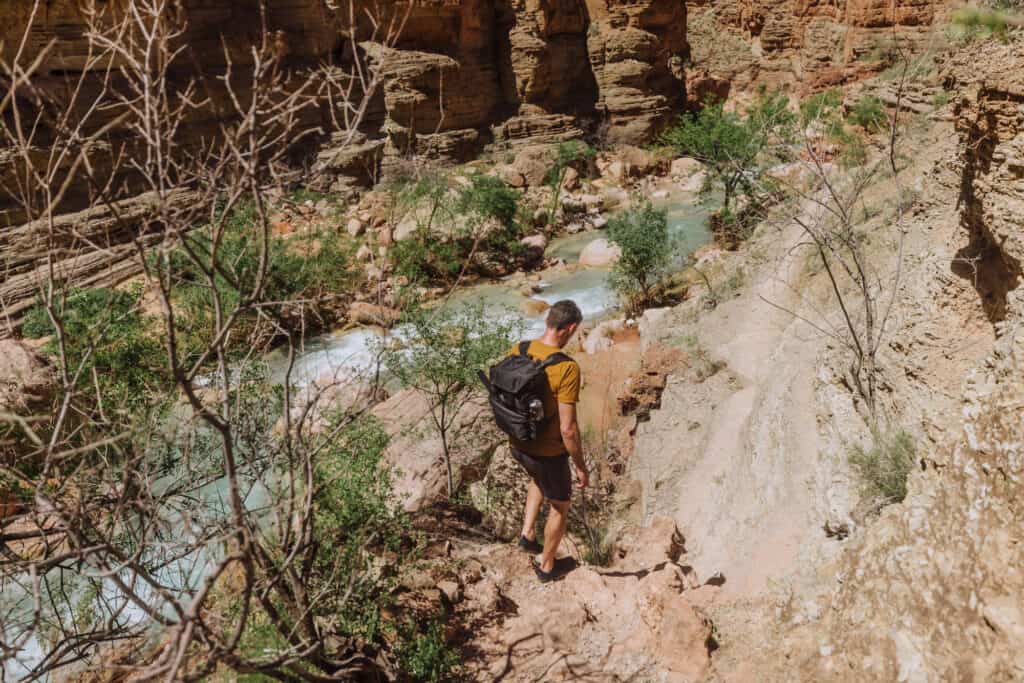
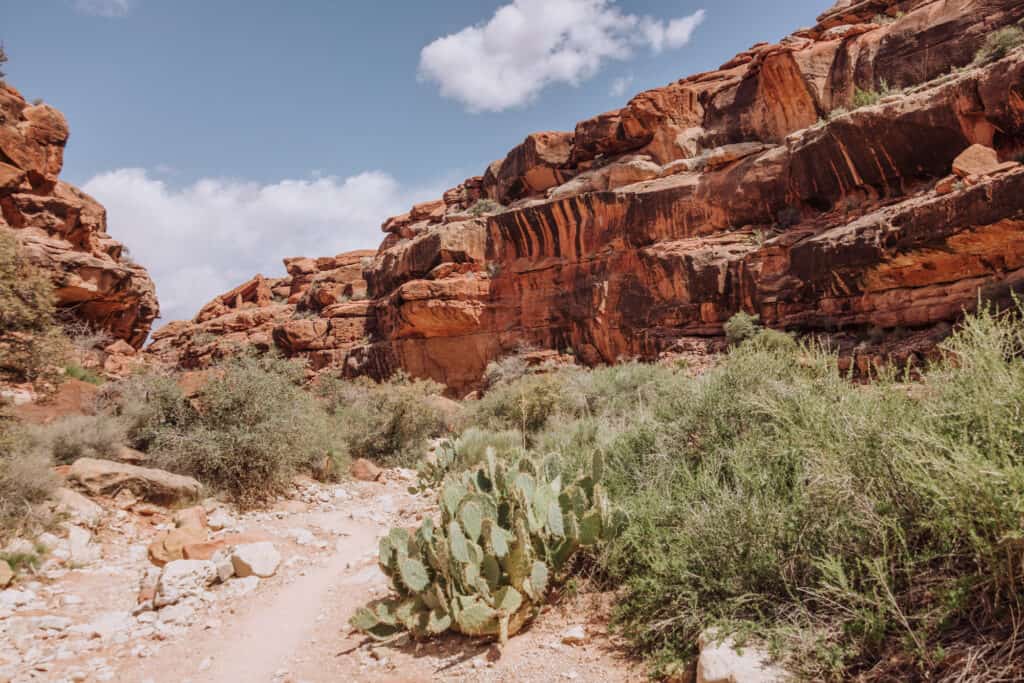
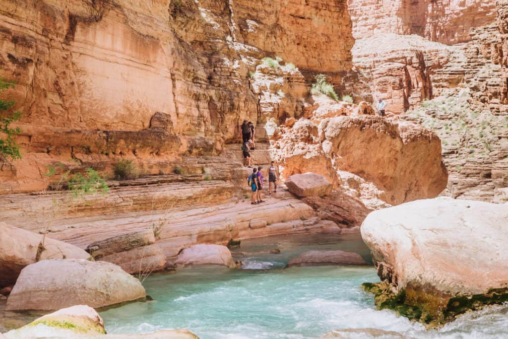
The Trail to the Confluence
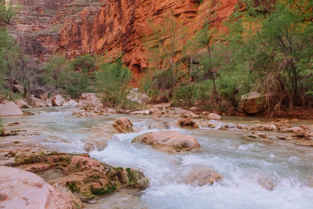
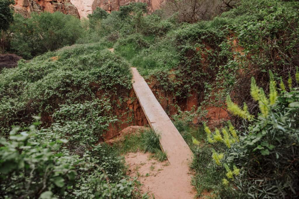
Hiking the trail to the confluence is fairly straight-forward, since you’re literally following Havasu Creek down the canyon to the Colorado River.
The creek is always in view, even if the trail itself can be a bit confusing at the water crossings.
Key Advice as you Start the Hike to the Confluence
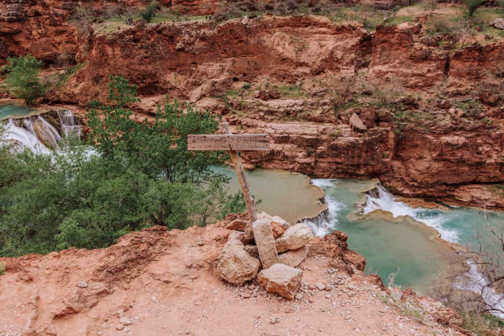
The trail from Mooney Falls to Beaver Falls is very well-marked and well-traveled, so you won’t have any problems on that section.
As you reach the overlook on the east (right side) of Beaver Falls, continue on the path up and over the rocks rather than descending toward the creek at this point.
You’ll see a sign that warns hikers not to depart for the confluence from there if it’s after 10:30am. We left right at 10:30, and several groups left after us, so it’s more guidance than a rule. Still, I wish we’d left earlier.
Havasu Creek Crossings
There are seven creek crossings on the hike to the confluence (at least in the trail’s current path).
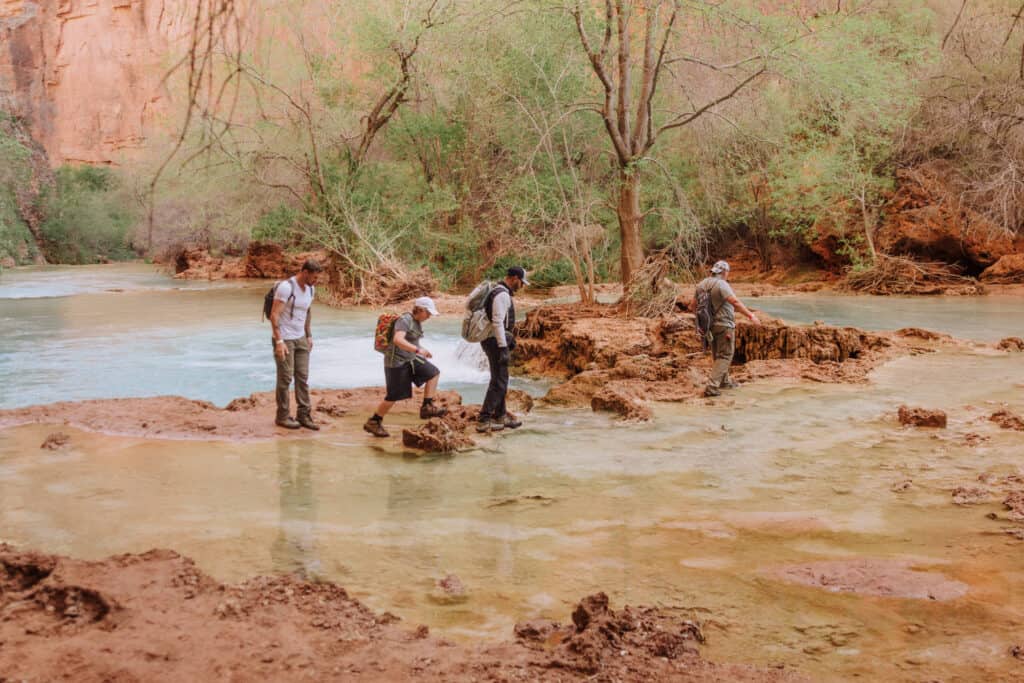
Thankfully, the rocks in the creek aren’t covered in moss, so you won’t slip at all. Still, it’s best to wear some sort of footwear as you cross, rather than just bare feet.
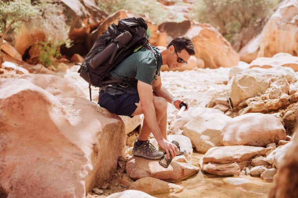
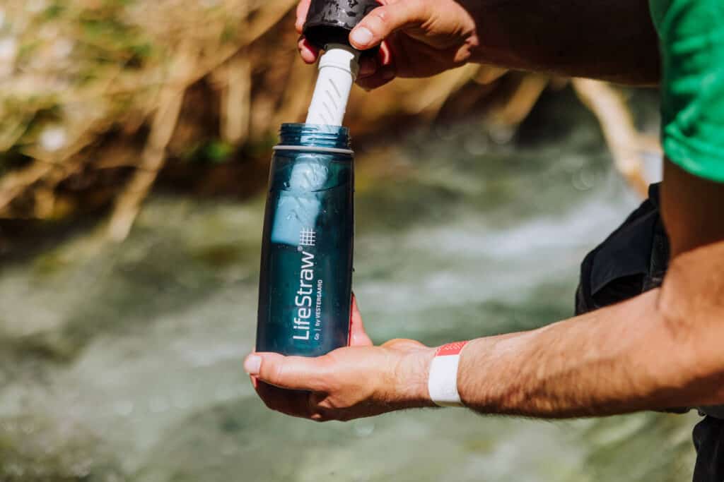
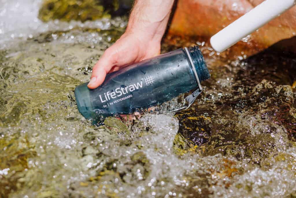
DEFINITELY bring a filtered drinking system, like a Life Straw bottle, so you can fill up at each crossing.
How to get to the confluence from the Havasupai Campground
It’s worth an upgrade to AllTrails Pro, which allows you to download the hiking route on your phone and access it even without cell coverage.
For much of the hike, while on airplane mode, you’ll still be able to track your position as a little blue dot to help you spot the creek crossings. It didn’t work for the entire trail, but it was a huge help that saved a lot of time!
Milestones and Trail Markers to Watch for
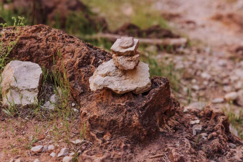
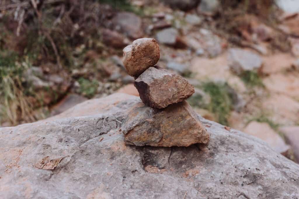
Cairns will be a big help along the hike! You’ll pass dozens of them. Most of the pyramid-shaped rock piles will signal a shift in the trail, and often a creek crossing.
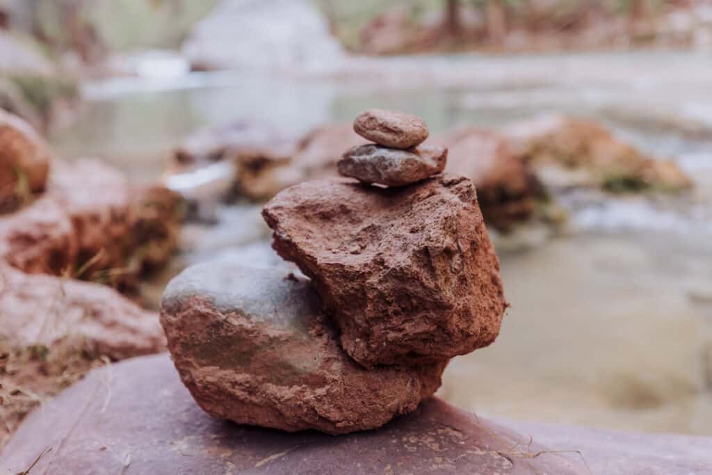
Basically, when you come across the rocks piled along the trail, glance across the water for another pile. If you see one, head in that direction.
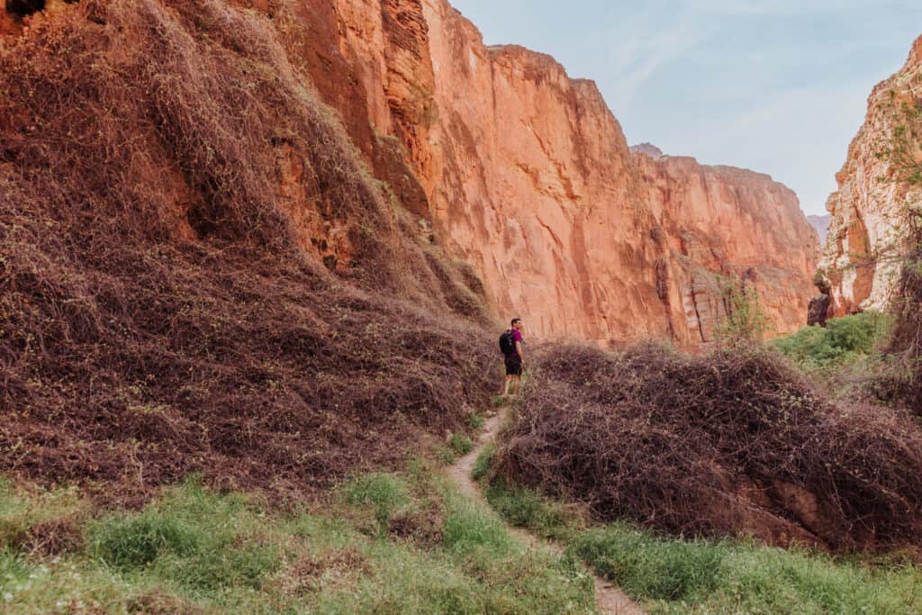
On the final third of the hike to the confluence, you’ll really notice the canyon walls start to rise. It’ll be a reminder that you’re in the Grand Canyon!
It’s such an interesting visual juxtaposition, because hiking along the blue creek, you get into a tropical mindset, only to be snapped back into the reality that you’re in the desert southwest!
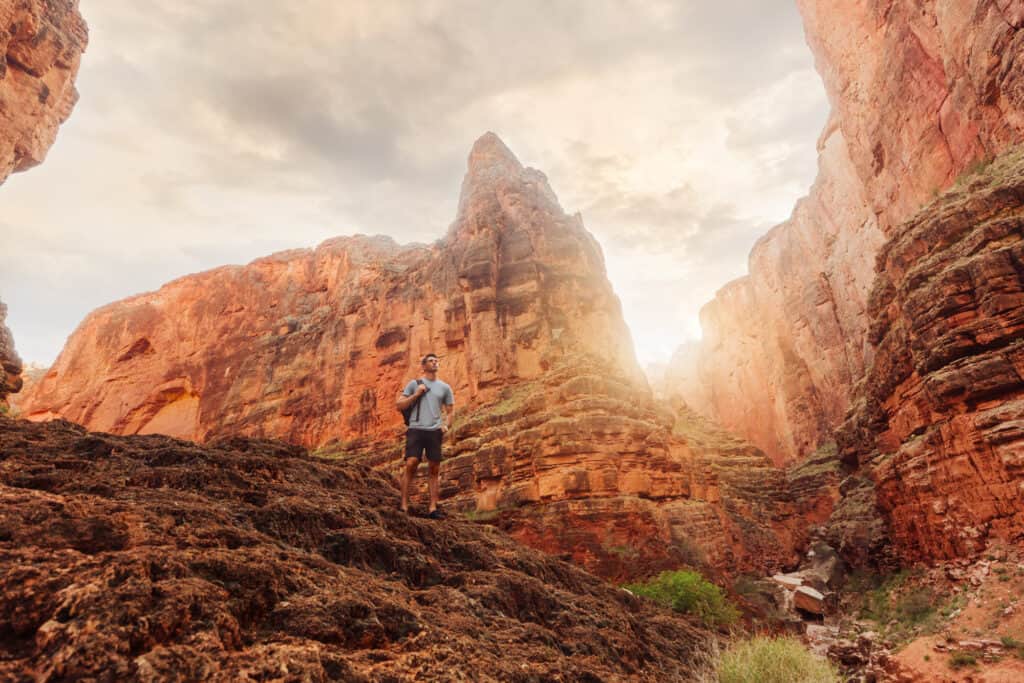
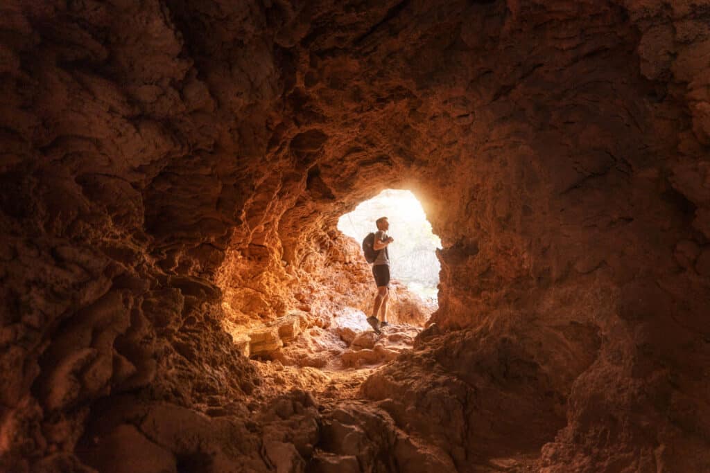
Another marker to watch for is a cave several miles in. Once you climb down through it, you’re almost at the confluence!
Havasupai Hiking Hazards
Again, the rocks in the creek really aren’t slippery, and it’s a constant source of water, so there aren’t many hazards aside from the ladders and rock climb down Mooney Falls.
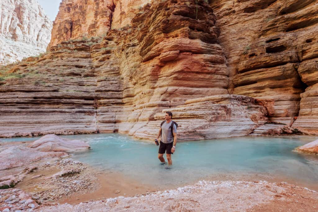
One danger you should know about is swimming in the beautiful water right near the end of your hike to the confluence.
Swimming near the Confluence
You’ll see people toss their hiking packs and shoes up on the rocks to jump in the water in the final canyon near the confluence. The water is over your head in spots, and waist-deep in others. It’s really difficult to see how deep your next step will be.
Plus, keep in mind: the current is pretty strong in the creek here! You’ll find yourself unable to keep a footing in spots. It’s concerning as you get closer to the Colorado River.
You likely won’t be able to swim against the current in the creek at the confluence to get back to your original entry location. You’ll have to climb the rocks at the end, before the water goes into the Colorado.
Rafting guides tied their big rafts up to the rocks at the confluence, which we used to climb out.
Two men who were part of the rafting trip thought the water looked good, and jumped in … only to realize how strong the current was! They were both unable to climb back up onto the rafts and needed assistance to fight the current and lift themselves out of the water.
The Colorado River, especially in the spring, will swiftly carry you downstream.
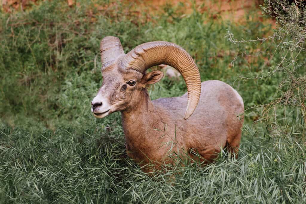
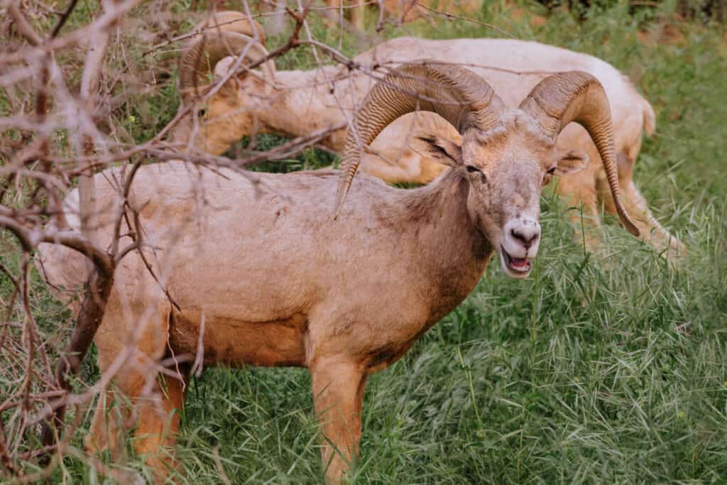
Desert Long-Horned Sheep
This isn’t really a hazard, but I’ll put it in this category. In fact, our run-in with a herd of desert long-horned sheep was a favorite part of the hike to the confluence for me.
It’s likely to happen on your hike back toward the campground. They climb down from the rocky ledges as the sun starts to dip below the canyon walls.
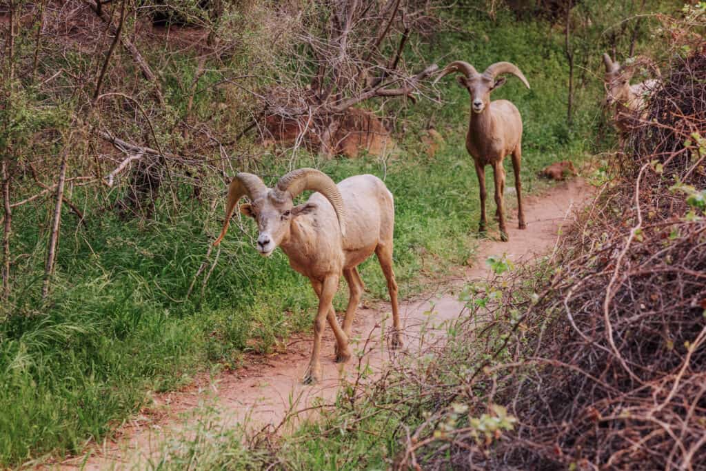
One day, we saw just one snacking on a bush way up on a cliff.
Another day, coming back from Beaver Falls we saw a herd right on the trail. You simply let them pass, and walk off into the bushes for dinner. The sheep seem relatively used to people, though the male (or males) was (were) clearly watching us and ready to protect the others if we got too close.
Waterfalls You’ll Pass Along Havasu Creek
On the hike to the confluence, you’ll pass the iconic waterfalls Havasu Creek is known for.
Mooney Falls
Mooney Falls is the tallest of the Havasupai Falls in the canyon, and requires the most dangerous climb of the trek to the confluence.
Mooney is named after a miner, DW “James” Mooney, who died climbing the rock wall in 1882. Some versions of the story say he was trying to scale the wall while carrying a friend who’d been hurt down below.
The water from Havasu Creek falls about 200 feet off the cliff at Mooney Falls, which you can find at the far end of the Havasupai Campground.
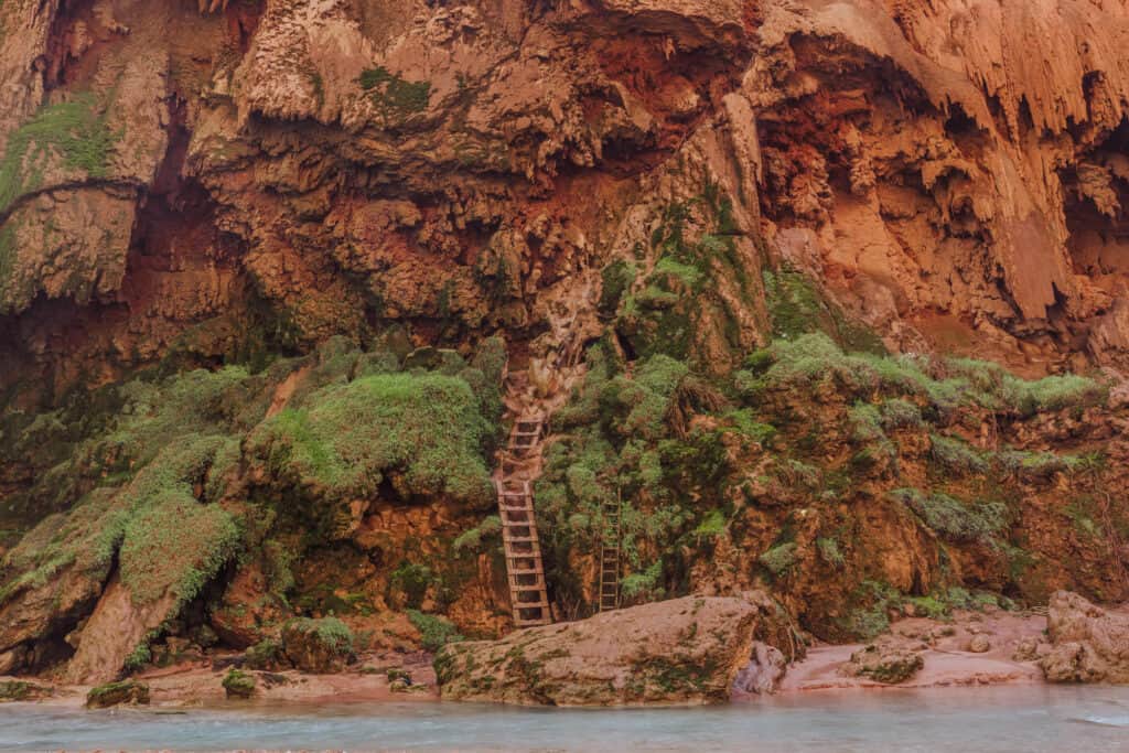
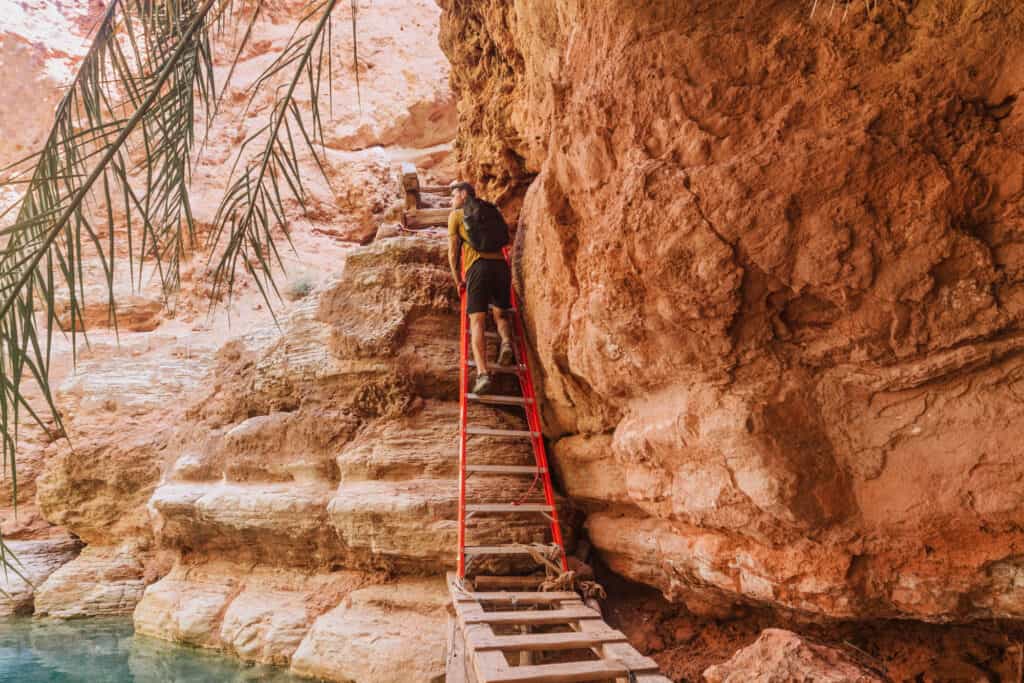
Today, you’ll have to climb through two tunnels, and then down a vertical cliff. You’ll rely on a system of chains and anchors, steps dug into the rock, and wooden ladders to get you to the base of Mooney Falls.
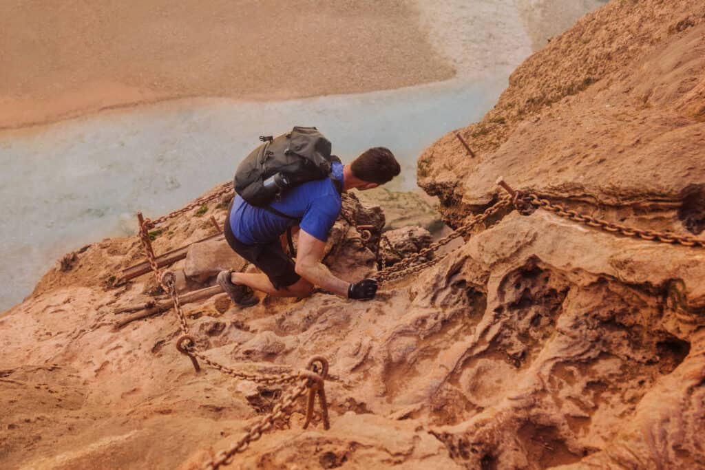
While you’ll be hit with mist and wind from the falls during your descent (and later your ascent) the rocks and wooden ladder rungs really aren’t slippery. There’s no moss growing on them to create an added challenge.
Once at the bottom of the cliff, you’ll be rewarded with majestic views of the falls, a beautiful pool to swim in, and the start of the trail to Beaver Falls and the confluence.
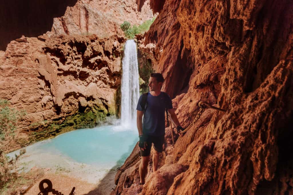
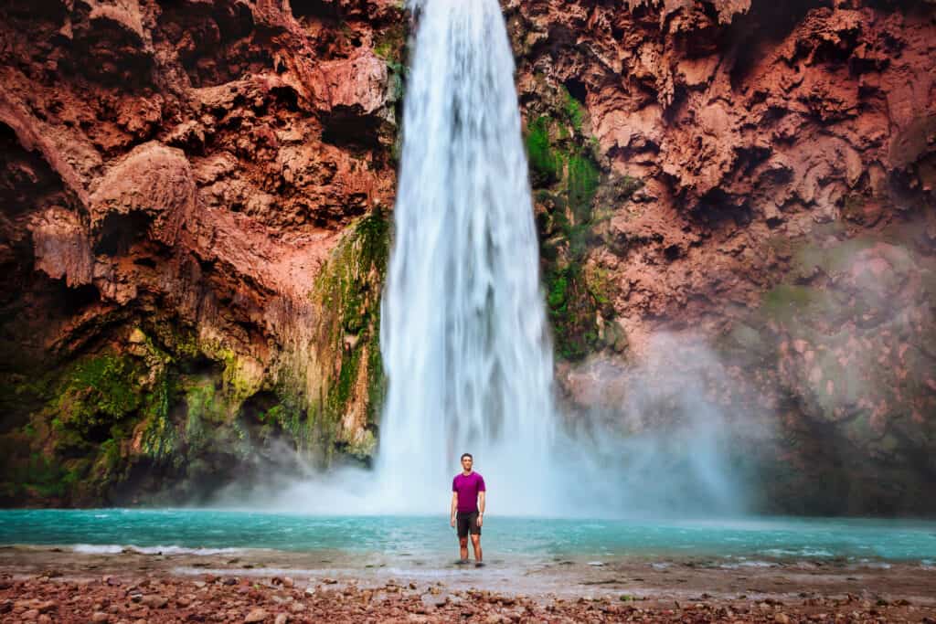
Beaver Falls
While Mooney Falls is far more dramatic and famous, Beaver Falls is also worth a visit on your trip to the confluence.
The hike from Mooney to Beaver Falls is about three-miles. You’ll make it to your first creek crossing about one-third of a mile into the hike past Mooney.
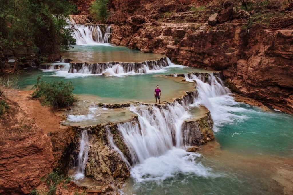
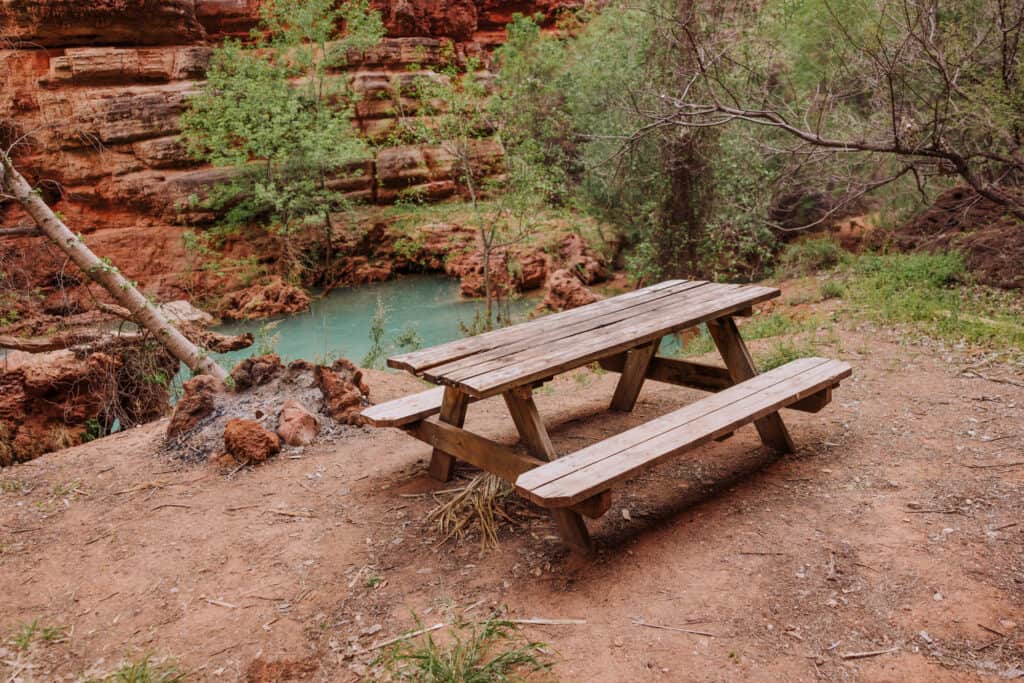
At several spots along Havasu Creek, you’ll notice flat waterfalls and wonder if you’ve reached Beaver Falls.
You’ll pass picnic tables along the way, plus mounds of grapevines and fields of wildflowers in the spring.
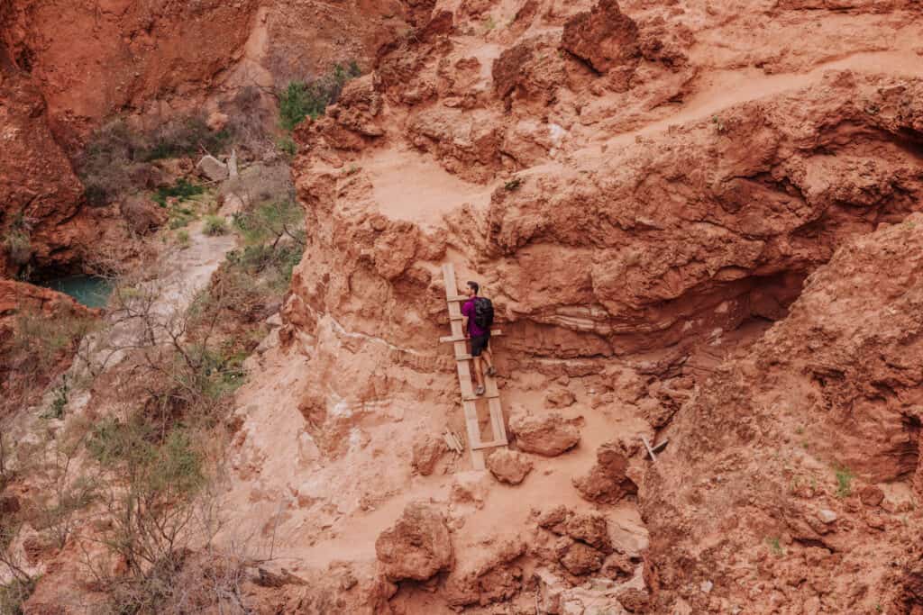
Beaver Falls requires another climb down a pretty steep mountainside, but after the Mooney Falls ladders the Beaver Falls ladders will seem easy!
You’ll first spot Beaver Falls from above. It’s known for its shallower cascades, created by lime and travertine. It’s a great spot to spend time swimming in the pools.
Confluence Hike Difficulty
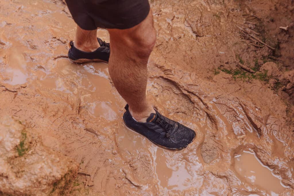
The hike to the confluence isn’t overly strenuous, and you don’t have to climb much in elevation. It goes from rocky to sandy in spots.
You’ll pass through fields of bushes, and climb along rocky ledges. Still, it’s manageable for most hikers. Actually, it’s manageable for everyone who was able to get down the ladders at Mooney Falls! After that, the rest of the hike to the confluence is a breeze!
Another smaller ladder is setup for a vertical incline before you get to Beaver Falls. Floods are notorious for wiping the ladders here out every so often, but the Havasupai Tribe and FEMA are usually quick to replace them.
After a flash flood in the spring of 2023, some hikers were surprised and a little put-off by the modern aluminum FEMA ladder that took the place of an old wooden one. For me, I was just thankful for the boost it gave us up the rocks!
The Best Time to Hike Havasupai
The best time to hike Havasupai Falls to the confluence is up for debate. I think it’s too cold during the winter months, since you have to cross Havasu Creek so many times. For me, that rules out October through March.
By mid-April, the weather is warmer and much more enjoyable.
I’d aim for mid-April through mid-June. While June can be very hot at Havasupai Falls, you’ll be covered in shade during much of the hike to the confluence.
By the end of June, you run the risk of monsoon rainfall impacting your visit. Monsoon season runs through September. Chances are, you won’t run into any issues at all with storms, but it’s something to keep in mind.
Gear to Bring on a Hike to the Confluence
There’s no consensus when it comes to footwear for a confluence hike at Havasupai.
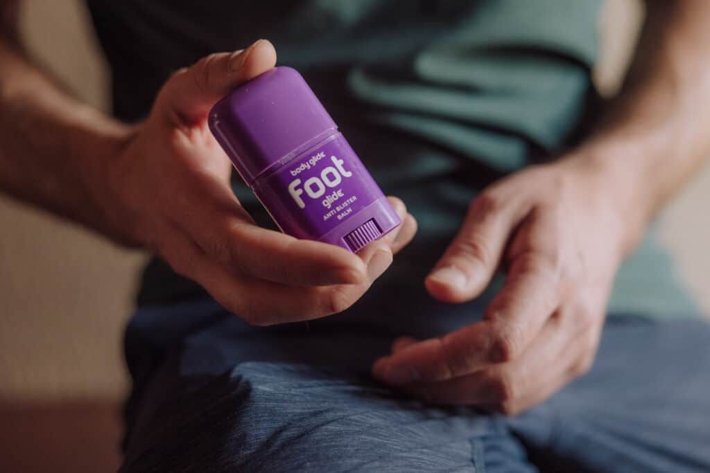
I got a pair of water shoes with grips on the bottom, which I didn’t really care for. Changing shoes became tedious and annoying at each crossing, but I did it to avoid blisters.
Slathering your feet with Foot Glide (which looks like a mini deodorant stick) helped prevent blisters, so I’d definitely recommend that product.
A lot of people wore hiking sandals, which they left on wet and dry. They don’t look comfortable to me, and I saw a few broken pairs tossed out on the side of the trail. Still, others swore by them, so really: go with what works for you!
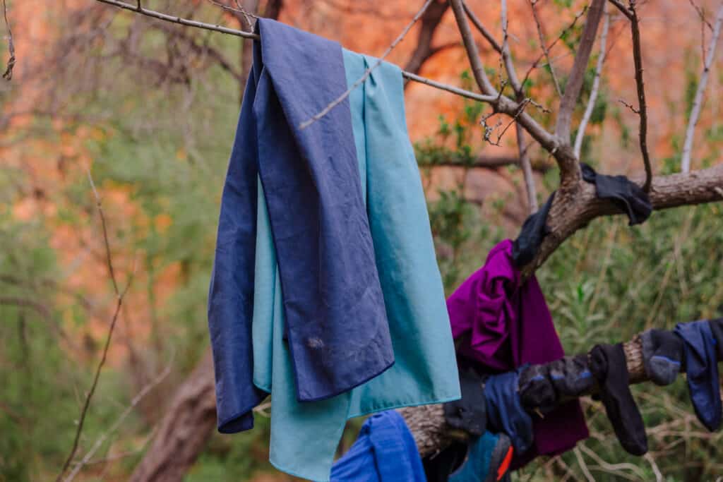
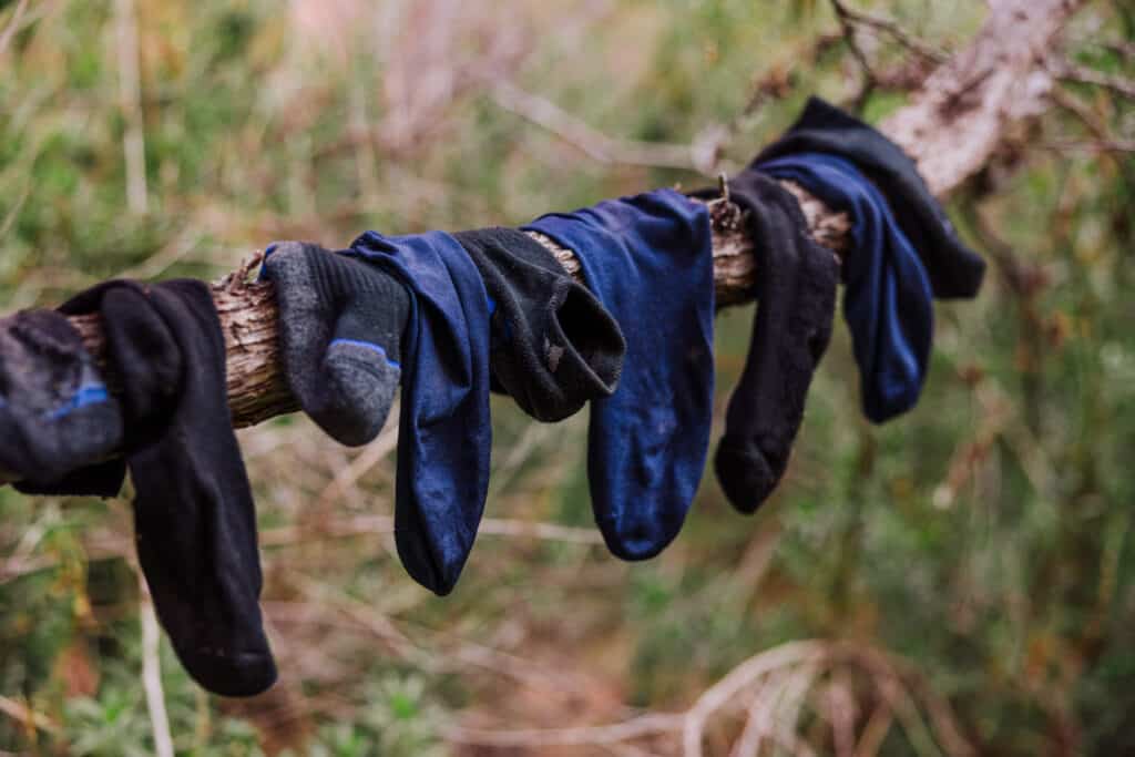
Bring a quick-dry towel if you plan to change shoes at each crossing, plus an extra pair of socks and a separate bag for your wet shoes in your backpack. Many of the campsites (including ours) had a tree full of socks and towels drying out for the next day’s hike!
Food and Water for the Hike
Again, I’d suggest a Life Straw or similar filtering water bottle. That way, it’ll be a light load which you can refill in the creek as you go.
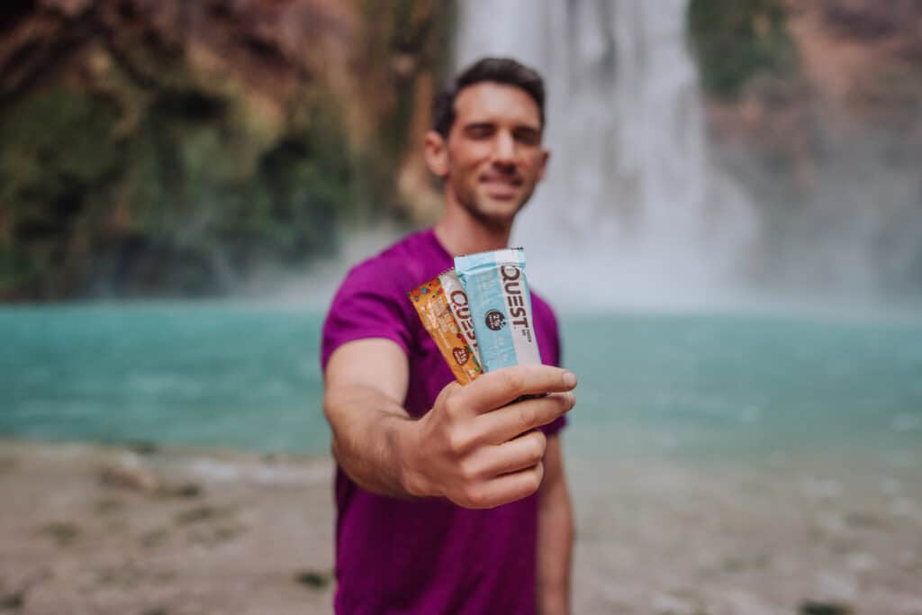
Bring more food than you think you’ll need. Nuts, protein bars, etc, will all be appreciated! We found ourselves with cravings on the way back, after we’d already consumed everything we’d packed on the way in!
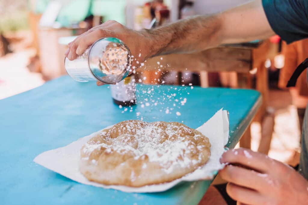
If you’re back before 6:30, you can climb up above Havasu Falls for fry bread and tacos!

The Basics: Havasupai Falls Advice
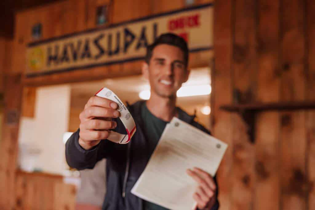
You still need a permit to visit Havasupai Falls.
The permit system has changed, from a telephone call-in reservation system to an online system.
In 2023, after Havasupai reopened after the pandemic, they accidentally double-booked reservations and canceled hundreds (maybe thousands) at random.
You’ll have to plan far in advance. Reservations for the whole season typically open February 1st, and sell-out quickly. If you don’t make the cut, you can buy canceled reservations over time, which are posted online each morning at 8:00am.
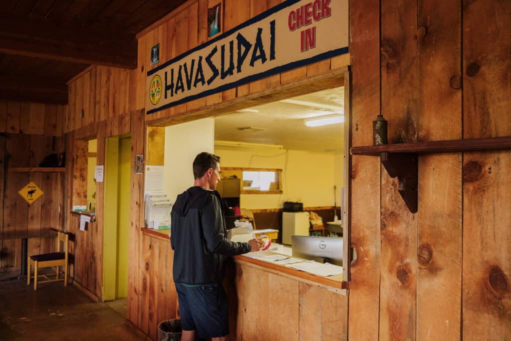
You have to check-in the day before your hike (by 5:00pm) or the morning of your hike (after 8:00am) at the Grand Canyon Caverns Inn. It’s an hour drive from there to the parking lot.
From the hilltop parking lot, the Havasupai Campground is an 11-mile hike down into the canyon and through the desert. It’s beautiful, but a challenge while carrying 30-40 pounds of camping gear on your back!
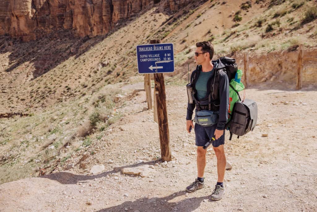
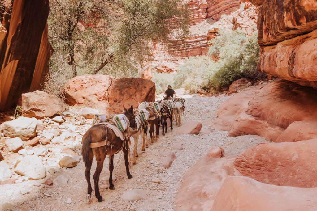
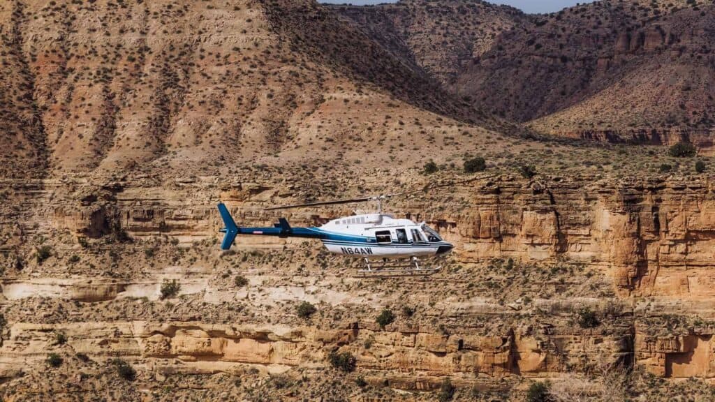
You can hire a mule to carry your equipment for you, or choose to fly a helicopter into the village of Supai. The tribal village is a two-mile hike down into the campground and the waterfalls.
FAQs about the Confluence Hike
Let’s tackle a few final “frequently asked questions” about hiking to the confluence on a trip to Havasupai Falls.
Can you ride horses or mules to the confluence?
No, the mules are really only for transporting backpacks and supplies for the tribe. You won’t see anyone riding them, aside from the one person in charge of each mule train.
While you can ride mules in other parts of the Grand Canyon, you cannot ride one at Havasupai. You’ll definitely have to hike to the confluence.
Are there Guides?
While the Havasupai Tribe offers guides at times, it can be difficult to arrange.
For a hike to the confluence, your best guide will be a downloaded map of the trail from AllTrails Pro.
You can inquire about the possibility of hiring a guide at the tourist office in the village of Supai.
Can You Paddleboard in Havasu Creek?
You may have seen an “Insta-famous” photo of people paddle boarding down the final canyon of Havasu Creek toward the Colorado River.
This photo, while real, was done just for the photo-opp. There’s no point in floating that small stretch of the creek. Plus, you risk getting swept into the Colorado, which is raging compared to the current of Havasu Creek.
Maybe most importantly, inflatables and paddle boards are not allowed at Havasupai Falls. They’re restricted these days because too many people were bringing them in and blowing them up for photos along the creek and in the pools … and then just leaving the plastic trash behind.
Can you hike in from the confluence on a rafting trip?
Yes, if you’re on a rafting trip down the Colorado River, you can hike up Havasu Creek for several miles.
Eventually, you’ll come to a sign, telling you that you’ve reached the boundary of the Grand Canyon National Park. It’ll tell you not to cross farther onto the Havasupai Reservation.
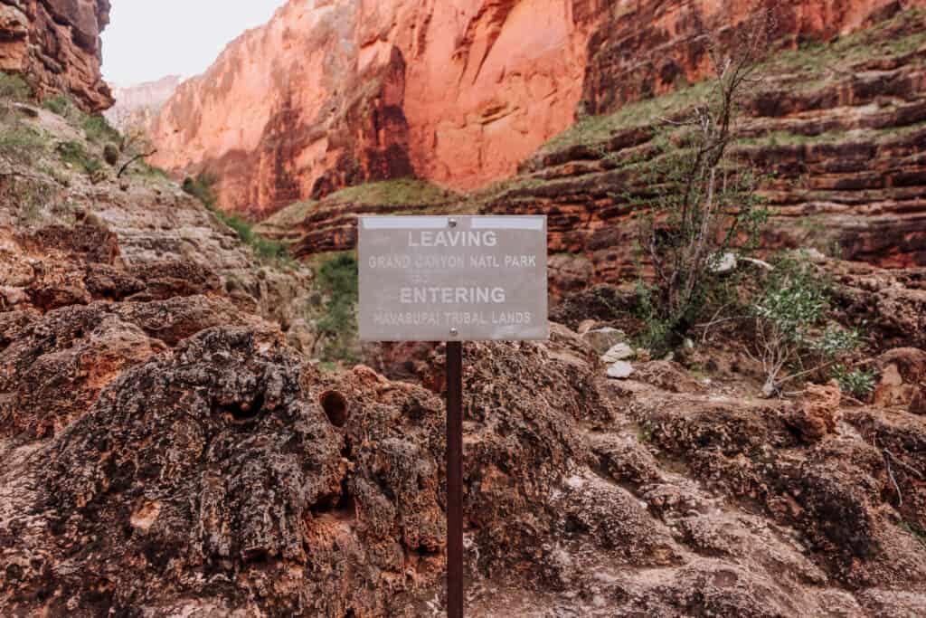
Still, you can make it a few miles up the blue creek if you’d like.
Wrap: Is the Confluence Hike Worth it at Havasupai?
The confluence may seem somewhat anti-climactic after hiking along the stunningly blue Havasu Creek all day, passing jaw-dropping sites like Mooney Falls and Beaver Falls, and maneuvering through the canyon itself.
Still, for me the hike to the confluence is definitely worth it at least on your first visit to Havasupai Falls. The trail is beautiful, and you’ll definitely return with a great feeling of accomplishment!
Would I hike to the confluence again? Probably not. Since the Havasupai permits are only good for three nights, next time I’ll spend a full day just hanging out and relaxing at Beaver Falls rather than continuing on all the way to the Colorado River.