Picacho Peak Hike: The Trail, Cables, Views, and Warnings

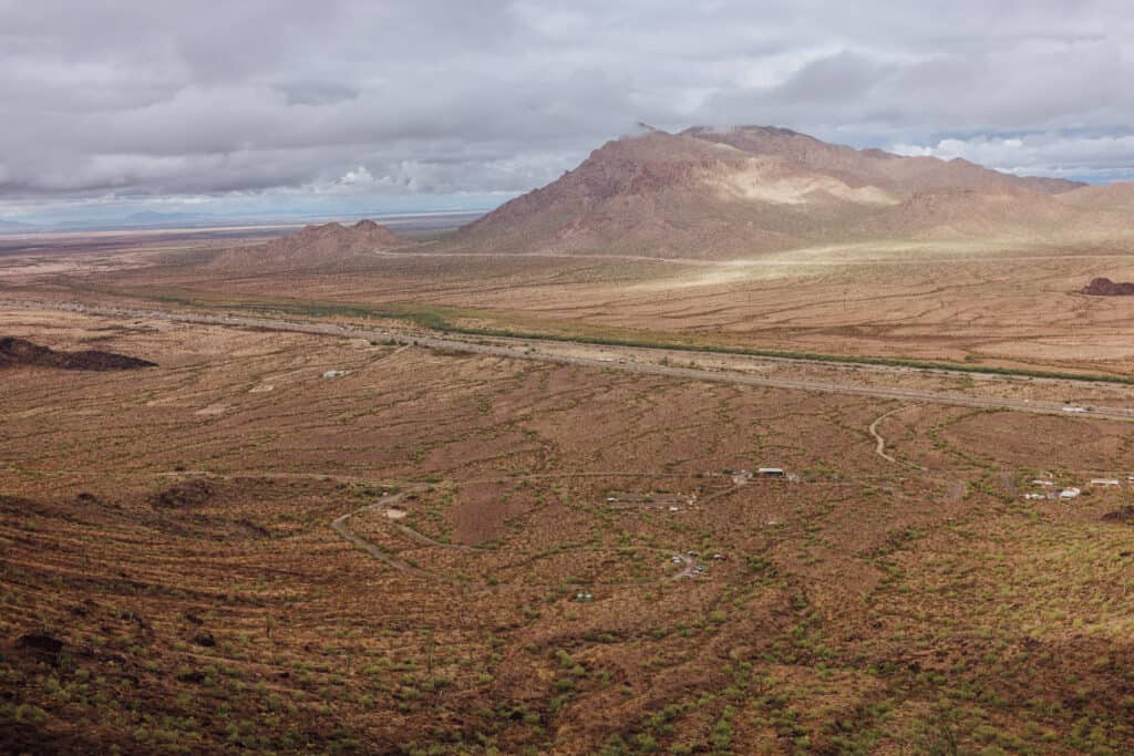
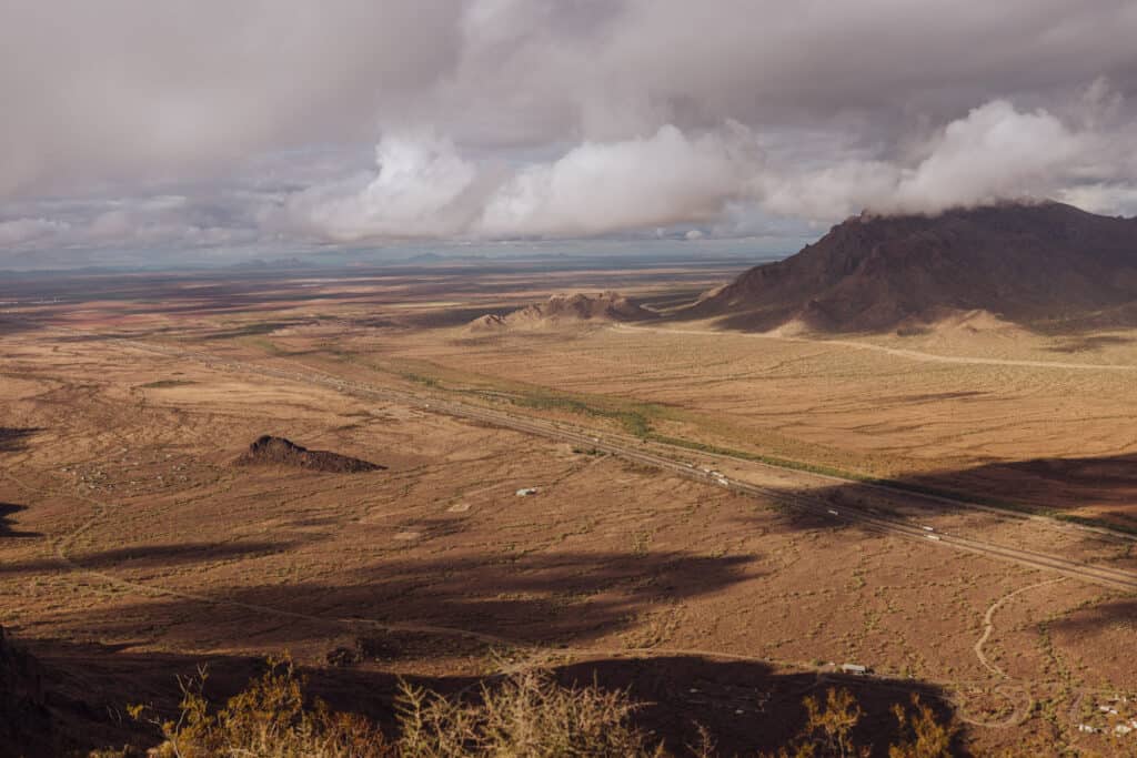
Driving along the I-10 between Tuscon and Phoenix, Arizona, you can’t miss Picacho Peak!
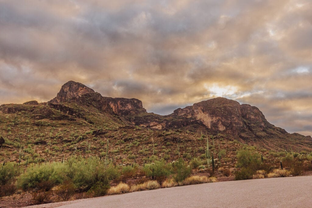
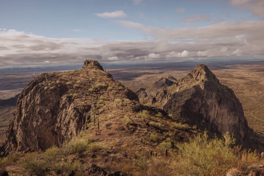
Picacho Peak is a prominent landmark with a rugged, cone-shaped appearance that rises dramatically from the desert landscape.
While it’s played an important role in history, these days it’s home to an Arizona State Park. You’ll find trails for hikers of all skill levels, including two trails that reach the summit.
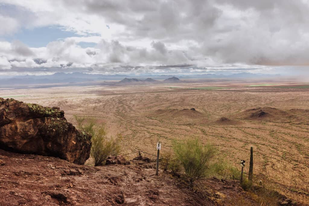
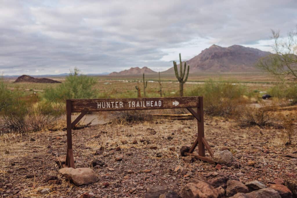
The most famous trail, the Hunter Trail, leads hikers up steep and challenging rocky terrain to the peak. The hike, which ranks as “difficult,” involves cables and sections where you need to use handrails. The reward at the top is a 360-degree view of the surrounding Sonoran Desert.
Key Information About Hiking Picacho Peak
- The Hunter Trail goes to the summit.
- You’ll rely on cables to pull you up the steep rocks.
- It’s about 3 miles (round trip).
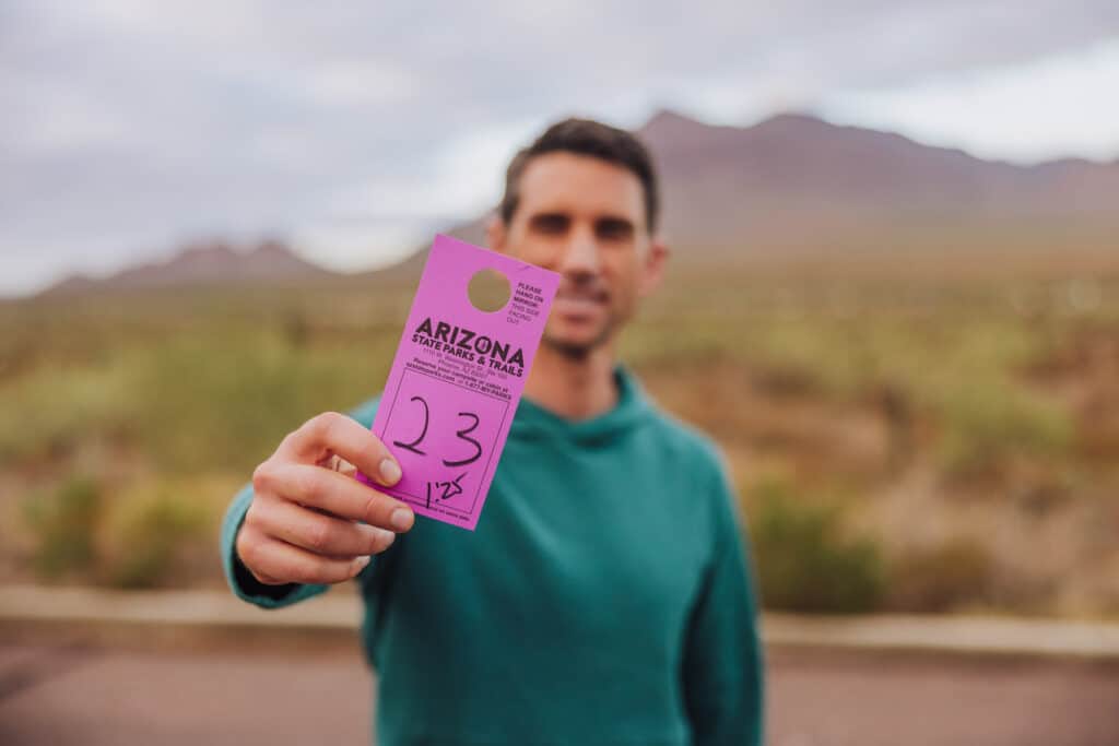
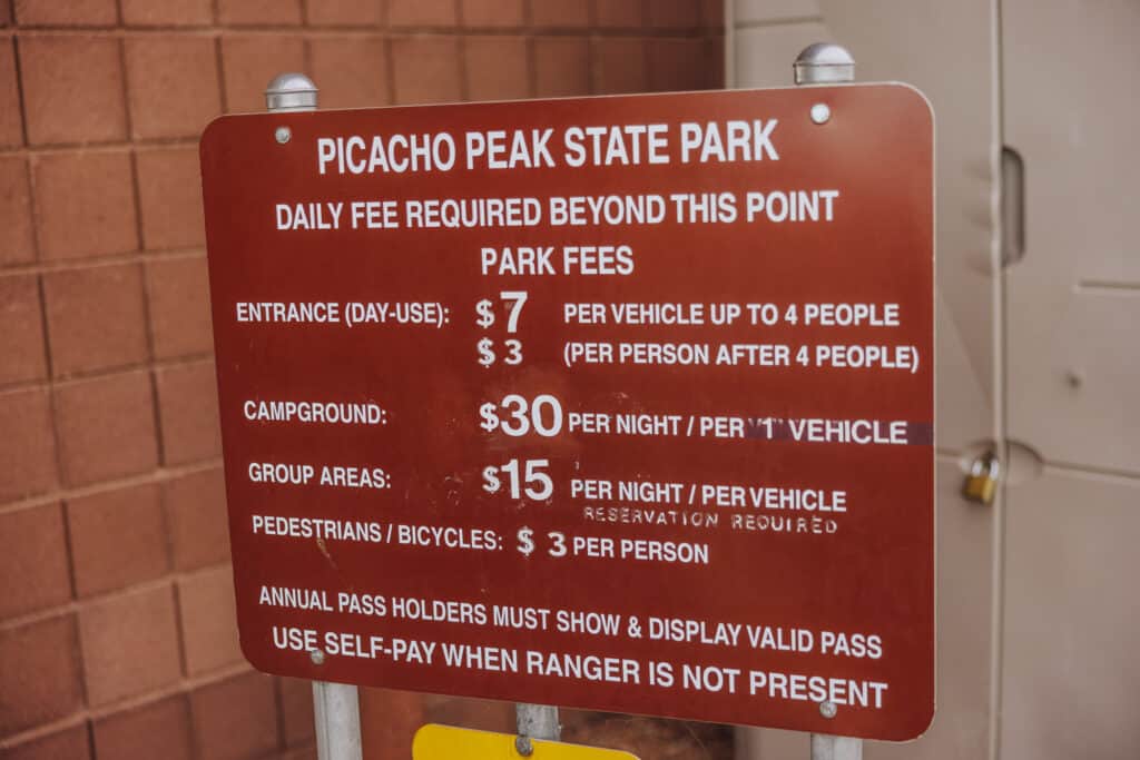
- The cost is $7 to park.
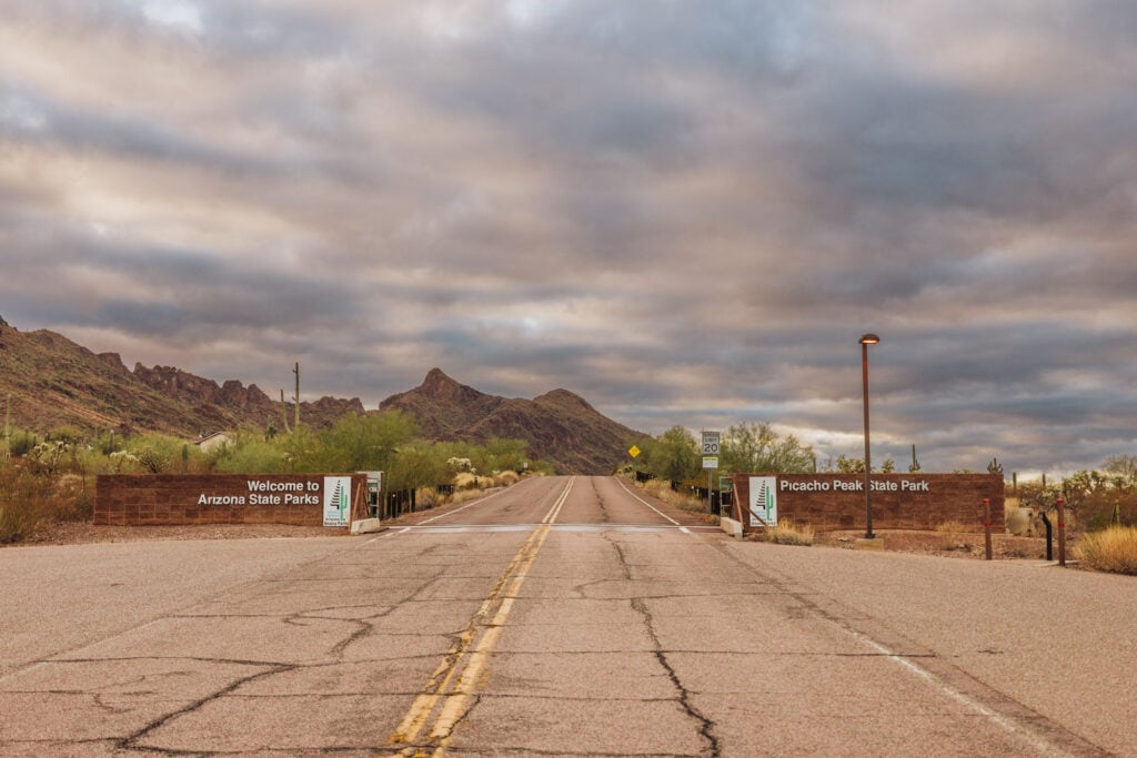
Picacho Peak State Park
Picacho Peak State Park is right off Interstate 10, closer to Tucson than Phoenix (exit 219).
- From Phoenix: 70 miles south
- From Tucson: 38 miles north
Picacho Peak Hike Fees
While there is no permit or reservation system to hike at Picacho Peak, it’s $7 to park your car for the day.
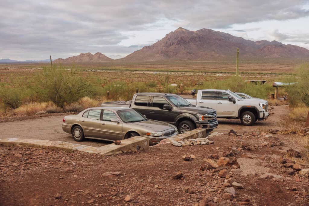
Parking for the Picacho Peak Hike
You’ll find a few parking lots around Picacho Peak State Park, along with a lot of roadside parking.
Most of the year, you’ll have no trouble finding a spot, but during peak wildflower blooms, visitors should get there early in the morning to ensure entry!
Map of Picacho Peak State Park
On this map of Picacho Peak, you can see how close the entrance is to the I-10.
Zoom in to see the road to the Barrett Loop Day Use Area, which is where you’ll find the Hunter Trail.
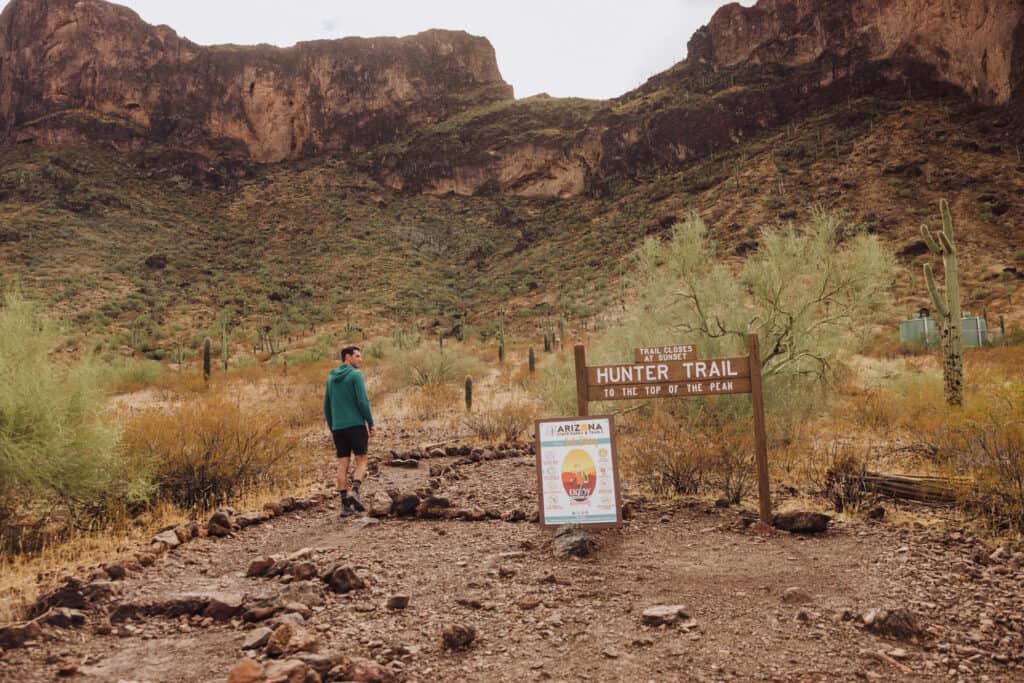
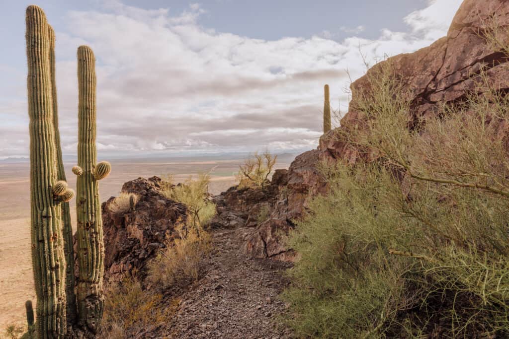
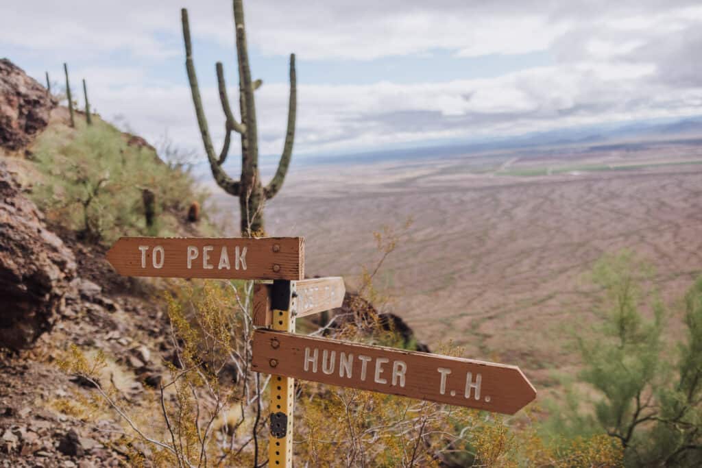
Hike the Hunter Trail to Picacho Peak’s Summit
The Hunter Trail will lead hikers to the summit at Picacho Peak.
It’s well-marked, well-traveled, and is enjoyably challenging!
Hiking Distance
The Hunter Trail is approximately 2.8 miles (roundtrip) to the summit and back.
Hikers can expect an elevation gain of around 1,500 feet (457 meters) from the trailhead to the summit.
From the trailhead, the first portion of the Hunter Trail is relatively easy or moderate. You’ll follow a well-marked, gradual incline up some steps and a dirt path.
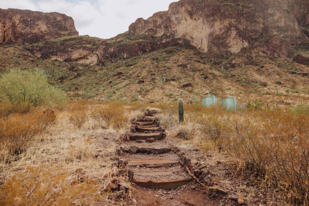
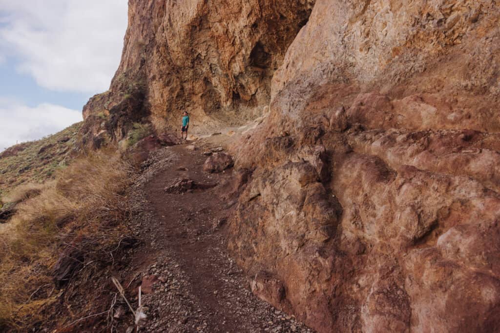
Once you start the ascent, you’ll find yourself walking along a rock wall, which is carved out in spots. Hunkering down in the shady caves will help on hot days!
The views are panoramic and sweeping, even from the first, more moderate portion of the Picacho Peak hike.
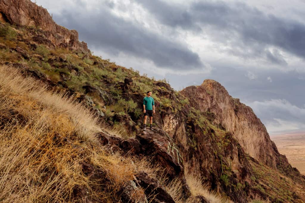
The only “downside,” if there is one, is that the I-10 is never out of site. You’ll be able to hear traffic for most of your hike.
I suppose the silver lining is: the trails at Picacho Peak are definitely easy to access!
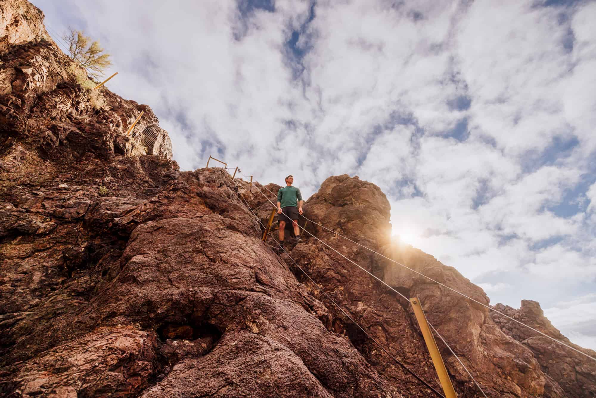
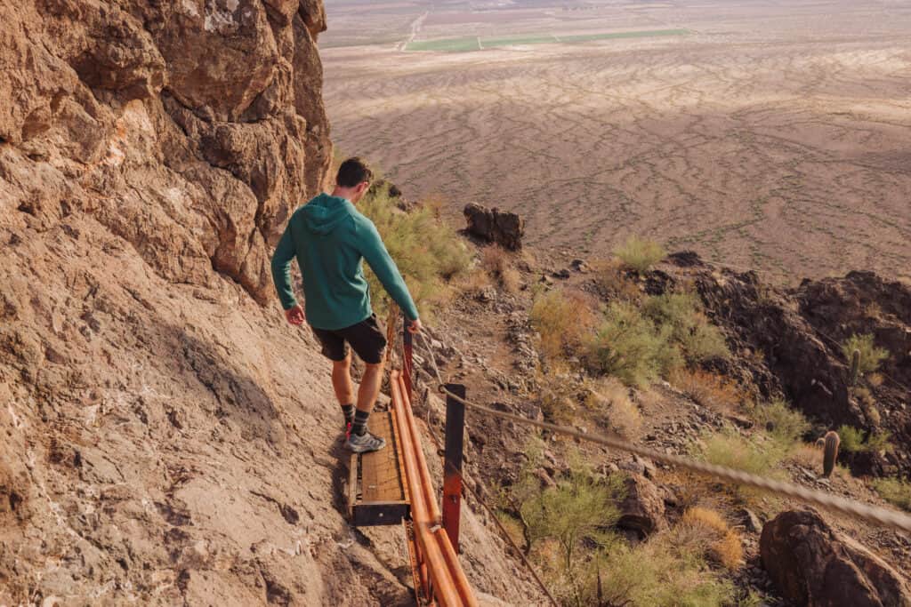
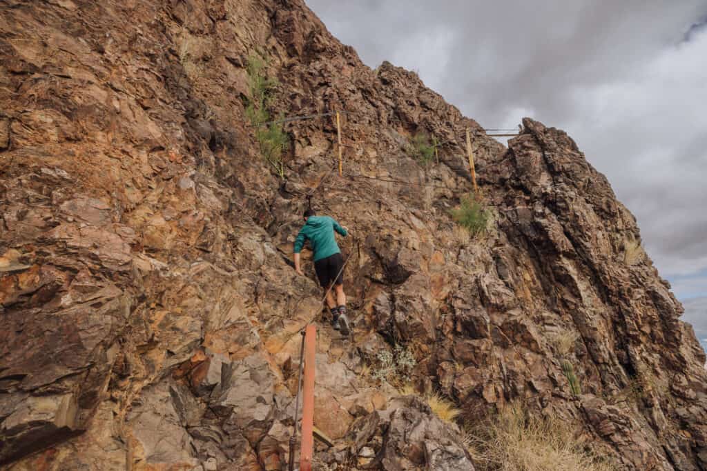
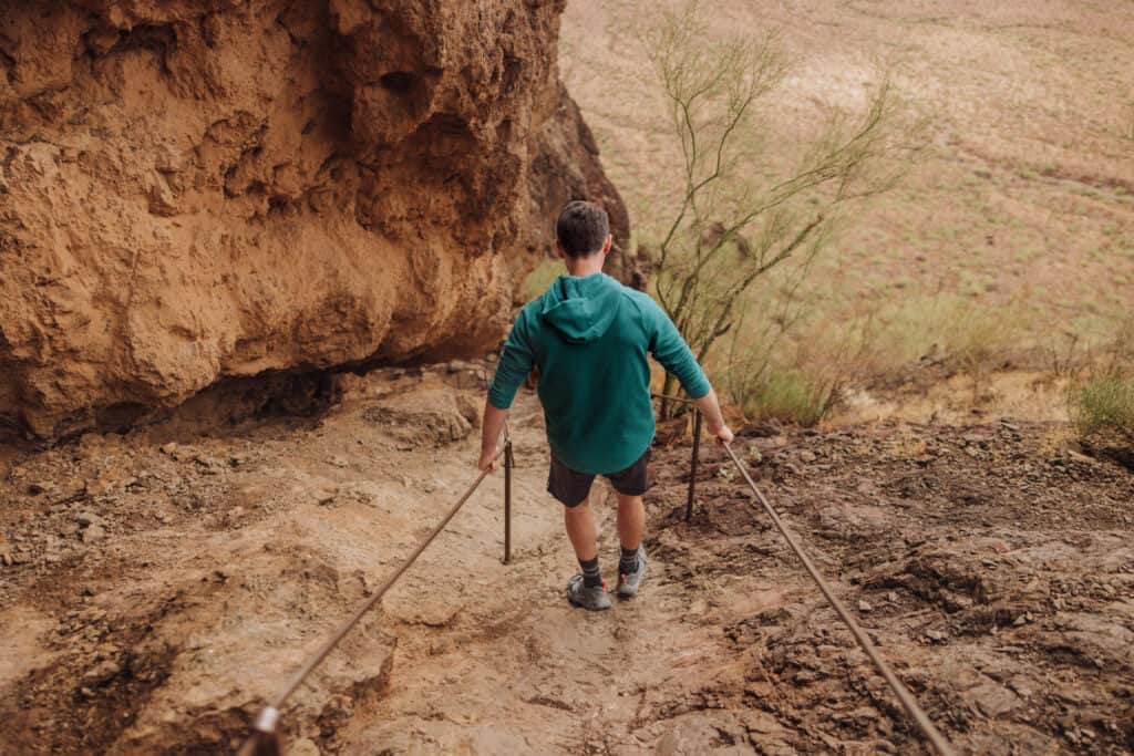
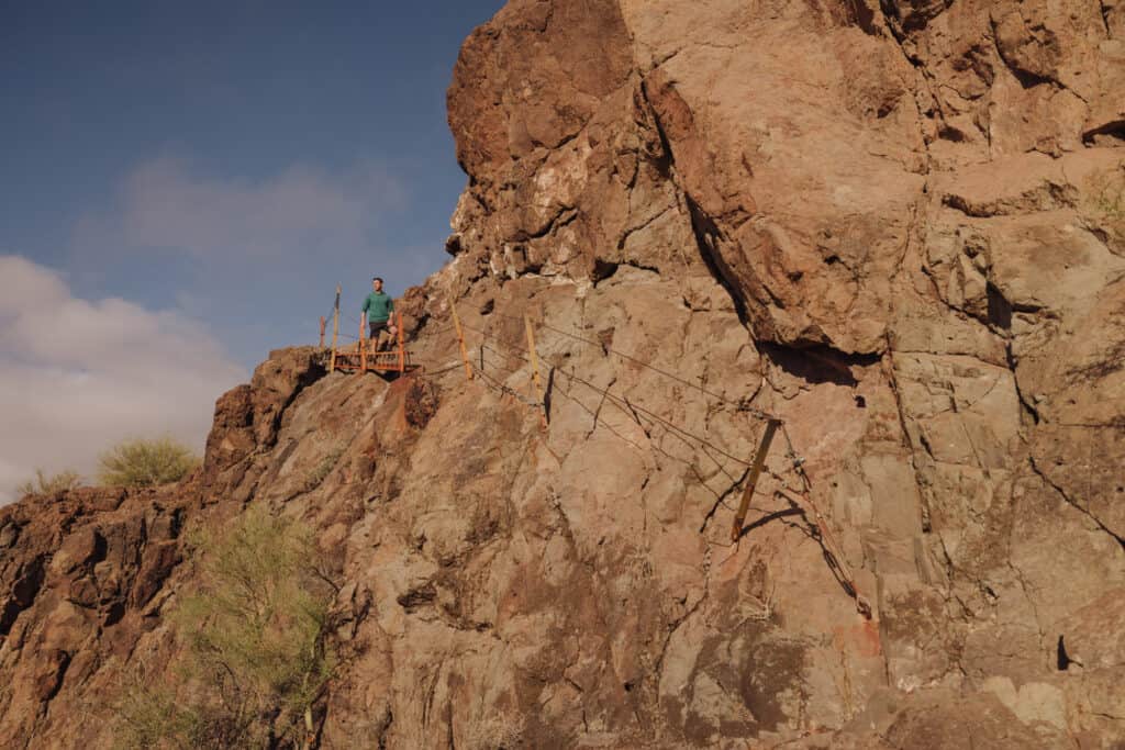
The hike gets much more challenging in the second half. You’ll find sturdy cables and handrails to help hoist yourself up the rocks. Honestly, for me the hike *down* was more challenging. I made good use of all of the assistance available!
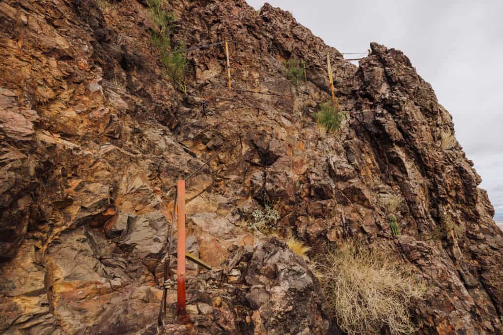
The steepest incline is almost 90 degrees in spots, but manageable thanks to the cables and handrails!
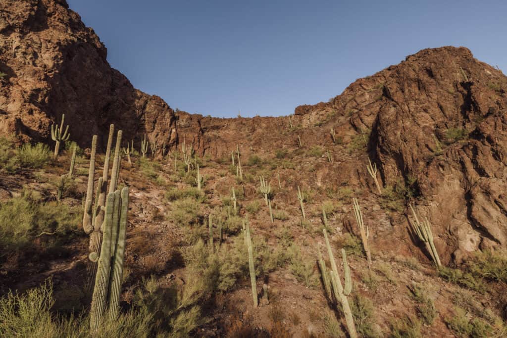
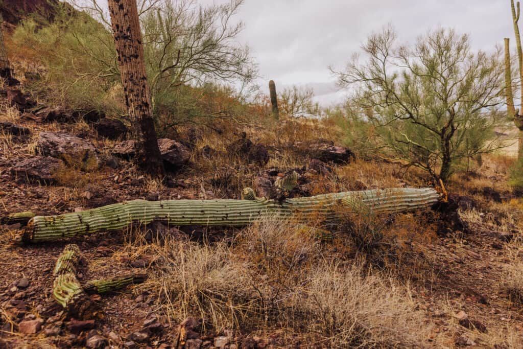
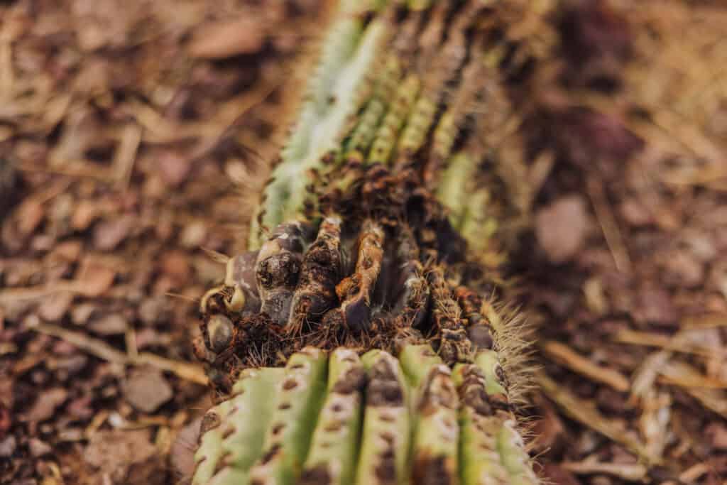
Along the way, you’ll see wildflowers (in season) and dozens of giant saguaro cacti, the icons of the Sonoran Desert!
Sadly, you’ll also pass a few giants that couldn’t survive the record-setting heat in the summer of 2023.
Hike Time
The full Picacho Peak hike typically takes around 3-4 hours round trip, but this can vary based on individual hiking speed and the time you spend at the summit.
I found myself wishing I’d brought more food to snack on while enjoying the view!
Hunter Trail Map
This map shows the path of the trail, from the parking lot, along the Hunter Trail to the summit of Picacho Peak.
The Sunset Vista Trail
The Sunset Vista Trail is a longer option, which is 3+ miles each way.
It starts in the westernmost parking area at Picacho Peak State Park, and joins the Hunter Trail to the peak.
It’s not recommended during the summer heat.
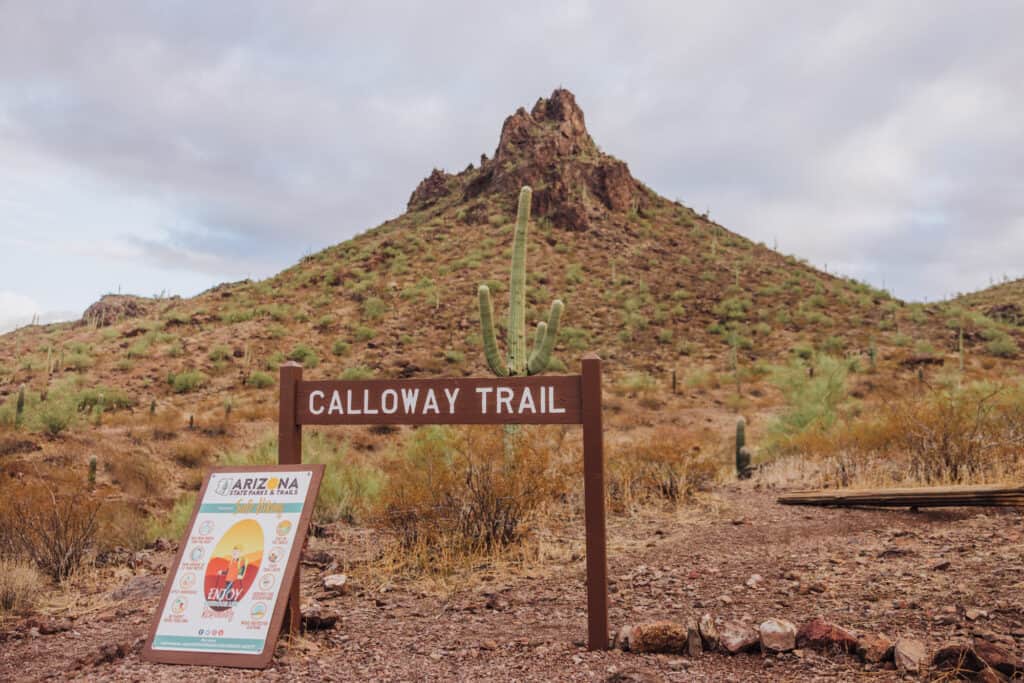
The Calloway Trail
The Calloway Trail is an easier option, and only a mile roundtrip.
It starts next to the Hunter Trailhead, and leads to an overlook. This is a far better option for kids and seniors, but does not bring you to the peak.
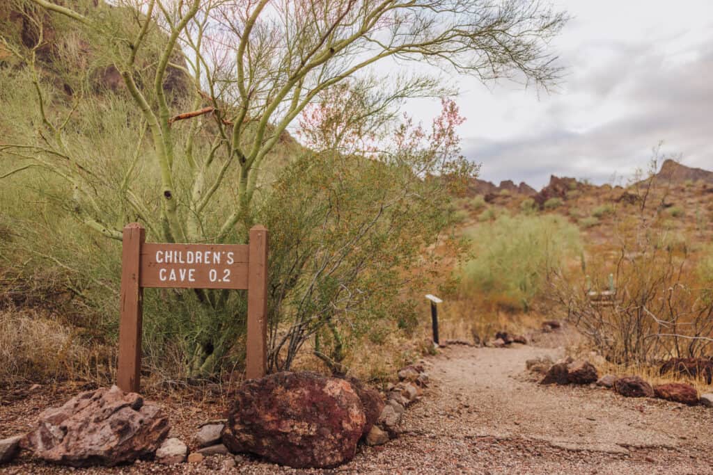
Children’s Cave Trail
Even better for younger children: an easy 0.2 mile trail that leads to a small cave in the rocks.
Picacho Peak Hike Difficulty
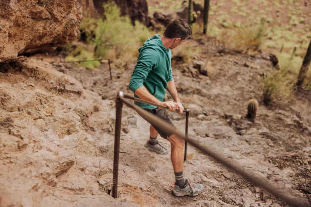
Considered a difficult trail, the Hunter Trail is known for its steep, rocky sections and narrow pathways. Some parts of the trail require using cables and handrails to ascend.
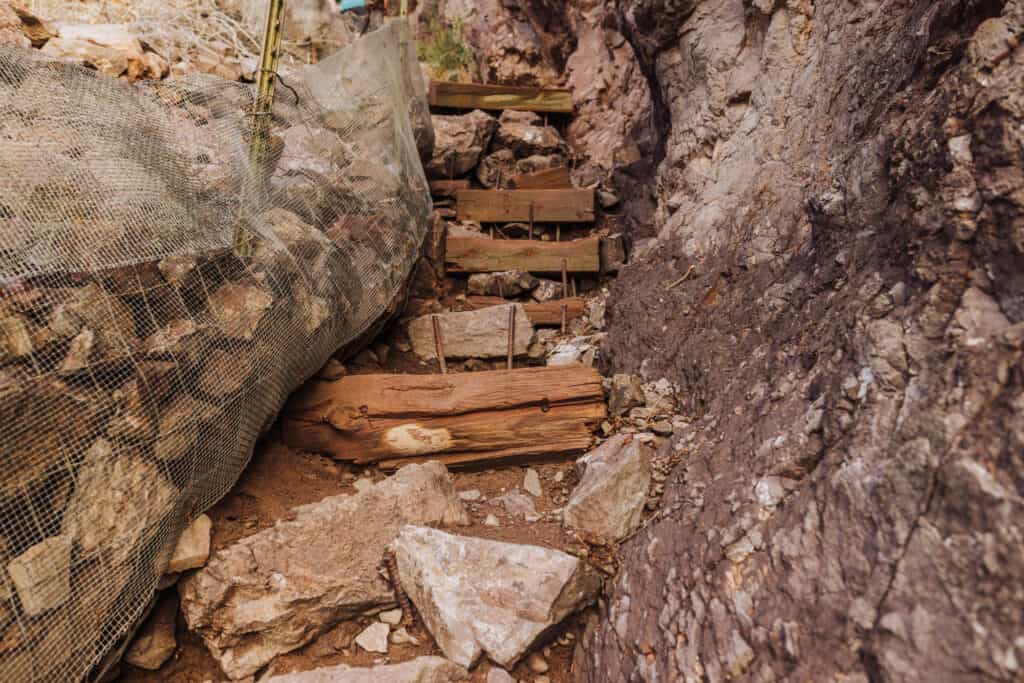
The wooden board I’m on in the photo above gets extremely slick if it’s rained. In fact, all of the wooden steps are very slippery along the way. In other spots, metal mesh is installed to catch rocks and keep them from rolling onto hikers.
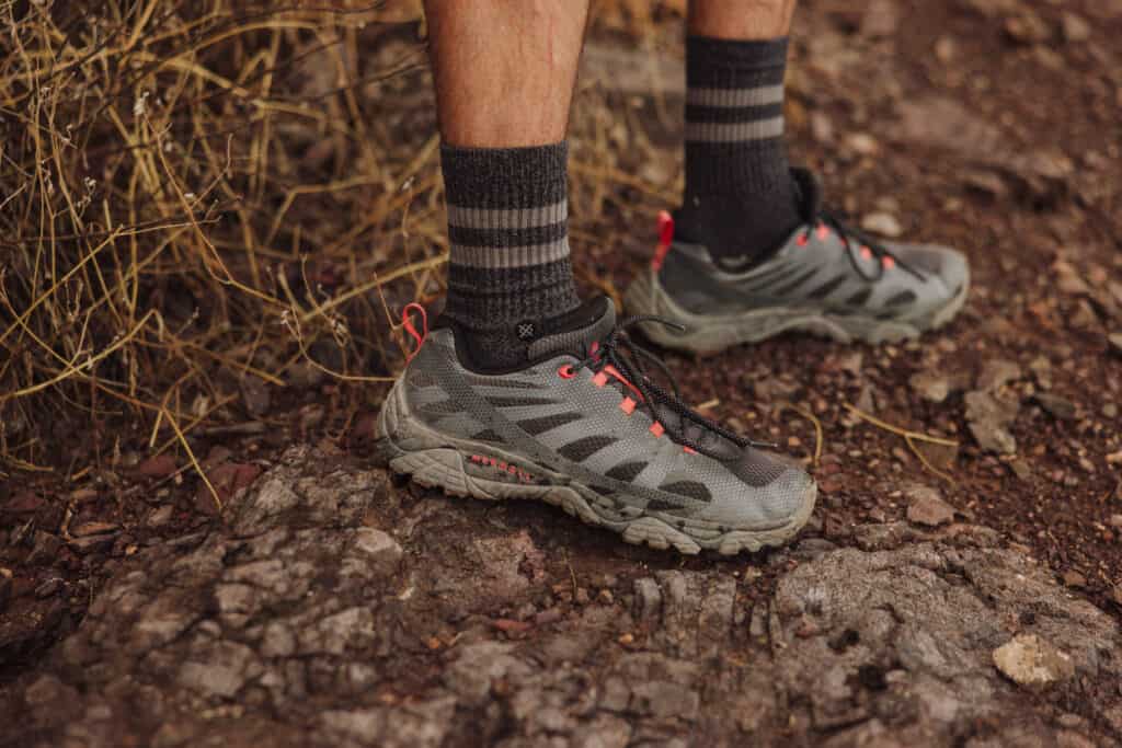
You’ll want to bring gloves, and maybe poles (depending on your preference) when you hike Picacho Peak.
I chose not to bring gloves, and found myself wishing I had a pair when it came to pulling myself up on the cables.
The Picacho Peak Hike Cables
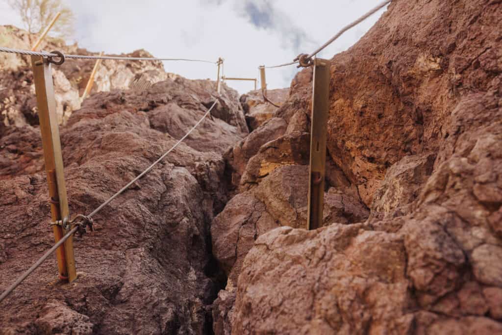
As mentioned, due to the challenging terrain, the trail includes sections where cables and handrails are installed to assist hikers in navigating steep or rocky areas safely.
Arguably the steepest, most challenging part of the hike to the summit of Picacho Peak involves a rocky crevasse, where you really have no choice but to use the cables for assistance.
What to Bring on a Hike at Picacho Peak
This list will change, depending on the season, but in general, I’d bring:
- hiking gloves
- hiking shoes with good tread
- hiking poles (if you like them)
- a hat
- SPF
- sunglasses
- a backpack with water
- water to leave in your vehicle
- snacks to take on the hike
- snacks to leave in your vehicle
Warnings & Weather at Picacho Peak
The weather will play a major role in a hike at Picacho Peak.
The summer monsoon season is very active in this part of Arizona, often whipping up late-day storms that bring powerful winds and downpours. Monsoon storms are also challenging to predict, and fairly spotty at times. It’s definitely something to keep in mind if you plan to hike Picacho Peak from July through September.
Also, during June, July, and August, you should expect triple-digit heat every day.
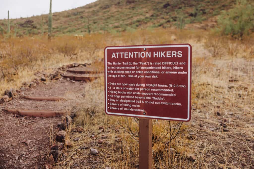
This “hike at your own risk” sign is posted at the Hunter Trailhead:
These are the average temperatures and rainfall you can expect each month in the area:
January
- Average Rainfall: Around 0.6 inches
- Daily Highs: 65°F
- Daily Lows: 39°F
February
- Average Rainfall: Around 0.7 inches
- Daily Highs: 69°F
- Daily Lows: 42°F
March
- Average Rainfall: Around 0.6 inches
- Daily Highs: 75°F
- Daily Lows: 46°F
April
- Average Rainfall: Around 0.2 inches
- Daily Highs: 83°F
- Daily Lows: 52°F
May
- Average Rainfall: Around 0.2 inches
- Daily Highs: 92°F
- Daily Lows: 60°F
June
- Average Rainfall: Around 0.2 inches
- Daily Highs: 101°F
- Daily Lows: 68°F
July
- Average Rainfall: Around 1 inch
- Daily Highs: 105°F
- Daily Lows: 75°F
August
- Average Rainfall: Around 1 inch
- Daily Highs: 103°F
- Daily Lows: 74°F
September
- Average Rainfall: Around 0.5 inches
- Daily Highs: 98°F
- Daily Lows: 68°F
October
- Average Rainfall: Around 0.5 inches
- Daily Highs: 87°F
- Daily Lows: 57°F
November
- Average Rainfall: Around 0.4 inches
- Daily Highs: 74°F
- Daily Lows: 45°F
December
- Average Rainfall: Around 0.7 inches
- Daily Highs: 65°F
- Daily Lows: 39°F
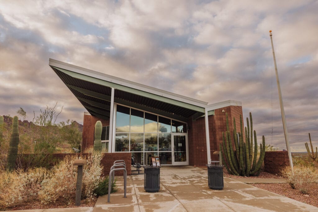
About Picacho Peak State Park
Picacho Peak State Park has a visitor center providing information about the park’s history, geology, and natural features, along with exhibits on local wildlife and the region’s ecosystems.
Throughout the year, the park hosts events like guided hikes, stargazing programs, and educational workshops focused on the desert ecosystem and history.
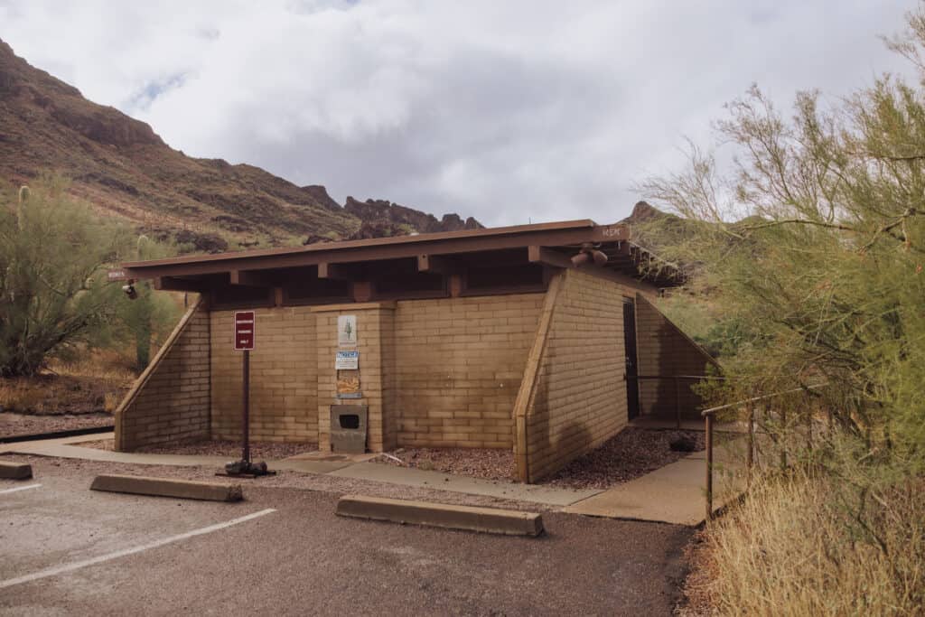
Facilities for Hikers
At the visitor center, you’ll find a small store.
Plus, there are basic bathrooms on the loop road through the park.
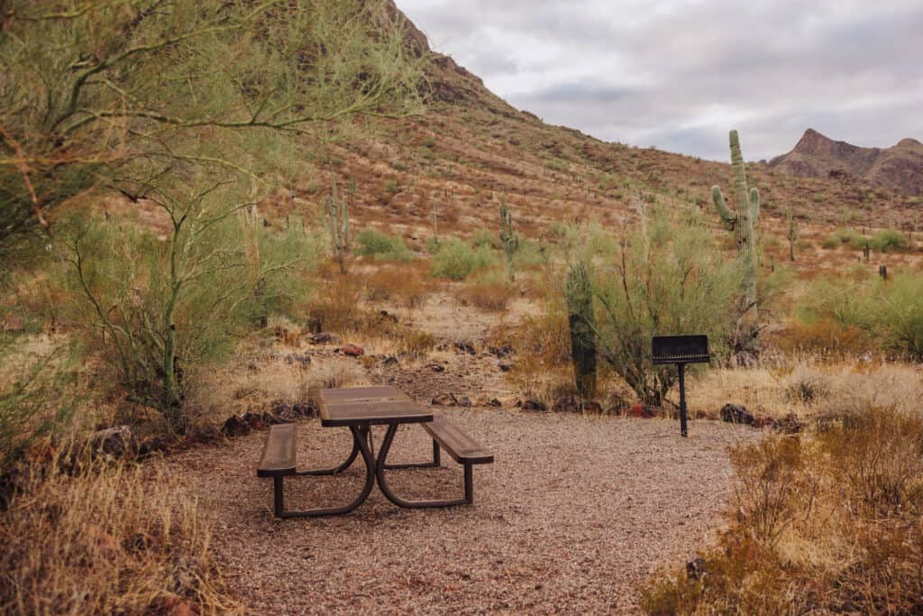
Camping at Picacho Peak
Campsites are limited at Picacho Peak State Park to 10 people max, with up to 6 adults.
There are several campground loops to choose from.
To reserve campgrounds, contact the state park directly.
History of Picacho Peak
Throughout its history, Picacho Peak has been a site of significance for various groups, from indigenous communities to explorers, settlers, and soldiers.
Native American Presence: The area around Picacho Peak has a long history of human habitation, with evidence suggesting that various Native American groups, including the Hohokam and later the Tohono O’odham, lived and traveled through this region for centuries.
Spanish Exploration: Spanish explorers and missionaries passed through the area in the 17th and 18th centuries. They established trails and routes, some of which are believed to have traversed near Picacho Peak.
American Settlement: In the mid-1800s, during the period of westward expansion in the United States, Picacho Peak and its surrounding area became part of the route used by pioneers heading to California along the Southern Emigrant Trail.
Civil War Engagement: One of the most notable historical events associated with Picacho Peak is the Battle of Picacho Pass, which occurred on April 15, 1862, during the American Civil War. It was a small engagement between Union cavalry from California and Confederate forces. This skirmish, although minor in scale, marked the westernmost battle of the Civil War.
Development of the Park: The land around Picacho Peak was eventually designated as a state park in the mid-20th century to preserve its natural beauty, unique geological formations, and historical significance.
FAQs About Hiking Picacho Peak
Let’s tackle a few more frequently-asked-questions about the Picacho Peak hike, some of which have already been answered up above.
What’s the elevation of Picacho Peak?
The elevation at Picacho Peak is about 3375 feet above sea level.
The hike itself is a gain of around 1,500 feet from the trailhead.
Do you need reservations to hike at Picacho Peak?
No, there’s no reservation or permit system at Picacho Peak State Park.
When can I see wildflowers at Picacho Peak?
Picacho Peak is known for its diverse display of wildflowers, especially during the spring season. Hikers will find poppies, lupines, brittlebush, desert marigolds, and more.
Wildflower season depends on the year’s precipitation and. temperatures. Some years you’ll find a huge bloom, while other years it’s more lackluster. They usually bloom from late February through April, and attract large crowds.
Do you have to pay to hike Picacho Peak?
The parking fee at the state park is $7.
How long is the Picacho Peak trail?
The Hunter Trail to Picacho Peak is 1.6 miles, each way.
The Calloway Trail is a less-challenging trail, which is one mile, roundtrip.
Can you bring dogs to Picacho Peak?
Yes, dogs are allowed, as long as they’re kept on a maximum six-foot-long leash.
I’ve seen dogs on the Hunter Trail to the summit, and wouldn’t recommend it. The rocks are too steep!
Can you fly a drone at Picacho Peak?
No, drones are not permitted in the state park.
Wrap: Is the Picacho Peak Hike Worth It?
Hiking to the summit of Picacho Peak is a great way to spend a day in the desert, if you’re visiting Tucson or Phoenix.
You’ll see people of all ages, excited to take on the challenge of climbing up the steep rocks and relieved to find cables and hand railings there to help!
While you’ll have classic desert views any time of year, wildflower season is especially pretty in the area.
As always, bring more water than you think you’ll need, and be prepared to be craving a big meal by the time you get back to your car!
Favorite Arizona Hikes
Check out some of our posts about Arizona’s other top hikes and iconic sites:
- Devil’s Bridge in Sedona
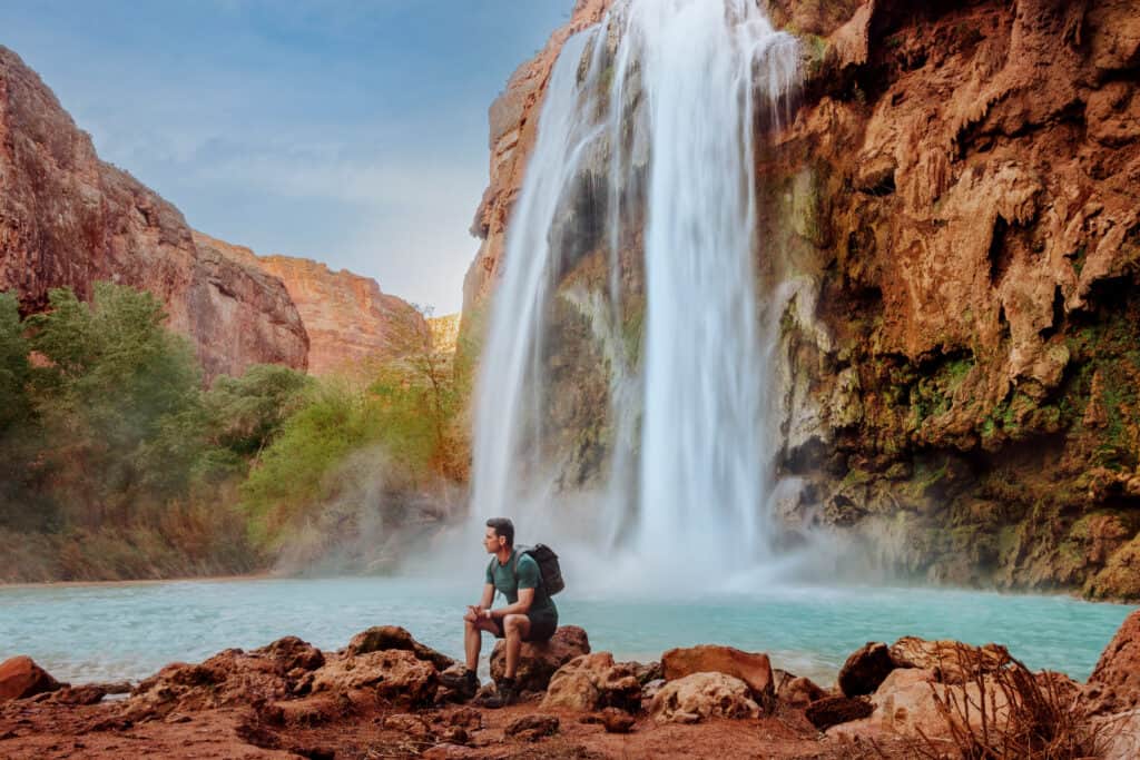
- Havasupai Falls (pictured below)
- Camelback Mountain
- Edge of the World
- White Pocket
- Antelope Canyon
- The Wave
- Horseshoe Bend