How to get to White Pocket AZ: A Guide with Warnings [2025 update]

ULTIMATE GUIDE TO WHITE POCKET: EVERYTHING YOU NEED TO KNOW!
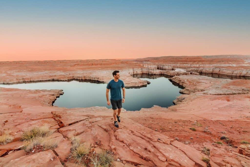
White Pocket, Arizona, is a geological marvel in the middle of the desert near the Utah border, in a remote part of the Vermilion Cliffs National Monument.
The photos are beautiful, but even the best photography doesn’t do this amazing, unique place justice! We were in awe, walking up to the site shortly after sunrise. And our disbelief stayed with us until the sun set.
Key Info about White Pocket AZ:
- You need a 4×4 to get there.
- The weather is unpredictable because the location is so remote.
- There’s no permit needed.
- White Pocket is (in my opinion) better than The Wave!
- The BLM has a new fee proposal for White Pocket.
Tours of White Pocket, Arizona
White Pocket is one of Arizona’s most difficult destinations to get to.
IMPORTANT: You cannot get to White Pocket without a 4×4.
If you’d rather not deal with the hassle of navigating to this remote location, there are several tours offered from Page, AZ, and Kanab, UT.
These tours to White Pocket AZ have excellent reviews:
Where is White Pocket, AZ?
White Pocket pops out of the desert in the Vermilion Cliffs National Monument, just south of the Utah border in Arizona, and really only became widely known 10 years ago, after a feature in National Geographic.
You’ll find White Pocket on a remote patch of Bureau of Land Management property, near several other natural wonders and rock formations.
“The Wave,” one of Arizona’s biggest tourist draws, is near White Pocket, but it’s inaccessible without a permit.
This map is centered on the White Pocket Trailhead (or parking lot). You can tell how remote this area is!
How to Get to White Pocket AZ
It’s not easy to get to White Pocket, Arizona, and you’ll need a 4×4 even if the weather is perfect.
Still, it’s worth the bumpy, sandy drive along slightly confusing BLM roads!
Guides & Permits to White Pocket
You don’t need a permit or a guide for White Pocket, unlike some of the other spots in the region which require you to go on a guided tour.
Still, many people find it helpful and more stress-free to have someone else take the reins and do the driving and navigating.
Booking a guided tour will allow you to nap in the vehicle, and let someone else worry about the ruts and directions.
Another perk of a guided tour at White Pocket is: the guide will know about hidden treasures like petroglyphs, which the rest of us might not see without an experienced visitor. The friendly folks at The Page – Lake Powell Hub can also help you find the best tour option for your visit.
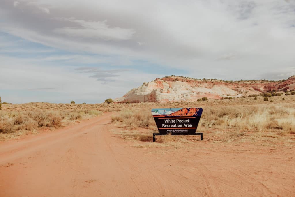
You do not need a permit for White Pocket, AZ, but the BLM is looking to change that and impose a new recreation fee of $10 per person.
Other nearby sites require different permits and passes.
The Wave’s permit is notoriously difficult to get, and involves a complicated lottery system. I’ve spent a lot of money ($9 for each lottery entry) and several years trying to get one of the few, coveted daily permits to The Wave.
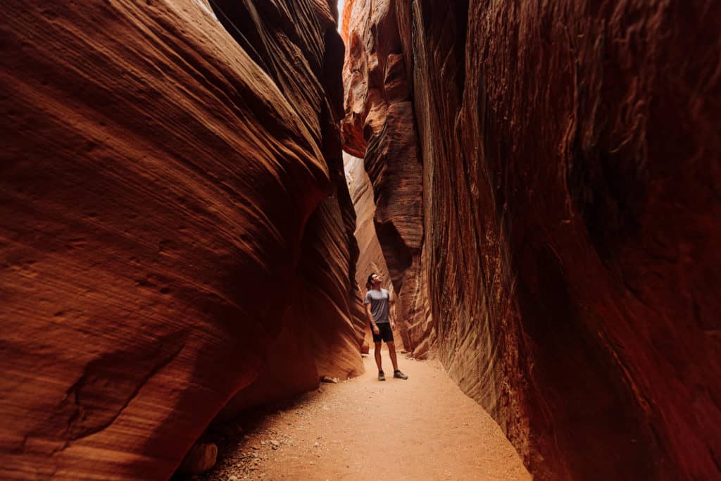
Nearby Buckskin Gulch is much easier and more accessible. You’re able to reserve a permit in advance, or pay right at the parking lot at the trailhead (which you’ll pass on your way into White Pocket).
➡️ Book a Buckskin Gulch Tour (from Kanab)
We’ll see if the permit process (or lack thereof) for White Pocket changes in the years ahead, but for now? Nothing to worry about!
Step-by-Step Directions to White Pocket, AZ
A word of warning: don’t follow the Google Maps directions. White Pocket, AZ, doesn’t even come up on Apple Maps (as of right now).
“White Pocket, AZ” comes up on Google Maps , but the directions and roads might not be completely accurate.
IMPORTANT: You’ll lose cell reception for much of the drive to White Pocket.
Randomly, you’ll be able to pick up signals as you walk around the White Pocket rocks, but don’t count on it.
We followed directions from the Bureau of Land Management, which include heading south on House Rock Valley Road (whether you’re coming from Page, Arizona, or Kanab, Utah, on Highway 89).
You’ll pass parking lots for other trailheads like Buckskin Gulch and Wire Pass.
The BLM has really improved the signage on these rural dirt/sand roads.
The main dirt and rock road (House Rock Road) has been nicely groomed on our drives down. Most vehicles should be able to make this part of the drive, going very slowly.
Again, you’ll need 4-wheel drive to go off the road toward White Pocket. It’s necessary.
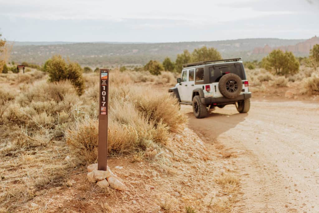
From House Rock Valley Road (on the road signs as 1065) 23.5 miles south of Hwy 89, you’ll turn onto BLM 1017.
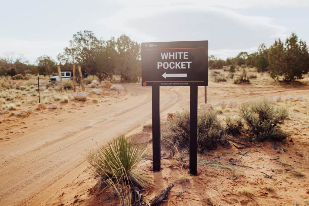
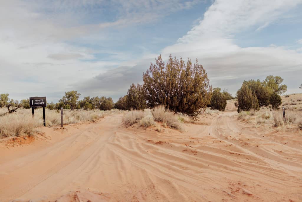
You’ll see a sign for White Pocket, which is directly across from a large old horse corral or stable.
You’ll head east on BLM 1017 for 6 miles, before you turn onto BLM 1087. Again, you’ll see a sign for White Pocket.
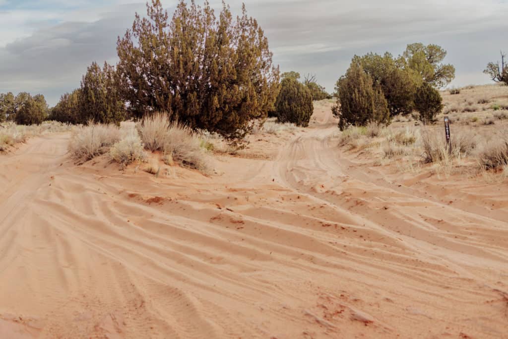
This road will split, and you’ll follow BLM 1086 to the trailhead.
Directions To White Pocket from Kanab, UT, or Page, AZ:
- Highway 89 to House Rock Valley Road
- House Rock Valley Road – south for 23.5 miles
- Watch for the old horse corral
- BLM Road 1017 – east for 6 miles
- BLM Road 1087 – northeast
- BLM Road 1086 at the split to the trailhead
You’ll Need a 4×4 to get to White Pocket, AZ
It’s not just a recommendation to take a 4WD vehicle. It really is a necessity, and there are a few rental options in both Kanab and Page.
The average rate to rent a Jeep for a day in Page is about $250. We’ve had good luck a few times with JeepBnB.
Most of the main road is hard dirt, and drivable in most vehicles. I’ve been on House Rock Valley Road a few times, and it seems to be graded often.
Strong storms during the summer monsoon season will often wipe it out. On a trip one August, even the best parts of the main road were impassable and flooded.
Once you turn off Rock Valley, you’ll hit a lot of sand traps.
We drove through the sand to get to White Pocket on a perfectly cool, dry day, and still had to put the Jeep into 4-wheel-drive.
If it’s raining, I’d avoid the drive. Ruts develop quickly, and even the 4-wheel drive might not be enough to set you free.
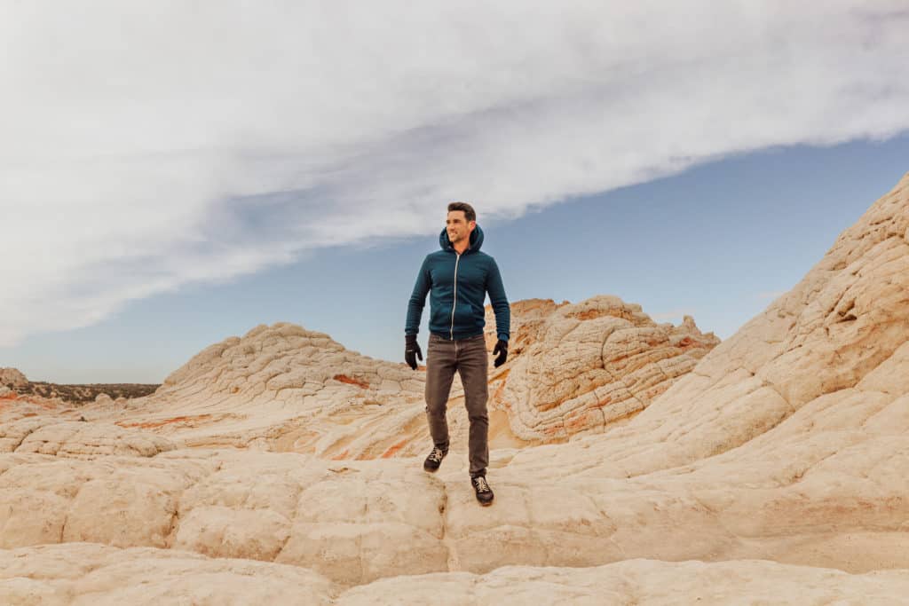
Hike White Pocket Arizona
It’s a hike to White Pocket … sort of … since you’ll have to walk in from the parking lot, and can explore the peaks and crevasses of the rock formations.
But aside from the brief walk from the trailhead parking lot, there are no established trails to hike on. You’ll just kind of wander around in a stupor, stunned by the landscape!
White Pocket is a Great Alternative to the Wave
White Pocket is, in my opinion, the best alternative to Coyote Buttes North, also known as “The Wave” in this part of Arizona.
Coyote Buttes has a difficult lottery permitting system. If you end up in the desert southwest, hoping for a permit to The Wave, but are unable to secure one, White Pocket will more than satisfy your desires to see something truly unique!
Geographically, The Wave is very close to White Pocket, but you’re not allowed to wander there without one of those coveted permits. And yes, they usually have someone checking permits on the trail to The Wave!
How Long to Spend at White Pocket
White Pocket is definitely a full day trip, from either Kanab or Page.
The drive time from Page is 2+ hours, and it’s the same from Kanab.
After all the time and effort you spend getting to White Pocket, you’d want to spend at least four hours there walking around and taking photos. The site has several different areas, formations, and peaks to explore.
On my next trip, I plan to camp and spend the night, to get the full sunset and sunrise over the site!
Drones at White Pocket
Drones aren’t allowed in national parks, but Vermilion Cliffs is a National Monument, so you can fly your drone at White Pocket.
Plus, the White Pocket area is not technically in a “wilderness area,” so it’s not protected.
You can consult the BLM if you have more questions. There’s a chance drone use may eventually be restricted at White Pocket.
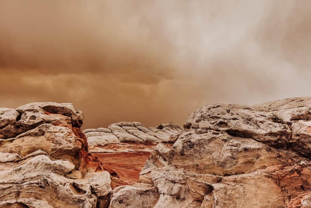
The Weather at White Pocket
This is important to keep in mind: weather predictions for White Pocket are difficult, because it’s such a distance from any major town.
You can’t rely on the forecast for either Kanab, Utah, or Page, Arizona, to accurately reflect the weather hitting the White Pocket area.
Keep checking the radar, when cell reception allows!
Monsoon season (late June through September) is especially tricky in this part of Arizona. Any of the slot canyons can flood quickly, and the BLM roads can wash out in a strong storm.
It actually snowed pretty hard on our drive out (in February), and the area gets extremely hot in the summer months.
Most of the day we were blasted by sand in 50mph winds. All part of the experience at White Pocket!
White Pocket in the Winter
Visiting White Pocket in the winter months brings the benefit of far smaller crowds. As I mentioned, we only saw a couple of vehicles the day we went in February.
Also, remember that the sun sets around 5:00pm, so the time you have to explore will be cut short. On the plus side of that, it’ll bring sunset’s amazing photography opportunities to you faster!
White Pocket In The Summer
Visiting White Pocket during the summer months opens the door to more comfortable camping, so it takes the whole experience to the next level.
On the downside, you’ll be there with many more people, and it does get hot! The lone famous tree standing from the white rocks won’t provide much shade 🙂
Plus, even more of a concern once you get into July and August will be the unpredictable monsoon storms, which could easily cause ruts and problems on the sandy roads into White Pocket.
The Best Time to Visit White Pocket
I’d say, visiting White Pocket in the spring or fall are likely your best bets.
That said, while winter brings snow and harsh winds, which we experienced, I wouldn’t think twice about going again in February, because the crowds were minimal.

Camping at White Pocket
I’d love to camp at White Pocket, just to make sure I’m there for the sunrise!
There are no bathrooms, garbage cans, or any services at the White Pocket trailhead.
While you’re likely to have room in the trailhead parking lot, I think the rangers would rather you camp in one of the posted camping locations you’ll see along the BLM roads into White Pocket.
Again, make sure to bring twice as much water as you think you’ll need, and plenty of food.
Also, the advice from the BLM is to either bury any ‘waste’ half-a-foot or more below ground, or bag it and haul it out with you.
In addition to sunscreen and shades, bring layers. Over just our day at White Pocket, the weather went from hot and sunny, to cold and rainy, to snowy.
Even in the summer, temperatures at night could cool off nicely, so you’ll want something extra for your early morning photography.
Where to Stay Near White Pocket
The closest cities to White Pocket are Kanab, Utah, and Page, Arizona.
White Pocket is a two-and-a-half hour drive from Page, AZ, in good conditions.
Page has a number of hotels and rental options. You can use this interactive map to search around to see what’s available for the dates you’re considering:
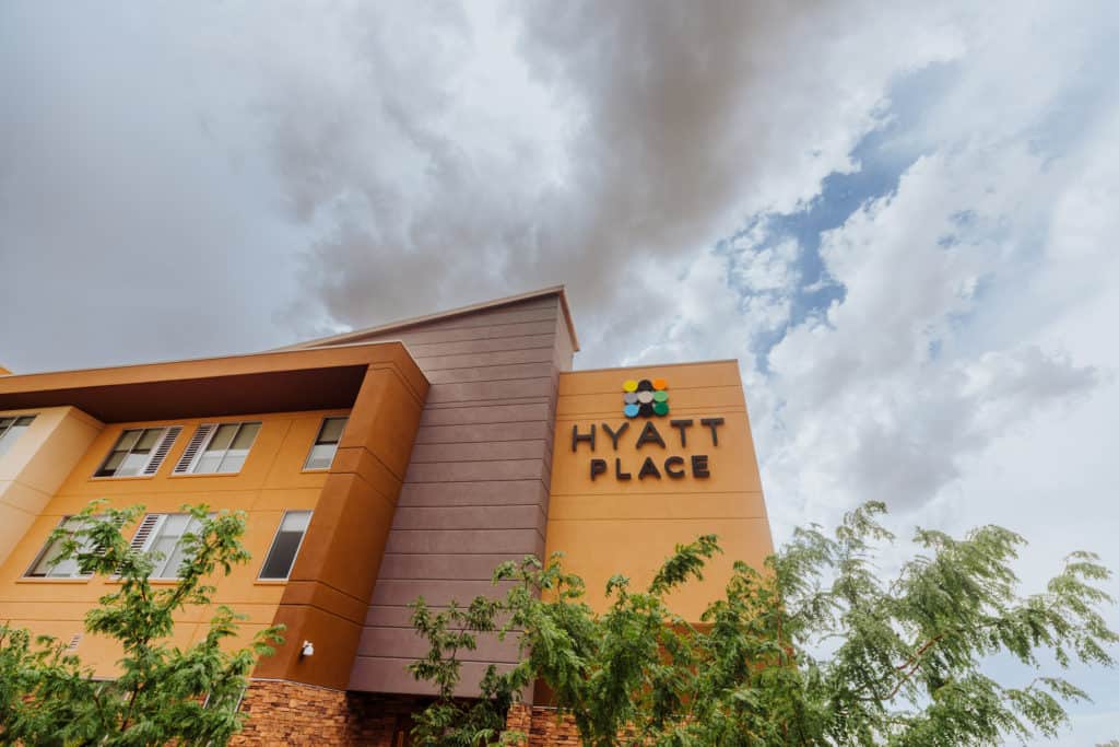
➡️ Hotel Recommendation: Hyatt Place Page/Lake Powell
We usually stay at the Hyatt Place in Page for several reasons:
What to Bring to White Pocket
If you’re going for a day trip from Page, Arizona, or Kanab, Utah, leave town before dawn so you can arrive at White Pocket early in the morning.
We left Page around 4:30am, and after a couple stops on the BLM roads along the way, we got there around 7:30am.
Even on a day trip, bring twice as much water as you think you’ll need, along with food. There’s always an off-chance that a storm will roll in and trigger a flood that will keep you there longer than expected.
Gloves, hats, and scarves will keep you warm in the winter months.
A good SPF is necessary any time of year, since the sun reflects off the rocks.
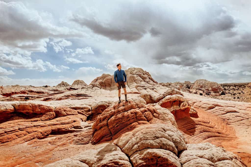
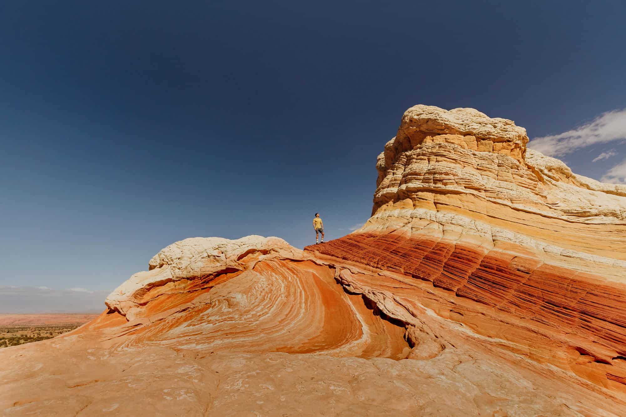
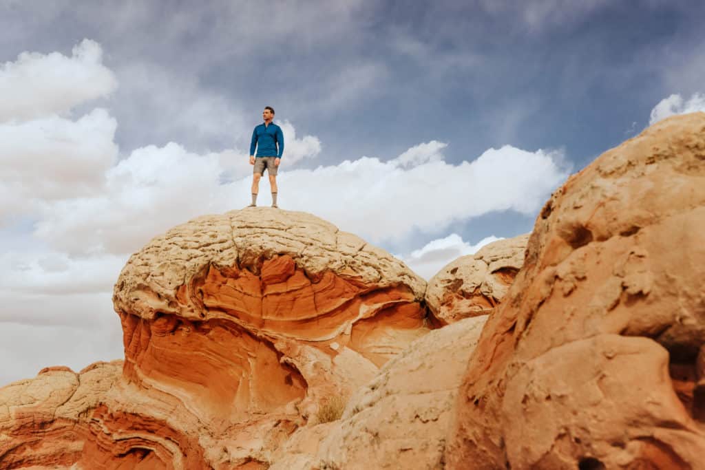
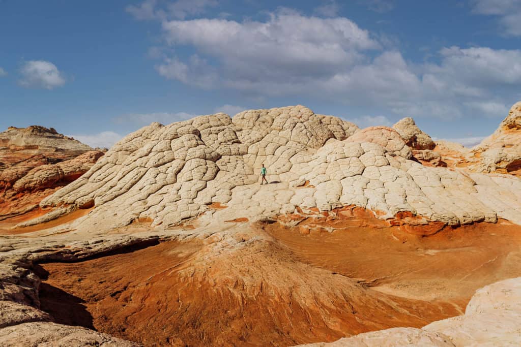
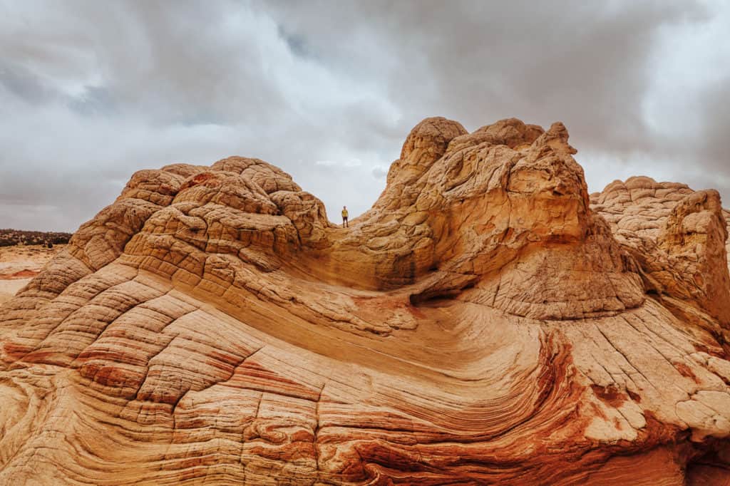
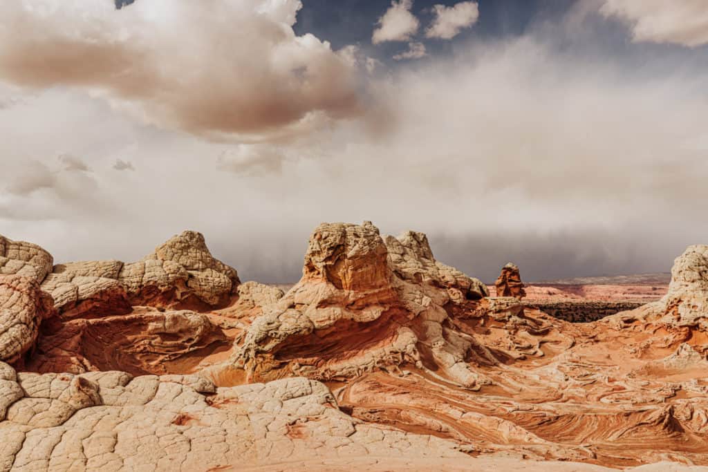
What Exactly is White Pocket?
Geologists can’t really agree on what caused this landscape, which looks otherworldly in the Arizona desert. They seem to agree that it formed during the Jurassic Period, as sand turned to rock, and earthquakes helped shape the layers and waves we see today.
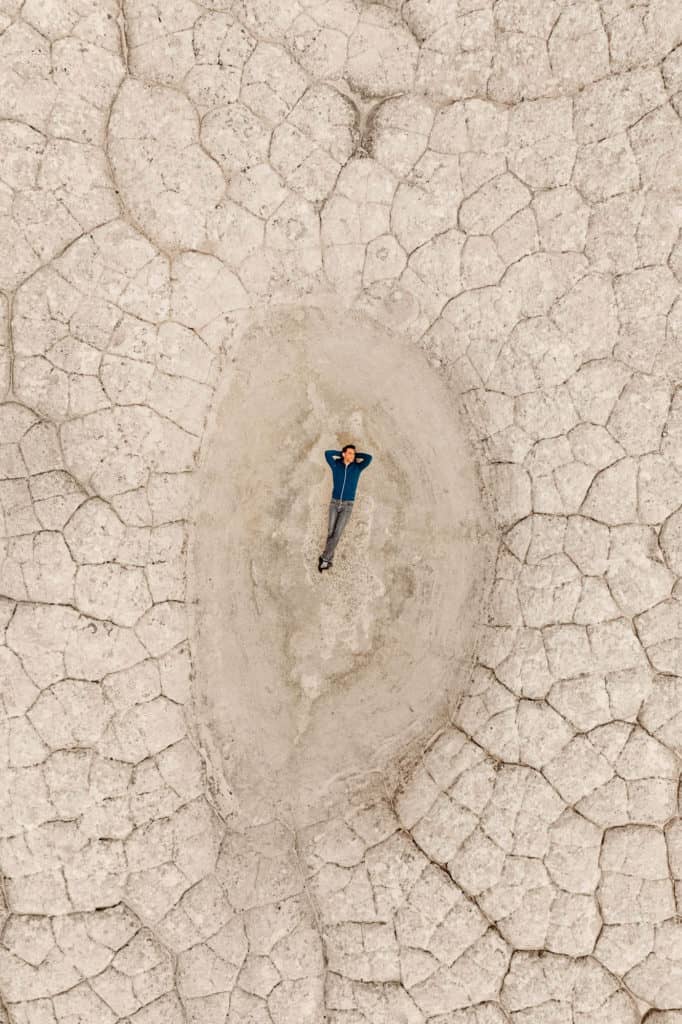
Bright red, orange, and yellow sandstone is covered by a layer of a whitish-grey sandstone. The dramatic color variations in the rock layers are the result of iron oxidation.
A prominent geologist published a paper on his findings, if you’re interested in reading more.
White Pocket’s rocks draw comparisons to brains, something from the board game Candyland, strips of bacon, and many other things.
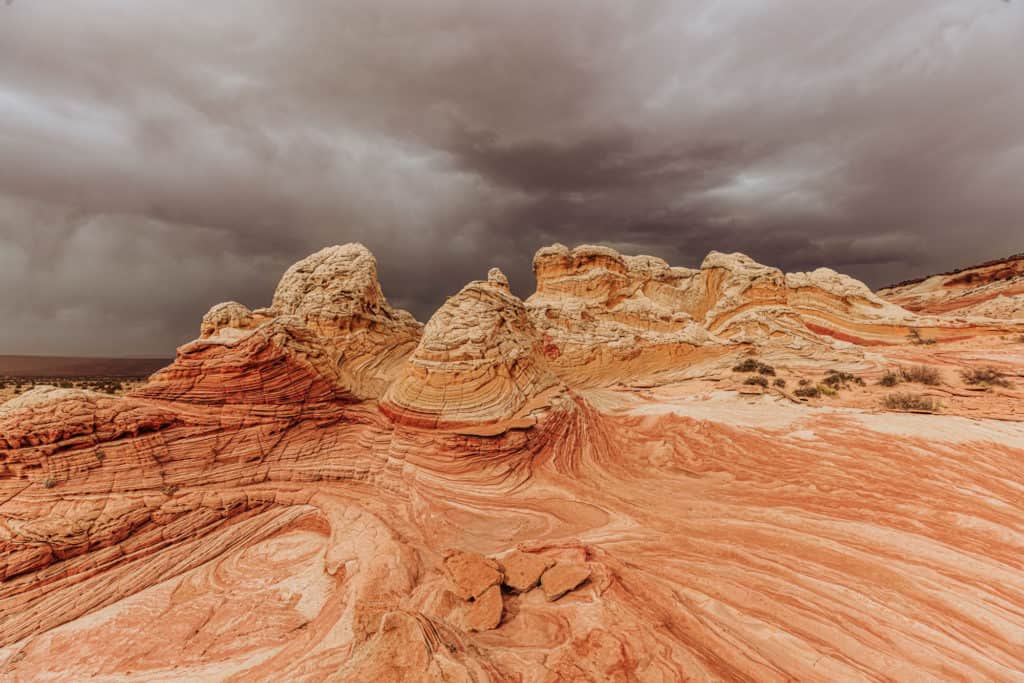
Some say White Pocket looks like the Grand Canyon covered in icing, while the chunky white formations look like cauliflower, or a frothy soda fountain drink.
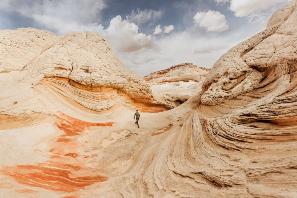
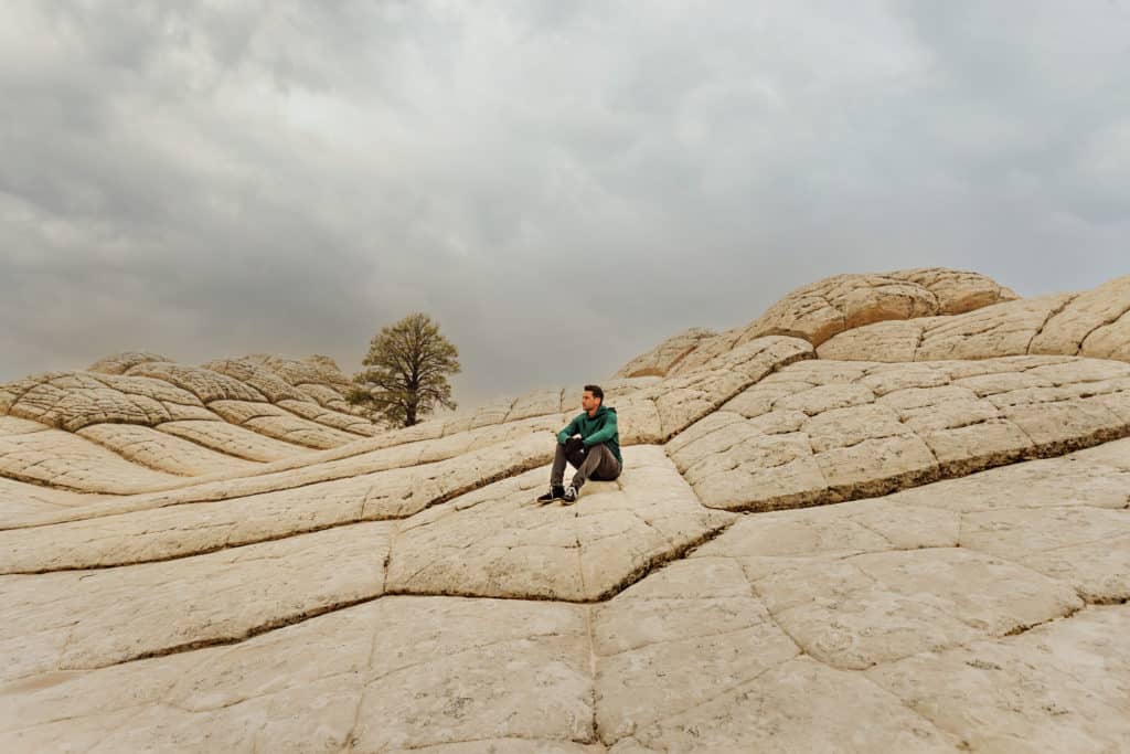
One area which is often photographed is a stark white setting. It features a series of waves of white stone, with an interesting geometric pattern seemingly-stamped on top.
A single tree grows from the rock. It’s basic, and beautiful.
The landscape is mostly barren, aside from a few small groupings of struggling shrubs and trees.
Other Sites Near White Pocket, AZ
Along the same BLM road, you’ll pass parking lots for the Wire Pass to Buckskin Gulch hike, and also a few others to check out.
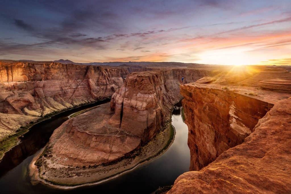
Plus, Antelope Canyon and Horseshoe Bend are right in Page. Both are “must sees” if you’re in the area!
➡️ Jared’s Detours Blog: Upper vs. Lower Antelope Canyon
If you’re staying in Page, you have a number of options, including: Horseshoe Bend, Alstrom Point, and everything Lake Powell has to offer:
Wrap: White Pocket is Worth the Hassle!
It’s an easy “yes” from me, as long as you follow advice from people who’ve made the trek.
Renting a Jeep adds to the cost, but it’s a necessity, and a relatively small price to pay to experience this unique landscape.
I feel like White Pocket is a spot that I could visit time after time, and on each visit find a new area to explore.