Attractions in Page, Arizona: The 15 Best Things to Do

THE BEST ATTRACTIONS IN PAGE, ARIZONA
This list grows every time I visit, and find more amazing things to do in Page, AZ!
Off the bat, I admit: I’m biased. I love Page! I live in Central Phoenix, and try to get up to the amazing scenery in Northern Arizona and on the Navajo Nation several times a year.
Key Info about Page, Arizona:
- 275 miles north of Phoenix
- 275 miles east of Las Vegas
- Home to Antelope Canyon, which you need a reservation to visit
- Home to Horseshoe Bend, Lake Powell, and many other amazing sites to see
Where to Stay in Page, Arizona
Page is home to a growing number of hotel and rental options. Even within the last few years, I’ve seen many more pop up along the Glen Canyon Dam Overlook area. You can plug your dates into this interactive map to check rates and availability:
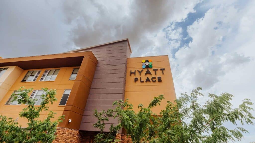
I usually stay at the Hyatt Place Page-Lake Powell. The rooms are big and clean, and the staff is friendly. Plus, the restaurant is a favorite in Page, and usually serves dinner until almost 10:00pm (great to come back to after a sunset hike). I’d recommend the Prickly Pear Cactus Quinoa Salad!
➡️ BOOK A HOTEL: Hyatt Place Page / Lake Powell
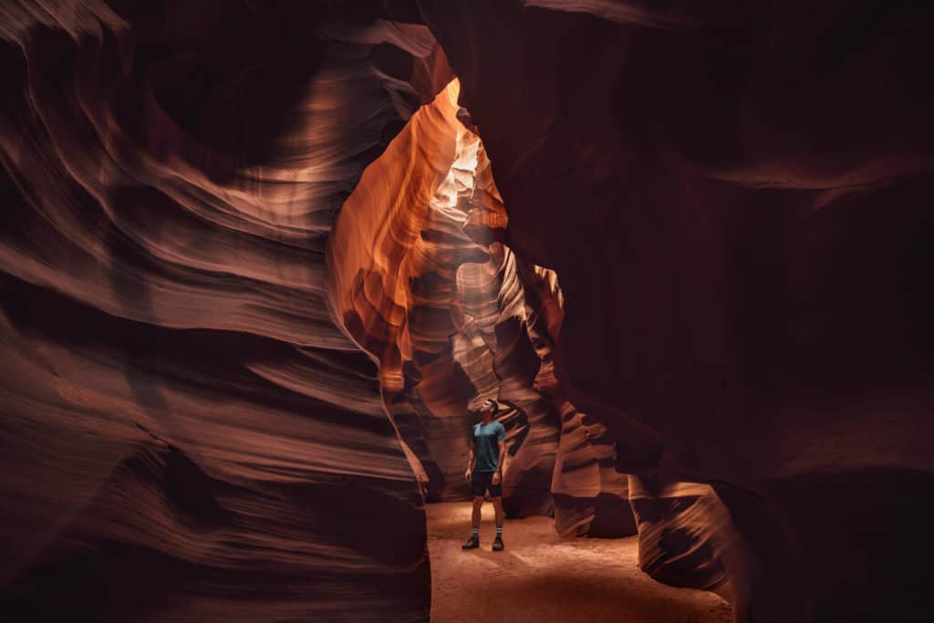
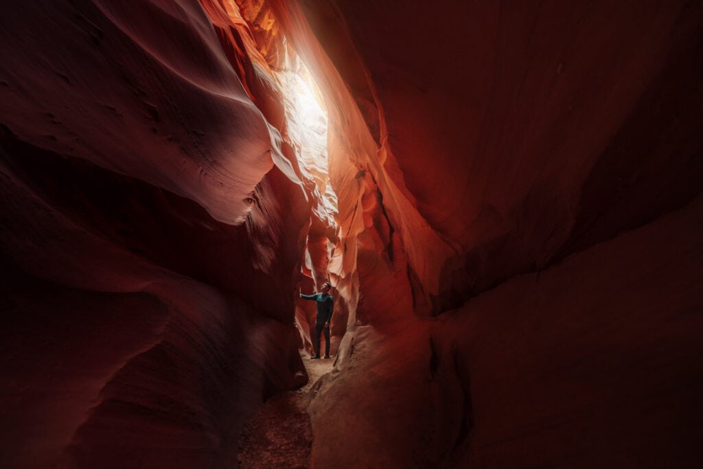
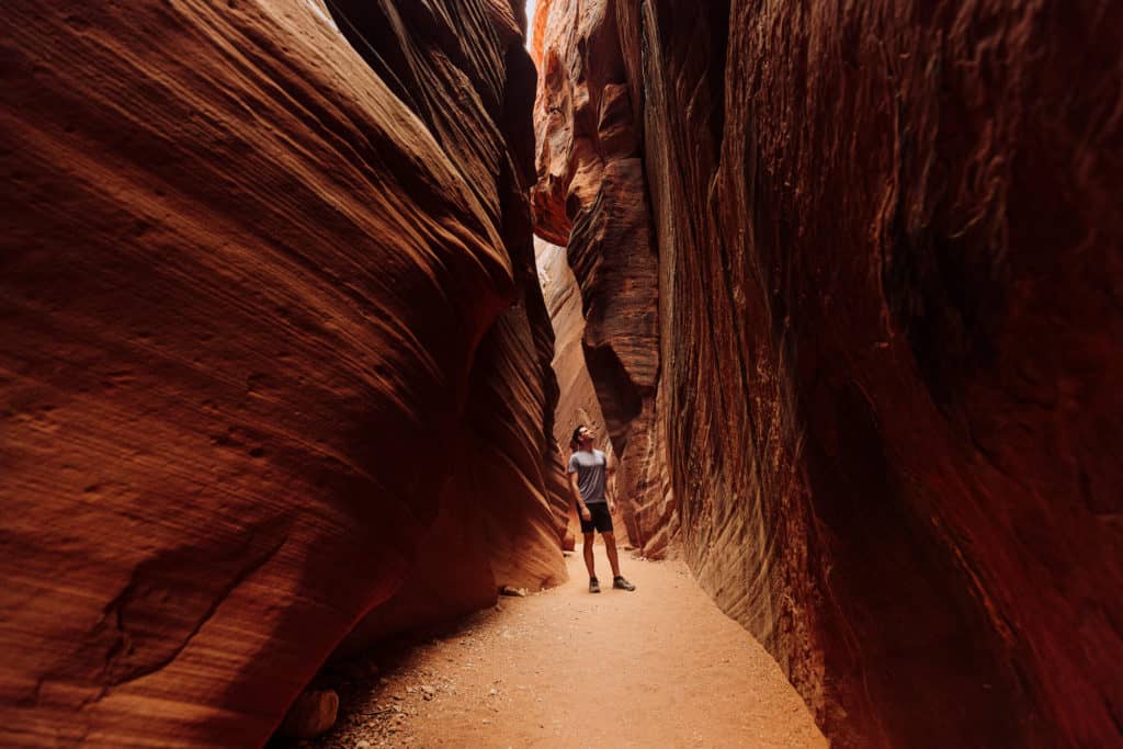
The Most Popular Attraction in Page: Antelope Canyon
Antelope Canyon is the natural desert wash, which now attracts millions of people from around the world to Page, Arizona, each year.
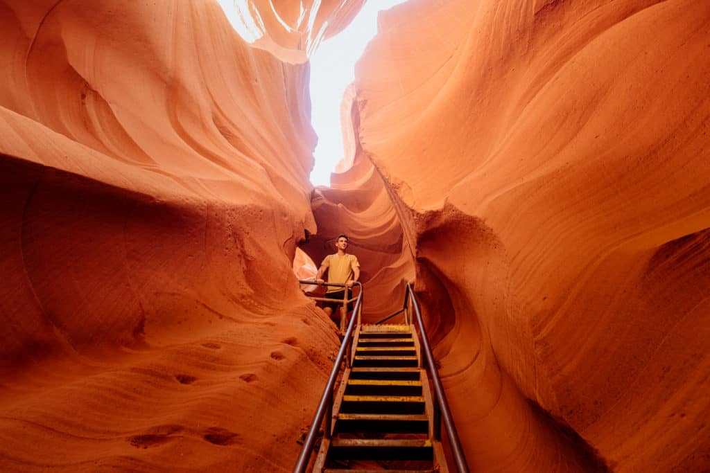
Over time, floods, wind, and sand have worn away the sandstone to create a canyon, which runs several miles into what is now Lake Powell.
Several parts of the canyon are open to the public, each owned or operated by different families with rights to the land.
This is one site in Page, AZ, where you need to make a reservation for a guided tour. You cannot explore Antelope Canyon on your own.
➡️ Click to Book Upper Antelope Canyon Tour
➡️ Click to Book: Lower Antelope Canyon Tour
➡️ Click to Book: Antelope Canyon X
I’ll explain each option below. I also have full blogs on the differences between Upper and Lower Antelope, and another post on Antelope Canyon X.
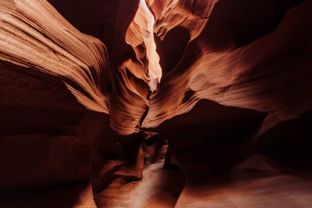
Upper Antelope Canyon
Tours of Upper Antelope Canyon are a bit longer (almost two hours), and they include a 20-minute ride each way from the city out to the canyon.
- Upper Antelope Canyon is better for seniors, people who can’t climb ladders, and children.
- Upper Antelope is more A-shaped, so it’s a bit darker and ‘moodier’ inside.
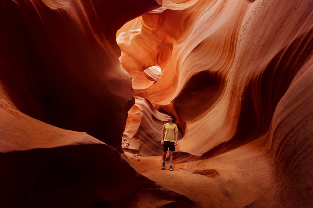
Lower Antelope Canyon
Tours of the Lower Antelope Canyon begin in a parking lot out in the desert, right at the canyon entrance.
Entering Lower Antelope requires a climb down a ladder, and the passageways inside are narrower.
- Lower Antelope Canyon is less expensive, and more crowded.
- The V-shape of the canyon lets more light in, so photos will be much brighter.
Antelope Canyon X
Antelope Canyon X is a newer section of the canyon to open to the public (though it’s been open for several years now).
- The family operating tours here allows far fewer people into the canyon, so you’ll see fewer people inside compared to the experiences at Upper and Lower.
- Antelope Canyon X also allows photography tours (unlike the other sections).

Adjacent to Antelope Canyon X is Cardiac Canyon, where only 6 people are allowed in daily for a tour that lasts 6 hours. It’s a far more peaceful experience, if that’s what you’re looking for.
Day Trips from Other Cities
To visit Antelope Canyon, you can hire a guide to do all the driving for you from other parts of Arizona, plus Las Vegas. Click any of these links for tour info:
- ➡️ Day Trip from PHOENIX
- ➡️ Day Trip from SEDONA
- ➡️ Day Trip from FLAGSTAFF
- ➡️ Day Trip from LAS VEGAS
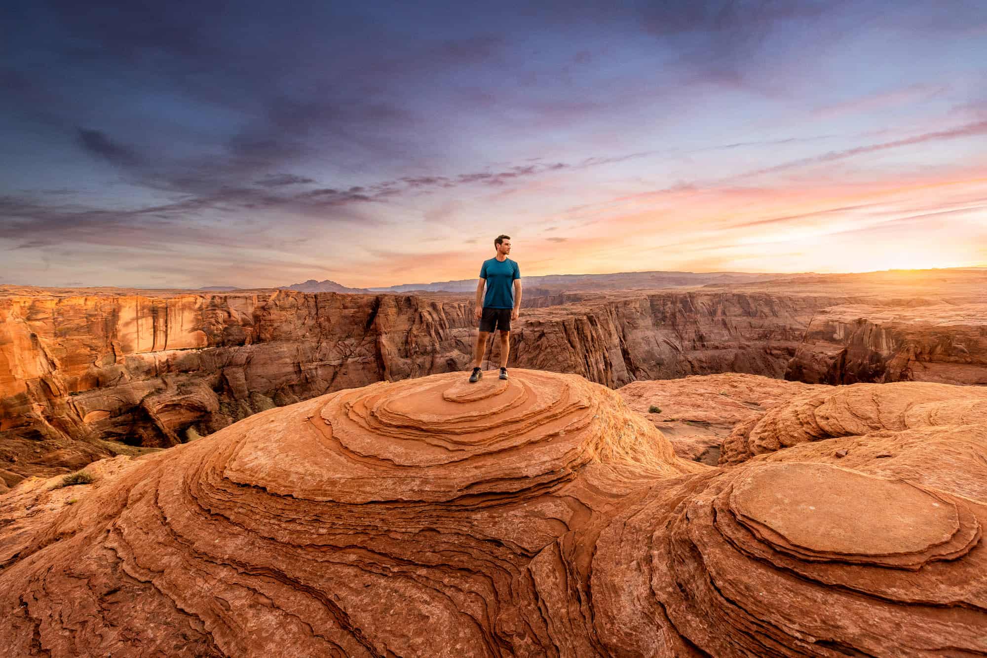
Another Top Attraction in Page: Horseshoe Bend
Horseshoe Bend is the Insta-famous bend in the Colorado River, which is just south of Page, AZ.
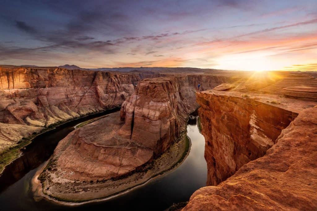
No permits or reservations are needed here. You’ll have to pay $10 to park in the lot (which is huge) a few miles south of town.
The path to get from the parking lot to the Horseshoe Bend overlook is less than a mile, and mostly flat (though hot under the summer sun, so bring water).
➡️ I have much more information on visiting Horseshoe Bend in a separate post.
While the main overlook at Horseshoe Bend is very crowded, the crowd dissipates as you walk down the cliff.
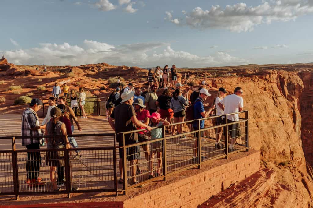
It’s much more enjoyable to make the extra effort to find your own rock to enjoy the view from, rather than stay bunched up on the viewing platform.
Sunset is the best time to go to Horseshoe Bend.
Getting to Page, AZ, to visit Horseshoe Bend
If you’re in the Southwest, you can take a tour from several cities to Horseshoe Bend for the day. Most of the options will also include a visit to one of the sections of Antelope Canyon. Click on an option below from whichever city you’re like:
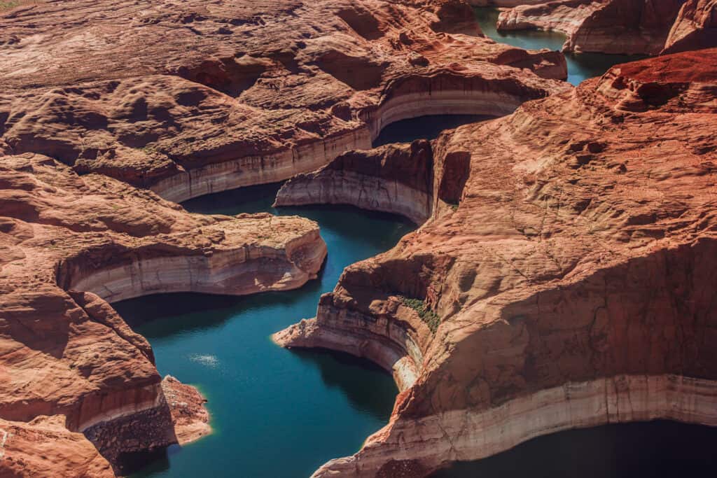
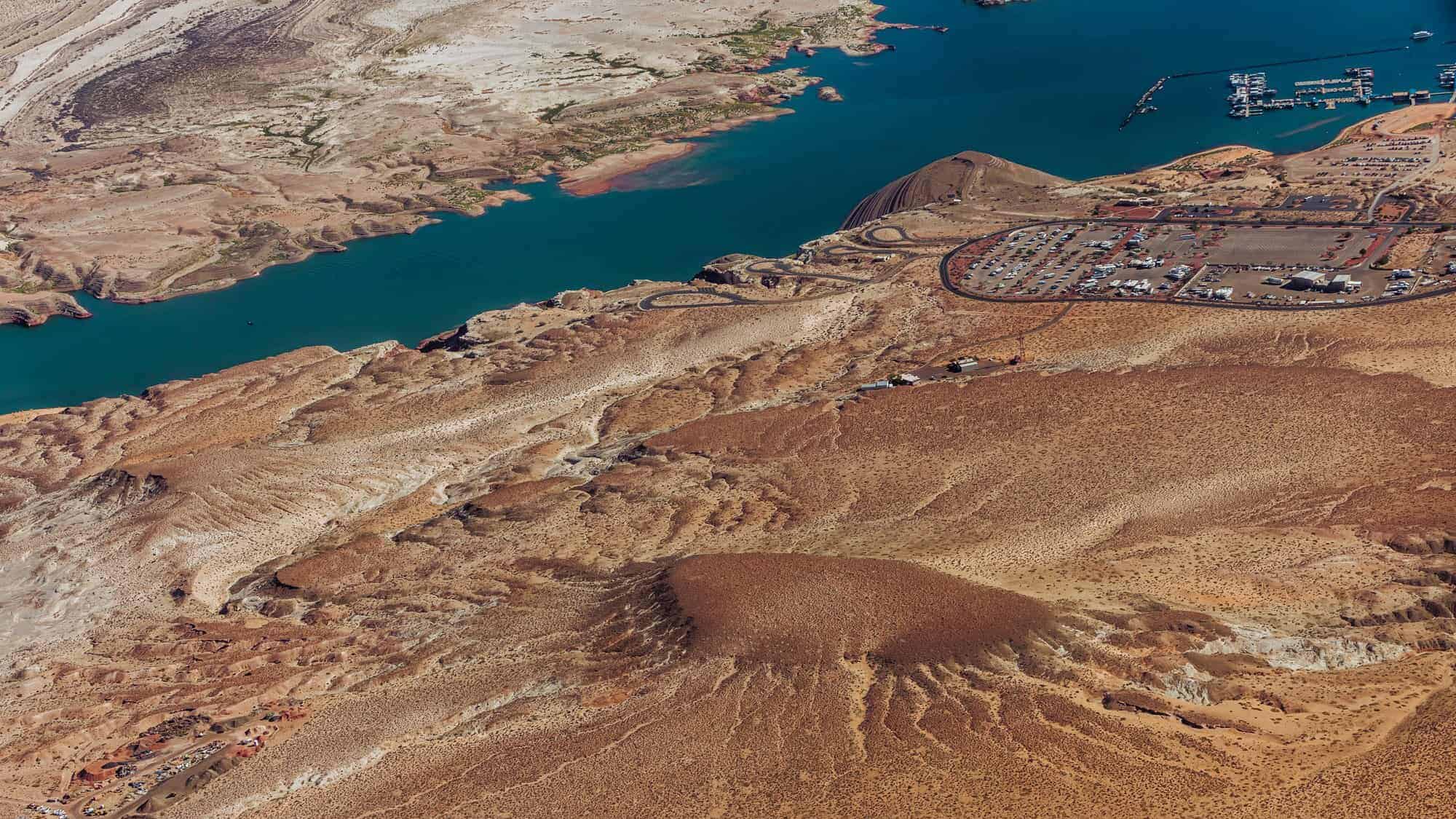
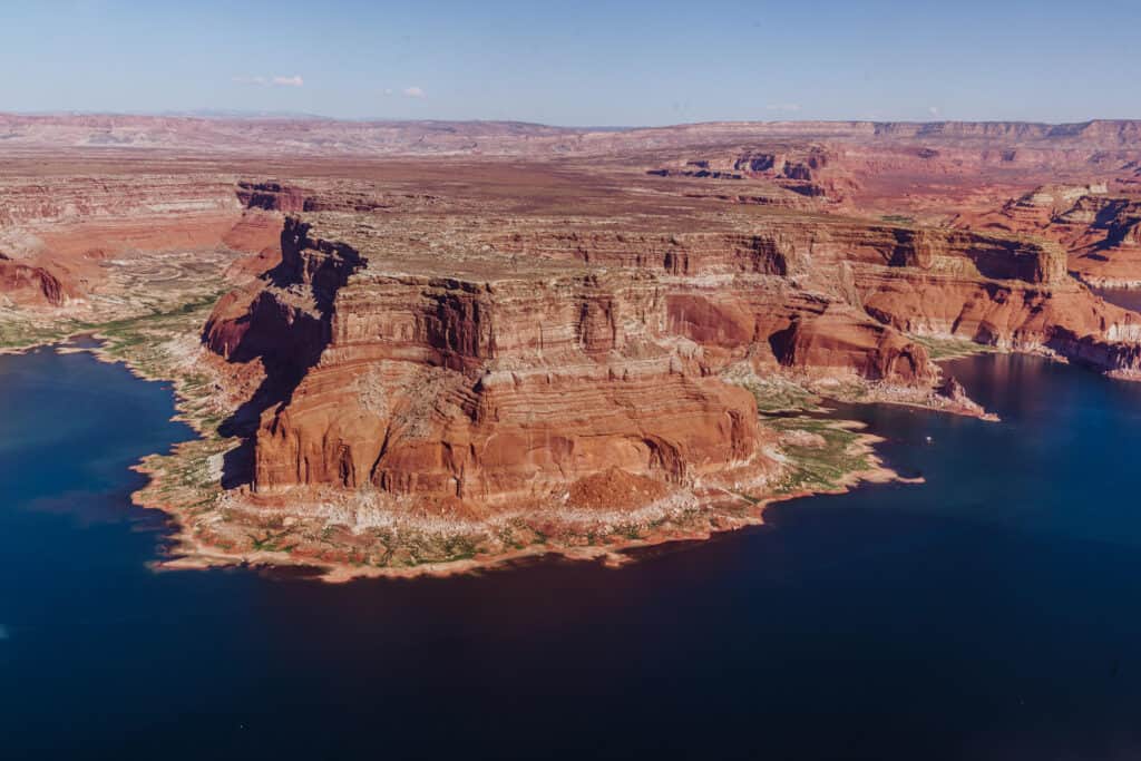
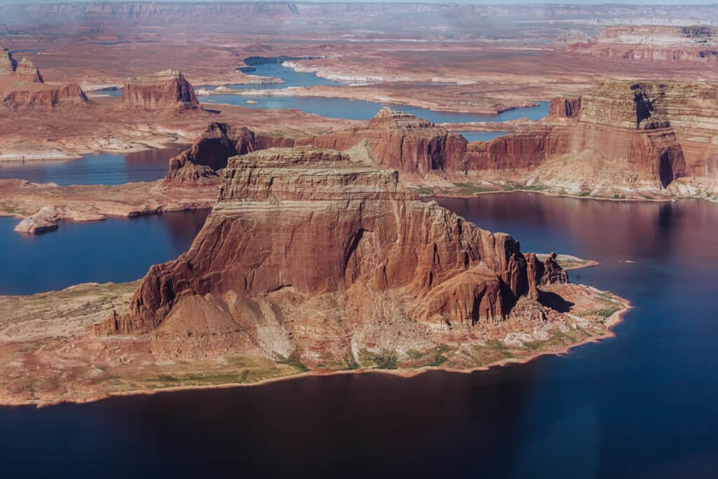
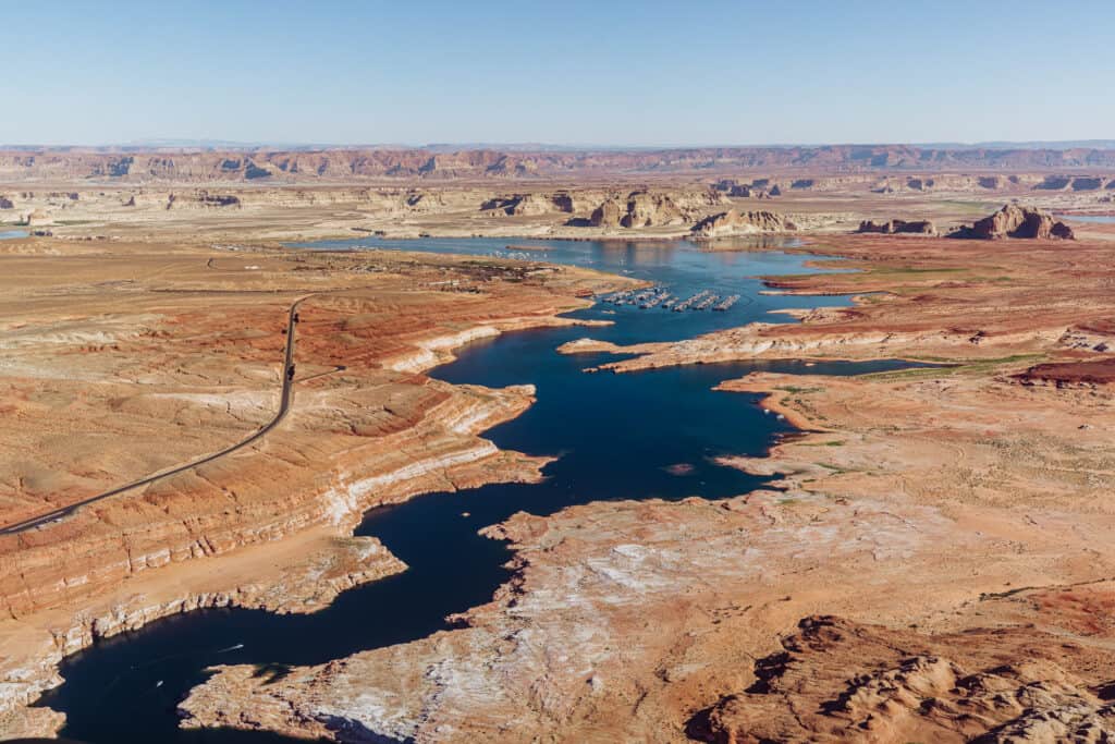
Explore Lake Powell
While Lake Powell’s water levels reached record lows in 2022, they bounced back a bit thanks to a strong snowpack in 2023. Still, it hasn’t been a consistent gain. Quite the opposite.
By the start of 2026, the water level at Lake Powell was down 31 feet from January of 2025.
The man-made reservoir is open for recreation, and features a variety of water sports and activities.
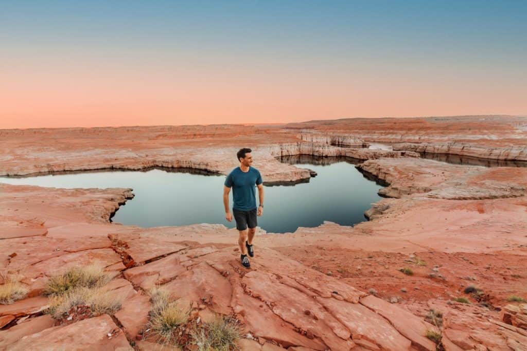
The Glen Canyon Dam created Lake Powell when it was completed in 1964, backing up the water flowing from the Colorado River. The lake is around 180-miles long, and lures up to 3-million people a year to the desert along the Arizona-Utah border.
The Glen Canyon National Recreation Center frequently updates its page with water levels and drought-related closures.
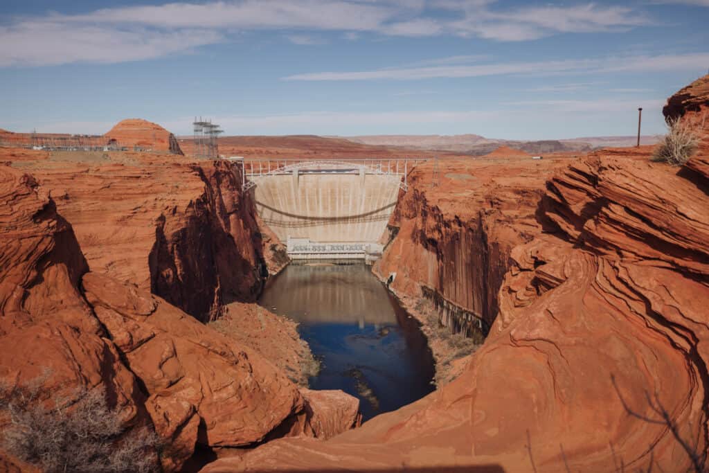
The Glen Canyon Dam
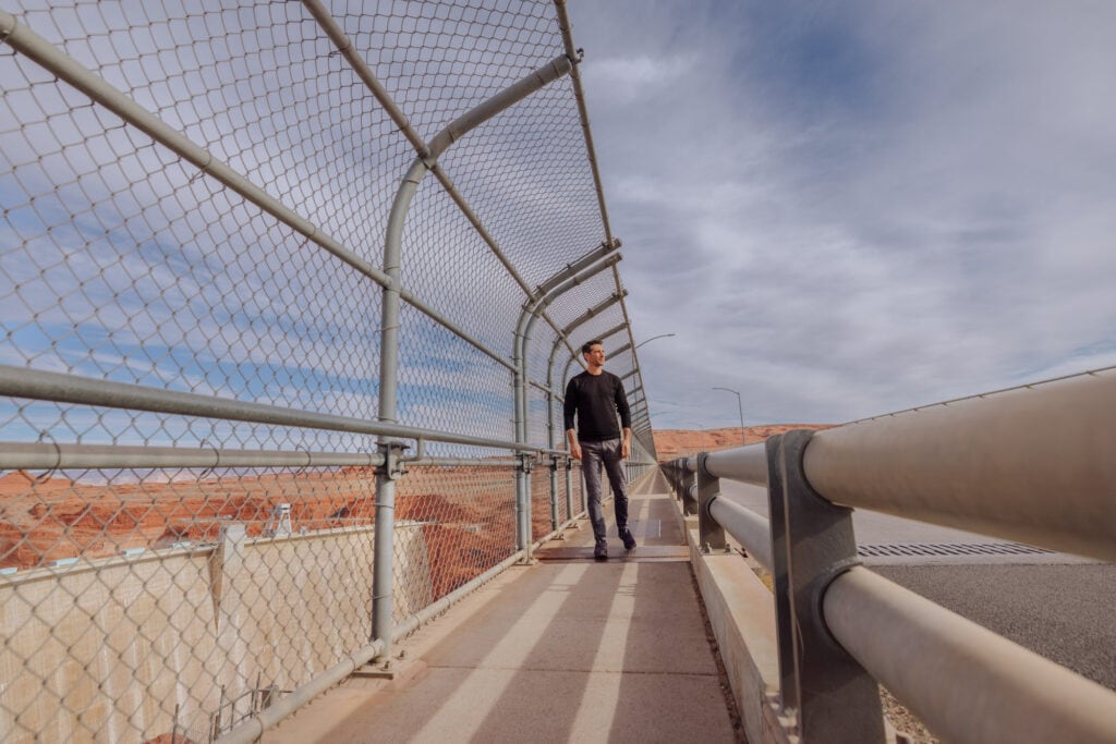
In Page, you’ll have no choice but to visit the Glen Canyon Dam. It’s right in town, and chances are: you’ll have to drive right over the bridge in front of it a few times!
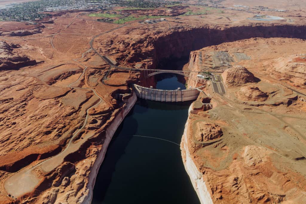
There are parking lots on either side of the dam to stop in, and you can walk across the pedestrian section of the bridge anytime.
Glen Canyon Dam Stats:
- 710 feet tall
- 1,560 feet across
- 25-feet thick at the crest
- 300 feet thick at the base
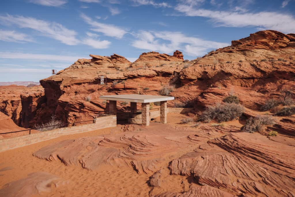
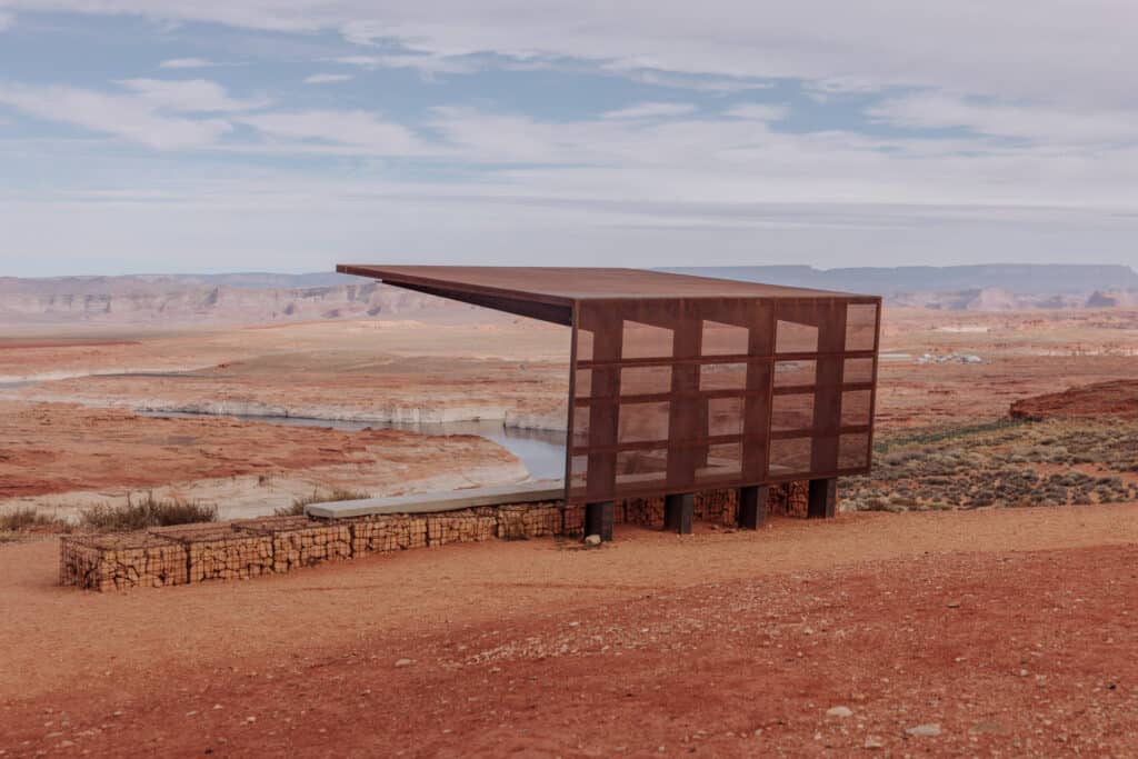
After walking across the dam, you can head to the Glen Canyon Dam Overlook for a great view of the immense structure. It’s a quarter-mile walk from the parking area, which is behind the Denny’s in Page, on Highway 89. It’s a good place for kids to roam around on rocks, too (behind where this photo was taken, of course- away from the cliffs).
Carl Hayden Visitor Center
The Carl Hayden Visitor Center is perched right at the top of the Glen Canyon Dam.
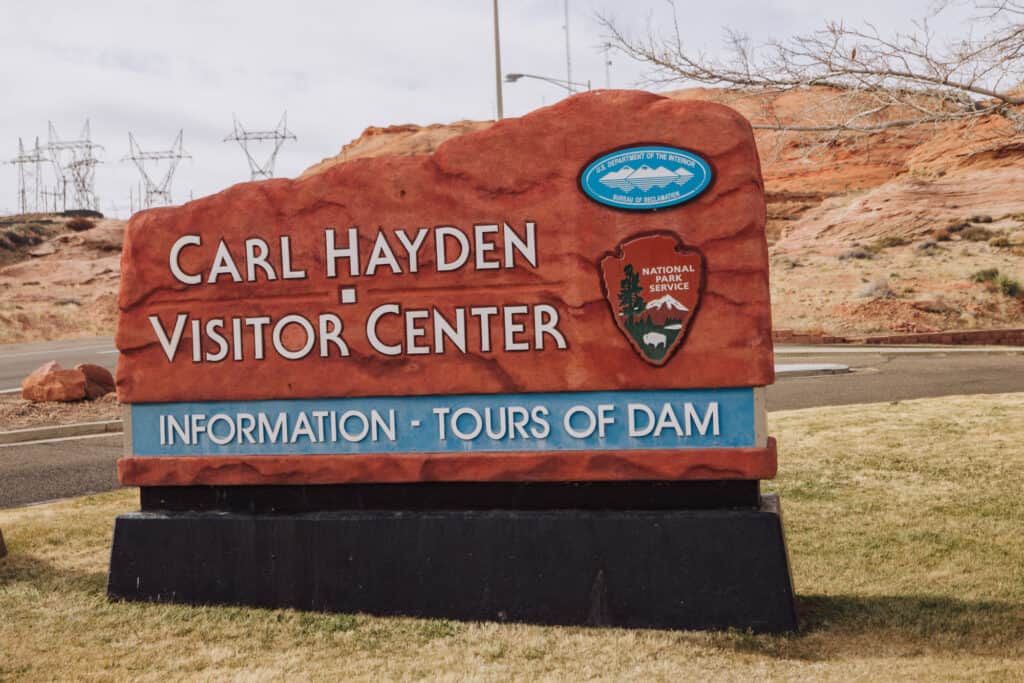
Hours vary during the summer and winter, but generally, the Carl Hayden Visitor Center is open from 8:00 am to 6:00 pm in the summer. Winter hours are slightly shorter, with the building open from 8:30 am to 4:30 pm.
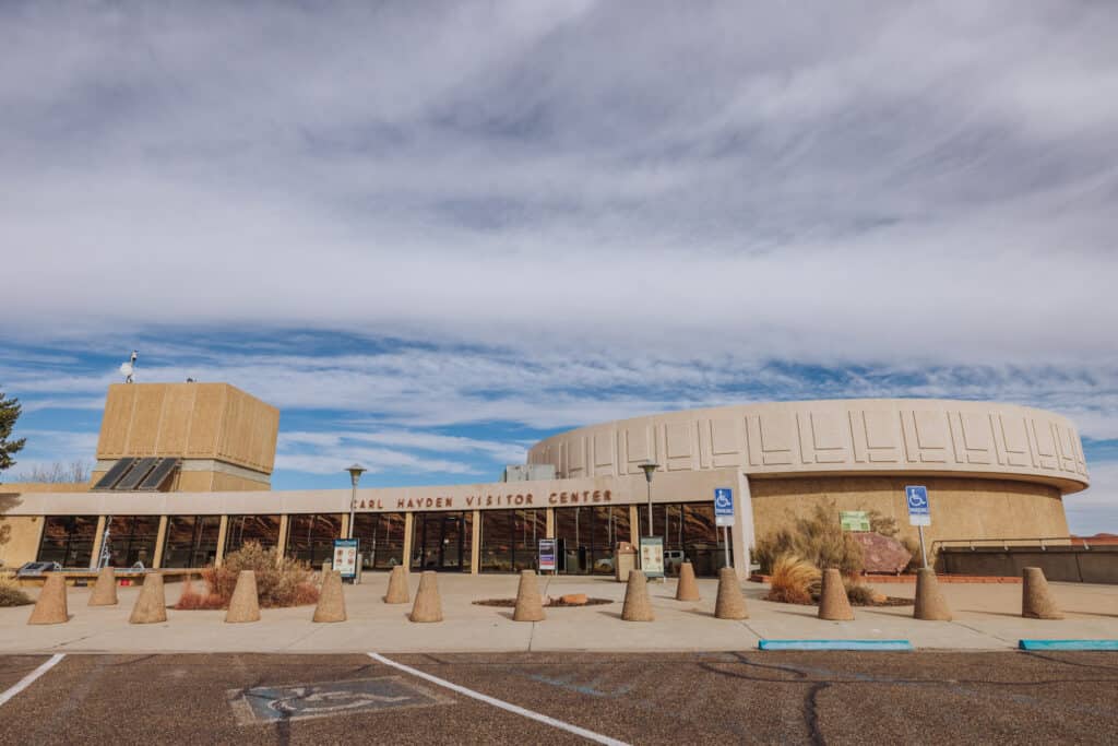
In addition to tours of the Glen Canyon Dam, the visitor center features exhibits and information on the project, and the hydroelectric power operation below.
Tours aren’t overly extensive, but they pack a lot of information into the 45 minutes. Reservations are first-come, first-served. You can reserve a spot with a guide up to 24 hours in advance at the Carl Hayden Visitor Center itself.
📞 Carl Hayden / Glen Canyon Tour: 928-608-6072
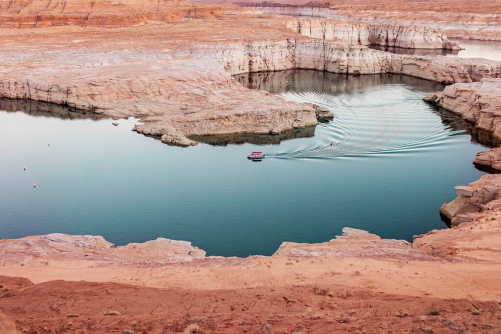
Lake Powell Boat Tours
A variety of companies based in Page offer boat tours on Lake Powell. Most of them will take you to Antelope Canyon or Navajo Canyon.
➡️ Click for Tour: Boating on Lake Powell
The Page-Lake Powell Hub, which is part of the Page Chamber of Commerce, has a guide to boating options. In the drought, during different times of the year some parts of the marinas and several of the boat ramps have been forced to close.
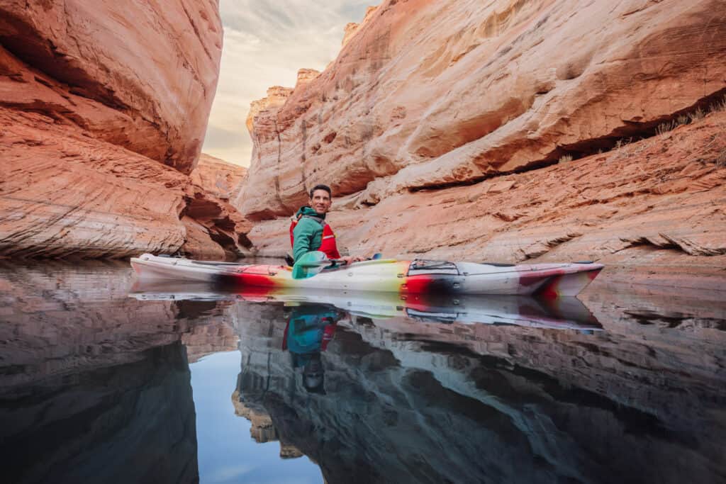
Lake Powell Kayak Tours
Kayaks are a great way to explore the ever-changing coves of Lake Powell. We went out with Lake Powell Paddleboards through Lake Powell into Antelope Canyon.
You can also go kayaking on the Colorado River, below the Glen Canyon Dam. The flow is pretty even, making for a relaxing journey. While you can paddle upstream and float back down, you can also hire a guide to bring you up.
Lake Powell Fishing
Lake Powell is full of walleye, small and largemouth bass, crappies and bluegills. You can fish from the 2,000 miles of shoreline, or rent a boat and head out to deeper water.
Again, The Hub has a list of great fishing options in their guide to Lake Powell.
The National Park Service also has a list of recommendations:
- Ambassador Guide Services: ambassadorguides.com
- Lake Powell Guide Services: lakepowellguideservices.com
- Lees Ferry On the Fly: leesferryonthefly.com
- Outdoor Adventure Rentals: outdooradventurerentals.com
- Up Lake Adventures: uplakeadventures.com
Colorado River Fishing: Trout harvest
The Colorado River, south of the Glen Canyon Dam, has an over-population of brown trout. They’re considered predators, and are eating two kinds of endangered, native fish species: the razorback suckers and the humpback chubs.
So, for the next few years, visitors have the opportunity to earn $25 (or more) per brown trout that they catch and remove from this part of the Colorado River. You can check the National Park Service’s “Brown Trout Incentivized Harvest” website for more information on how to take part.
Lake Powell Houseboats
A Lake Powell Houseboat vacation is still on my “must do” list in Arizona. They’re not inexpensive, but they’ll fit quite a few people onboard. As an example, Antelope Point’s smallest boat starts at $1,200 per day and sleeps 10 people. Their largest boat sleeps 14 and is $2,900 per day.
More affordable options can be found right at the Wahweap Marina in Page. Some of their houseboat options are $2,500 for 5 days.
Aerial & Helicopter Tours
Page has its own airport, which is home to a few different helicopter and fixed-wing tour companies. They’ll take you flying around the area to see the attractions around Page from above!
➡️ Click to Book: Helicopter to Tower Butte
➡️ Click to Book: Helicopter to Horseshoe Bend
Tower Butte
If you fly into Page, you’ll likely see Tower Butte standing along Lake Powell. It’s a 1,000-foot-tall sandstone structure, 9 miles outside of Page.
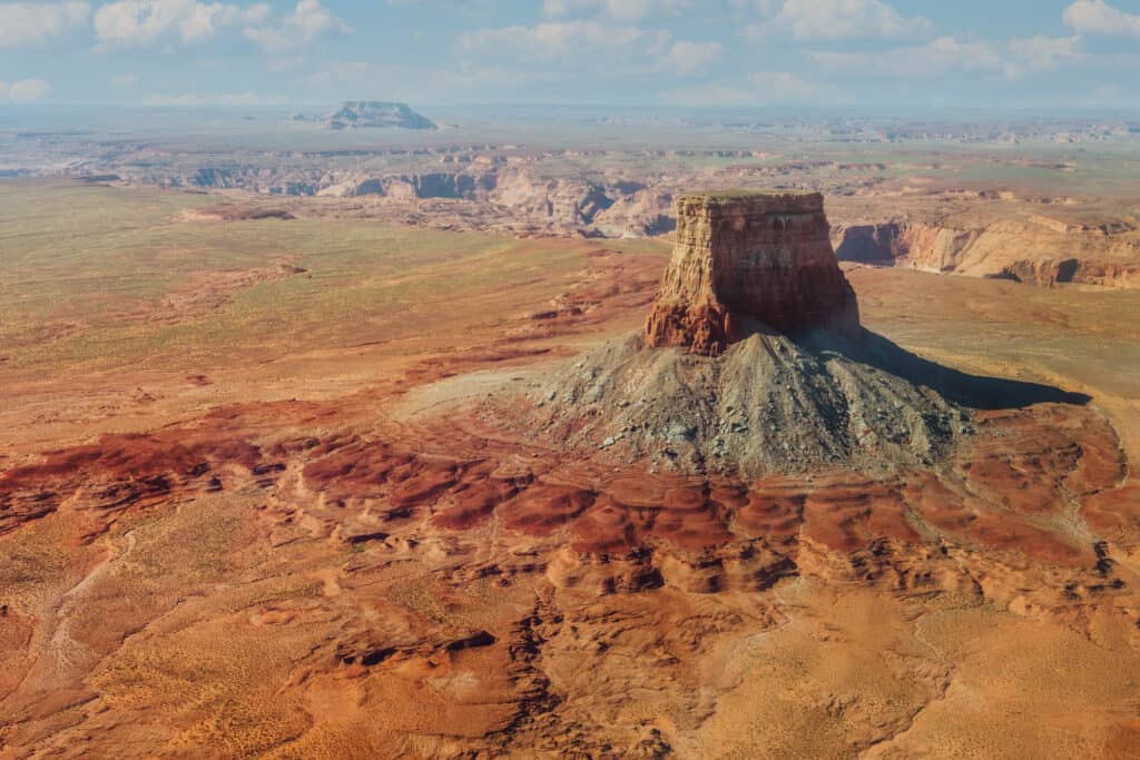
A few outfitters offer guided tours out to Tower Butte, including on horseback with Tower Butte Trailride.
Britney Spears recorded part of her video for “I’m not a Girl” from the top of Tower Butte.
Fly Over The Wave, Lake Powell, & More
American Aviation has a fleet of Cessnas, constantly taking off to bring visitors to sites from Horseshoe Bend to The Wave to Tower Butte.
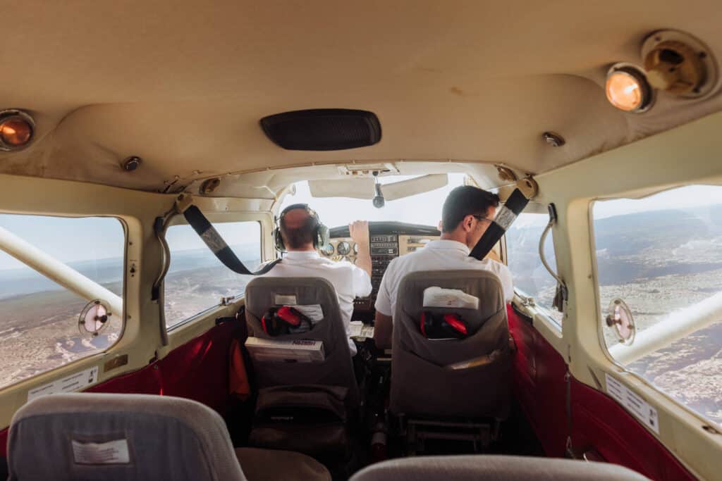
Adding to the flight experience, the pilot was able to take us down low enough that we were basically flying through part of the Grand Canyon.
The FAA only grants a few of the low-flying permits each day, so the hikers aren’t disturbed by loud air traffic constantly buzzing overhead.
Marble Canyon is the name given to a large area of the Colorado River from Lees Ferry north to the beginning of the Grand Canyon. We flew over it as part of our aerial tour (see below). It marks the western boundary of the Navajo Nation, and includes the famous Navajo Bridge, where Highway 89A crosses the Colorado River.
While there’s no marble in “Marble Canyon,” you can see how the colorful rocks gave it its name.
While it’s very difficult to get a permit to hike to The Wave, you can fly over it as part of this tour.
Hiking: My Favorite Thing to Do in Page, AZ
Hiking in this part of Northern Arizona is what first lured me up here years ago. You can find great trails with jaw-dropping desert landscape views at trailheads right in Page, and many more outside town.
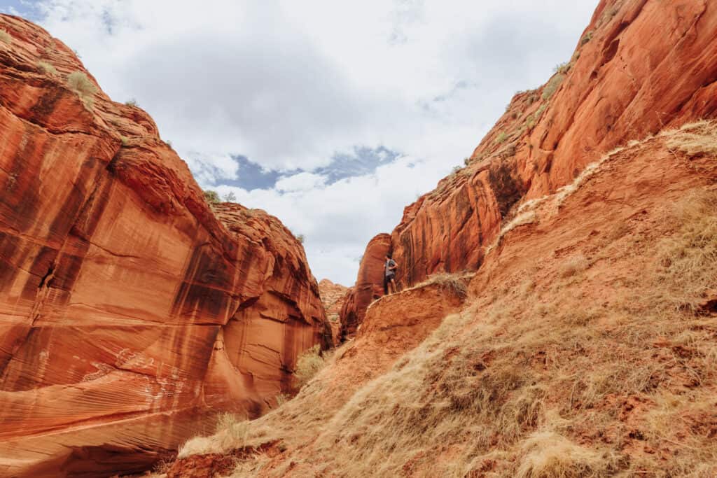
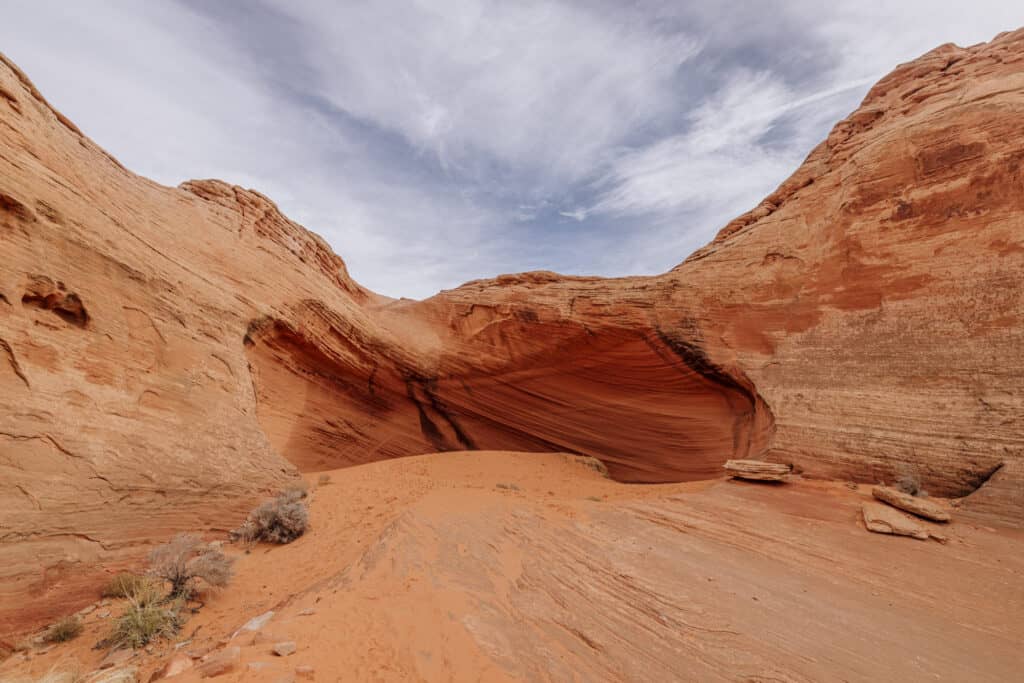
Wire Pass to Buckskin Gulch
Wire Pass to Buckskin Gulch will always be a favorite. The key here is to *not* go to drive the Buckskin Gulch trailhead on the map, but rather to the Wire Pass trailhead. I go in-depth on Wire Pass on this blog:
🌎 Jared’s Detours Blog: Alternatives to the Wave
Off Highway 89, between Page and Kanab, you’ll take a bumpy drive down House Rock Valley Road. While an SUV is best, cars can make it if the road’s been leveled recently. The $6 fee can be paid in an envelope right at the Wire Pass trailhead.
It’s a short, enjoyable hike through the desert to a stunning slot canyon. Just be wary of the weather during the summer monsoon season. This area is notorious for dangerous flash flooding.
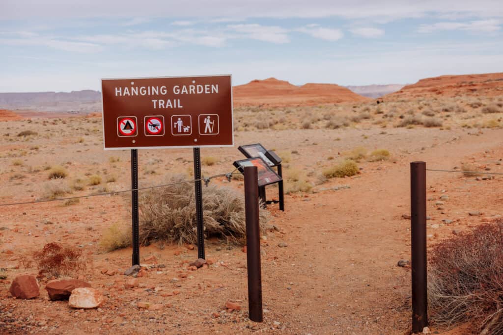
Hanging Gardens Trail
The Hanging Gardens Trail is home to a unique lush landscape in the desert, fed by springs.
The trail itself is about a mile-and-a-half, and pretty easy to hike. The trailhead is just northwest of Page, between the city and the dam. You can checkout the map here.
You’ll find “hanging gardens,” which are plants, rooted in the wall of a cliff. It’s unique, for sure, and worth the short hike if you’re in Page.
Waterhole canyon
Waterhole Canyon is a slot canyon a few miles south of Page. This is one, similar to Antelope Canyon, where you’ll need to hire a Navajo Guide. There are a few tour options, including Waterhole Canyon Experience, which offers both a hiking tour and a photography tour.
Cathedral Wash Trailhead
Cathedral Wash is a good hike to do if you’re heading to Lees Ferry, south of Page. You’ll find it on this map, right after you cross the Colorado River on Highway 89A.
Cathedral Wash is a mostly dry rocky route to the Colorado River. It’s named after the cathedral-like rock at the end of the canyon. The trail is about 3-miles, and is part of the Glen Canyon National Recreation Area.
Lees Ferry Spencer Overlook Trail
The Spencer Trail in Lees Ferry is a historic route, dating back more than a century. It was developed as a trail for mules to use in gold mining operations in the early 1900s.
While “as the crow flies” the trail is very close to Page, you’ll have to drive way out of the way to get to the trailhead. Heading south on Highway 89, you’ll cross onto Highway 89A in Bitter Springs, and head north across the river to Lees Ferry.
It’s best to avoid hiking the Spencer Trail in the heat of the summer, which is between four and five miles, round trip. For the trailhead, head to the Lees Ferry boat launch and look for the start of the River Trail, which will lead you to the Spencer Trail.
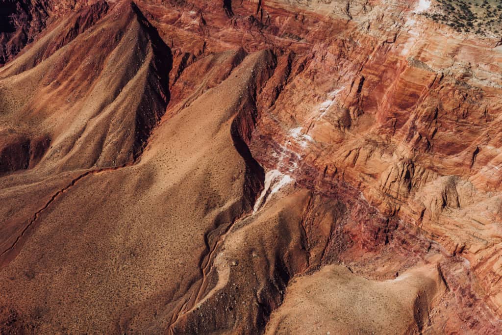
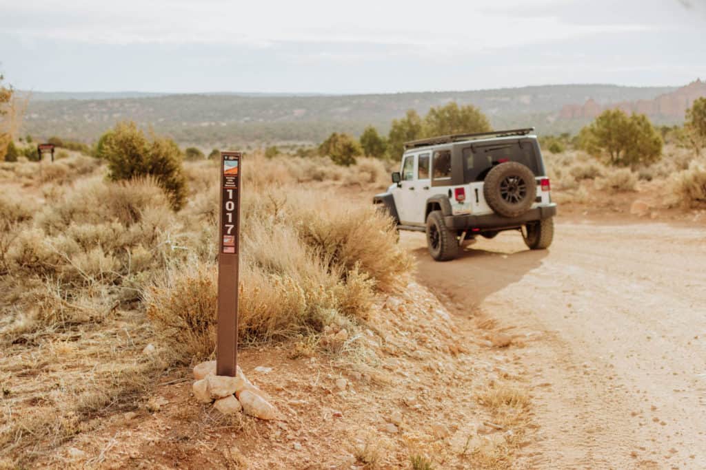
4×4 Adventures Around Page
Page is a great base for adventures into the Arizona/Utah desert. These destinations are unique to this region, and require four-wheel-drive vehicle to get there. We’ve had good luck several times renting a Jeep with JeebBnB. You’ll pick it up right in Page.
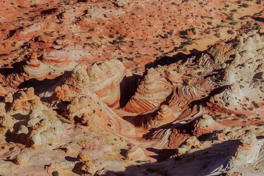
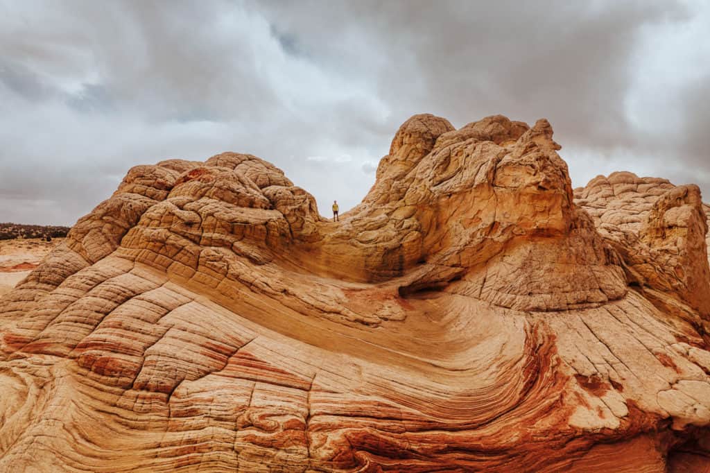
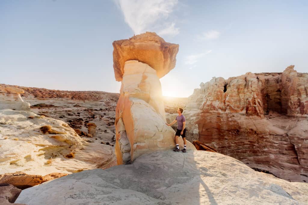
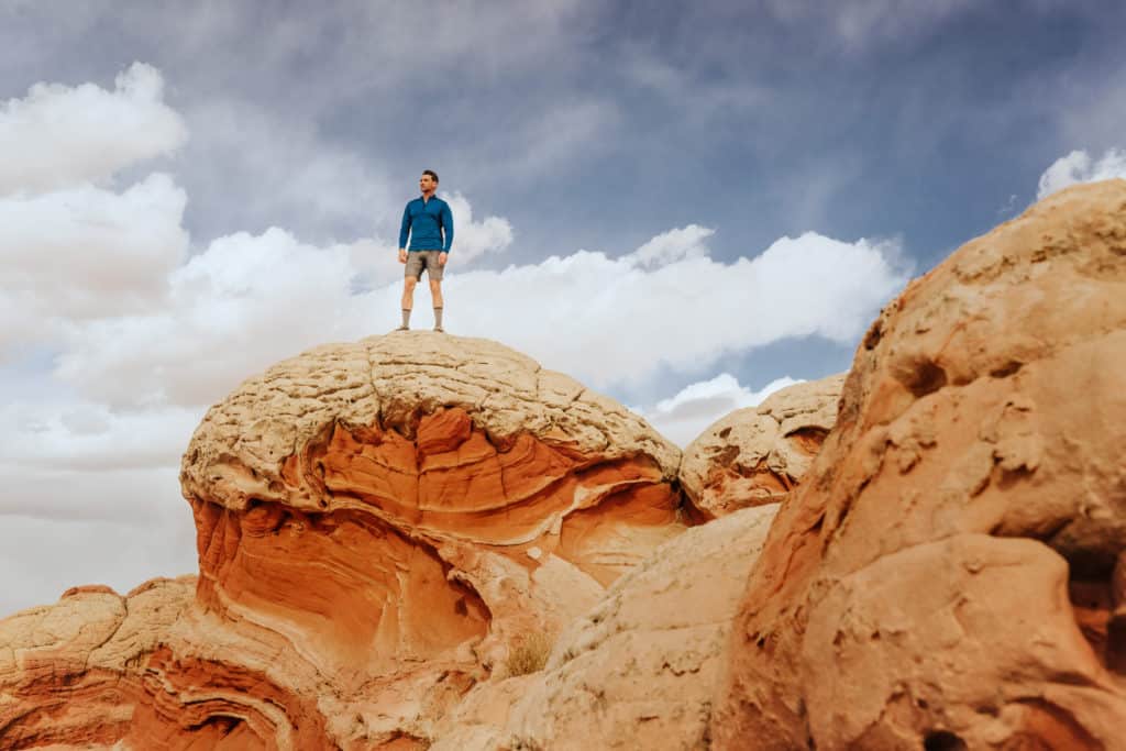
White Pocket
White Pocket is probably my favorite site I’ve gone to see from Page. It takes some effort to get there, but is truly unlike anything I’ve seen.
➡️ Book a Tour: White Pocket & Vermillion Cliffs
I have a whole other post about it here: Jared’s Detours Blog: Guide to White Pocket, Arizona
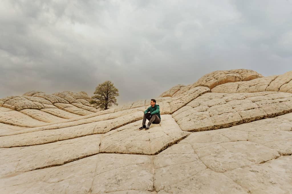
White Pocket is a geological wonder in a remote part of the Vermilion Cliffs National Monument.
Bright red, orange, and yellow sandstone is covered by a layer of a whitish-grey sandstone. The patterns and coloration have been described as everything from brains, to something from the board game Candyland, to strips of bacon.
It’s remote, and requires a 4×4 SUV or truck to get through the sand traps on the way, but if you’re up for an adventure, I’d definitely choose White Pocket!
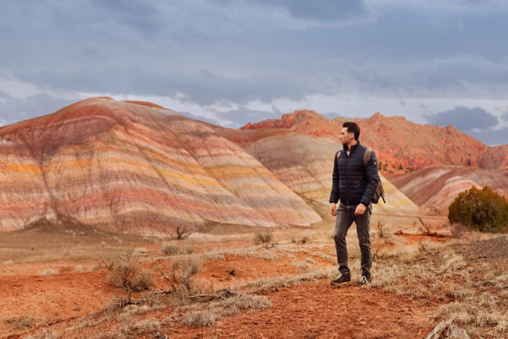
Rainbow Valley
While Utah is famous for its rainbow hills, Northern Arizona has its own set! You’ll find these on the Rock House Valley Road, on the way to The Wave and White Pocket. It’s barely even on any maps or guides, and you’ll feel like you’re trespassing to get there.
Click here for the map to the trailhead, which is south of the Wire Pass Trailhead. The rainbow mountains you’ll find here can easily be combined with a visit to Wire Pass! You’ll follow a dry wash toward the rainbow mountains, which are visible from the road. You’ll likely be the only ones there!
The Wave
I’ll be honest: I’ve never been to The Wave! I’ve spent a lot of money, registering for the BLM’s lottery. I landed a permit just once over the years, but couldn’t make the timing work with my job.
The rules to enter are strict, and only a handful of people get to hike each day. I go over all of the rules and ways to enter in a separate blog post: Winning a Permit to The Wave
The only way I’ve been able to see The Wave is from above, during our aerial tour!
I do know: it’s not worth trying to do the hike without a permit. You’ll face a fine, and a ranger is almost always monitoring hikers and their passes. My advice is: If you’re going to Page, apply for a permit to The Wave (as long as you have 4×4 transportation) and be prepared with backup plans if you don’t win. I have a full list of Alternatives to The Wave and Hikes Near Page, AZ.
Alstrom Point
Alstrom Point is very close to Page, “as the crow flies,” but it takes some effort to get to this gorgeous spot. It’s a great place for camping. I’d love to wake up to the sunrise here.
You’ll be perched on a cliff, overlooking Lake Powell and the canyon below.
The drive from Page is only 40 miles, but it’ll take between an hour-and-a-half and two-hours to get there. We had an SUV, which was helpful, but it didn’t have 4-wheel-drive. So we ended up parking at one point and walking quite a ways to the cliff.

Skylight Arch
Skylight Arch was never a great “draw” in my mind… until I actually went there. It was too close to Page, or something, to seem exciting. The truth is: the views are stunning, and it’s a great spot to visit! Click here for a map to the trailhead, which is a half-hour drive (14 miles) from Page.
You might be able to get there in an SUV without 4×4, but I’d recommend four-wheel-drive for this trip. It’s just a few miles outside Page, but the terrain is really rocky. After parking in a small lot at the end of the trail, you’ll have to walk about a mile to get to the rock arch. You’ll love the views of Lake Powell and the mountains in the distance. It’s especially pretty at sunset!
Stud Horse Point
Stud Horse Point is a stop you’d make on the drive toward Skylight Arch. Again, while you could make it in an SUV, I’d definitely recommend four-wheel-drive.
Click here for a map to the parking spot. From there, it’s a quick (but steep) walk down toward the hoodoos. I have to say: Stud Horse Point surpassed expectations. The rock formations are inexplicable and fascinating!
Attractions in Page, Arizona for Kids & Families
Many of the activities above are good for kids, including Antelope Canyon, but I’ll add a few more ideas in this section.
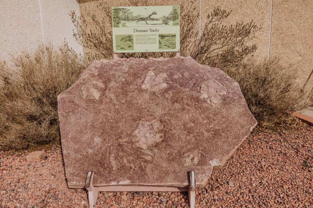
Dinosaur Tracks
There’s a slab of rock with dinosaur tracks on display at the Carl Hayden Visitor Center by the Glen Canyon Dam.
The prints were made by a 20-foot long dilophosaurus 170 million years ago when the desert was a marshy plain.
Easy Hikes
Behind the Shell station (at the corner of Highway 98 and Coppermine) you can hike easily through the sandy trail to cool rock formations and a cave.
Glen Canyon Dam Overlook
Another good spot for kids to roam around the rocks is at the Glen Canyon Dam Overlook (behind the Denny’s). I mentioned it up above, but will repeat it in this section.
I think kids would enjoy hobbling down the rocky trail to the overlook, and there are plenty of climbing spots that are kid-friendly (and not close to the edge) by the overlook.
Sunsets in Page
You’ll have several options to catch an iconic Arizona sunset around Page! I’ll suggest my favorites here.
Wahweap Overlook
The Wahweap Overlook is a couple miles northwest of Page. It’s easy to get to, and you’ll find a parking lot overlooking Lake Powell and the Wahweap Marina down below. The overlook is on the western cliffs of the lake (and the sun sets west of that spot). You won’t get a fiery, dramatic Arizona sunset here, but you’ll still get a gorgeous glow, with a background that will look like a painting.

Grandview Overlook
The overlook is on the north edge of town, and provides panoramic views of the surrounding desert and Lake Powell. It’s a great spot to watch sunset or sunrise.
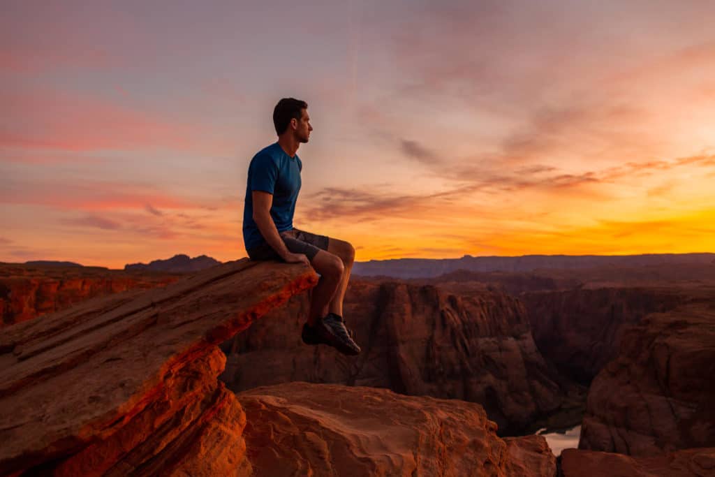
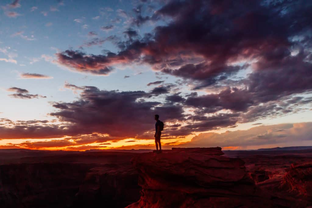
Horseshoe Bend
Horseshoe Bend is (perhaps 🤔) my favorite sunset spot in Page. The sun will set in the west, beyond the iconic bend in the Colorado River.
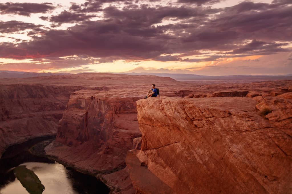
The key here is to wait until sunset for photos. Use the glow of the sun’s final moments of the day. If it’s cloudy, it’ll be much easier. Cloud cover delivers nice, even lighting for photos. Shooting there in the bright sunshine, especially toward the end of the day, will create back-lit photos with harsh shadows on your faces.
Plus, getting there early and migrating down the cliffs away from the crowd, will lead to much nicer pictures.
From Page to the Grand Canyon or Zion
While the Grand Canyon isn’t close to Page, if you’re coming from afar, you might as well go the extra mile (or couple of hours) to go see it!
Page to the South Rim of the Canyon
The South Rim is, by far, the most popular spot on the Grand Canyon. The National Park Service says 90% of travelers visit the South Rim, which is open 24 hours a day, 365 days a year.
The drive from Page to the South Rim of the Grand Canyon will take about two-and-a-half hours. It’s about 150 miles.
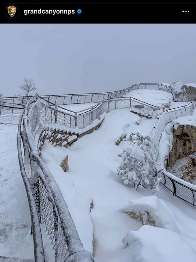
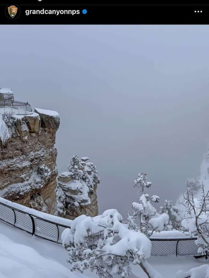
While November through February see much lighter traffic, in terms of visitors, you’ll have to check the weather. The Grand Canyon is notorious for white-out snowstorms, which can be beautiful, but a major hassle. The NPS Instagram and Twitter accounts do a great job keeping the public updated on snow and weather conditions.
Page to the North Rim of the Canyon
The North Rim is considered “the rim less traveled” when it comes to the Grand Canyon, but the experience is just as spectacular, from mid-May through November. It takes about two-and-a-half hours to get from Page to the North Rim’s Visitor Center.
You’ll take Highway 89, to Highway 89A, which snakes around beautiful Marble Canyon. Then you’ll head south on Highway 67, across the Kaibab Plateau to the North Rim. Highway 67 is only open seasonally.
The North Rim of the Grand Canyon closes through the winter each year, from December through mid-May.
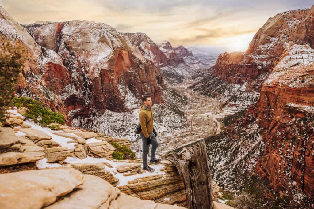
Page to Zion National Park
Zion National Park’s beauty has become even more well-known over the years. From Page, it’s less than a two-hour drive west, along Highway 89, to Highway 9 (West). The route takes you through Kanab, Utah, to the ranger station at the East Entrance of Zion.
Page to Bryce Canyon National park
Bryce Canyon is another doable trip while based in Page. It’s about two-and-a-half hours from Page, along Highway 89, all the way up north through Hatch, Utah, into Bryce.
How to Get to Page, Arizona
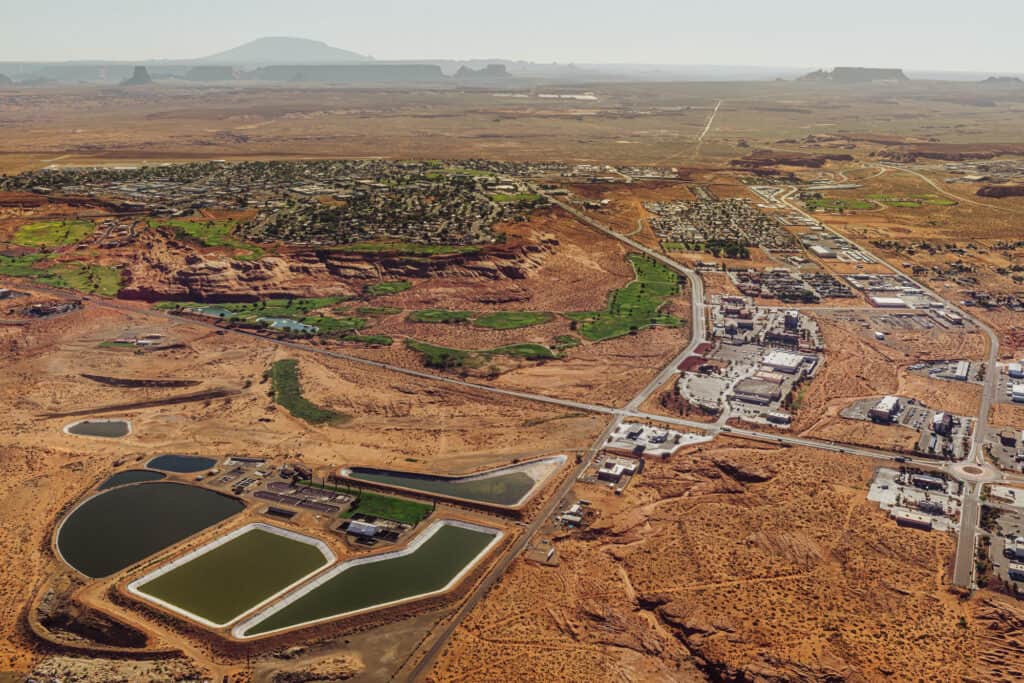
While many of the amazing natural wonders and things to do in Page, AZ, have been here for centuries, the city itself is relatively new.
Page is close to Arizona’s northern border with Utah, and really became a permanent community while the Glen Canyon Dam was being built between the mid-1950s and 1960s.
Airports Near Page, AZ
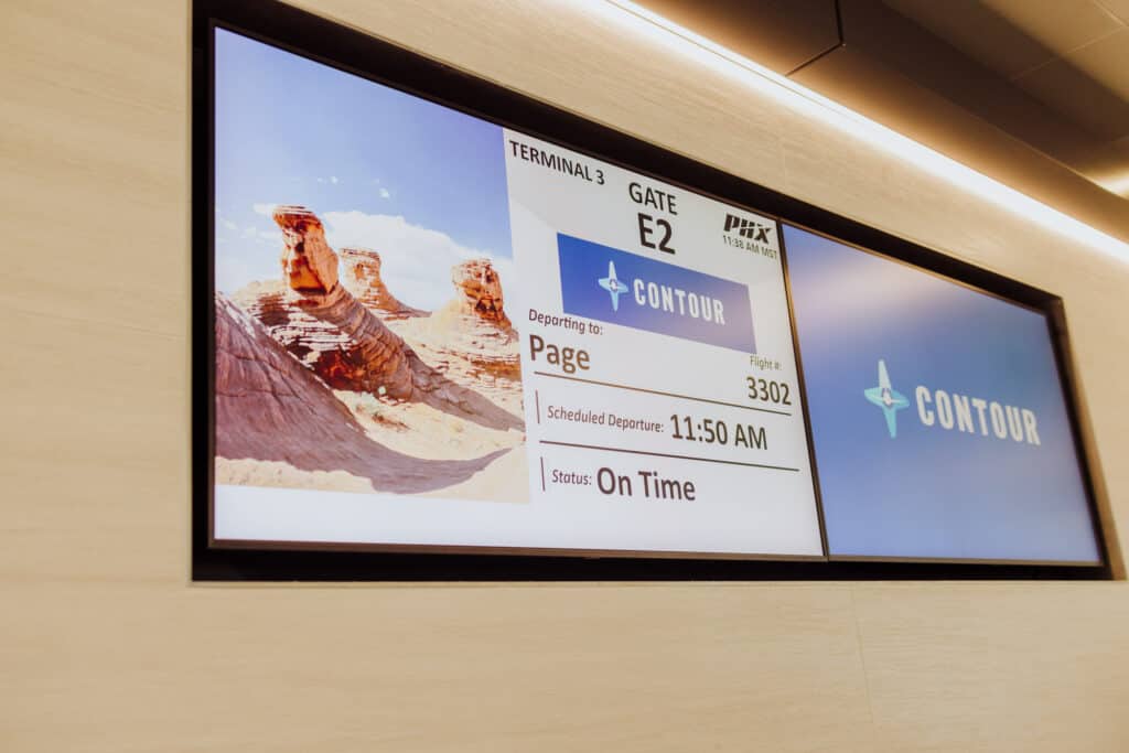
Page, Arizona, has its own airport! While it’s mostly tourism-based, it has a few commercial flights a day.
A small regional carrier, Contour Airlines, began flying 30-seat Embraer Regional Jets from Phoenix Sky Harbor to Page a few years ago. Depending on the day of the week (and the season) the jet will hop back and forth over Arizona a few times a day.
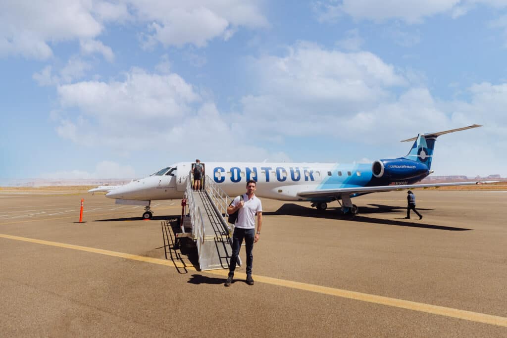
Contour operates out of Terminal 3 at Sky Harbor, and the flight itself is just about 40 minutes.

Depending on where you’re coming from, a flight into Flagstaff’s airport is an option, though it’ll still be a two-hour drive north to Page.
Alternatively, several airlines fly into St. George Utah. It’s 150 miles from St. George to Page, which will take about two-and-a-half hours to drive.
Renting a Car in Page
The airport is home to an Avis counter, with a very friendly and helpful staff. They’re quick to warn you, however, that their vehicles are *not* meant to be taken off-roading.

You can also find Jeep rental companies based in Page, but they’ll be pricey. Expect to pay north of $200 per day to rent a 4×4 Jeep here. We’ve rented from a couple of companies, including Jeep BnB.
Phoenix to Page, AZ
Driving up from Phoenix will take you a bit longer than four hours. It’s a straight-forward drive. You basically take Interstate 17 north for two hours to Flagstaff, and AZ State Highway 89 another two hours north to Page.
During the winter, you’ll want to be wary of the weather. An hour north of Phoenix, infamous for our hellishly-hot summers, you could find yourself in a blizzard between December and February!
You can also hire a driver to navigate and do all the work for you.
➡️ Book a Driver: Phoenix / Scottsdale to Page
Las Vegas to Page, AZ
Las Vegas will also be about a 4+ hour drive to Page. It’s around 270 miles. Taking Interstate 15 north and east into Utah is faster than heading down toward Kingman, AZ, and over.
Several tour guides will do the driving for you, if you’d prefer to relax and nap along the way.
FAQ: Attractions in Page, Arizona
Let’s tie up some loose ends, answering some of the frequently asked questions about Page, AZ.
When’s the Best Time to Visit Page?
I don’t have a firm answer on this, even though I’ve spent time in Page in all four seasons. Summer can be brutally hot, but if you’re camping, you’ll enjoy the nice cool evenings under the stars. I’d love to camp at White Pocket and Alstrom Point this summer!
If I was forced to choose, I’d vote for a trip to Page in April/early-May, or October.
What’s the Elevation of Page, Arizona?
Page sits at an elevation of 4300 feet, compared to:
- Flagstaff: 6,900 feet
- Sedona: 4,350 feet
- Prescott: 5,370 feet
- Phoenix: 1,100 feet
- Las Vegas: 2,000 feet
What’s the weather like in Page, AZ?
Page sees extreme heat in the summer, and freezing overnight lows in the winter.
An important thing to keep in mind if you’re visiting Page is the summer monsoon season. It usually begins in late June, and lasts through September. The monsoon system often brings strong storms up from the south, triggering flash flooding in the slot canyons. Antelope Canyon’s tour companies are strict about canceling tours if a storm is approaching.
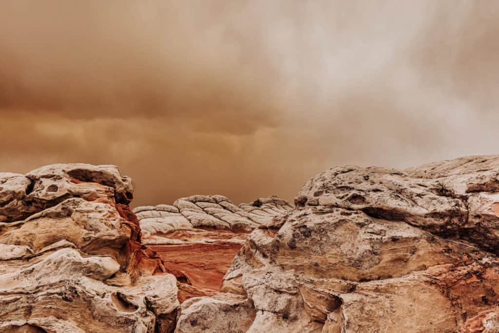
Plus, on day trips from Page, you’re likely to encounter varying weather conditions. On a trip to White Pocket in February, we were sweaty during the day while hiking around, but then freezing as we drove back to Page in a snowstorm at night.
This photo shows an incoming dust storm, which hit us before the snow at White Pocket:
What’s the Summer Weather Like in Page?
While monsoon storms can bring relief from the heat during the summer, you should be prepared for extreme summertime temperatures. More than once, we’ve been out hiking, *wishing* we’d brought much more water with us.
In the summer, while daytime highs can approach 100 degrees in Page, it tends to cool off nicely after sunset. Overnight lows usually dip into the lower 70s or upper 60s from June through August.
What’s the Winter Weather Like in Page?
December and January are the coldest months in Page. Daily high temperatures are in the mid-40s, and they dip below freezing into the upper 20s at night. By February, highs move up into the 50s.
Is Monument Valley near Page?
Monument Valley is 125-miles east of Page, AZ. The drive will take 2-hours.
Does it Snow in Page, AZ?
Yes! A few times a year, Page will be blanketed in snow. January of 2023 was an especially snowy month, with several inches accumulating during a few different storms.
The staff at Kens Tours (one of the Lower Antelope Canyon companies) do a good job of documenting storms on their Instagram account. The snowfall is very pretty against the canyon walls, and usually melts quickly.
Wrap: What is Page, AZ, Known For?
While Page grew as a city thanks to the influx of workers needed to build the Glen Canyon Dam, it developed into much more over the decades.
The Navajo Generating Station, a coal-fired power plant, was once the major employer and economic driver of this part of Arizona and the Navajo Nation. More than 500 jobs vanished when it closed in 2019.
Tourism is now an even more crucial part of the local economy in Page. The community seems focused on finding the right balance between luring crowds to the amazing sites in the area, and being good stewards to the natural beauty found here.
Check out some of the videos, exploring the sites around Page: