37 Hidden Gems in Arizona: Waterfalls, Hikes, and Natural Wonders

Arizona is full of beautiful hidden gems, beyond the Grand Canyon, Antelope Canyon, and Sedona, which are on bucket lists for people from around the world.
In a state known for its desert landscapes, people are surprised to find stunning waterfalls, summertime swimming holes, underground cave systems, and other natural wonders.
Let’s go through my favorite 25 hidden gems. They’re almost total unknowns for most people from out of state, and many will be new to native Arizonans, too!
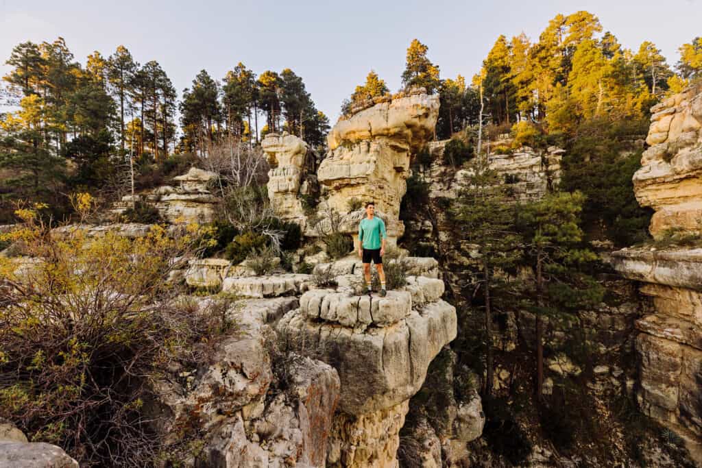
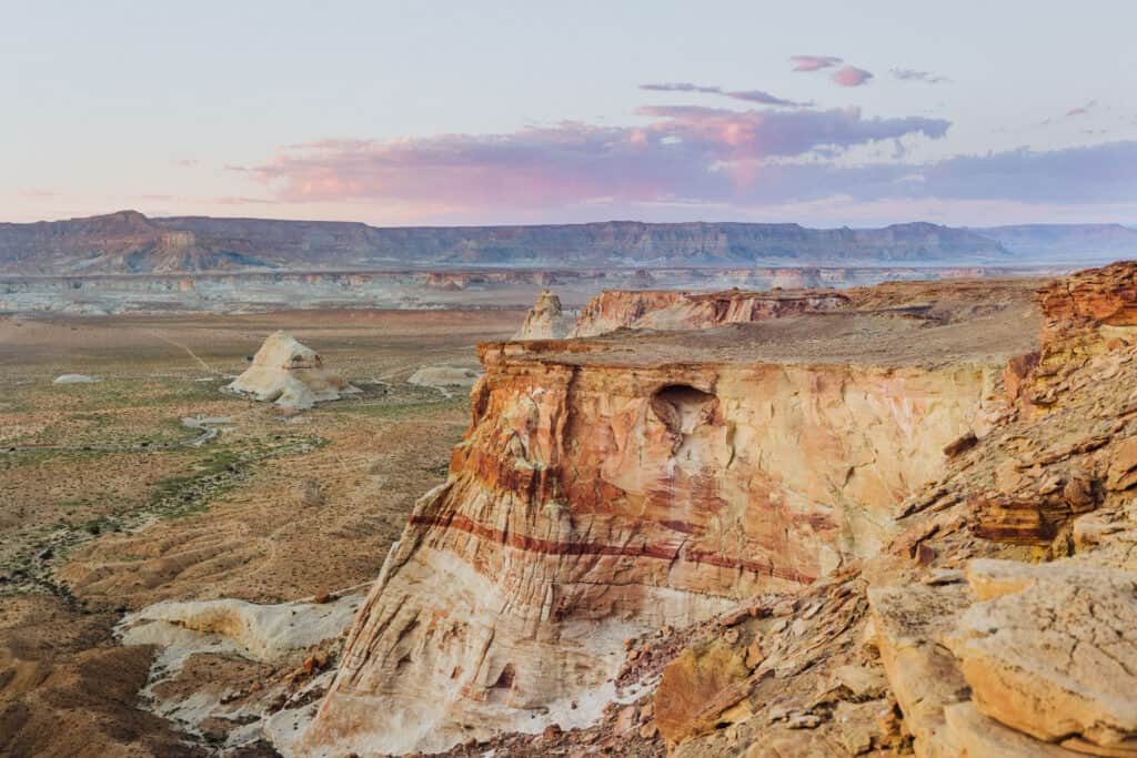
37. Blue Canyon & Coalmine Canyon
This otherworldly rock formation is the definition of “off-the-beaten-path.”
It’s known as Blue Canyon, and it’s near another stunning vista, called Coalmine Canyon.
This one requires an extra hoop to jump through: you can’t go on your own. It’s on Hopi land, so you’ll need a native guide to take you.
- Location: East of Tuba City, AZ
- Cost: We paid $120 for a guide
There are no services nearby, and the roads can be rough and confusing. Again, you’ll need to go with a guide, and there’s a list on the Hopi Tribe’s website or an official tour operator.
36. Walnut Canyon
Walnut Canyon is a National Monument east of Flagstaff, which is home to ancient cliff dwellings.
A civilization lived in a village, carved into rock walls 800 years ago.
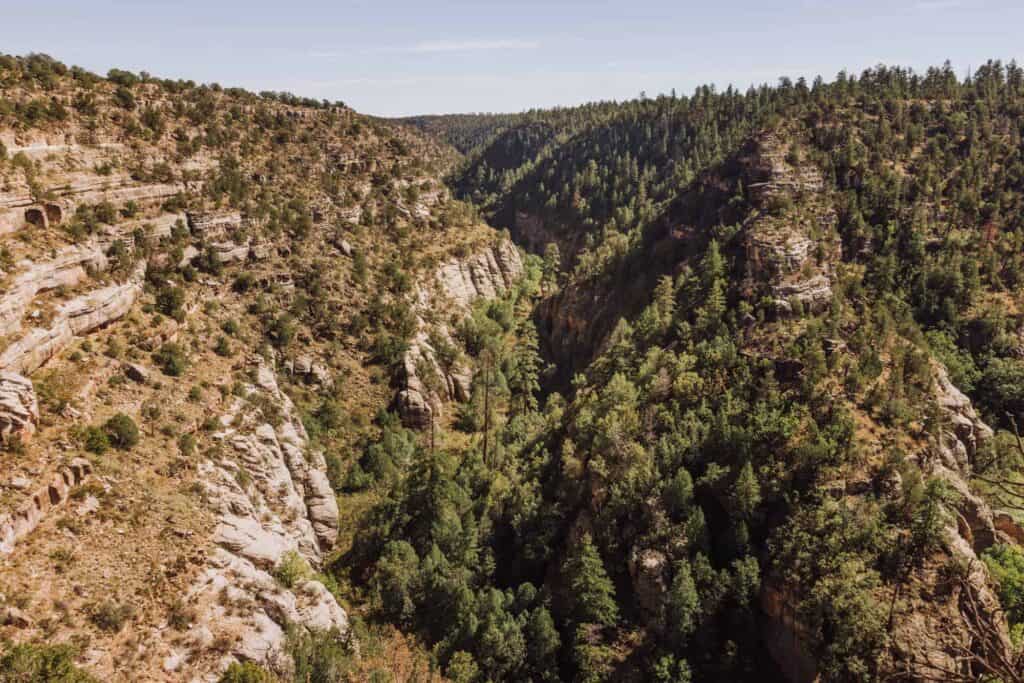
Today, visitors can view them from above, or take a steep hike down for an up-close look at ancient life in this rugged landscape.
- Location: 10 miles east of Flagstaff, off I-40
- Hours: Daily, 9:00am – 5:00pm
- Cost: $25 per car
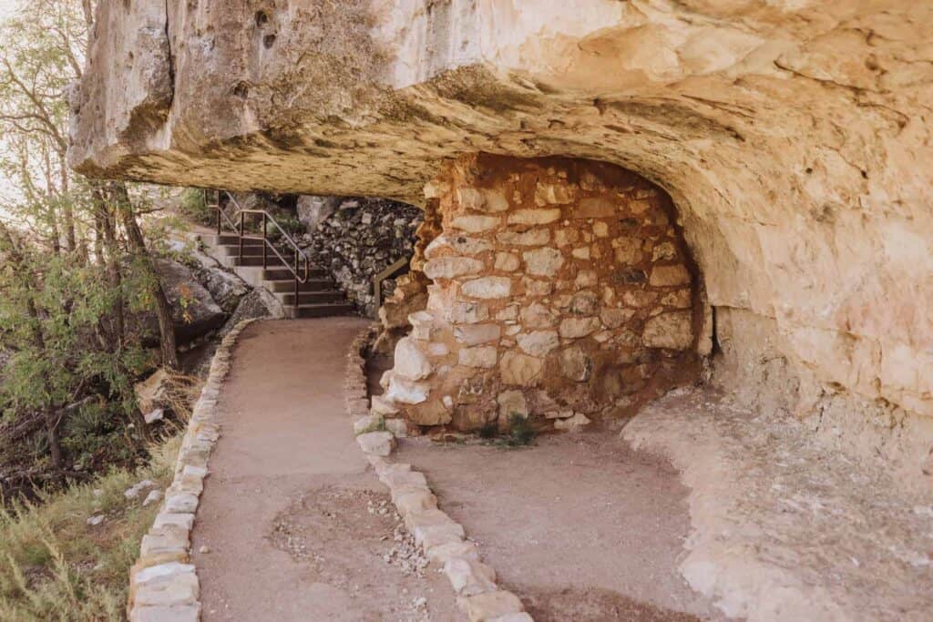
The Rim Trail at Walnut Canyon will take you along the edge of the canyon, while the Island Trail will take you down 200 steps into the cave dwellings.
35. Meteor Crater
Meteor Crater in Northern Arizona is one of the best-preserved meteorite impact sites on Earth, from a meteorite that hit 50,000 years ago.
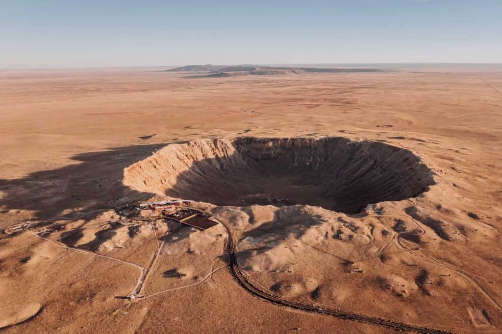
You’ll learn about the meteorite, and the site’s role in NASA history at the museum on site. The Apollo Astronauts all trained here.
- Location: Between Flagstaff and Winslow, off I-40
- Cost: $29 for adults, with discounts for seniors, kids, and veterans
New in 2026, they started offering hikes down into the crater for the first time! They’re limited, and you’ll have to book in advance.
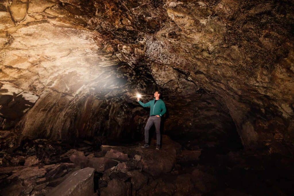
34. The Lava River Cave
You can explore a natural volcanic tunnel that runs under the Coconino National Forest.
The mile-long stretch was formed 700,000 years ago, when lava erupted from a volcanic vent nearby.
- Location: 20 miles from Flagstaff
- Cost: Free & no reservations or permits needed
- Access: The USFS roads to the site have to be plowed.
A reminder for the Lava River Cave (or “lava tube”): make sure you bring a flashlight!
33. Tonto Natural Bridge
Tonto Natural Bridge is an Arizona State Park near Payson, where visitors can hike under what’s said to be the world’s largest travertine bridge.
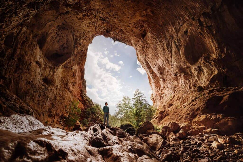
The park is great for avid hikers, families with kids, and seniors, because you can choose your own adventure and enjoy this natural wonder from different vantage points.
- Location: 20 miles NW of Payson
- Cost: $7 for adults, $4 for kids
- No reservations or permits needed
There are three main hiking trails, along with viewpoints for non-hikers. Plus, a shorter side trail leads down to a chilly, mossy waterfall.
If you get there first thing in the morning, you’re likely to see the resident javelinas feasting on the lawns!
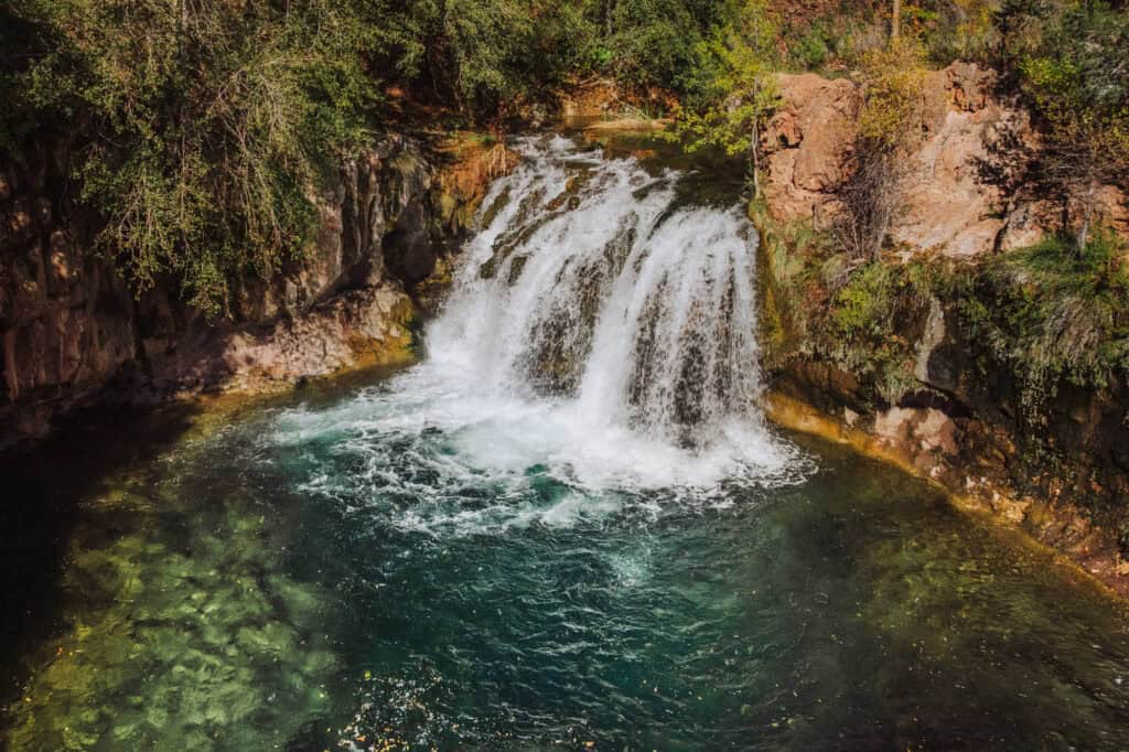
32. Water Wheel Falls
Water Wheel Falls is in the Tonto National Forest, near Payson, Arizona. It’s a family-friendly hike, which leads to a series of cascading waterfalls and swimming holes.
- Location: 10 miles north of Payson
- Cost: You’ll need an $8 day pass, which you can buy along the road.
- Warnings: parking is limited, and there’s no cell service.
The hike itself is about 1.5 miles if you do the whole thing.
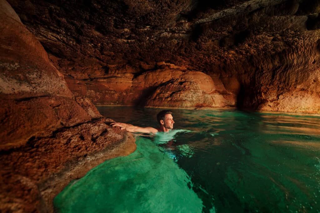
31. Fossil Springs
I can’t say enough about Fossil Springs!
Hiking from the Bob Bear Trailhead, near Payson, you’ll come to a beautiful waterfall and creek, with a hidden cave to swim into.
You’ll need a permit to visit from April through September.
- Location: Near Strawberry, AZ, which is a 2-hour drive from Phoenix
- Cost: Nominal fee …*if* you can secure a permit on recreation.gov
- Warning: Cell coverage is spotty or non-existent, depending on where you are on the trail.
The Bob Bear Trail hike is 10 miles, roundtrip. The way in is all downhill, and the way out is all uphill, so it’s rated as a “difficult” hike.
Remember, it snows in the winter and is brutally hot in the summer in this part of Arizona.
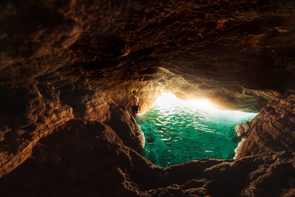
Down below the main waterfall, you can swim into a cave, where the light reflects off the rocky bottom to create an iridescent glow.
30. Fossil Creek
People confuse Fossil Creek and Springs. It’s part of the same waterway, but two very different experiences.
Fossil Creek’s trail will still bring you along a crystal-clear creek to a pretty waterfall.
Fossil Creek is pretty, but not as dramatic as Springs. Plus, to enter, you’ll go in through Camp Verde, rather than Payson/Strawberry.
- Location: Camp Verde, AZ
- Cost: $6 per car, and you’ll need to reserve a parking permit on recreation.gov
- Warning: It’s a 10+ mile drive down a rough, dirt road.
The hike to Fossil Creek is much easier than the hike to Springs.
29. Sycamore Falls
Syacmore Falls is a stunning waterfall in Northern Arizona.
The hike itself is less than a mile, and it’s relatively easy.
Sycamore Falls can be seasonal, so if it’s been dry for a month, the waterfall could be a trickle. On the other hand, after a big storm or snowmelt, it could be raging.
- Location: near Williams, AZ, around 45 minutes SW of Flagstaff
- Cost: Free, and no permits or reservations are needed
28. Picacho Peak
Picacho Peak is a prominent landmark off the I-10 between Phoenix and Tucson, with a rugged, cone-shaped appearance that rises dramatically from the desert landscape.
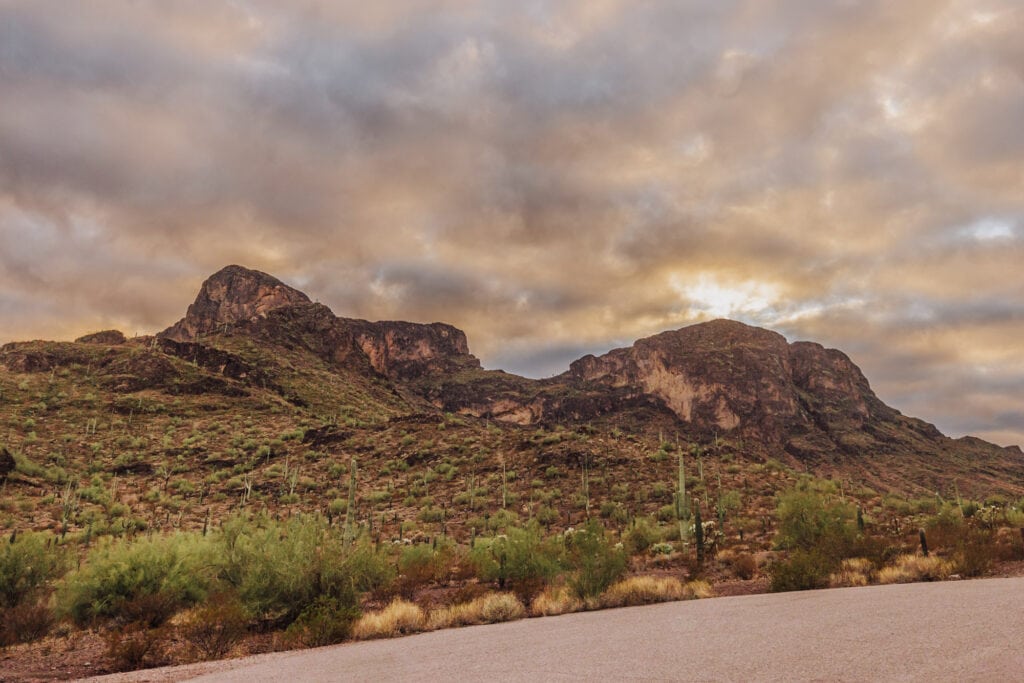
While it’s played an important role in history, these days it’s home to an Arizona State Park.
The most famous trail, the Hunter Trail, leads hikers up steep and challenging rocky terrain to the peak. The hike, which ranks as “difficult,” involves cables and sections where you need to use handrails.

- Location: 75 miles south of Phoenix
- Cost: $7 to park
The hike is about 3 miles (round trip).
If you go during springtime, you might be there during a beautiful wildflower bloom!
27. Tuzigoot National Monument
Tuzigoot National Monument isn’t a natural wonder, but it’s been around for almost 1,000 years.
It’s a preserved hilltop pueblo built by the Sinagua people between 1125 and 1400. At its peak, the settlement housed around 225 residents in over 110 rooms, serving as a trade hub for turquoise, shell, and other goods.
The site was excavated in the 1930s and offers sweeping views of the Verde Valley.
- Location: Clarkdale, AZ
- Cost: $10 per adult
26. Watson Lake
Watson Lake is a scenic reservoir in Prescott, nestled among dramatic granite boulders known as the Granite Dells, creating one of Arizona’s most striking landscapes.
The lake offers kayaking, canoeing, and fishing, and is a popular spot for wildlife viewing,
- Location: Prescott
- Cost: $5 per vehicle
25. Chiricahua National Monument
Chiricahua is a stunning National Monument, which is on track to become a national park. At that point, it might drop off the list of “hidden gems.” For now, you can visit anytime, without a crowd!
Nicknamed the “Wonderland of Rocks,” Chiricahua is known for its towering rock formations, created by volcanic activity and millions of years of erosion.
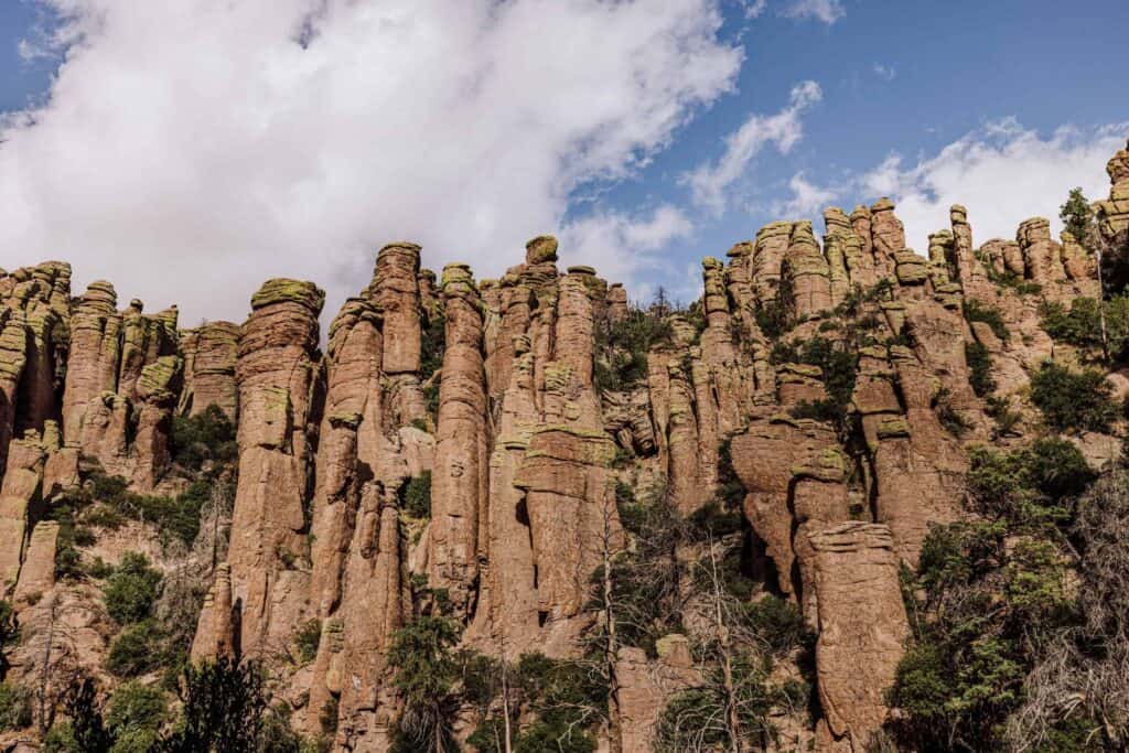
- Location: Willcox, about 120 miles east of Tucson
- Cost: Free
The top trails are: Echo Canyon Trail, Heart of Rocks Loop, and Massai Point Nature Trail.
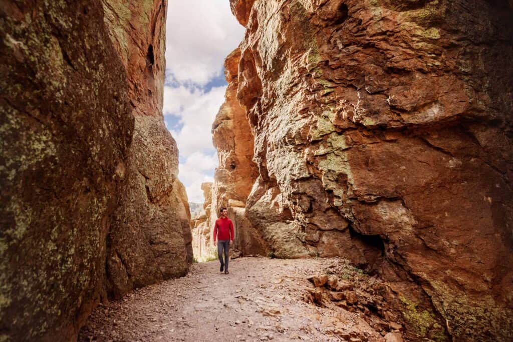
Bonita Canyon Campground is the only campground, and reservations are required.
24. Kartchner Caverns
Kartchner Caverns is another of Arizona’s underground hidden gems. The cave system is a relatively new discovery, which was kept secret for decades before eventually turning into an Arizona State Park.
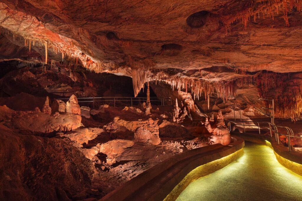
In addition to the stunning rock formations, Kartchner is known for its focus on preservation and scientific research.
- Location: 50 miles SE of Tucson
- Cost: Tours begin at $23, and you should reserve in advance.
- Warning: No photos or cameras allowed inside.
It’s a “living cave,” so you’ll witness water drops continue to create new formations.
23. The Trails at Boyce Thompson Arboretum
Talk about a cool hidden gem in the desert (if you like plants)!
Boyce Thompson Arboretum, about 40 miles east of Mesa, AZ, is the oldest and largest botanical garden in the Southwest, established in 1924.
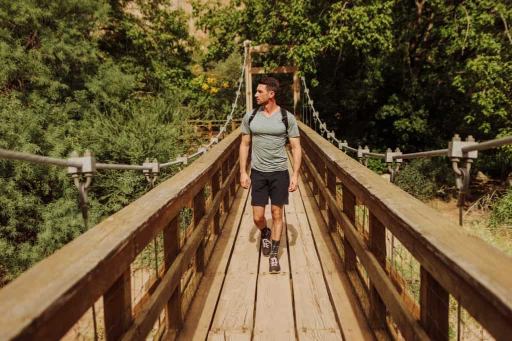
Nestled among stunning desert scenery, it spans over 300 acres and showcases plants from arid regions around the world.
- Location: Superior, AZ
- Cost: $25
The hiking trails and bridges here are great for all ages!
22. Rune Wines
Arizona is home to a few wine regions. In Sonoita, Rune is known as Arizona’s only completely off-the-grid winery.
The property combines sustainability, local wines, and stunning scenery.
Whether you’re a seasoned wine connoisseur or just looking for a relaxing day in Arizona, Rune is the perfect place to unwind with good wine and beautiful views.
- Location: Sonoita
- More: Arizona Wineries
It’s a great place (kind of in the middle of nowhere) to enjoy local wines and amazing sunset views.
21. Organ Pipe Cactus National Monument
Organ Pipe Cactus National Monument is in southern Arizona, along the Mexican border.
Its claim to fame is: it’s the only place in the United States where the iconic organ pipe cactus grows wild in significant numbers.
The monument spans nearly 330,000 acres of the Sonoran Desert, and it was designated a UNESCO Biosphere Reserve in 1976.
- Location: Near Ajo
- Cost: $25 (though the highway drives right through it for free)
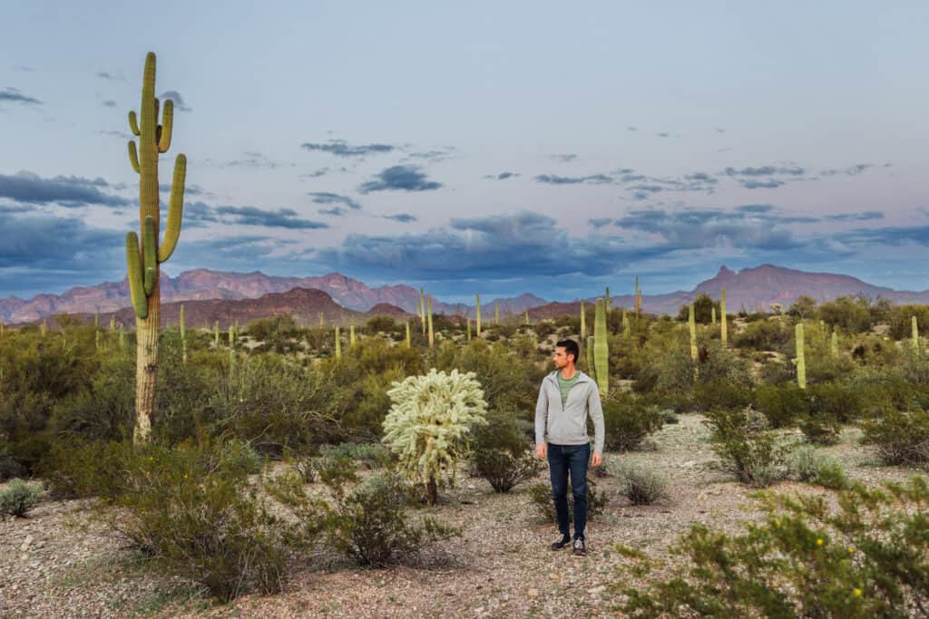
20. Hike Through a Saguaro Forest
Saguaro National Park is known for its vast forest of the iconic symbols of Arizona and the Sonoran Desert.
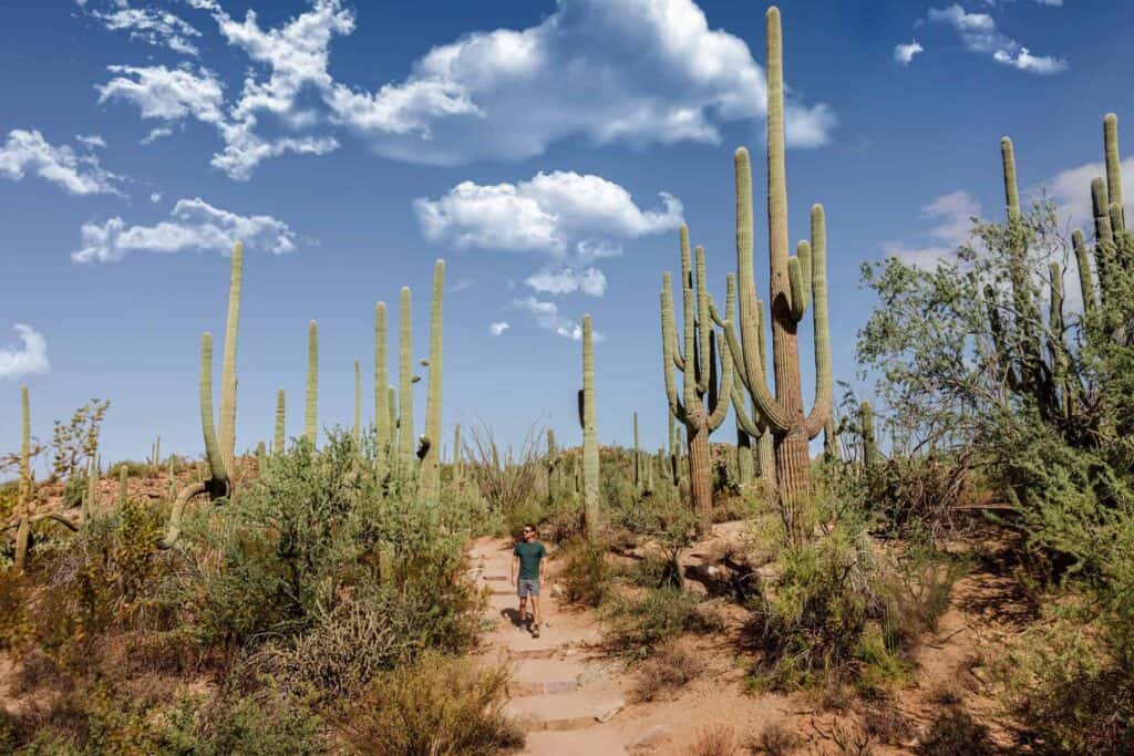
The park is split into two sides: the Tucson Mountain District (West) and Rincon Mountain District (East), each offering hikes and amazing desert views.
- Location: Tucson
- Cost: $25 weekly pass
- Warning: Extreme summer heat & monsoon storms (plus snakes)
The Valley View Overlook Trail is considered the most jaw-dropping!
19. The 7 Sacred Pools
This is a popular site in Sedona, but it’ll be a hidden gem for anyone from out of state.
While it sounds like a red rock swimming hole, the “pools” are actually small ponds, naturally carved over time in the rock.
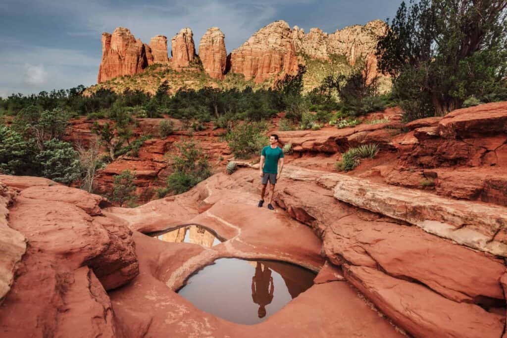
Still, it’s a beautiful site and a nice hike.
- Location: Sedona
- Cost: Free
- Access: Soldier Pass Trailhead
- Shuttle Info: Click here
- Warning: Neighborhood parking is forbidden, and they’re strict about it.
There’s room for around 20 cars in the trailhead lot when it opens at 8:00am.
Much of the time, the Soldiers Pass Trailhead is closed or full, so visitors can take the shuttle from the Posse Grounds lot in Sedona.
Alternatively, you can park in the Posse Grounds lot and walk the one mile to the trailhead.
18. The Birthing Cave
The Birthing Cave is a stunning red rock formation in Sedona. While it’s well-known, I’ve been there when it’s totally empty, so for visitors it’s a hidden gem.
The hike is a mile each way, and you’ll follow the Deadman’s Pass Trail.
- Location: Sedona
- Cost: $5 day pass
- Warning: You’ll lose cell service, so have the map open on your phone to follow the GPS dot
Sedona’s become more crowded than ever, so if all 30 spaces in the lot are taken, you’ll have to find street parking and walk.
17. Grasshopper Point
Grasshopper Point is one of Sedona’s best swimming holes. It’s far less busy than the well-known, crowded Slide Rock State Park up the road.
- Location: Sedona, off Highway 89A in Oak Creek Canyon.
- Cost: $15 per car
- Hours: Open until sunset
16. The Halfway Picnic Swimming Hole
Halfway Picnic is a USFS national recreation area north of Sedona. There’s a very pretty swimming hole here, if you can find parking to visit.
- Location: 7 miles north of Sedona, along Highway 89A
- Hours: 6:00am – 10:00pm
- Cost: $5 per car (Red Rock Pass or America the Beautiful Pass required)
15. The “Crack” at Wet Beaver Creek
Hike the Bell Trail to this iconic spot in the red rocks outside Sedona.
It’s a 4-mile hike, so it’s a bit of a challenge (especially in the heat). The payoff is the swimming hole, surrounded by boulders to jump off.
- Location: The Bell Trail Parking Lot, on Highway 179 (turns into FS Road 618) east of the I-17
- Cost: $5 per car (pay at the kiosk)
- Warning: There’s not much shade along the way. Bring plenty of water for your hike *out* at the end of the day.
14. Edge of the World
Also known as the “Jenga Rocks” and “The Knob,” this hidden gem is attracting more traffic.
This is an amazing camping site, which overlooks the red rocks of Sedona, which may require a 4×4 to navigate the Forest Service roads.
- Location: Between Sedona & Flagstaff
- Cost: Free, with no permits needed
- Warning: You’ll lose cell reception
The cliff’s edge delivers an amazing view. Some people climb the rocks themselves. It requires a leap across a crevasse to get to the rock base itself.
From Highway 89A, north of Sedona, look for the Forest Road 535 turnoff. From there, it’s 19 miles on the windy, dirt road.
From Sedona, the “Edge of the World” is at least an hour-long drive in good conditions.
13. Wire Pass to Buckskin Gulch
Wire Pass to Buckskin Gulch is a great slot canyon hike, off Highway 89 between Page, AZ, and Kanab, UT.
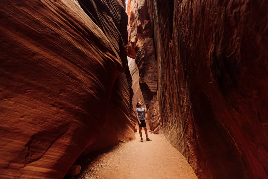
The directions can confuse people. Make sure you go to the Wire Pass Trailhead, rather than the Buckskin Gulch Trailhead.
- Location: Near Page, AZ
- Cost: $6 fee, which can be paid at the trailhead
It’s a short, enjoyable hike through the desert to a stunning slot canyon.
An SUV is best, since you’ll be on a dirt road to the lot.
12. Rainbow Valley
Close to Wire Pass, and right off the same dirt road (Rock House Valley Rd.) you’ll come across a spot known as Rainbow Valley.
It can be seen right off the road, and it’ll require a trudge through a cattle pasture to get there. Follow a dry wash, which will lead you to the mountain.
- Location: Near Page, AZ
- Cost: Free
11. Alstrom Point
This gem is technically across the state line in Utah, but it delivers a stunning view of Arizona.
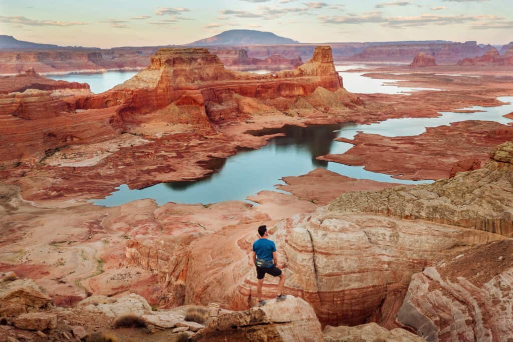
It takes some effort to get here, on the cliffs north of Lake Powell.
- Location: North of Page
- Cost: Free
In terms of distance, the drive from Page is only 40 miles, but it’ll take almost two hours to get there.
I’d take an SUV, and a 4×4 will allow you to drive the rocks to the cliff (rather than have to park and walk).
10. Skylight Arch
Skylight Arch is a natural rock formation in Northern Arizona, with more amazing views.
- Location: 14 miles from Page
- Cost: Free
The drive from Page is about 30 minutes. I’d recommend a 4×4 here, too, for the rocky terrain.
There’s a lot for parking, and then a mile-long walk to the rock arch. You’ll have views of Lake Powell, the desert, and the mountains.
It’s especially pretty at sunset!
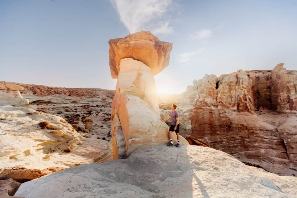
9. Stud Horse Point
Stud Horse Point is another hidden gem near Page. In fact, it’s close to Skylight Arch, but the hoodoos here create a totally different scene.
- Location: North of Page
- Cost: Free
It’s fun to wander around and explore the inexplicable, fascinating formations.
8. Biidi the Arch
Well, frankly, this is a hidden gem… that’s been found.
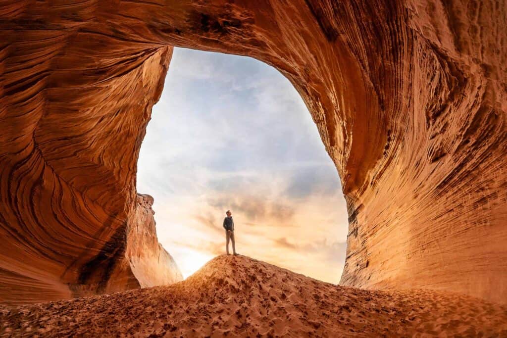
Unless you go early in the morning, you’re likely to find a crowd at this super easy-to-get-to rock cave in Page.
- Location: Page, behind the Big Lake Trading Post (Shell Station)
- Cost: Free
On the short hike from the lot through the desert, it doesn’t look like much. Standing inside and looking out, you understand why it draws a crowd these days!
7. The Via Ferrata in Antelope Canyon
While Antelope Canyon is known worldwide, there’s a new section that opened in 2025, which is still a hidden gem.
It’s called Antelope Ridge Adventure Park.
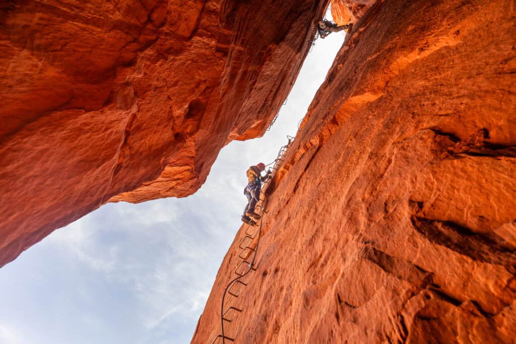
Antelope Ridge Adventure Park stands apart by allowing visitors to rappel and scale the walls of the canyon.
The owners built a “via ferrata,” which is an Italian phrase that means “iron path.” They installed rungs, ladders, and cables to help you climb along the walls, suspended over the canyon floor.
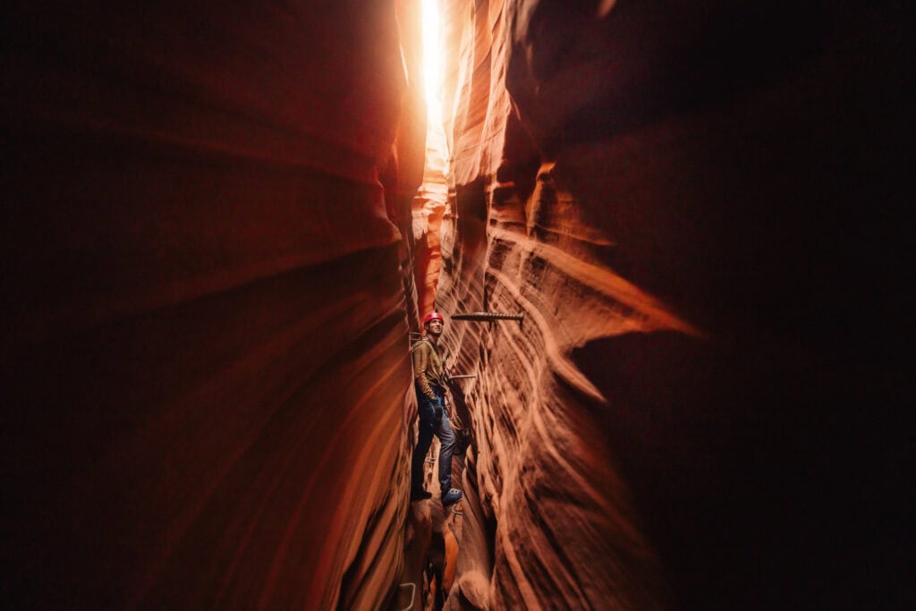
- Location: Lechee
- Cost: $130 per person
- Book:
It’s a lengthy tour in a small group with full photography abilities. No experience in rock climbing or rappelling is necessary, and they provide the gear, guides, and safety lessons.
6. The Antelope X Photography Tour
Antelope Canyon X is one of my favorite tour options. What makes X a hidden gem (of all the Antelope Canyon experiences) is the fact that they offer a special photography tour.
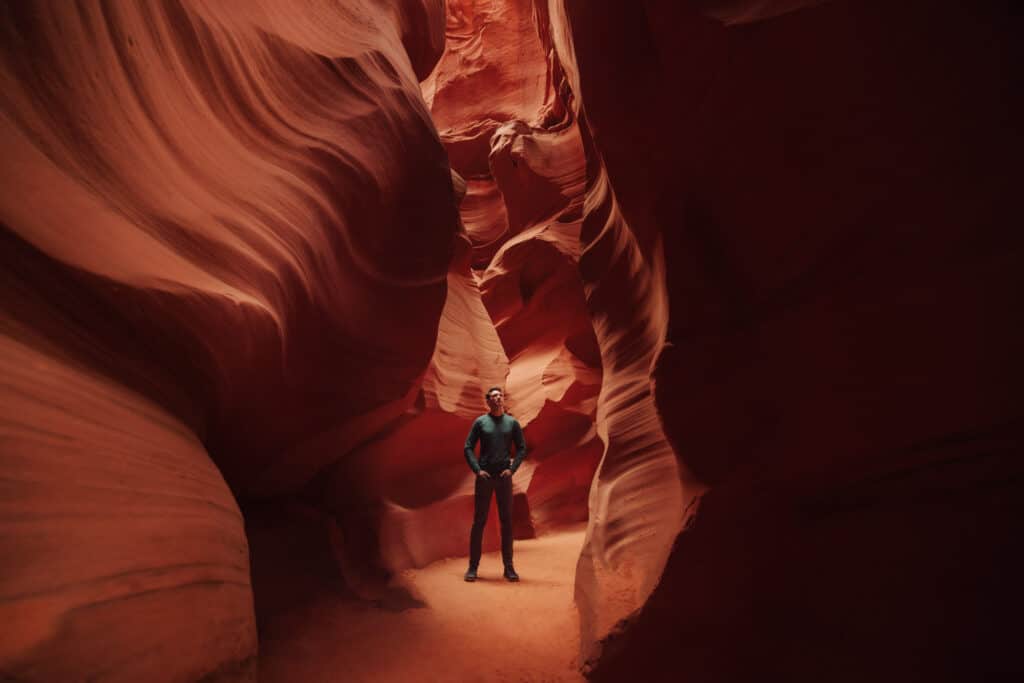
Video is banned in Lower Antelope Canyon, and tripods and other photography equipment are banned in most parts of the canyon.
- Location: Page
- Cost: $240
- Book:
The photography tours are slightly more expensive, but lengthy: 3 hours. That allows photographers to find and shoot different locations in different light, as the sun moves across the sky during the day.
5. Cardiac Canyon
Cardiac Canyon is the least-visited part of Antelope Canyon. It opened to the public more recently, and tours are capped at just a handful of people each day.
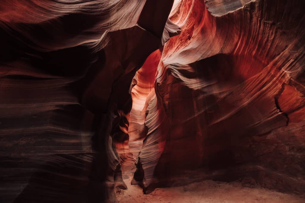
More people walk through Lower Antelope Canyon each day, than walk through Cardiac Canyon all year… making it a true hidden gem.
- Location: Page
- Cost: $200
Tours are more expensive, because you get all day, almost alone in the canyon with guides. The hike is 2.5 to 3 miles, done over the course of six hours.
The family operating Cardiac Canyon has lived on the land since the 1860s.
4. Cathedral Wash Trailhead
Cathedral Wash is a hidden gem of a hike south of Page. There’s a good chance you’ll see just a couple of other hikers the whole way.
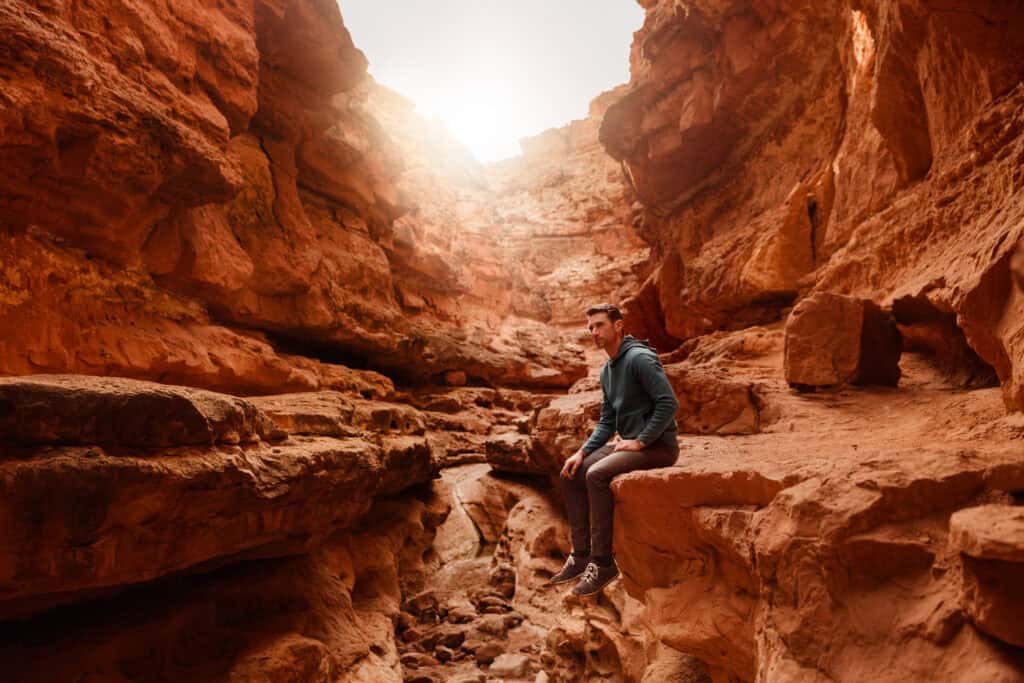
You’ll be hiking a 3-mile dry, rocky route to the Colorado River in the Glen Canyon National Recreation Area.
- Location: Lees Ferry
- Cost: $30
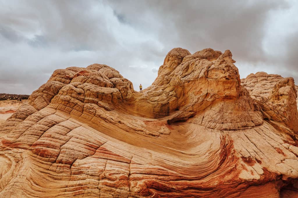
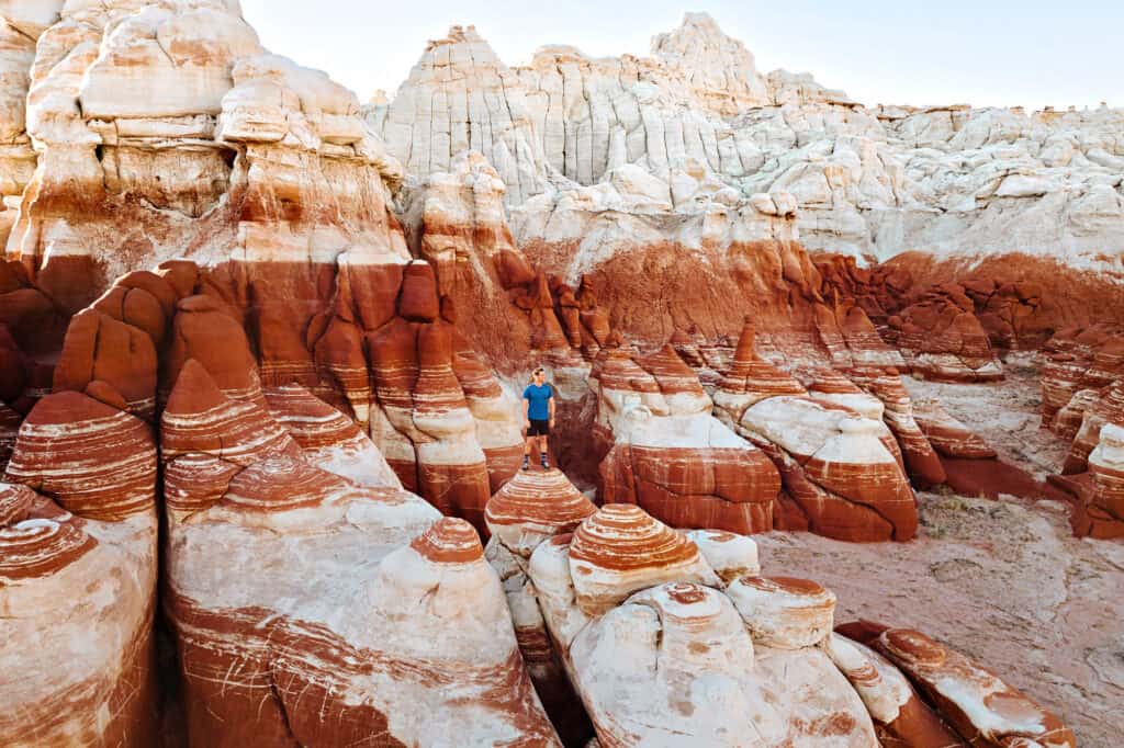
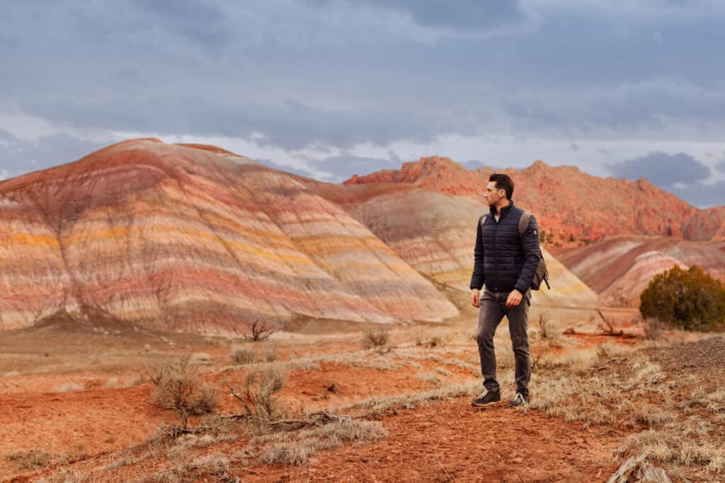
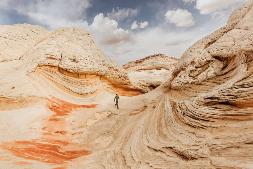
3. White Pocket
White Pocket is another hidden gem, which is remote, but also becoming more popular.
The visuals here are just unbelievable. It’s one of my top 5 favorite sites in Arizona … but it’s a process to get there!
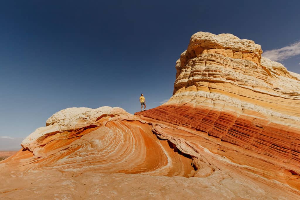
Important: you’ll need a 4×4 no matter when you go to get through the sand on the way to White Pocket.
- Location: Vermillion Cliffs National Monument (between Page and Kanab)
- Cost: Free … though there’s talk of adding a fee
Even the BLM describes White Pocket as a “mind-boggling geological feature, formed 190 million years ago.”
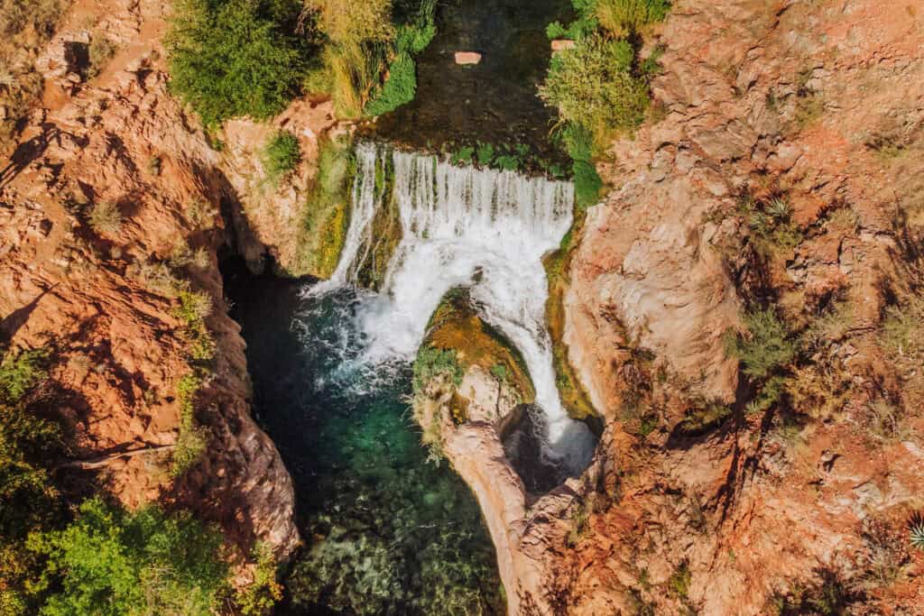
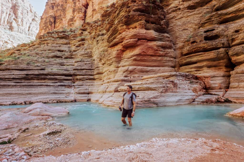
2. Beaver Falls
Beaver Falls in Arizona is an oasis on the Havasupai Reservation near the Grand Canyon.
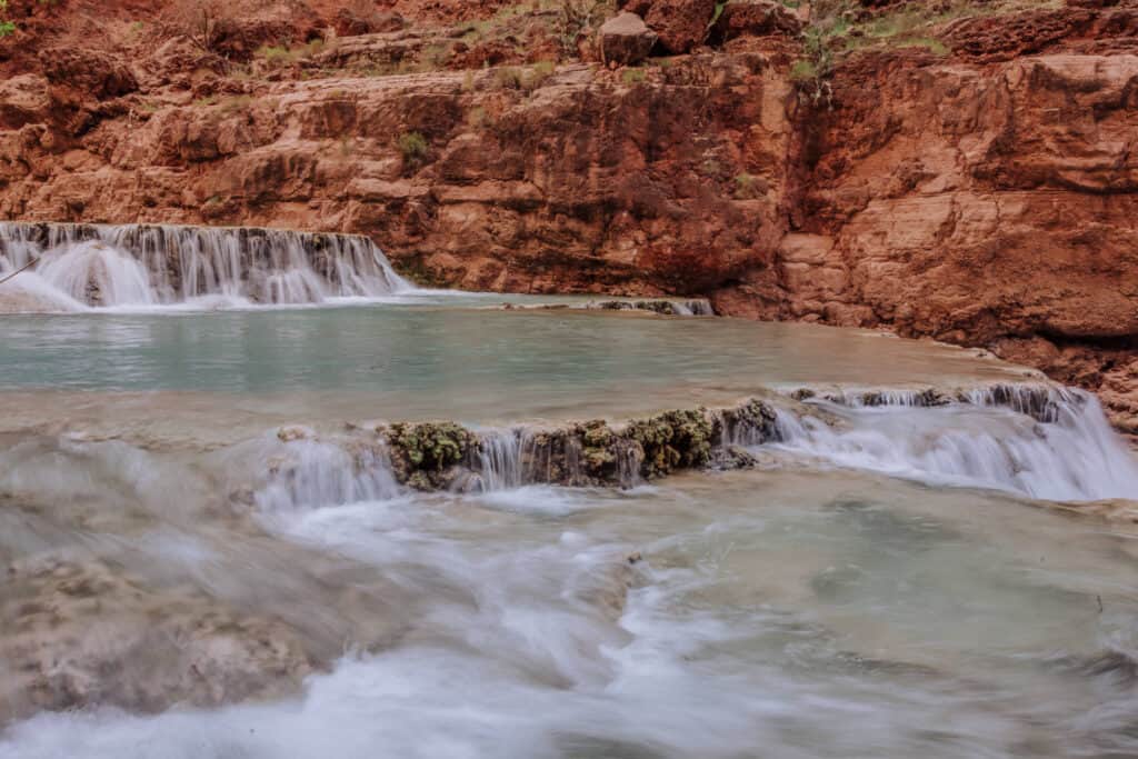
Visiting Beaver Falls, and the other stunning waterfalls along Havasu Creek, requires a permit, overnight camping, and a lengthy hike through a desert canyon.
It gets overshadowed by the more Insta-famous Havasu Falls, but that’s what makes Beaver more of a hidden gem.
- Location: Havasupai Reservation
- Cost: $450+ for the hiking permit
It’s worth the extra hike to get to what might be the most unique swimming hole in Arizona.
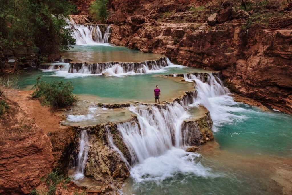
This is *not* a day trip from anywhere… aside from the Havasupai Campground.
1. The Havasu Creek – Colorado River Confluence
Havasu Creek, famous for its blue water, is the second largest tributary to the Colorado River. It flows through a canyon into the Colorado at a spot known as “the confluence.”
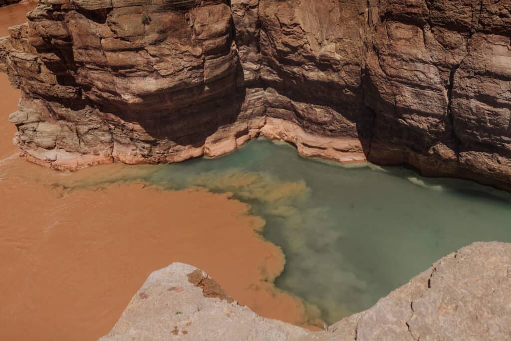
Hiking from the Havasupai Campground to the confluence is a full-day, 18-mile trek. The trail is not well marked, and you’ll have to cross Havasu Creek multiple times on your hike.
- Location: Havasupai Reservation
- Cost: $450+ for the hiking permit
This is a hidden gem that you’ll have to spend time planning and researching, but it’s a bucket list destination for sure!