Hiking in Page, AZ: 15 Scenic Trails for All Ages

Page, Arizona, and its surrounding areas offer a variety of hiking options with stunning landscapes and unique geological formations.
A visit to Northern Arizona, Southern Utah, and the Navajo Nation opens the door to an amazing adventure. There are countless hiking options around Page, AZ, offering something for every member of the family.
Now, Let’s Get Hiking in Page, AZ!
Where to Stay in Page, AZ
Page is home to a growing number of hotels and rental options. You can plug your dates into the interactive map below to see the rates and availability:
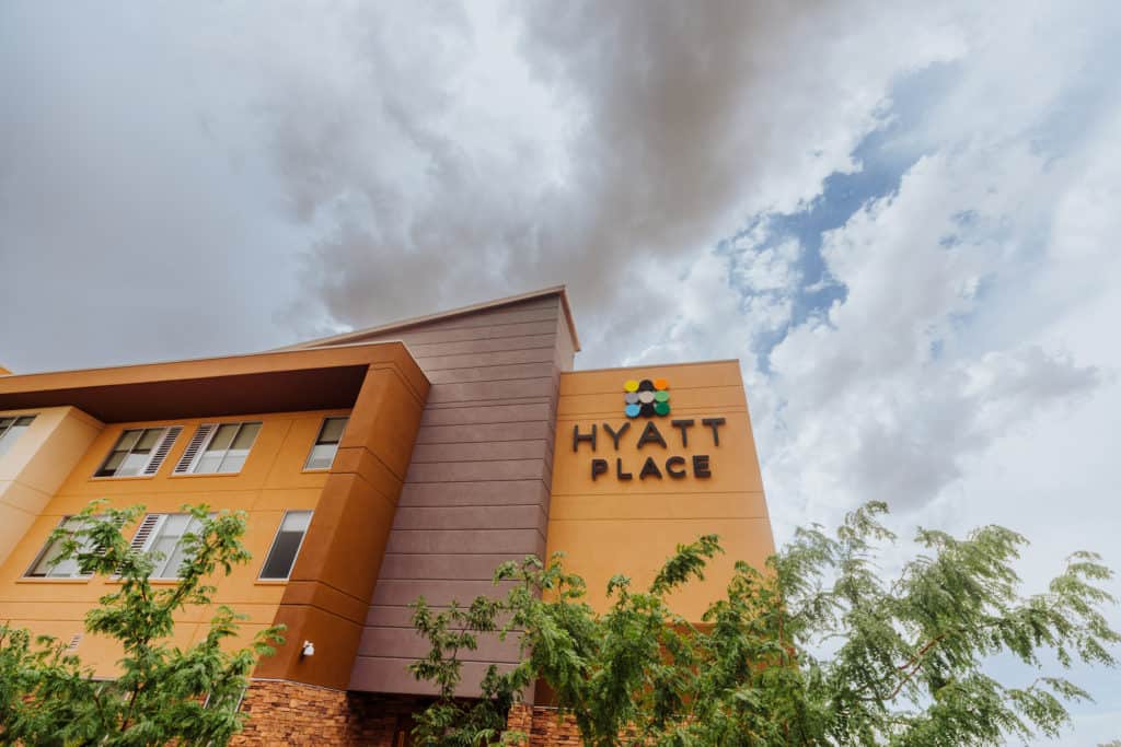
I usually stay at the Hyatt Place in Page. The rooms are large, and the restaurant is one of the best in town! The kitchen is open late, so they’ll still be serving after your sunset hike. It’s also open early, serving breakfast before you head out in the morning!
The Big Draws in Page
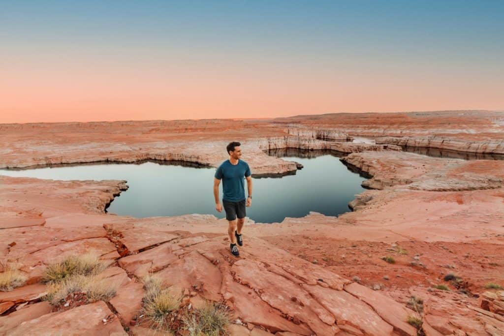
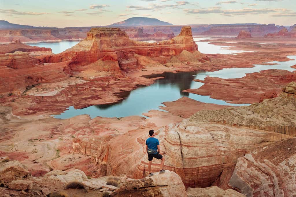
Most people are drawn to Page, AZ, by its world-famous attractions: Antelope Canyon, Horseshoe Bend, and Lake Powell.
I’m always amazed to see the number of international visitors in town, who’ve come from all over Asia and Europe to experience the national wonders here firsthand.
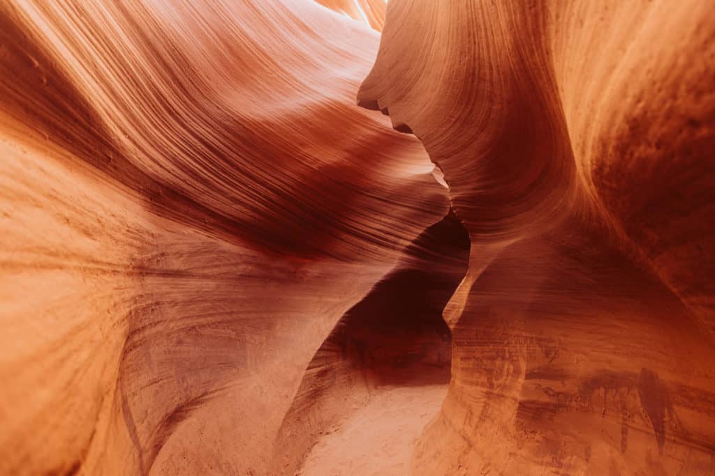
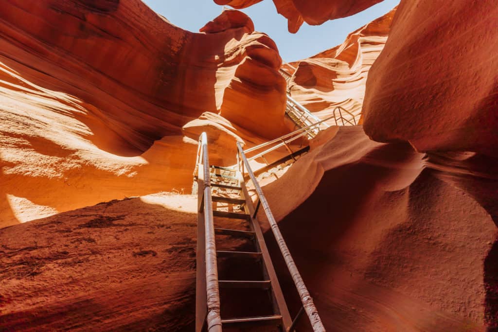
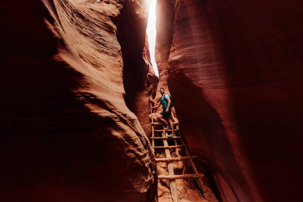
Antelope Canyon is a desert wash, carved deep through the sandstone by floodwaters over time. Today, people marvel at the waves in the walls, illuminated beautifully by sunlight.
Different parts of Antelope Canyon are operated privately by Navajo families. You can’t visit on your own. You’ll have to book a tour with a Navajo guide to visit.
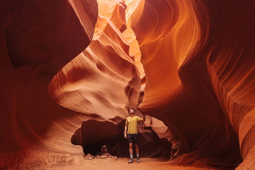
Antelope Canyon X
Antelope Canyon X is the least-crowded section, since visitor numbers are capped at lower levels each day.
Navajo guides will lead you on a 90-minute tour through two stretches of the canyon.
The family operating Antelope X also offers special photography tours, plus a full-day experience in another area called Cardiac Canyon, where only 6 visitors are allowed each day.
➡️ Click to Book: Antelope Canyon X
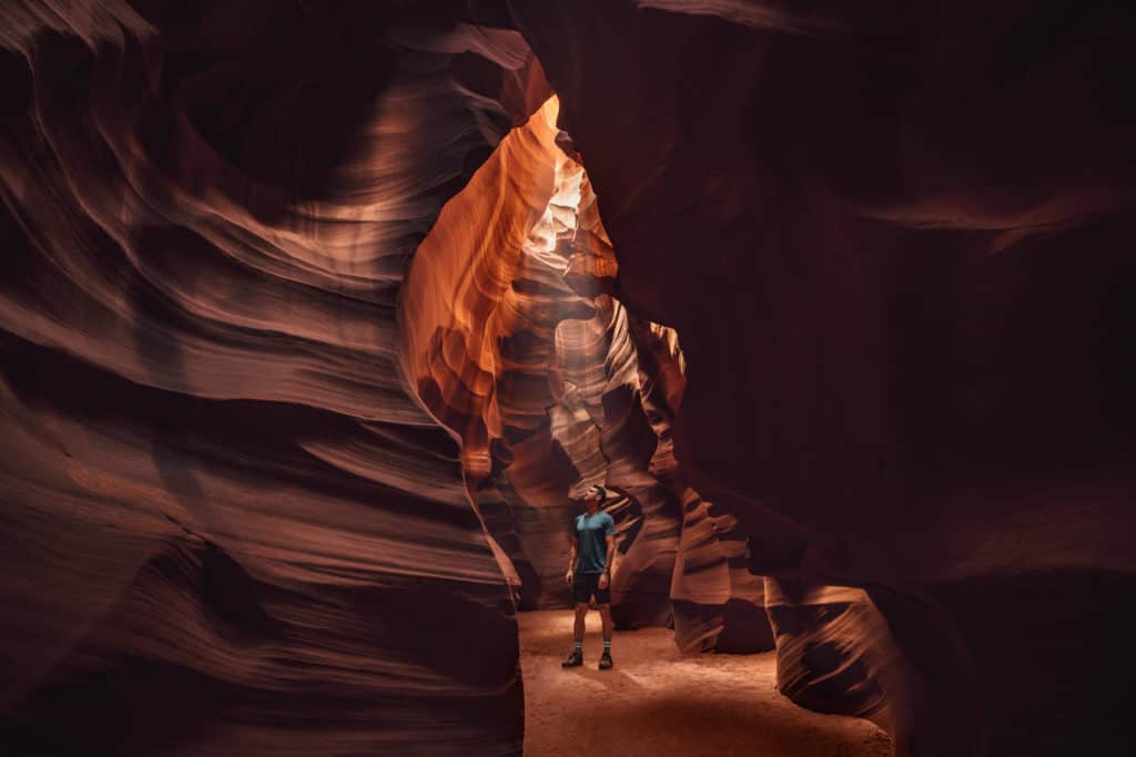
Upper Antelope Canyon
Upper Antelope is A-shaped, so less light shines in from above. This is a better option for seniors and younger children, since no ladders are involved. Plus, the pathway through Upper Antelope is wide and mostly flat.
➡️ Click to Book: Upper Antelope Canyon
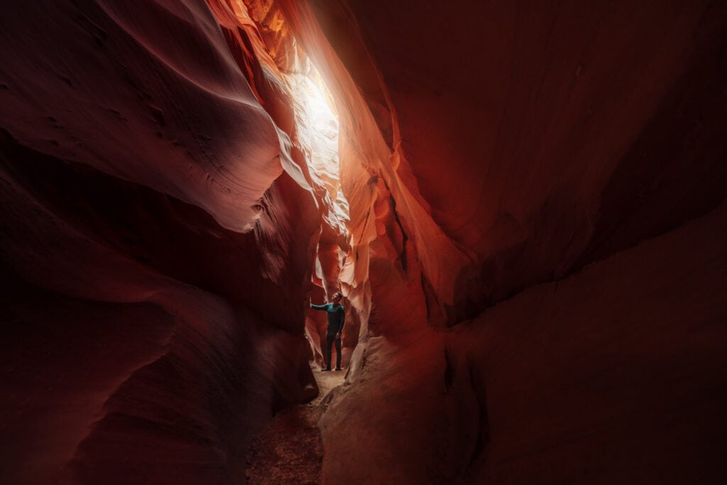
Lower Antelope Canyon
Lower Antelope has the brightest, orangey walls, because it’s V-shaped, allowing more light to shine in from above.
➡️ Click to Book: Lower Antelope Canyon
This option requires a bit more physical ability, since you’ll have to climb down a ladder to enter.
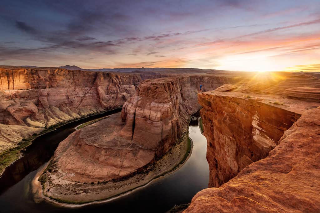
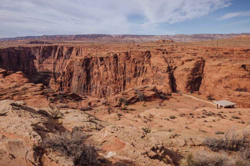
Horseshoe Bend
Horseshoe Bend is a famous bend in the Colorado River, just outside Page, AZ.
No permits or reservations are needed. You’ll just have to pay $10 to park in the huge lot off Highway 89. From there, it’s less than a mile down a flat path to the overlook.
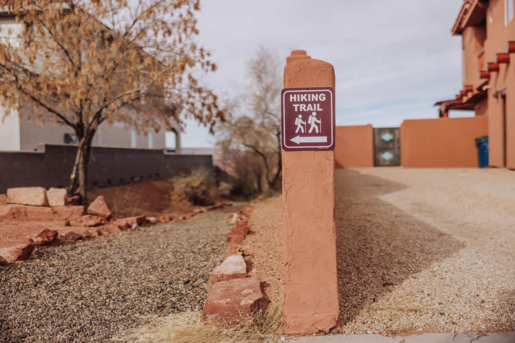
Hiking in Page: Trails in Town
There are number of hiking trails right in Page, AZ! They’re well-marked, easy to find on a map, and generally manageable for most people.
The Rim View Trail
The Rim View Trail, also known as the Rim Trail, is a nearly 16-mile loop around Page, AZ. It’s good for hiking or biking, and offers sweeping views of the desert scenery surrounding the city.
The Rim Trail is accessible from several trailheads:
- Airport Trailhead (south end of the Page Airport)
- Lake Powell Blvd. Trailhead (in front of the Best Western)
- Lake View Trailhead (corner of Ridgeway & Indigo on the north side of the city)
- Page Public Library (south side of the city)
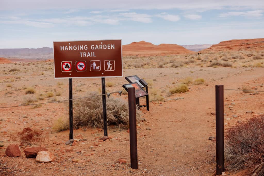
Hanging Gardens Trail
The Hanging Garden Trailhead is just off Highway 89, right before it crosses Glen Canyon Dam.
It’s an easy trail, which leads to greenery growing on the rocks, interesting formations, and views of Lake Powell. The trail is about a mile long, and takes people less than an hour. It’s good for people of all ages.
Beehive Trail
The Beehive Trail is on the other side of the Glen Canyon Dam, just outside of Page, AZ. The trailhead is at the Beehive Campground, off Highway 89.
This is a 2-mile loop, which is flat and considered ‘easy.’ You’ll wind through some slickrock formations, not far from Lake Powell and the Wahweap Marina entrance road.
The Chains
This area doesn’t have a specific trail, but it’s a good spot to climb around on the rocks near Lake Powell. Depending on the water level, it might make a good rocky beach area for the day.
Wahweap Overlook
This is another spot without a specific trail, but still offers beautiful views of Lake Powell and rocks to climb around on.

Skylight Arch
Skylight Arch requires a short drive out of Page, and a higher-profile vehicle. I wouldn’t drive my car there, but I’ve driven a truck and an SUV.
It’s a 14-mile drive on BLM land, which might take longer than you think because parts of the road are rocky and uneven.
The hike is about a 2-mile loop, rated ‘easy’ in terms of difficulty. It brings you to a huge arch in the rock, and is a great spot to watch the sunset.
Stud Horse Point
Stud Horse Point is on the way to Skylight Arch, so you might as well hit both at the same time. You’ll find really amazing rock formations and hoodoos to explore.
Hiking in Page: 6 Trails Worth Driving To
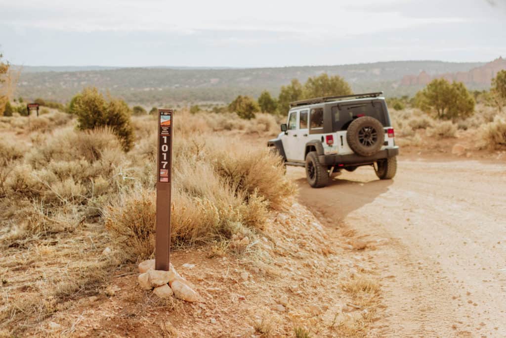
If you have a 4×4, you should definitely consider heading out of Page to experience some of the unique hiking trails in the region. Some are world-famous, while others are better-kept-secrets.
A standard SUV or higher-profile vehicle is enough to get you to some of these spots, but the roads are often dirt so the weather will play a big role in how accessible they are.
1. The Wave
The Bureau of Land Management put strict limits on how many people can visit the curved layers in the rocks, known as The Wave.
I have a whole other post on how to try to get a permit for The Wave. I’ve only succeeded once out of more than a dozen tries over the years. You can try in a lottery months before your visit, or in the daily lottery. Keep in mind, for the “daily lottery” you can only apply if you’re already in the area. If you win it on a Friday, you’ll have to attend a safety briefing on Saturday, and then you can go to The Wave on Sunday … so it’s a three-day process.
If you succeed, you’ll only see a few other people out there. One will likely be a ranger checking permits, so I’d advise against going to The Wave without a permit.
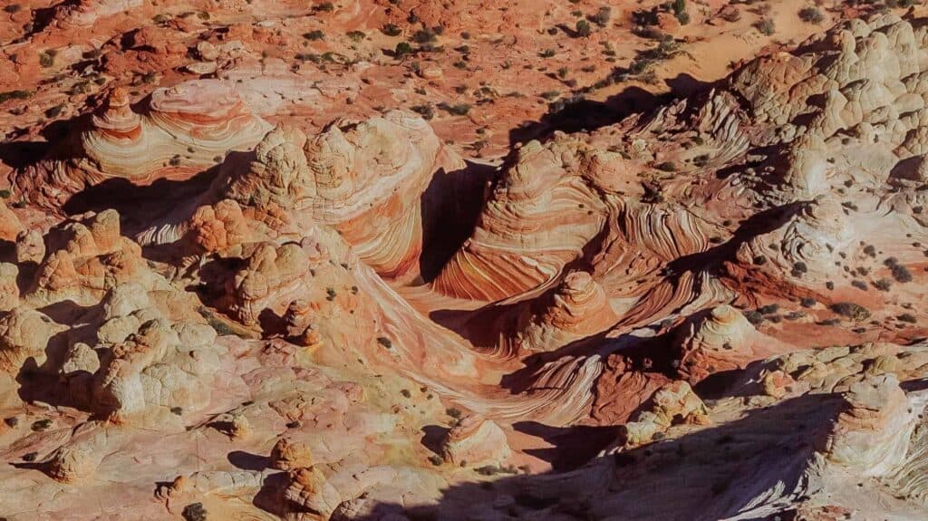
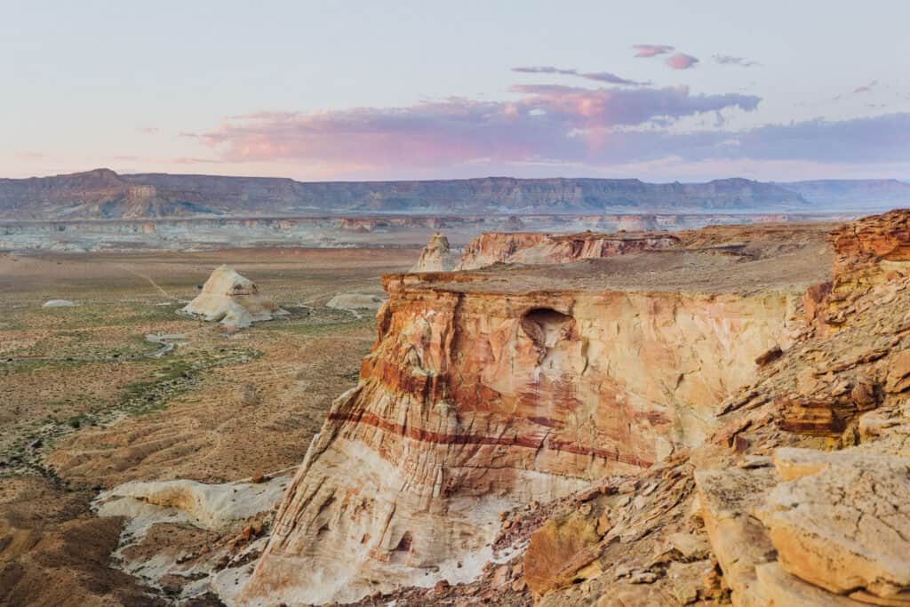
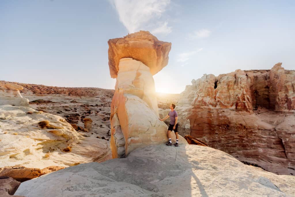
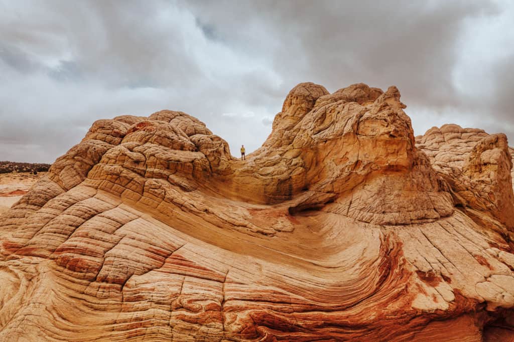
2. White Pocket
I prefer White Pocket to The Wave! The geological formations are more interesting (and other-worldly!) and there’s no permit needed.
You *will* definitely need a 4×4 to get to White Pocket, no matter what time of year you visit. You can rent a Jeep from Page. We’ve used JeepBnB a few times.
It’s around a 2-hour drive from Page to White Pocket. The last stretch will be on a sandy road, which often traps vehicles without 4-wheel drive.
While there are no hiking trails at White Pocket, you can spend a full day exploring the unique rocky landscape.
3. Rainbow Valley
Rainbow Valley is kind of a hidden spot along House Rock Valley Road, the same dirt road you’ll take to get to The Wave, White Pocket, and other sites.
About 12-miles after you turn south off Highway 89 onto the dirt road, you can park and see the rainbow stripes in the mountains off to the east.
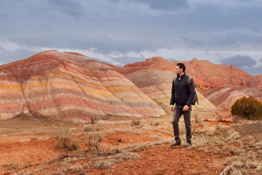
You could easily combine a stop at Rainbow Valley with a trip to Wire Pass.
4. Wire Pass to Buckskin Gulch
No permit or reservation needed to visit this beautiful slot canyon!
Again, you’ll head west on Highway 89 out of Page, and turn south on Rock House Valley Road.
The key here is: go beyond the Buckskin Gulch Trailhead parking lot. Go to Wire Pass and hike in from there.
From there, it’s an easy hike through the slot canyon, which is very family-friendly.
5. Alstrom Point
Geographically, as the crow flies, Alstrom Point is pretty close to Page, AZ, but it’s actually across Lake Powell to the north in Utah. No permits are needed.
It’ll take at least 90-minutes to drive to Alstrom Point from Page. Our SUV made it most of the way, but we stopped before trying to climb over big rocks and walked the final mile or two to the cliffs.
You can camp here, or just stay for a few hours hiking along the cliffs. Sunrise and sunset are both beautiful, but if you stay for sunset make sure you can find your way back to your vehicle in the dark!
6. The Spencer Trail
The Spencer Trailhead is across the Colorado River from Page, AZ, to Lees Ferry. It’s about a 45-mile drive, which will take less than an hour.
A lot of boat tours leave from Lees Ferry, so the area might seem crowded. But the trail is usually a much quieter experience.
This one is steep and strenuous in spots! It’s about 4.5 miles long, and rated ‘difficult.’ It’ll lead you up switchbacks to views of the river as it winds through the desert.
Spencer’s Trail is actually an old mule trail established more than a century ago for hauling gold mine supplies.
Hiking in Page: Trails for Kids
A few of the hiking options above are good for kids, but these spots are good for young children, too.
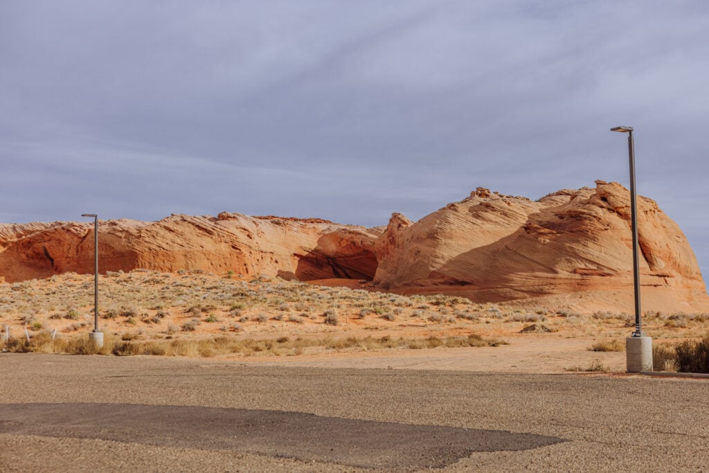
Rocks Behind the Shell
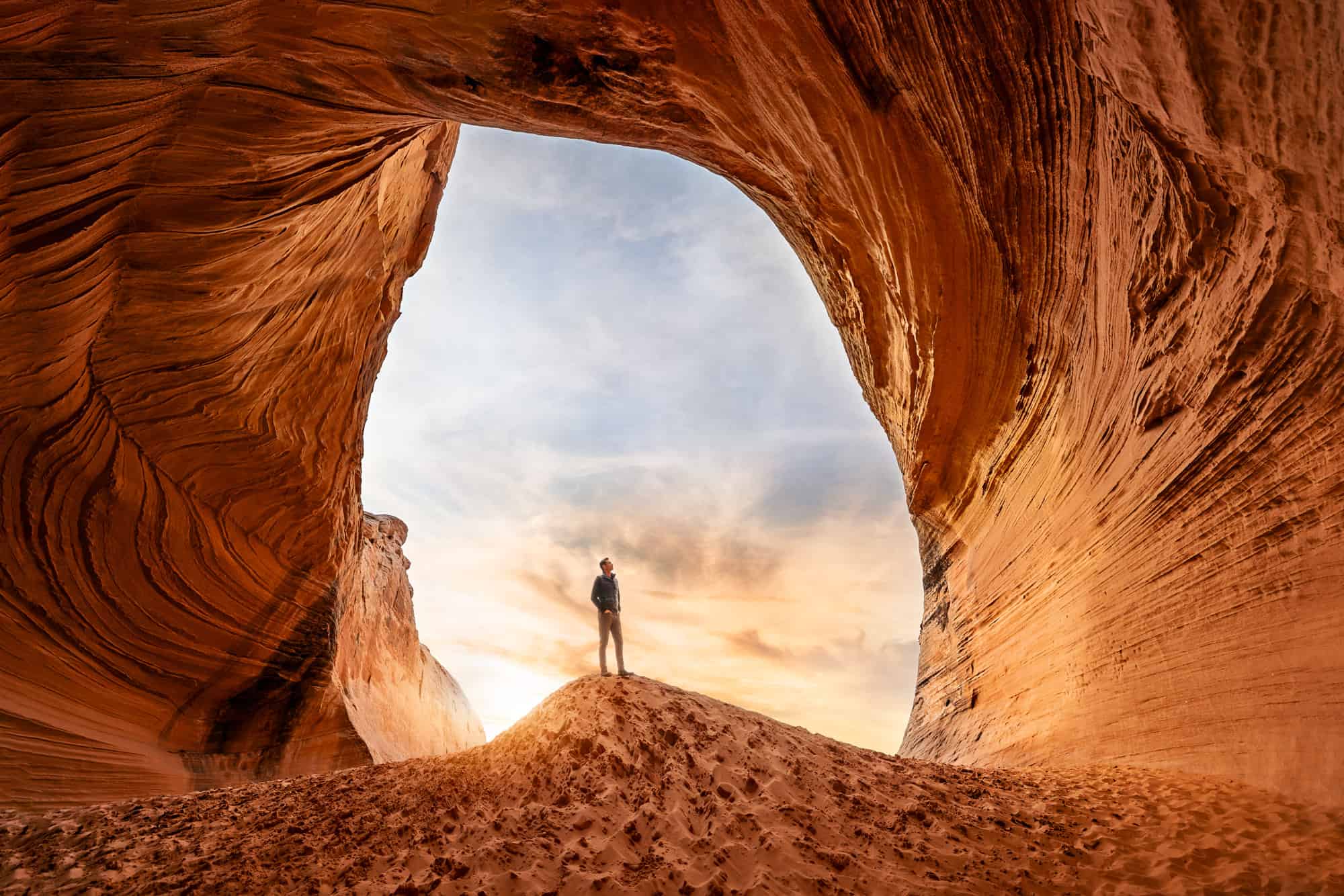
I mean: literally the rocks behind the Shell Gas Station, at the corner of Coppermine Road and Highway 98. This isn’t an official trail, but it’s a smooth, sandy walk behind the gas station to a pretty cool rock formation kids might enjoy.
We took the main image at the top of this blog inside the cave here!
Glen Canyon dam overlook
There’s a large lot on Overlook Drive, behind the Denny’s on Highway 89. You’ll find a trail that leads down to an overlook of the dam and Colorado River.
It’s an open area with rocks to climb around on, which is very family-friendly.
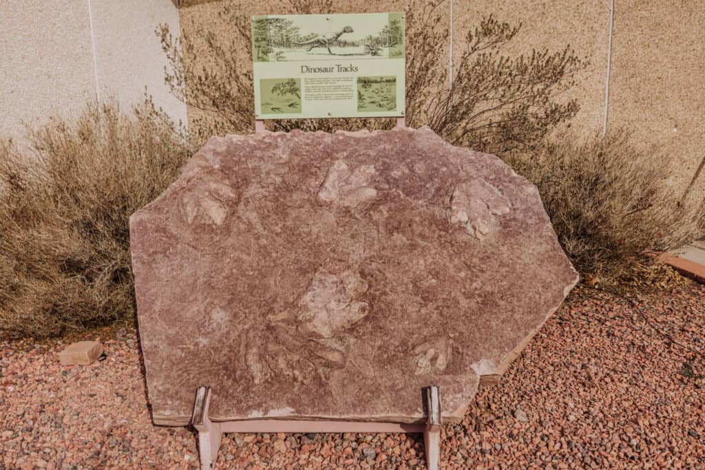
Dinosaur Tracks
Okay, there’s no hike at all here, but there are huge dinosaur tracks at the Carl Hayden Visitor Center, right on the edge of the Glen Canyon Dam. Just pull into the lot and they’re right out front.
They’re from a dilophosaurus, 170 million years ago.
The Best Time to Visit Page, AZ
The best time to visit Page, AZ, depends on your preferences for weather and crowd sizes. I’ve visited in all seasons, from snowy days to extreme heat, and found pros and cons to each.
Spring (March to May):
- Weather: Spring is a great time to visit, with daytime temperatures warming into the 60s, 70s, and even 80s by May. If it rains, be prepared for flooding and closures in the slot canyons.
- Crowds: Crowds spike during spring break, then drop off a bit before they swell again during the summer months.
Summer (June to August):
- Weather: Summer can be hot, with temperatures exceeding 100°F during the day. It’s still fine to visit Page in the summer, but essential to stay hydrated and protect yourself from the sun. If you’re hiking, it means drinking a lot of water the night before you hike, and bringing twice as much water as you think you’ll need. Hiking spots like Antelope Canyon and Wire Pass provide some shade from the sun.
- Monsoon: The monsoon weather pattern can send strong storms to Page, which often cause flooding in the slot canyons.
- Daylight: The sun rises early and sets late in the summer, so the time you have to explore increases by a few hours, compared to a winter visit.
- Crowds: Summer is the peak tourist season, so expect larger crowds from around the world. Be sure to book reservations in advance at Antelope Canyon, since tours can sell out.
Fall (September to November):
- Weather: Similar to spring, fall offers more mild temperatures in Page. It’s still pretty hot through September, so over-hydrate before any hiking.
- Crowds: Crowd sizes are typically lower than in the summer months, but still pretty strong.
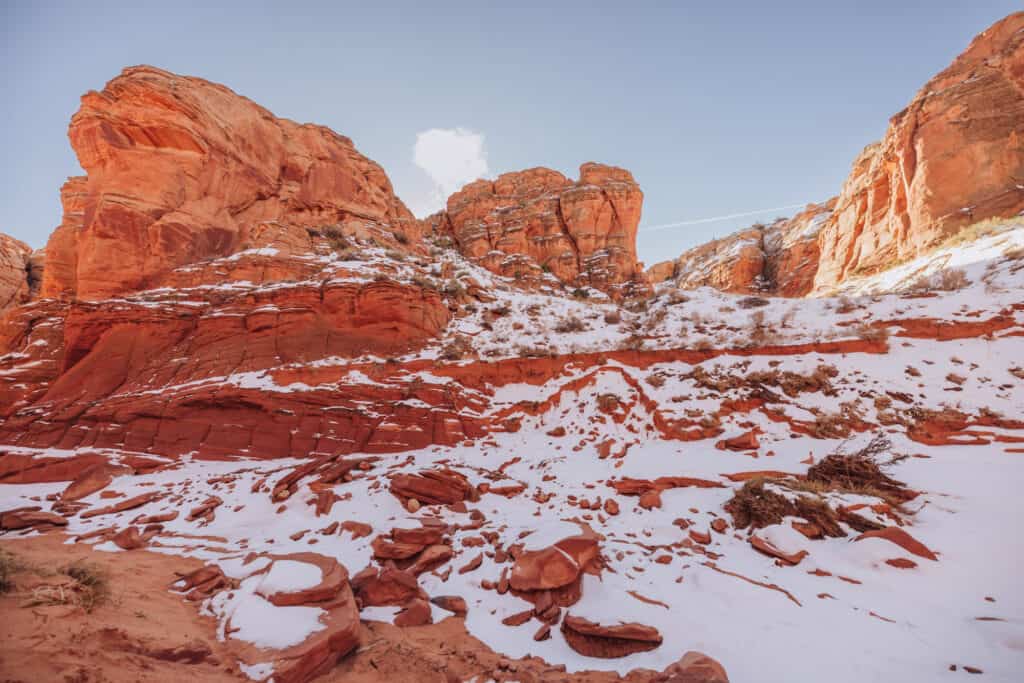
Winter (December to February):
- Weather: It snows in the winter in Page, but it doesn’t accumulate much and usually melts quickly. Daily highs range from 30°F to 50°F, and it drops below freezing many nights.
- Crowds: Crowds are generally lower in winter compared to the peak months, so it’s a great time to try to get a permit for The Wave!
FAQs About Hiking in Page, AZ
Let’s go over a few frequently-asked-questions about hiking in Page, Arizona. Some of these were already answered above.
How do you get to Page from Phoenix?
Phoenix is about 275 miles south of Page. It’s about a 4.5-hour drive north. Or you can fly on Contour Airlines, which has at least one flight between PHX Sky Harbor Airport and Page each day.

How do you get from Vegas to Page?
Las Vegas is the same distance as Phoenix. It’s about 275 miles, and a 4.5-hour drive.
What’s the closest airport to Page, AZ?
Page has its own airport, but the only commercial flight is the Contour flight from Phoenix.
The closest airport would be St. George Utah. From there, renting a car you can drive through Zion National Park on your way to Page.
St. George is about 150 miles from Page.
How far is Sedona from Page?
Sedona is 160 miles south of Page. The drive will take about 3 hours. When friends and relatives visit Phoenix, I always suggest driving up through Sedona to hike Devil’s Bridge or one of the other trails, stopping at the South Rim of the Grand Canyon, and then going on to Page.
How far is Monument Valley from Page?
Monument Valley Tribal Park has a 17-mile loop you can drive through to see some of the most iconic vistas in the West. It’s 125 miles east of Page, AZ. The drive will take 2-hours.